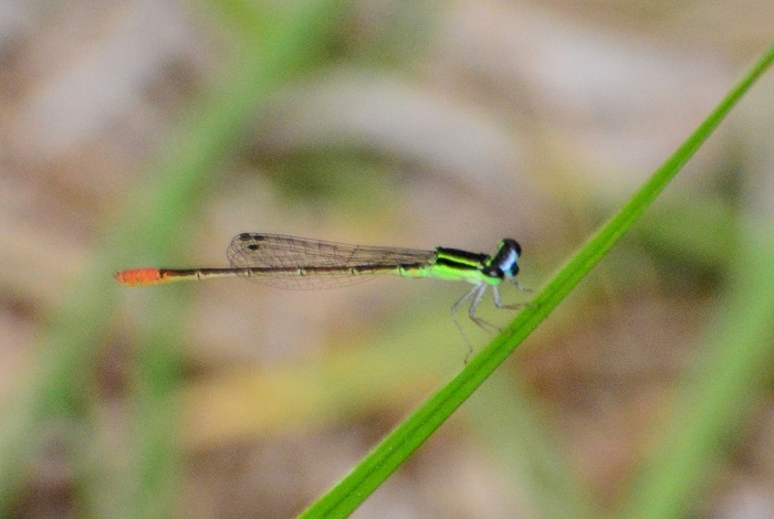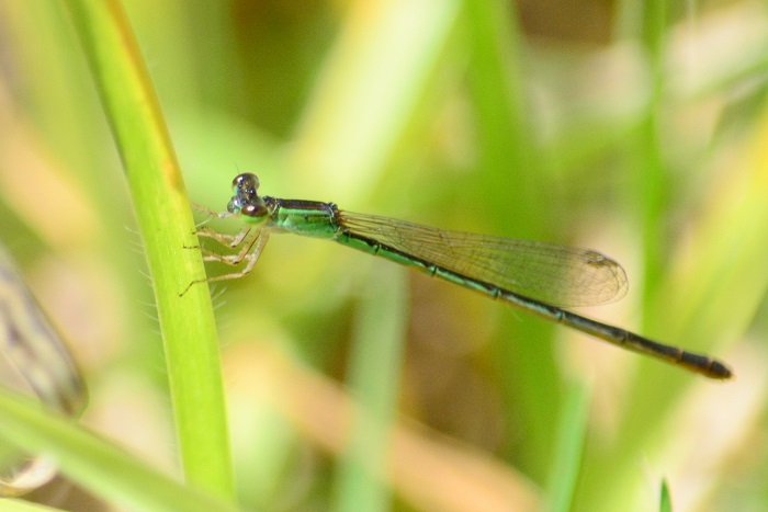
Find the Blue Riverjack in the FBIS database (Freshwater Biodiversity Information System) here.
Family Platycnemididae
Identification
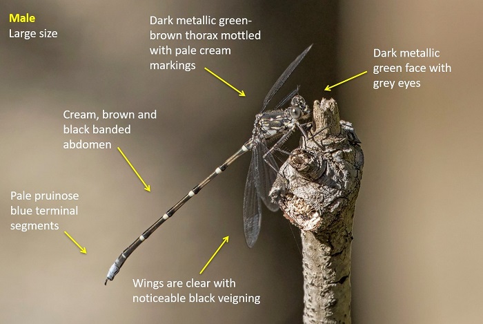
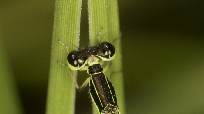
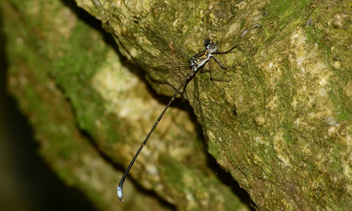
Blue RiverjackMetacnemis valida – Male Near Port Elizabeth, Eastern Cape Photo by Andre Marais
Medium sized with a robust build.
Length reaches 41mm; Wingspan attains 56mm.
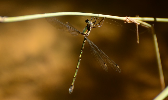
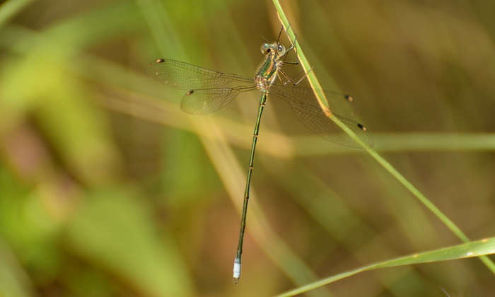
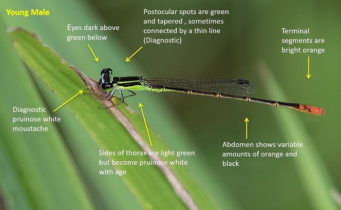
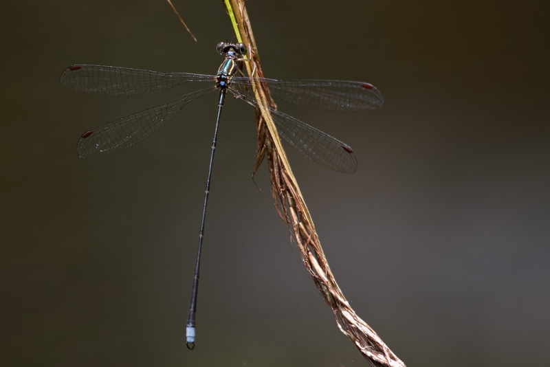
The Blue Riverjack is unlike any other South African species. Males are strikingly coloured in bright blue and black bands and stripes. Males are distinctive and easily identified.
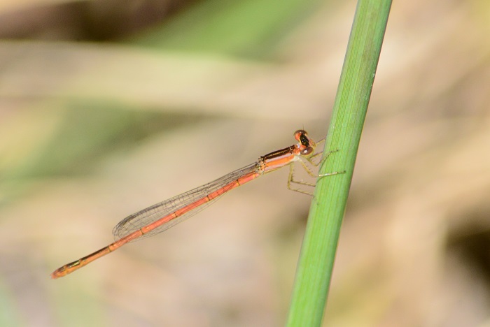
Females are similar to those of Mesocnemis singularis (Savanna Riverjack), but that species lacks the pale diagonal band on the sides of the thorax. The two species are not known to co-occur.
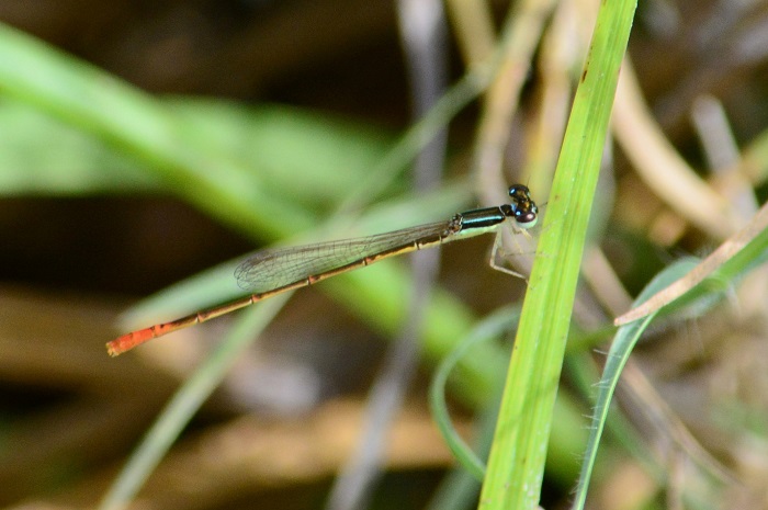
Blue RiverjackMetacnemis valida – Female Photo by Hesmarie Els
Habitat
The Blue Riverjack has a preference for rocky, fast-flowing rivers and streams. It requires clean, clear and shallow water with an abundance of rocks.
Behaviour
The Blue Riverjack perches on rocks, close to the waters edge in exposed sunny locations. Perches less often on overhanging or emergent plant stems. The Blue Riverjack often sits in the midstream and females are frequently found alongside the males. It flies low and fast over the water when disturbed.
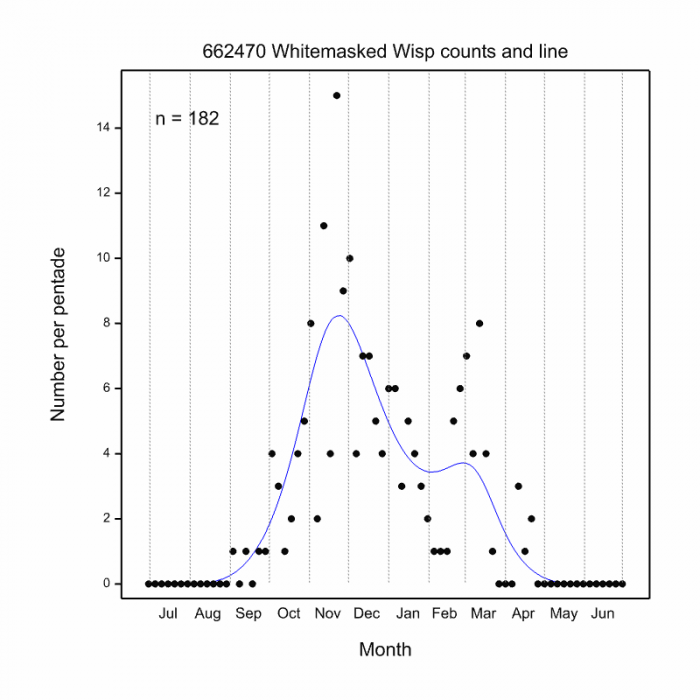
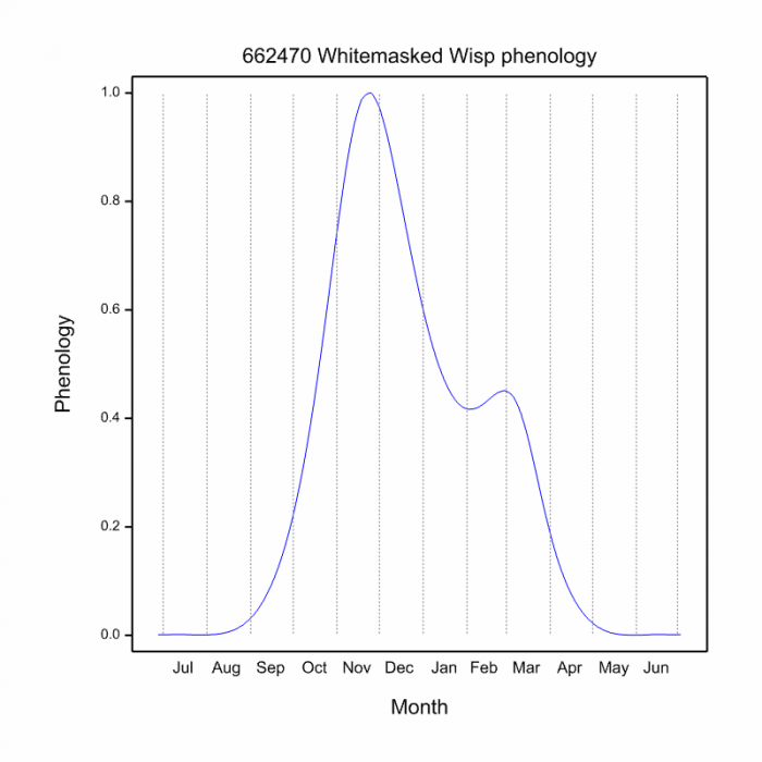
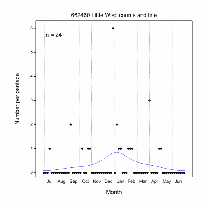
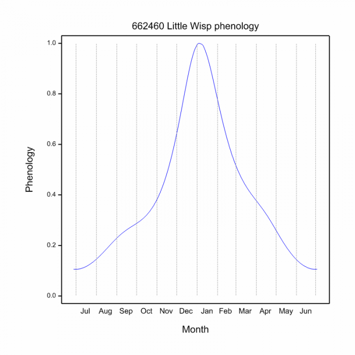
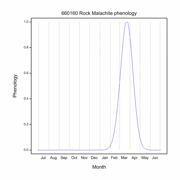
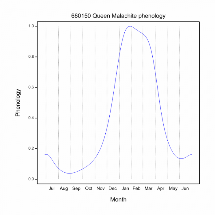
Most active from November to March (See Phenology below).
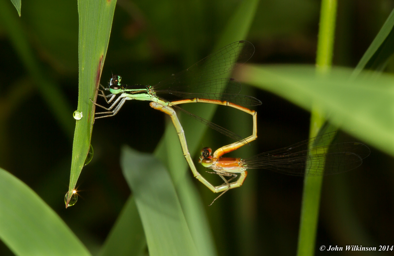
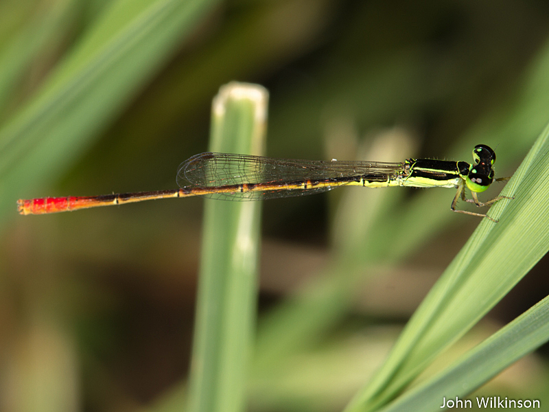
Blue RiverjackMetacnemis valida – Male Photo by John Wilkinson
Status and Conservation
The Blue Riverjack is rare and localised. It is listed as Endangered in the IUCN Red List of Threatened Species. Metacnemis valida is not tolerant towards habitat degradation and is severely threatened by habitat loss within its restricted distribution. Negative impacts on its habitat include turbid water from soil erosion and copses of alien trees along the river banks that shade out rivers.
Blue RiverjackMetacnemis valida – Male Photo by Hesmarie Els
Distribution
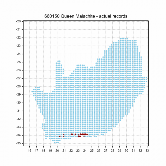
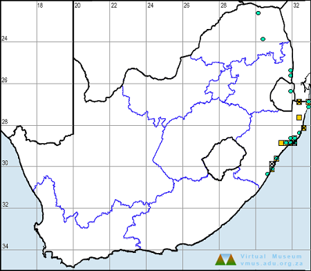
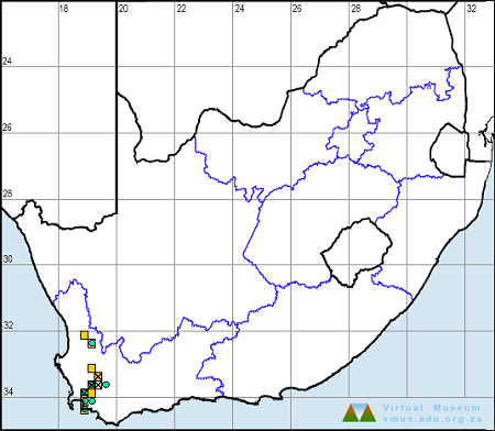
The Blue Riverjack is endemic to the Eastern Cape province of South Africa. It ranges from near Humansdorp in the South to Bizana in the north.
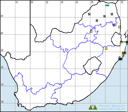
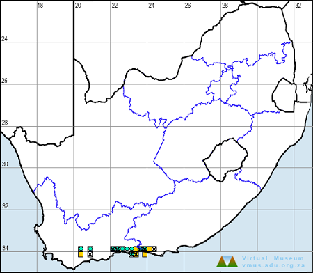
Below is a map showing the distribution of records for Blue Riverjack in the OdonataMAP database as at February 2020.
Below is a map showing the distribution of records for Blue Riverjack in the OdonataMAP database as of December 2024.
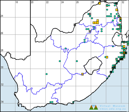
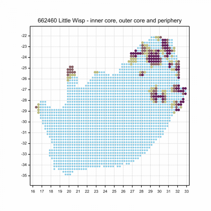
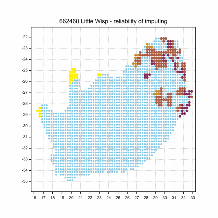
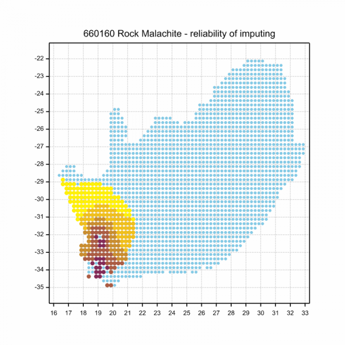
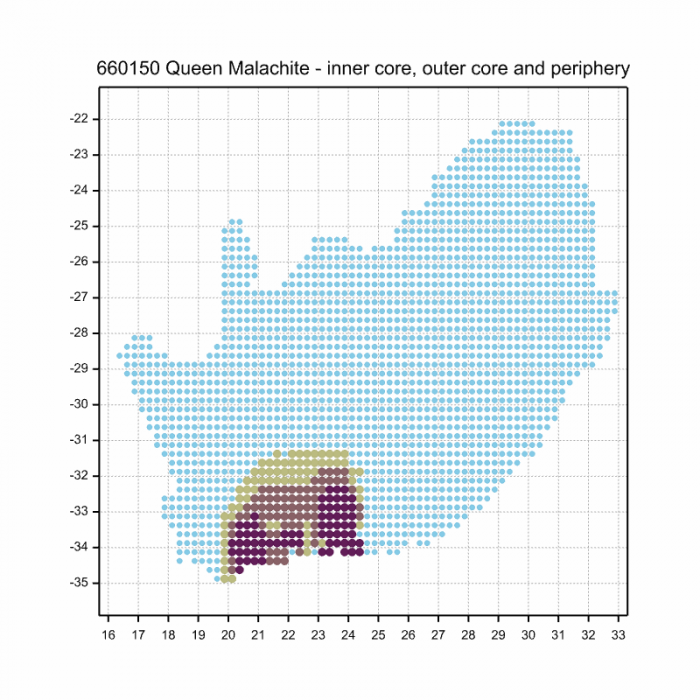
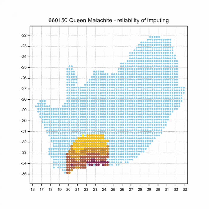
The next map below is an imputed map, produced by an interpolation algorithm, which attempts to generate a full distribution map from the partial information in the map above. This map will be improved by the submission of records to the OdonataMAP section of the Virtual Museum.
Ultimately, we will produce a series of maps for all the odonata species in the region. The current algorithm is a new algorithm. The objective is mainly to produce “smoothed” maps that could go into a field guide for odonata. This basic version of the algorithm (as mapped above) does not make use of “explanatory variables” (e.g. altitude, terrain roughness, presence of freshwater — we will be producing maps that take these variables into account soon). Currently, it only makes use of the OdonataMAP records for the species being mapped, as well as all the other records of all other species. The basic maps are “optimistic” and will generally show ranges to be larger than what they probably are.
These maps use the data in the OdonataMAP section of the Virtual Museum, and also the database assembled by the previous JRS funded project, which was led by Professor Michael Samways and Dr KD Dijkstra.
Phenology
Blue RiverjackMetacnemis valida – Male Photo by Cornelia Rautenbach
Further Resources
The use of photographs by Andre Marais, Cornelia Rautenbach, Hesmarie Els, John Wilkinson, and Stewart Bruce MacLachlan is acknowledged.
Blue RiverjackMetacnemis validaHagen in Sélys, 1863
Other common names: Kibusi Streamjack (Alternative English Name); Blourivierjuffer (Afrikaans)
Recommended citation format: Loftie-Eaton M; Navarro R; Tippett RM; Underhill L. 2025. Blue Riverjack Metacnemis valida. Biodiversity and Development Institute. Available online at https://thebdi.org/2020/04/20/blue-riverjack-metacnemis-valida/
References: Tarboton, M; Tarboton, W. (2019). A Guide to the Dragonflies & Damselflies of South Africa. Struik Nature.
Samways, MJ. (2008). Dragonflies and Damselflies of South Africa. Pensoft
Samways, MJ. (2016). Manual of Freshwater Assessment for South Africa: Dragonfly Biotic Index. Suricata 2. South African National Biodiversity Institute, Pretoria
Blue RiverjackMetacnemis valida – Male Photo by John Wilkinson
Find the Glistening Demoiselle in the FBIS database (Freshwater Biodiversity Information System) here.
Family Calopterygidae
Identification
Glistening DemoisellePhaon iridipennis Kosi Bay, KwaZulu-Natal Photo by Ryan Tippett
Very large. This is the largest species of damselfly in Southern Africa.
Length reaches 75mm; Wingspan attains 87mm
The Glistening Demoiselle is an unmistakable species in South Africa. The overall colouration of males is dark glossy green, often with a coppery tinge. Females are slightly browner and less colourful than the males. Both sexes show iridescent purple-blue sparkles in the wings, when seen in the right light. The Glistening Demoiselle is easily identified by its large size, cryptic colouration, and forest-floor habitat.
Glistening DemoisellePhaon iridipennis – Female Mabibi, iSimangaliso Wetland Park, KwaZulu-Natal Photo by Ryan Tippett
Habitat
The Glistening Demoiselle is a species of forests and dense woodland. Along the East coast of South Africa, it occupies coastal, dune, and swamp forests. Further inland it inhabits riverine/gallery forest and woodlands along savanna rivers, as well as the forested verges of pans and marshes. The Glistening Demoiselle is shade-dependent and is seldom seen away from cover. In South Africa it is found up to 800m above sea level.
Typical habitat – Gallery woodland along the Pongola River, KwaZulu-Natal Photo by Ryan TippettHabitat – Forest lined pan in Savanna. Mkhuze Game Reserve, KwaZulu-Natal Photo by Ryan Tippett
Behaviour
The Glistening Demoiselle is typically found low down in dense, shady undergrowth, mostly within about two meters of the ground. It frequently perches on sticks and logs among the leaf litter. The wings are folded at rest and held at a 45 degree angle while the abdomen is slightly raised. It is very cryptic when perched, but conspicuous in flight due to its iridescent wings and large size. At the water’s edge it perches low down on rocks and overhanging sticks. The Glistening Demoiselle is frequently found far from water in forest undergrowth and along pathways, particularly after breeding.
The Glistening Demoiselle has been recorded all year round in the warmer regions. It is most active from October to March with a peak during late November (See Phenology below).
Glistening DemoisellePhaon iridipennis Hluhluwe District, KwaZulu-Natal Photo by Ryan Tippett
Status and Conservation
Phaon iridipennis is locally common. It is listed as of least concern in the IUCN Red List of Threatened Species. The Glistening Demoiselle is fairly resistant to habitat degradation, including water turbidity and it is tolerant of at least some alien plant growth.
Glistening DemoisellePhaon iridipennis Kosi Bay, KwaZulu-Natal Photo by Ryan Tippett
Distribution
The Glistening Demoiselle is widespread across tropical Africa. It extends from the Eastern Cape in the South, up through the Eastern parts of Southern Africa, and throughout most of East, Central, and West Africa. It is also found in Madagascar.
Below is a map showing the distribution of records for Glistening Demoiselle in the OdonataMAP database as at February 2020.
Below is a map showing the distribution of records for Glistening Demoiselle in the OdonataMAP database as of December 2024.
The next map below is an imputed map, produced by an interpolation algorithm, which attempts to generate a full distribution map from the partial information in the map above. This map will be improved by the submission of records to the OdonataMAP section of the Virtual Museum.
Ultimately, we will produce a series of maps for all the odonata species in the region. The current algorithm is a new algorithm. The objective is mainly to produce “smoothed” maps that could go into a field guide for odonata. This basic version of the algorithm (as mapped above) does not make use of “explanatory variables” (e.g. altitude, terrain roughness, presence of freshwater — we will be producing maps that take these variables into account soon). Currently, it only makes use of the OdonataMAP records for the species being mapped, as well as all the other records of all other species. The basic maps are “optimistic” and will generally show ranges to be larger than what they probably are.
These maps use the data in the OdonataMAP section of the Virtual Museum, and also the database assembled by the previous JRS funded project, which was led by Professor Michael Samways and Dr KD Dijkstra.
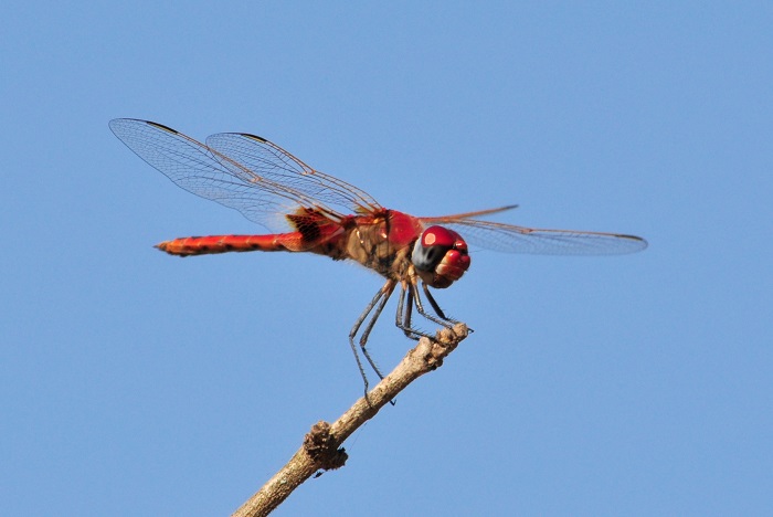
Phenology
Glistening DemoisellePhaon iridipennis Mkuze River, KwaZulu-Natal Photo by Ryan Tippett
Further Resources
The use of photographs by Andries de Vries is acknowledged.
Other common names: Glinsterjuffertjie (Afrikaans).
Recommended citation format: Loftie-Eaton M; Navarro R; Tippett RM; Underhill L. 2025. Glistening Demoiselle Phaon iridipennis. Biodiversity and Development Institute. Available online at https://thebdi.org/2020/04/20/glistening-demoiselle-phaon-iridipennis/
References: Tarboton, M; Tarboton, W. (2019). A Guide to the Dragonflies & Damselflies of South Africa. Struik Nature.
Samways, MJ. (2008). Dragonflies and Damselflies of South Africa. Pensoft
Samways, MJ. (2016). Manual of Freshwater Assessment for South Africa: Dragonfly Biotic Index. Suricata 2. South African National Biodiversity Institute, Pretoria
Martens, A; Suhling, F. (2007). Dragonflies and Damselflies of Namibia. Gamsberg Macmillan.
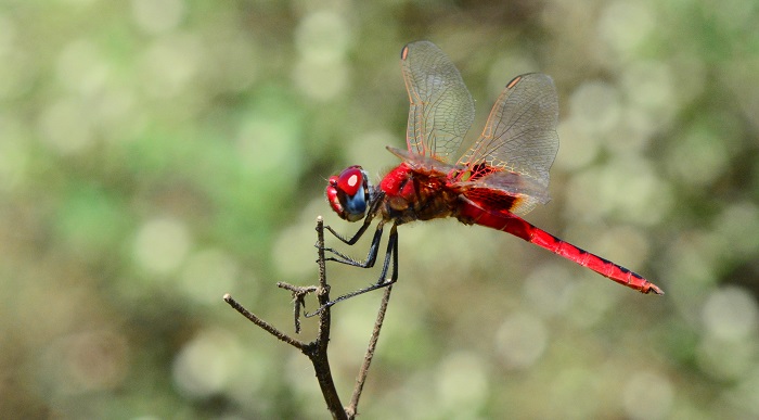
Glistening DemoisellePhaon iridipennis Amakhosi Game Reserve, KwaZulu-Natal Photo by Ryan Tippett
Find the Pallid Spreadwing in the FBIS database (Freshwater Biodiversity Information System) here.
Family Lestidae
Identification
Pallid SpreadwingLestes pallidus – Male Mpempe Pan, KwaZulu-Natal Photo by Ryan Tippett
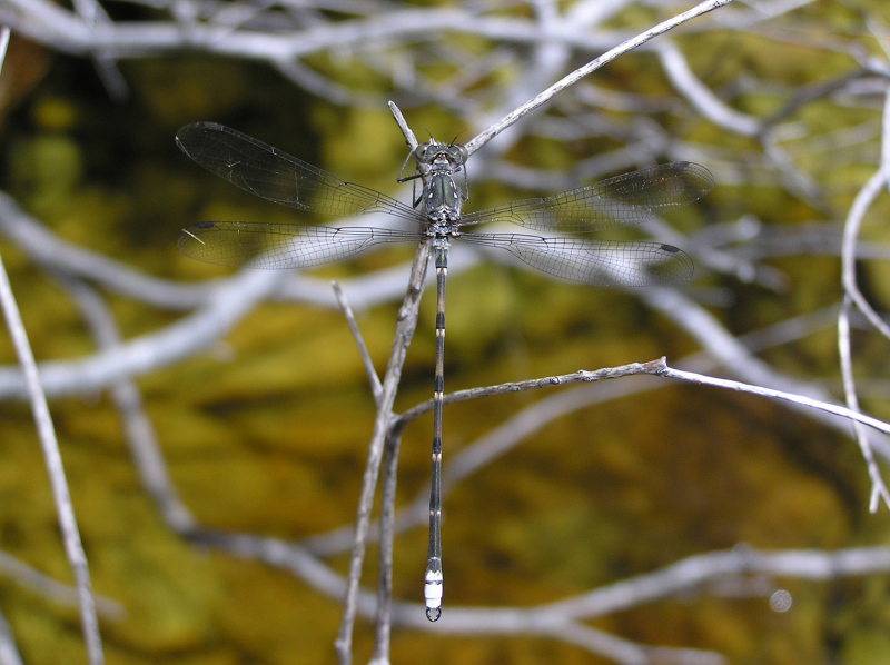
Small size
Length up to 44mm; Wingspan attains 48mm.
The Pallid Spreadwing exhibits highly variable colouration. The khaki brown form of Lestes pallidus is very similar to Lestes ictericus (Tawny Spreadwing), but that species has noticeably rounded wing tips, plain brown pterostigmas and differently shaped claspers.
Pallid SpreadwingLestes pallidus – Female Hluhluwe district, KwaZulu-Natal Photo by Ryan Tippett
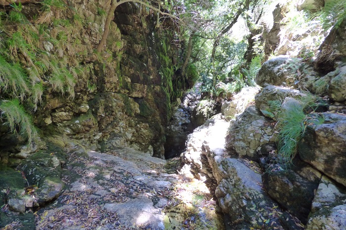
Habitat
The Pallid Spreadwing favours ephemeral habitats, particularly rain-filled water bodies. It inhabits pools, pans, and marshy areas with an abundance of grass. The Pallid Spreadwing is mostly found in seasonally dry savanna regions.
Habitat – Near Hluhluwe, KwaZulu-Natal Photo by Ryan Tippett
Behaviour
The Pallid Spreadwing is able to rapidly colonise seasonal waterbodies after rain, even sites that have been dry for several years. It spends long periods perched on grass stems with its wings outstretched. The Pallid Spreadwing is often gregarious and both sexes are found in the same vicinity.
The Pallid Spreadwing is most active from September to May, but flies all year at some sites (See Phenology below).
Pallid SpreadwingLestes pallidus – Pair Ehlatini Bush Camp, KwaZulu-Natal Photo by Ryan Tippett
Status and Conservation
The Pallid Spreadwing is localised, but common to abundant where it occurs. It is listed as of Least Concern in the IUCN Red List of Threatened Species.
Pallid SpreadwingLestes pallidus – Male Carnarvon district, Northern Cape Photo by Ryan Tippett
Distribution
The Pallid Spreadwing is native to Sub-Saharan Africa, where it is widespread but patchily distributed.
In South Africa, the Pallid Spreadwing is widespread in the north, becoming less common in the south where it is far more localised.
Pallid SpreadwingLestes pallidus – Male Linyanti, Botswana Photo by Ryan Tippett
Below is a map showing the distribution of records for Pallid Spreadwing in the OdonataMAP database as at February 2020.
Below is a map showing the distribution of records for Pallid Spreadwing in the OdonataMAP database as of December 2024.
The next map below is an imputed map, produced by an interpolation algorithm, which attempts to generate a full distribution map from the partial information in the map above. This map will be improved by the submission of records to the OdonataMAP section of the Virtual Museum.
Ultimately, we will produce a series of maps for all the odonata species in the region. The current algorithm is a new algorithm. The objective is mainly to produce “smoothed” maps that could go into a field guide for odonata. This basic version of the algorithm (as mapped above) does not make use of “explanatory variables” (e.g. altitude, terrain roughness, presence of freshwater — we will be producing maps that take these variables into account soon). Currently, it only makes use of the OdonataMAP records for the species being mapped, as well as all the other records of all other species. The basic maps are “optimistic” and will generally show ranges to be larger than what they probably are.
These maps use the data in the OdonataMAP section of the Virtual Museum, and also the database assembled by the previous JRS funded project, which was led by Professor Michael Samways and Dr KD Dijkstra.
Pallid SpreadwingLestes pallidus – Male Hluhluwe district, KwaZulu-Natal Photo by Ryan Tippett
Phenology
Pallid SpreadwingLestes pallidus – Female Hluhluwe district, KwaZulu-Natal Photo by Ryan Tippett
Further Resources
The use of photographs by Alan Manson is acknowledged. All other photographs by Ryan Tippett.
Pallid SpreadwingLestes pallidusRambur, 1842
Other common names: Pale Spreadwing (Alt. English); Bleekspanvlerkie (Afrikaans)
Recommended citation format: Loftie-Eaton M; Navarro R; Tippett RM; Underhill L. 2025. Pallid Spreadwing Lestes pallidus. Biodiversity and Development Institute. Available online at https://thebdi.org/2020/04/20/pallid-spreadwing-lestes-pallidus/
References: Tarboton, M; Tarboton, W. (2019). A Guide to the Dragonflies & Damselflies of South Africa. Struik Nature.
Samways, MJ. (2008). Dragonflies and Damselflies of South Africa. Pensoft
Samways, MJ. (2016). Manual of Freshwater Assessment for South Africa: Dragonfly Biotic Index. Suricata 2. South African National Biodiversity Institute, Pretoria
Martens, A; Suhling, F. (2007). Dragonflies and Damselflies of Namibia. Gamsberg Macmillan.
Pallid SpreadwingLestes pallidus – Female Ehlatini Bush Camp, KwaZulu-Natal Photo by Ryan Tippett
Find the Tawny Spreadwing in the FBIS database (Freshwater Biodiversity Information System) here.
Family Lestidae
Identification
Tawny SpreadwingLestes ictericus Lusaka Province, Zambia Photo by Norman Barrett
Small size
Length up to 38mm.
The Tawny Spreadwing is an elongate, drab coloured damselfly with few distinguishing features. It is very similar to the common pale brown form of the Pallid Spreadwing (Lestes pallidus). The Tawny Spreadwing is told apart by having broad, rounded wing tips, plain brownish (not bicoloured) pterostigmas, and in males by the differently shaped claspers that lack inner teeth.
Females closely resemble the males but lack the distinctive claspers.
The Tawny Spreadwing is a tropical savanna species. It lives near seasonal pools and pans, especially where there is shallowly flooded grass. It occupies similar habitats to Lestes pallidus but seems to prefer more humid savanna regions.
Behaviour
The Tawny Spreadwing is usually found at water where it sits on emergent grass stems with wings outstretched. In South Africa it has been recorded during March and April. See Phenology below.
Status and Conservation
The Tawny Spreadwing is rare in South Africa. It is listed as Vulnerable in the IUCN Red List of Threatened Species.
Distribution
The Tawny Spreadwing is native to the wetter savanna regions of Sub-Saharan Africa. Lestes ictericus is marginal in South Africa where it is only recorded from extreme north-eastern KwaZulu-Natal.
Below is a map showing the distribution of records for Tawny Spreadwing in the OdonataMAP database as at February 2020.
The next map below is an imputed map, produced by an interpolation algorithm, which attempts to generate a full distribution map from the partial information in the map above. This map will be improved by the submission of records to the OdonataMAP section of the Virtual Museum.
Ultimately, we will produce a series of maps for all the odonata species in the region. The current algorithm is a new algorithm. The objective is mainly to produce “smoothed” maps that could go into a field guide for odonata. This basic version of the algorithm (as mapped above) does not make use of “explanatory variables” (e.g. altitude, terrain roughness, presence of freshwater — we will be producing maps that take these variables into account soon). Currently, it only makes use of the OdonataMAP records for the species being mapped, as well as all the other records of all other species. The basic maps are “optimistic” and will generally show ranges to be larger than what they probably are.
These maps use the data in the OdonataMAP section of the Virtual Museum, and also the database assembled by the previous JRS funded project, which was led by Professor Michael Samways and Dr KD Dijkstra.
Phenology
Further Resources
The use of photographs by Bertie Brink and Norman Barrett is acknowledged.
Tawny SpreadwingLestes ictericusGerstäcker, 1869
Other Common Names: Yellow Spreadwing (Alt. English); Geelbruinspanvlerkie (Afrikaans).
Recommended citation format: Loftie-Eaton M; Navarro R; Tippett RM; Underhill L. 2025. Tawny Spreadwing Lestes ictericus. Biodiversity and Development Institute. Available online at https://thebdi.org/2020/04/20/tawny-spreadwing-lestes-ictericus/
References: Tarboton, M; Tarboton, W. (2019). A Guide to the Dragonflies & Damselflies of South Africa. Struik Nature.
Samways, MJ. (2008). Dragonflies and Damselflies of South Africa. Pensoft
Samways, MJ. (2016). Manual of Freshwater Assessment for South Africa: Dragonfly Biotic Index. Suricata 2. South African National Biodiversity Institute, Pretoria
Find the Sickle Spreadwing in the FBIS database (Freshwater Biodiversity Information System) here.
Family Lestidae
Identification
Sickle SpreadwingLestes uncifer – Male Near Hluhluwe, KwaZulu-Natal Photo by Ryan Tippett
Medium-large size
Length up to 48mm; Wingspan reaches 51mm.
The Sickle Spreadwing is easily recognised and unlike any other spreadwing in the region. Its large size and green, turquoise and brown colouration is distinctive. In males the obviously hooked, white claspers are diagnostic.
Females are similar to males but are duller and lack the distinctive white, hooked claspers.
Sickle SpreadwingLestes uncifer – Pair Near Hluhluwe, KwaZulu-Natal Photo by Ryan Tippett
Habitat
The Sickle Spreadwing inhabits ponds, pools, and marshes. It prefers habitats with tall grass and sedges surrounded by dense bush. Lestes uncifer is restricted to low altitudes, mostly in humid, and well-wooded, or forested areas.
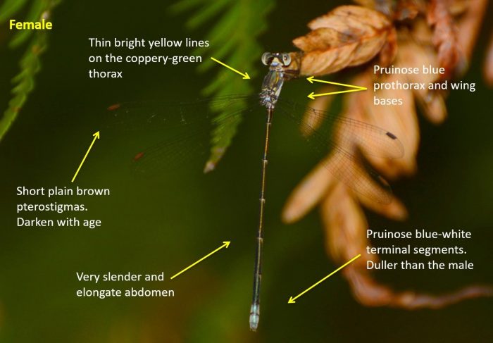
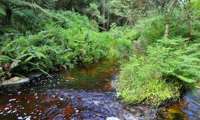
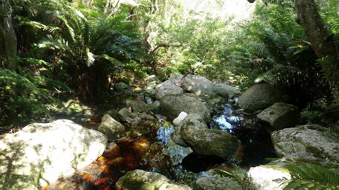
Habitat – Near Hluhluwe, KwaZulu-Natal Photo by Ryan Tippett
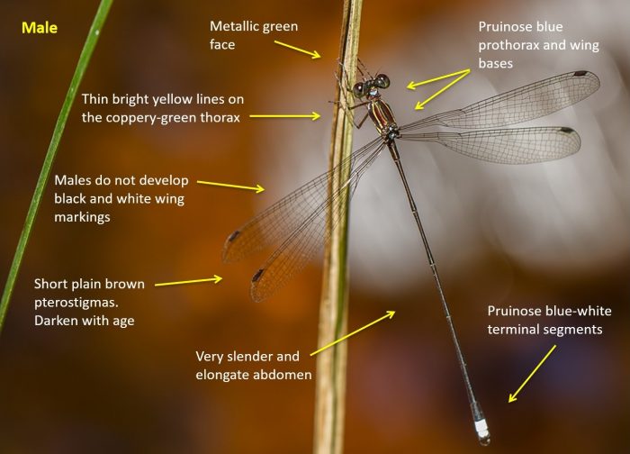
Behaviour
The Sickle Spreadwing spends long periods hanging vertically from tall emergent plant stems. It is well camouflaged and is a shy and weary species that retreats into thick vegetation when disturbed. Females occur in the same vicinity as the males. The Sickle Spreadwing takes relatively large prey, including other damselfly species.
Sickle SpreadwingLestes uncifer – Feeding on a Spotted Spreadwing Lestes tridens. Near Hluhluwe, KwaZulu-Natal Photo by Ryan Tippett
The Sickle Spreadwing is most active from late November to June, possibly all year at some sites. See Phenology below.
Status and Conservation
The Sickle Spreadwing is an uncommon and highly localised species. In South Africa, it is listed as Vulnerable in the IUCN Red List of Threatened Species. This is due to its scarcity and marginal occurrence in the country. The Sickle Spreadwing has a wider distribution in tropical Africa and is considered of Least Concern over the rest of its range. The Sickle Spreadwing is fairly sensitive to habitat degradation and is mostly found in undisturbed places. In some areas it will make use of small man-made ponds and dams, provided they offer good quality habitat.
Sickle SpreadwingLestes uncifer – Male Near Hluhluwe, KwaZulu-Natal Photo by Ryan Tippett
Distribution
The Sickle Spreadwing is native to much of the southern and eastern parts of Africa, where it is widespread. It ranges from South Africa northwards to Kenya and Uganda. In South Africa, the Sickle Spreadwing is found in the lowveld regions of Limpopo and Mpumalanga, and the sub-tropical north-eastern parts of KwaZulu-Natal.
Below is a map showing the distribution of records for Sickle Spreadwing in the OdonataMAP database as at February 2020.
Below is a map showing the distribution of records for Sickle Spreadwing in the OdonataMAP database as of December 2024.
The next map below is an imputed map, produced by an interpolation algorithm, which attempts to generate a full distribution map from the partial information in the map above. This map will be improved by the submission of records to the OdonataMAP section of the Virtual Museum.
Ultimately, we will produce a series of maps for all the odonata species in the region. The current algorithm is a new algorithm. The objective is mainly to produce “smoothed” maps that could go into a field guide for odonata. This basic version of the algorithm (as mapped above) does not make use of “explanatory variables” (e.g. altitude, terrain roughness, presence of freshwater — we will be producing maps that take these variables into account soon). Currently, it only makes use of the OdonataMAP records for the species being mapped, as well as all the other records of all other species. The basic maps are “optimistic” and will generally show ranges to be larger than what they probably are.
These maps use the data in the OdonataMAP section of the Virtual Museum, and also the database assembled by the previous JRS funded project, which was led by Professor Michael Samways and Dr KD Dijkstra.
Phenology
Sickle SpreadwingLestes uncifer – Male Near Hluhluwe, KwaZulu-Natal Photo by Ryan Tippett
Further Resources
The use of photographs by John Wilkinson is acknowledged. All other photographs by Ryan Tippett.
Sickle SpreadwingLestes unciferKarsch, 1899
Other common names: Sekelspanvlerkie (Afrikaans)
Recommended citation format: Loftie-Eaton M; Navarro R; Tippett RM; Underhill L. 2025. Sickle Spreadwing Lestes uncifer. Biodiversity and Development Institute. Available online at https://thebdi.org/2020/04/20/sickle-spreadwing-lestes-uncifer/
References: Tarboton, M; Tarboton, W. (2019). A Guide to the Dragonflies & Damselflies of South Africa. Struik Nature.
Samways, MJ. (2008). Dragonflies and Damselflies of South Africa. Pensoft
Samways, MJ. (2016). Manual of Freshwater Assessment for South Africa: Dragonfly Biotic Index. Suricata 2. South African National Biodiversity Institute, Pretoria
Sickle SpreadwingLestes uncifer – Pair Near Hluhluwe, KwaZulu-Natal Photo by Ryan Tippett
Find the Peak Bluet in the FBIS database (Freshwater Biodiversity Information System) here.
Family Coenagrionidae
Identification
Peak BluetAfricallagma sinuatum – Male Monk’s Cowl, KwaZulu-Natal Photo by Evert Kleynhans
Small size
Length up to 36mm; Wingspan attains 37mm.
The Peak Bluet is a small blue, green, and black damselfly. It is the most elongated Bluet in the region. The very long slender abdomen and distinctive clasper shape should rule out any confusion with other species.
The Peak Bluet is most similar to the Slender Bluet (Africallagma fractum). The Peak Bluet is more elongate and has a greenish hue on the upper thorax. It also has distinctively shaped claspers.
The Peak Bluet is a species of the grassland biome. It occurs in open, mountainous regions with high rainfall where it inhabits the grassy fringes of seeps and streams. The Peak Bluet is mostly found between 1000 to 2000m above sea level.
Behaviour
The Peak Bluet usually perches on grass stems over the water, it may occasionally also be seen seen sitting on rocks in the stream.
The Peak Bluet is on the wing from September to March.
Status and Conservation
The Peak Bluet is uncommon and localised in South Africa. It is listed as of Least Concern in the IUCN Red List of Threatened Species.
Distribution
Africallagma sinuatum has a disjunct distribution in south-east Africa and has been recorded in the Democratic Republic of the Congo, Ethiopia, Malawi, South Africa, Tanzania, Zambia, and Zimbabwe. In South Africa, the Peak Bluet has only been recorded from several widely scattered locations in Mpumalanga, KwaZulu-Natal, and the Eastern Cape.
Below is a map showing the distribution of records for Peak Bluet in the OdonataMAP database as of February 2020.
Below is a map showing the distribution of records for Peak Bluet in the OdonataMAP database as of December 2024.
The next map below is an imputed map, produced by an interpolation algorithm, which attempts to generate a full distribution map from the partial information in the map above. This map will be improved by the submission of records to the OdonataMAP section of the Virtual Museum.
Ultimately, we will produce a series of maps for all the odonata species in the region. The current algorithm is a new algorithm. The objective is mainly to produce “smoothed” maps that could go into a field guide for odonata. This basic version of the algorithm (as mapped above) does not make use of “explanatory variables” (e.g. altitude, terrain roughness, presence of freshwater — we will be producing maps that take these variables into account soon). Currently, it only makes use of the OdonataMAP records for the species being mapped, as well as all the other records of all other species. The basic maps are “optimistic” and will generally show ranges to be larger than what they probably are. These maps use the data in the OdonataMAP section of the Virtual Museum, and also the database assembled by the previous JRS funded project, which was led by Professor Michael Samways and Dr KD Dijkstra.
Further Resources
The use of photographs by Evert Kleynhans and Lappies Labuschagne is acknowledged.
Peak BluetAfricallagma sinuatum(Ris, 1921)
Other Common names: Spitsbloutjie (Afrikaans).
Recommended citation format: Loftie-Eaton M; Navarro R; Tippett RM; Underhill L. 2025. Peak Bluet Africallagma sinuatum. Biodiversity and Development Institute. Available online at https://thebdi.org/2020/04/17/peak-bluet-africallagma-sinuatum/
References: Tarboton, M; Tarboton, W. (2019). A Guide to the Dragonflies & Damselflies of South Africa. Struik Nature.
Samways, MJ. (2008). Dragonflies and Damselflies of South Africa. Pensoft
Samways, MJ. (2016). Manual of Freshwater Assessment for South Africa: Dragonfly Biotic Index.Suricata 2. South African National Biodiversity Institute, Pretoria
Find the Sooty Threadtail in the FBIS database (Freshwater Biodiversity Information System) here.
Family Platycnemididae
Identification
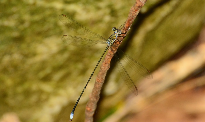
Sooty ThreadtailElattoneura frenulata – Male Seweweekspoort, Western Cape Photo by Ryan Tippett
Small size
Length up to 35mm; Wingspan attains 46mm
Male Sooty Threadtails are easily identified by their elongate build and dark colouration. Females are very similar to those of Elattoneura glauca (Common Threadtail), but are generally darker. Best told by their association with the males.
The Sooty Threadtail inhabits mountainous areas. It frequents well-vegetated, flowing streams and rivers, ideally with pools and slow-moving sections. It is often found among tall grass and other rank vegetation along the riverbank.
Habitat – Bainskloof, Western Cape Photo by Sharon Stanton
Behaviour
The Sooty Threadtail perches low down on grass stems and other stream side vegetation. It frequently sits on rocks or bare ground close to the water. Females are usually found in the same vicinity as the males. The Sooty Threadtail is generally sluggish and reluctant to fly. It does not fly far once disturbed and quickly resettles on a perch.
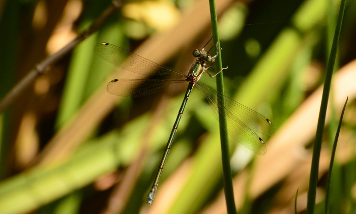
Most active from October to March (See Phenology below).
Sooty ThreadtailElattoneura frenulata – Male Tradouw’s Pass, Western Cape Photo by Ryan Tippett
Status and Conservation
Although it has a restricted distribution, the Sooty Threadtail is locally common. It is listed as of Least Concern in the IUCN Red List of Threatened Species. The Sooty Threadtail is moderately sensitive to habitat damage. It requires clean, clear water, but it does occur in habitats with some alien vegetation. The Sooty Threadtail will also readily make use of suitable, small, man-made impoundments along streams and rivers.
Sooty ThreadtailElattoneura frenulata – Male Vanrhynsdorp Waterfall, Western Cape Photo by Ryan Tippett
Distribution
The Sooty Threadtail is endemic to South Africa. It is widespread in the mountainous regions of the Western Cape, extending marginally into the Eastern Cape province.
Below is a map showing the distribution of records for Sooty Threadtail in the OdonataMAP database as at February 2020.
Below is a map showing the distribution of records for Sooty Threadtail in the OdonataMAP database as of December 2024.
The next map below is an imputed map, produced by an interpolation algorithm, which attempts to generate a full distribution map from the partial information in the map above. This map will be improved by the submission of records to the OdonataMAP section of the Virtual Museum.
Ultimately, we will produce a series of maps for all the odonata species in the region. The current algorithm is a new algorithm. The objective is mainly to produce “smoothed” maps that could go into a field guide for odonata. This basic version of the algorithm (as mapped above) does not make use of “explanatory variables” (e.g. altitude, terrain roughness, presence of freshwater — we will be producing maps that take these variables into account soon). Currently, it only makes use of the OdonataMAP records for the species being mapped, as well as all the other records of all other species. The basic maps are “optimistic” and will generally show ranges to be larger than what they probably are. These maps use the data in the OdonataMAP section of the Virtual Museum, and also the database assembled by the previous JRS funded project, which was led by Professor Michael Samways and Dr KD Dijkstra.
Sooty ThreadtailElattoneura frenulata – Male Seweweekspoort, Western Cape Photo by Ryan Tippett
Phenology
Sooty ThreadtailElattoneura frenulata – Male Tradouw’s Pass, Western Cape Photo by Ryan Tippett
Further Resources
The use of photographs by Corrie du Toit and Sharon Stanton is acknowledged. All other photographs by Ryan Tippett.
Other common names: Roetswartdraadstertjie (Afrikaans)
Recommended citation format: Loftie-Eaton M; Navarro R; Tippett RM; Underhill L. 2025. Sooty Threadtail Elattoneura frenulata. Biodiversity and Development Institute. Available online at https://thebdi.org/2020/04/17/sooty-threadtail-elattoneura-frenulata/
References: Tarboton, M; Tarboton, W. (2019). A Guide to the Dragonflies & Damselflies of South Africa. Struik Nature.
Samways, MJ. (2008). Dragonflies and Damselflies of South Africa. Pensoft
Samways, MJ. (2016). Manual of Freshwater Assessment for South Africa: Dragonfly Biotic Index. Suricata 2. South African National Biodiversity Institute, Pretoria
Sooty ThreadtailElattoneura frenulata – Male Seweweekspoort, Western Cape Photo by Ryan Tippett
Definition. The lowdown : the most important facts and information about something (Cambridge Dictionary). This blog summarizes the key results out of LepiMAP for the butterflies of KwaZulu-Natal and the Eastern Cape.
LepiMAP is the atlas of the Lepidoptera, both butterflies and moths, in Africa. It is one of the sections of the Virtual Museum. The first major output out of this database was the Conservation Assessment of Butterflies of South Africa, Lesotho and Swaziland. The development of this atlas is reviewed here. The butterfly atlas not only collected new distributional data using the Virtual Museum and dedicated field surveys, it also assembled the data for 300,000 records of specimens in museums and private collections. Some of the specimens were collected in the 19th century. The total number of records for this atlas was 337,000. This substantial database was the platform on which the LepiMAP initiative grew. The total size of the LepiMAP database on 15 April 2020 was 546,767 records, both butterflies and moths, throughout Africa.
This review is focuses on a small geographic component of the data, and only on the butterflies. This is the first of three blogs on the state of play in LepiMAP in South Africa. This one deals with KwaZulu-Natal and the Eastern Cape. The second with Western Cape, Northern Cape and the Free State, and the third with the remaining northern provinces of South Africa: North West, Limpopo, Mpumalanga and Gauteng.
LepiMAP is now using the updated taxonomy and the English common names in the second edition of Steve Woodhall’s Field Guide to the Butterflies of South Africa. The revision was published by Penguin Random House in March this year. It features the 671 species of butterflies which have been recorded in South Africa, Lesotho and Eswatini. The common names of the butterflies have been changed as part of an initiative to give butterflies more descriptive names (e.g. the area they fly in or the habitat that they prefer). The coppers (Aloeides) are now knowns as russets. The bars (Cigaritis) are now called silverlines.
KwaZulu-Natal
Butterfly species richness in the quarter degree grid cells of KwaZulu-Natal, from the LepiMAP database. This analysis uses the entire database, including museum and specimen records.
What is special about LepiMAP in KwaZulu-Natal is that every quarter degree grid cell has records of butterflies. That’s not quite right. There’s a grid cell with only one record and one species. It is grid cell 2731DD Ngxongwane. This record is of a Red-line SapphireIolaus sidus made by BW Plowes in January 1986. That’s 34 years ago! After the lockdown, someone needs to make a special effort to go to visit quarter-degree grid cell 2731DD Ngxongwane! It is not a long distance from the N2 as it heads northwestwards south of Eswatini.
The grid cell which seems to have the most species is 2931CC Durban East. An uncritical look at the database says that 286 species of butterfly have been recorded here. The oldest record in the database for this grid cell was made on 17 February 1854 by CGC Dickson. It’s an African Snout Libythea labdaca laius. Inside the database, in the part not open to public viewing, it says it this record was made at “Durban Morningside Burman Bush”, a locality that still persists to this day. This place description would have been linked to the actual specimen, so it is a genuine record of a species in this grid cell. The database has a total of 55 records for this species in this grid cell, made through the decades; the most recent was made by Jenny Norman on 22 March 2004, 16 years ago. African Snout needs to be refreshed.
This Durban East grid cell has an alleged total of 14,093 records of butterflies! The problem here is that there are a huge number of early museum specimens that are simply labelled “Durban” and have had their coordinates directed into this grid cell. The number of records for this grid cell since 1980 is 2,570. It would be a massively time consuming exercise to go through all the early records, and to try to work out which of the old records really came from this grid cell, and which came from somewhere in the general vicinity of “Durban”. Fortunately, this is serious problem only for this grid cell! 286 species here, even historically since 1854, is a bit of a stretch, even though it includes the bluff, the largely destroyed wetlands of Durban Bay and Durban North. See the map here.
Pride of place for the grid cell with the most butterfly records goes to 3030BC Scottburgh. It has 16,559 records; of these, 14,614 are photographic LepiMAP records uploaded via the Virtual Museum website. The photographic records stretch back to 2008, and have been contributed by citizen scientists such as Mary Lindsay, Christopher Small, Mark Liptrot, Luelle Watts, Trish Strachan, Christopher Willis and Garth Aiston. There must be a fantastic opportunity here to look at subtle changes in species composition through the past decade.
One-year butterfly species richness in the quarter degree grid cells of KwaZulu-Natal, from the LepiMAP database. This map is based on LepiMAP records from 12 April 2019 to 12 April 2020
This map is quite alarmingly empty! Steve Woodhall admonishes LepiMAPpers: “For me, the take home message from this map is that we KZNers have become creatures of habit, going to our favourite spots month in month out!” The two grid cells towards the south with 159 and 138 species are 2930DD Durban West and 3030BC Scottsburgh, respectively. These have resident LepiMAPpers, and their long-term regular contributions are going to be amazing to search for trends. Two grid farther north have more than 100 species in the past year. Steve says: “2931AB Tugela (105 species) is high because of the popularity of Harold Johnson Nature Reserve, and in 2831CD Eshowe the popular spots are Dlinza and Mandawe. We need to move out.”
Months of the most recent visits to the quarter degree grid cells of KwaZulu-Natal, according to the LepiMAP database. The year of the visit is colour-coded according to the bar on the right, and the month of the last butterfly record submitted to LepiMAP is shown in the grid cell. Grid cells shaded beige have not had a butterfly record submitted since prior to the year 2000.
Many grid cells are dark blue or light blue, so that they have had records since 1 January 2019, especially along the coast on along the N3 axis towards the interior. But an inspection of the previous figure shows that, in many grid cells, just a handful of records have been made! There are two grid cells which are beige, so they have not had a single record this millennium!
Eastern Cape
Butterfly species richness in the quarter degree grid cells of the Eastern Cape, from the LepiMAP database. This analysis uses the entire database, including museum and specimen records.
In the Eastern Cape, the grid cells having the largest species richness for butterflies are mainly along the coast and the coastal plain. The grid cell with the largest number of species, according to the database, is 3129DA Port St Johns. There are 5,315 records of butterflies allegedly from this grid cell, and 227 species. But 3,453 of these are prior to 1980. It is likely that this grid cell has the same problem is the Durban East grid cell mentioned above. The 1,862 records since 1980 represent 182 species, and it remains the most species rich grid cell in the Eastern Cape. Many museum specimens collected over a large area would have been labelled “Port St Johns”, which was once the largest town in the region.
One-year butterfly species richness in the quarter degree grid cells of the Eastern Cape, from the LepiMAP database. This map is based on LepiMAP records from 12 April 2019 to 12 April 2020
Most records of butterflies submitted to LepiMAP from the Eastern Cape during the past year have been from coastal grid cells. It would be amazing to get a lot more records from all over the Eastern Cape!
Months of the most recent visits to the quarter degree grid cells of the Eastern Cape, according to the LepiMAP database. The year of the visit is colour-coded according to the bar on the right, and the month of the last butterfly record submitted to LepiMAP is shown in the grid cell. Grid cells shaded beige have not had a butterfly record submitted since prior to the year 2000.
There is a large number of grid cells shaded beige, and without a month. These have not been visited this millennium! There is lot of opportunity to make a major contribution to LepiMAP in all these grid cells.
Fanie Rautenbach does almost all the identifications of butterflies for LepiMAP. We asked him for his ideas on all these maps, for both provinces. He said: “I think these maps are very informative. The more you look at them the more information you see. However, they do highlight a major problem we have with LepiMAP. The project is doing well in a small number of sectors and doing not so well in the majority of sectors. I am especially surprised by the number of sectors in the Eastern Cape that have no records in the last 20 years. We really need to come up with ideas (1) to recruit more citizen scientists in the rural areas and (2) to encourage current citizen scientists to travel more.” If you are able to help, please do. The need is great.
Find the Vaal Sprite in the FBIS database (Freshwater Biodiversity Information System) here.
Family Coenagrionidae
Identification
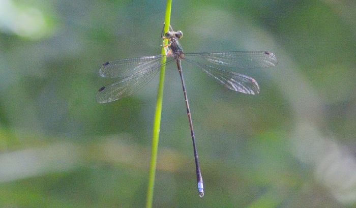
Vaal SpritePseudagrion vaalense – Mature Male Near Prieska, Northern Cape Photo by Ryan Tippett
Small size but is the largest of the ‘Red’ sprites in South Africa.
Length up to 39mm; Wingspan attains 49mm
Like many other Pseudagrion species the male Vaal Sprite’s colouration is variable and changes gradually with age. The postocular spots in particular, range from greenish when young, through greenish-orange, to orange-brown in aged individuals. The sides of the thorax are greenish-blue in young individuals. The light blue pruinosity starts low down and eventually extends up to the antehumeral stripe with maturity.
Vaal SpritePseudagrion vaalense – Young Male Upington, Northern Cape Photo by Ryan Tippett
Females are khaki brown, often with a thin pale blue dusting on the sides of the thorax and abdomen. They are best identified by their association with the males.
The Vaal Sprite is one of four mostly red sprites found in South Africa. The others are the Acacia Sprite, Masai Sprite, and the Variable Sprite
Vaal SpritePseudagrion vaalense – Female Near Prieska, Northern Cape Photo by Ryan Tippett
Habitat
The Vaal Sprite inhabits strong flowing rivers in open landscapes. The preferred habitat is fast flowing water with abundant rocks and some emergent and bank side vegetation like reeds and grasses. It appears to somewhat avoid large stretches of broken or white water. In areas where they are numerous, the Vaal Sprite will also occupy slow-moving parts of the river as well as quiet backwaters. Pseudagrion vaalense mostly frequents undisturbed habitats and generally avoids dams and degraded stretches of rivers.
Ideal habitat – Orange River near Keimoes, Northern Cape Photo by Ryan Tippett
Behaviour
The Vaal Sprite is seldom found away from rivers. They perch prominently at sunny locations on rocks and vegetation, typically low down, close to the water. It is weary and alert, often flying to midstream rocks and reeds when disturbed. The Vaal Sprite frequently hovers over eddies and swirls where the current is strong. The flight is rapid and usually low over the water. Females are frequently found in the same vicinity as the males.
The Vaal Sprite is active from OctobertoMay (see Phenology below)
Vaal SpritePseudagrion vaalense Near Prieska, Northern Cape Photo by Ryan Tippett
Status and Conservation
The Vaal Sprite is locally common at suitable sites within its restricted distribution. It is listed as of Least Concern in the IUCN Red List of Threatened Species. The Vaal Sprite is moderately sensitive to habitat degradation and occurs mostly in undisturbed places. The species has not adapted to man-made habitats.
Vaal SpritePseudagrion vaalense Near Keimoes, Northern Cape Photo by Ryan Tippett
Distribution
The Vaal Sprite is endemic to South Africa and southern Namibia. It is restricted to the Orange/Vaal River system and its major tributaries. The Vaal Sprite has been recorded from the Free State, North West, Northern Cape, and Eastern Cape Provinces.
Vaal SpritePseudagrion vaalense Near Keimoes, Northern Cape Photo by Ryan Tippett

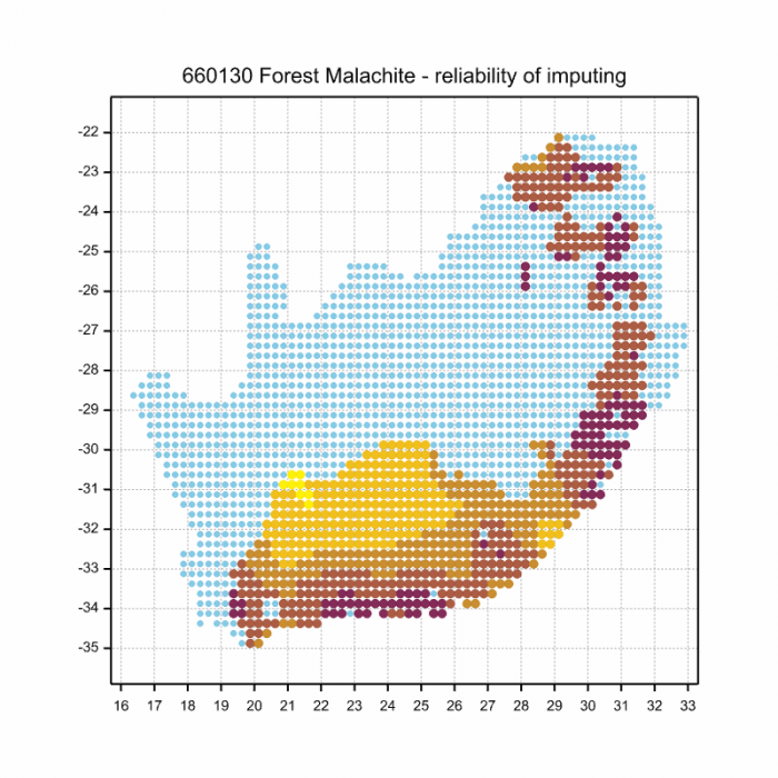
Below is a map showing the distribution of records for Vaal Sprite in the OdonataMAP database as at February 2020.
Below is a map showing the distribution of records for Vaal Sprite in the OdonataMAP database as of December 2024.
The next map below is an imputed map, produced by an interpolation algorithm, which attempts to generate a full distribution map from the partial information in the map above. This map will be improved by the submission of records to the OdonataMAP section of the Virtual Museum.
Ultimately, we will produce a series of maps for all the odonata species in the region. The current algorithm is a new algorithm. The objective is mainly to produce “smoothed” maps that could go into a field guide for odonata. This basic version of the algorithm (as mapped above) does not make use of “explanatory variables” (e.g. altitude, terrain roughness, presence of freshwater — we will be producing maps that take these variables into account soon). Currently, it only makes use of the OdonataMAP records for the species being mapped, as well as all the other records of all other species. The basic maps are “optimistic” and will generally show ranges to be larger than what they probably are.
These maps use the data in the OdonataMAP section of the Virtual Museum, and also the database assembled by the previous JRS funded project, which was led by Professor Michael Samways and Dr KD Dijkstra.
Vaal SpritePseudagrion vaalense Near Keimoes, Northern Cape Photo by Ryan Tippett
Phenology
Vaal SpritePseudagrion vaalense – Pair Near Prieska, Northern Cape Photo by Ryan Tippett
Further Resources
All photographs by Ryan Tippett.
Vaal SpritePseudagrion vaalenseChutter, 1962
Other common names: Vaalriviergesie (Afrikaans)
Recommended citation format: Loftie-Eaton M; Navarro R; Tippett RM; Underhill L. 2025. Vaal SpritePseudagrion vaalense. Biodiversity and Development Institute. Available online at https://thebdi.org/2020/04/13/vaal-sprite-pseudagrion-vaalense/
References: Tarboton, M; Tarboton, W. (2019). A Guide to the Dragonflies & Damselflies of South Africa. Struik Nature.
Samways, MJ. (2008). Dragonflies and Damselflies of South Africa. Pensoft
Samways, MJ. (2016). Manual of Freshwater Assessment for South Africa: Dragonfly Biotic Index. Suricata 2. South African National Biodiversity Institute, Pretoria
Martens, A; Suhling, F. (2007). Dragonflies and Damselflies of Namibia. Gamsberg Macmillan.
Vaal SpritePseudagrion vaalense – Female Near Prieska, Northern Cape Photo by Ryan Tippett
It’s clear that the world on the far side of the lockdown is going to be different. It also seems that birding will change. Birders will look up more! And see the blue sky birds.
It is striking how many of the recent submissions to BirdPix are variations of this theme:
Kelp Gull over Rondebosch on the 7th of Lockdown, otherwise known as 2 April 2020. Submitted to BirdPix by Itxaso Quintana (BirdPix 108342)
This is the bluest photo in the whole of BirdPix. And there have been dozens more blue sky birds since the start of the lockdown in South Africa on Friday 27 March. The theme of this blog is something like “the birds and the blues”.
When you run out of garden birds, or if you don’t have a garden, lockdown birding needs a new strategy. And judging by the photos submitted in the past two weeks, BirdPixers are looking up more and more.
Salome Willemse, based at Botuin Olives in Vanrhynsdorp, has submitted about half a dozen blue sky birds to BirdPix. She says: “I have realised that we have far more birds if you pay attention to the sky as well. I have recorded 64 species from my garden. Maybe 20 or so flew over.” This is the first African Black Swift she has seen in her pentad, which she atlases regularly.
African Black Swift over Botuin Olives on the outskirts of Vanryhnsdorp, Western Cape. 11 Lockdown = 6 April 2020. Submitted to BirdPix by Salome Willemse (BirdPix 108575)
This is also the first BirdPix record of African Black Swift in quarter degree grid cell3118DB and becomes its 132nd species. It’s not surprising that it took 336 BirdPix records for the grid cell to record this species, because the normal range of African Black Swift fades out at about the Olifants River, about 50 km to the south.
African Sacred Ibis over Botuin Olives on the outskirts of Vanryhnsdorp, Western Cape. 11 Lockdown = 6 April 2020. Submitted to BirdPix by Salome Willemse (BirdPix 108576)
Another of Salome’s blue sky birds is this African Sacred Ibis. Besides being a beautiful photo showing the translucence of the wings, what is fascinating about this photo is that the ibis is doing primary moult. The five outermost primaries look a bit duller than the inner ones, and the sixth one from the outside is not quite fully grown. The black tip of the feather is the first to be produced, and finally ends up in position on the trailing edge of the wing. Rather little is known about the moult of the African Sacred Ibis. So this record makes a contribution to ornithology.
Mark Stanton, in Randberg, says: “The garden certainly has its limits! …” So he looked up and found …
African Palm-Swift over Randburg, Gauteng. 12 Lockdown = 7 April 2020. Submitted to BirdPix by Mark Stanton (BirdPix 108653)
… African Palm-Swift. “This was a lifer for me in my garden! I just never bothered to try and get images of them before, I always assumed they were White-rumped Swifts which are common around here. This was in among the 100 images I took.” This is the second record of African Palm-Swift in grid cell 2627BB; the previous record was made in April 2017, so it was overdue for “refreshment“. This grid cell has 1,874 BirdPix records for 166 species.
Great White Pelicans over Riebeek Kasteel, Western Cape. 13 Lockdown = 8 April 2020. Submitted to BirdPix by Fiona Hellmann (BirdPix 108783)
One of Fiona Hellmann’s blue sky birds submitted to BirdPix was these two Great White Pelicans flying over her home in Riebeek Kasteel. Most pelicans in the Western Cape are based on Dassen Island. Every day the birds radiate out from the island and many feed at the farm dams in the Swartland, so they are fairly common in the area. Even so, this is the first BirdPix record for this grid cell (3318BD). Fiona says: “I’m not spending more time looking at the sky – just more time sitting on the stoep and watching everything fly past. My strategy is to listen out for the Pied Crows and White-necked Ravens. Most often when I hear them they are mobbing or harassing a bird of prey.” Her stoep view is below.
The view from Fiona Hellmann’s stoep over the Riebeek Mountains, Western Cape
But if you live in the suburbs, the view of the blue is interrupted by street furniture. Aesthetically, this might be a negative, but it provides a practical positive. Perches.
House Crow in Rondebosch East, Western Cape. 8 Lockdown = 3 April 2020. Submitted to BirdPix by Fanie Rautenbach (BirdPix 108510)
So you thought the House Crows had been eliminated from the Western Cape? They are still around. This blue sky bird was recorded by Fanie Rautenbach. Fanie plays a pivotal role in LepiMAP, and most of the records he submits to the Virtual Museum are butterflies, and he has also made some impressive contributions to other sections of the Virtual Museum. He does the identifications of almost all the butterflies, and does them amazingly fast. We owe him a special vote of thanks. He says: “At the moment, I have no other choice but to look skywards. Not much going on here in terms of butterflies here in my non-existent garden. Sometimes the House Crows wake me up with their persistent caws.”
Red-eyed Dove in Plumstead, Western Cape. 8 Lockdown = 3 April 2020. Submitted to BirdPix by Rene Navarro (BirdPix 108391)
Even Rene Navarro, the information systems specialist responsible for the original design of the Virtual Museum, for its development and for keeping it running, is staring up into the sky from time to time in his garden in Plumstead , camera at the ready. The scalloped edges of the breast feathers of this Red-eyed Dove indicate that it is a juvenile. The complex texture of the electricity cables is as interesting as the bird!
Jackal Buzzard in St Francis Bay, Eastern Cape. 8 Lockdown = 3 April 2020. Submitted to BirdPix by Desire and Gregg Darling (BirdPix 108552)
Perhaps not unsurprisingly, a fair proportion of the blue sky birds are of raptors. Desire and Gregg Darling submitted this awesome Jackal Buzzard from St Francis Bay in the Eastern Cape. This is the 19th record of Jackal Buzzard from grid cell 3424BB; the previous record was in July 2019, so it was due for “refreshment“. Other blue sky raptors are Verreaux’s Eagle from the northern Cederberg, African Harrier-Hawk from Randburg and African Fish-Eagle from Riebeek Kasteel.
The most frequently recorded blue sky bird was the ubiquitous Pied Crow. If you ignore the crows, the fascinating thing about this collage is the variety of shades of blue sky.
Swift Tern over Rondebosch, Western Cape. 9 Lockdown = 4 April 2020. Submitted to BirdPix by Karis Daniel (BirdPix 108475)
Karis Daniel photographed this Swift Tern flying north over suburban Rondebosch. It was one of many carrying a fish. The tide goes out a long way from Rondebosch! What’s going on? Currently Swift Terns are breeding on Robben Island. So the ultimate destination of each fish is a chick on the island. The terns must be catching the fish in False Bay, and taking the short cut across the peninsula between False Bay and Table Bay. The distance between the breeding colony and False Bay is about 45 km. So these birds are flying 90 km to fetch one fish for their chick.
This is a small part of the Swift Tern breeding colony on Robben Island on 8 March 2020. Submitted to BirdPix by Les Underhill (BirdPix 106285)
By good luck, BirdPix has a record of the 2020 Swift Tern breeding colony on Robben Island. The photo was taken on 8 March. At that stage, the terns were tightly on their nests, incubating eggs. On 4 April, when Karis took the photo with the fish, the eggs would have hatched, and parents would have to cope with hungry chicks. The nearest suitable fish must have been in False Bay. At least the birds didn’t take the long sea-route around Cape Point to get there.
Subantarctic Skua, offshore of Stilbaai, Western Cape. 7 Lockdown = 2 April 2020. Submitted to BirdPix by Menno and Krysia Stenvert (BirdPix 108631)
The blue is not only sky, it can also be sea. Of the 16 records of Subantarctic Skua in the BirdPix database, this is probably the only one taken from land. The remainder are at sea, often 20 or more kilometres from the shore. Menno Stenvert estimates that this Subantarctic Skua was about 1.5 km offshore of his home at Stilbaai.
What a lot of blue photographs. I hope you will go outside with your camera and patiently search the sky for birds. Please upload them to the Virtual Museum. The method for doing the submissions is described here.