

Cover photo by Gert Bensch.
Find Pinhey’s Wisp in the FBIS database (Freshwater Biodiversity Information System) here.
Family Coenagrionidae
Identification

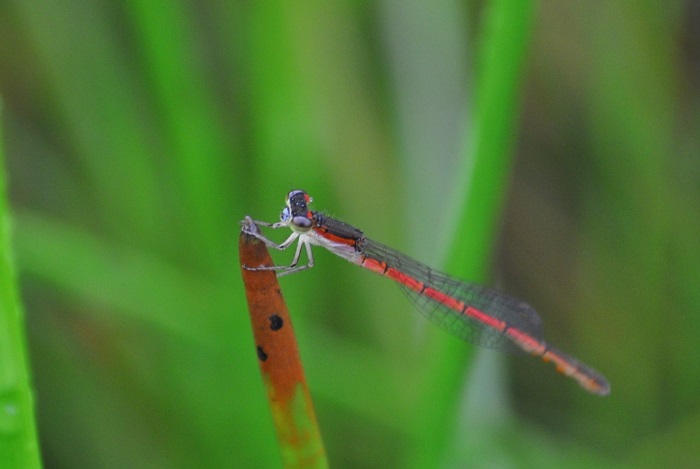
Near Underberg, KwaZulu-Natal
Photo by Ryan Tippett
Very small size
Length up to 21mm; Wingspan attains 26mm.
Pinhey’s Wisp is most like Agriocnemis exilis (Little Wisp). They are similar in size and are, in fact, the two smallest damselflies in the region. Pinhey’s Wisp has an unbroken green line across the face and an incomplete green line across the prothorax. The Little Wisp shows the exact opposite, having a broken green moustache and an unbroken green line on the prothorax.
Females are variable and best told by their association with the males.
Click here for more details on identification.
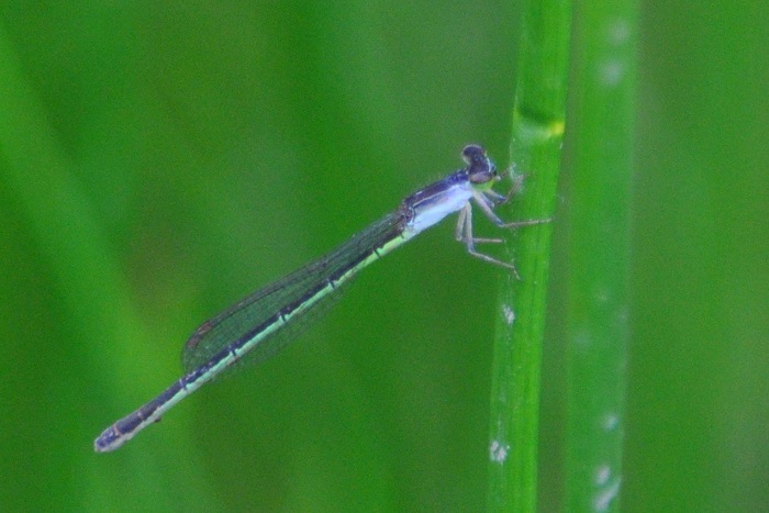
Near Underberg, KwaZulu-Natal
Photo by Ryan Tippett
Habitat
Pinhey’s Wisp inhabits the dense grass and sedge margins of pools, dams, seeps, and marshes, as well as the fringes of slow-moving streams. It is found at a fairly high altitude, from 1200m to 1600m above sea level.

Photo by Andries De Vries
Behaviour
Pinhey’s Wisp usually perches vertically on a sedge or grass stem. It typically sits low down, close to the water, among vegetation, where it is unobtrusive and easily overlooked.
Pinhey’s Wisp is on the wing from October to April (See Phenology below).
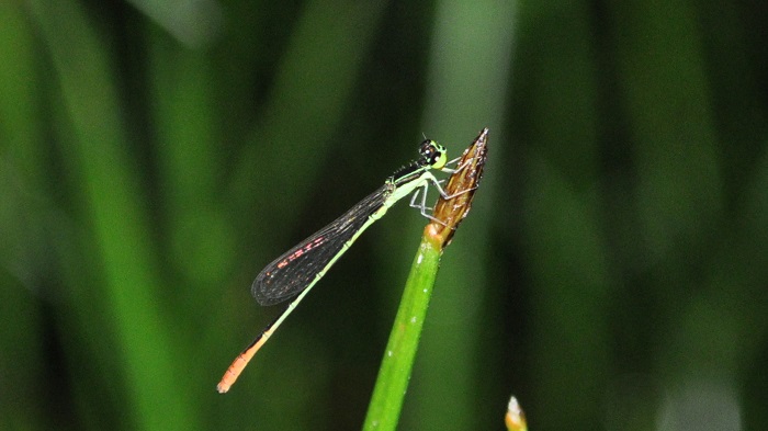
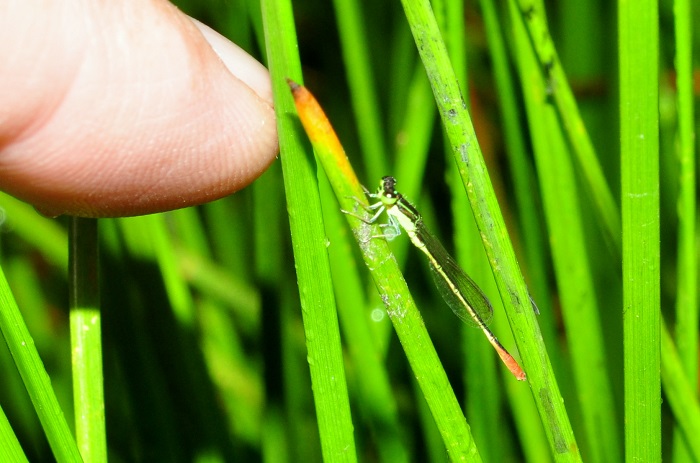
Near Underberg, KwaZulu-Natal
Photo by Ryan Tippett
Status and Conservation
Pinhey’s Wisp is fairly common but localised. It is listed as of Least Concern in the IUCN Red List of Threatened Species.
Distribution
Pinhey’s Wisp occurs in southern, central, and eastern Africa. In South Africa, it is found inland, in the eastern parts of the country, from the Eastern Cape up to Limpopo.
Near Underberg, KwaZulu-Natal
Photo by Ryan Tippett
Below is a map showing the distribution of records for Pinhey’s Wisp in the OdonataMAP database as at February 2020.

Below is a map showing the distribution of records for Pinhey’s Wisp in the OdonataMAP database as of December 2024.
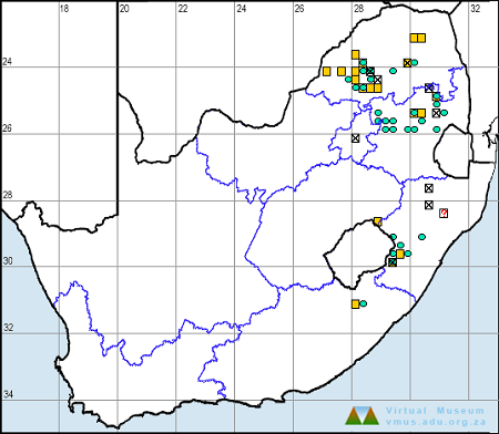
The next map below is an imputed map, produced by an interpolation algorithm, which attempts to generate a full distribution map from the partial information in the map above. This map will be improved by the submission of records to the OdonataMAP section of the Virtual Museum.


Ultimately, we will produce a series of maps for all the odonata species in the region. The current algorithm is a new algorithm. The objective is mainly to produce “smoothed” maps that could go into a field guide for odonata. This basic version of the algorithm (as mapped above) does not make use of “explanatory variables” (e.g. altitude, terrain roughness, presence of freshwater — we will be producing maps that take these variables into account soon). Currently, it only makes use of the OdonataMAP records for the species being mapped, as well as all the other records of all other species. The basic maps are “optimistic” and will generally show ranges to be larger than what they probably are.
These maps use the data in the OdonataMAP section of the Virtual Museum, and also the database assembled by the previous JRS funded project, which was led by Professor Michael Samways and Dr KD Dijkstra.
Phenology


Near Underberg, KwaZulu-Natal
Photo by Ryan Tippett
Further Resources
The use of photographs by Andries De Vries and Gert Bensch is acknowledged. Other photographs by Ryan Tippett.
Pinhey’s Wisp Agriocnemis pinheyi Balinsky, 1963
Other common names: Pinhey-soetjie (Afrikaans)
Recommended citation format: Loftie-Eaton M; Navarro R; Tippett RM; Underhill L. 2025. Pinhey’s Wisp Agriocnemis pinheyi. Biodiversity and Development Institute. Available online at https://thebdi.org/2020/05/08/pinheys-wisp-agriocnemis-pinheyi/
References: Tarboton, M; Tarboton, W. (2019). A Guide to the Dragonflies & Damselflies of South Africa. Struik Nature.
Samways, MJ. (2008). Dragonflies and Damselflies of South Africa. Pensoft
Samways, MJ. (2016). Manual of Freshwater Assessment for South Africa: Dragonfly Biotic Index. Suricata 2. South African National Biodiversity Institute, Pretoria