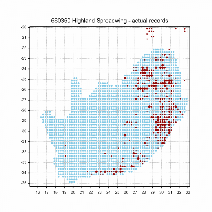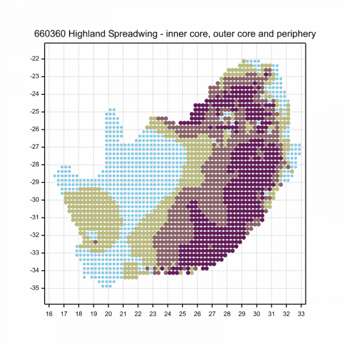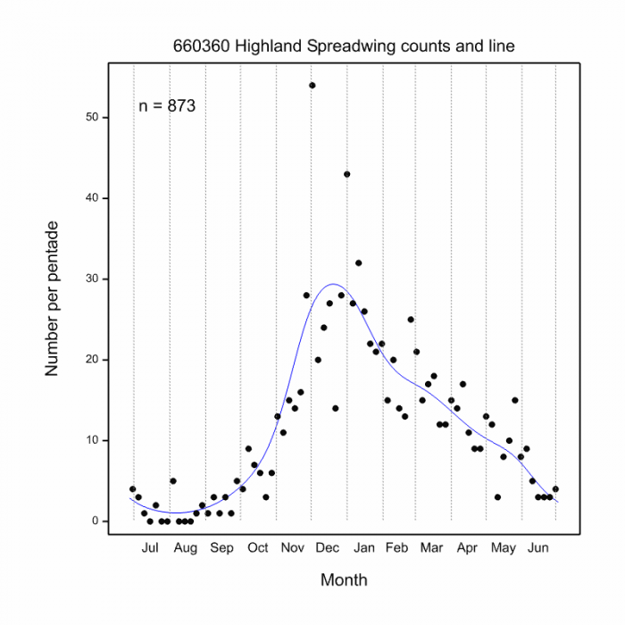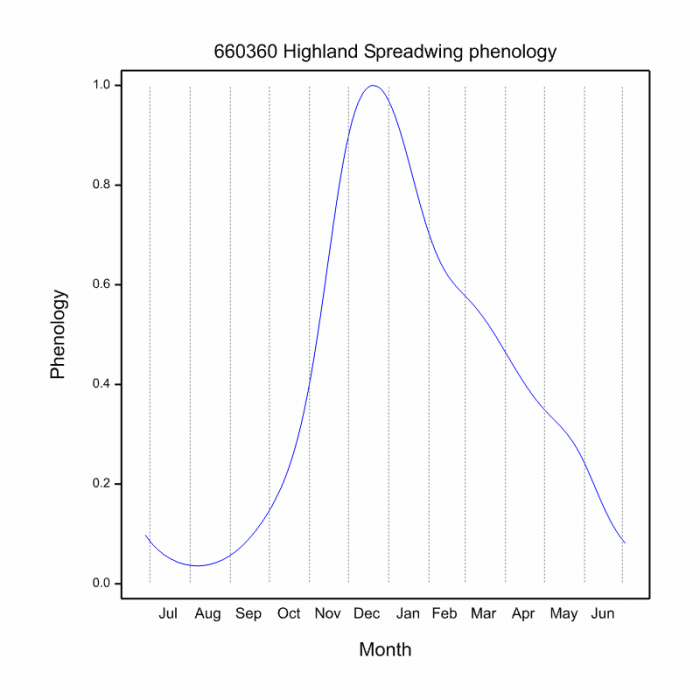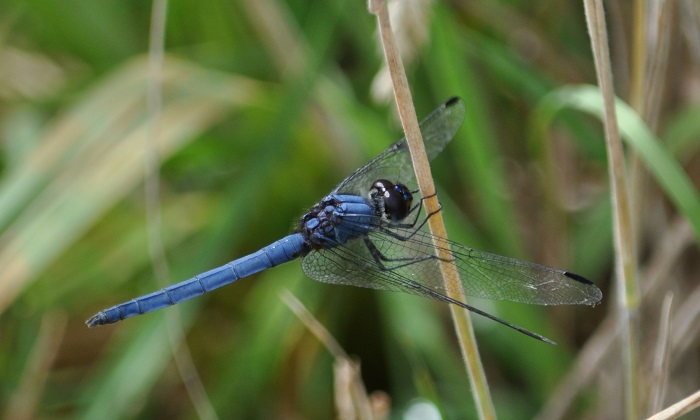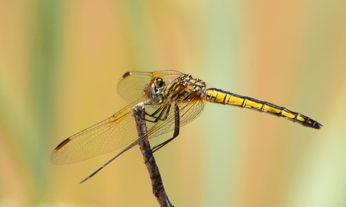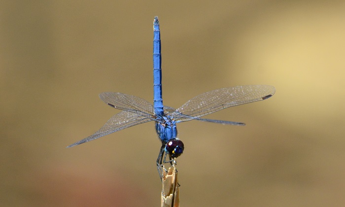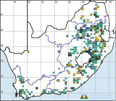
LepiMAP aims to atlas not only butterflies, but also moths. Which species of moth was recorded most frequently in LepiMAP during the lockdown period starting 27 March? The top species, with 37 records between 27 March and 3 April, was Achaea lienardi, with a proposed English common name of Lienard’s Achaea. This moth is special, because it challenges the concepts that most of us have about what constitutes a “species”.
This is Mark Liptrot’s photograph of Achaea lienardi from Kloof in KwaZulu-Natal. It is LepiMAP Record 713458
This photograph was taken by Mark Liptrot at his home in Kloof, KwaZulu-Natal on 3 April. Here is another moth, identified to be the same species, this time from Lüderitz in Namibia, submitted by Jessica Kemper during the lockdown period. Compare this photo with the one above.
This is Jesscia Kemper’s photograph of Achaea lienardi from Lüderitz in Namibia. It is LepiMAP Record 713178
If you look closely, there are some patterns which are the same for these two records. But the colour scheme is quite different. It is hard to believe they are the same species. It turns out that Achaea lienardi is desperately variable. There is a paper written almost a century ago (Jack 1922) which says that if you make a collection of 50 of these moths, scarcely two are alike. The little white markings on the trailing margin of the hindwing are a constant feature (but can be covered by the way the moth is sitting) and the shape of the postmedial line on the forewing is diagnostic. (To find a useful summary of the names of all the features on moths, look here.) The next picture is a collage of 18 photos of Achaea lienardi submitted during the lockdown.
A collage of 18 of the Achaea lienardi submitted during the lockdown. Their LepiMAP record numbers are 711711 713178 713458 713530 713531 713540 713539 713809 714034 714035 714111 714119 714365 714565 715673 715674 716051 and 716111
Gosh, these are all the same species! Those of us who depend on colour as the cue for identifications are lost; but the members of the moth expert panel quickly pick up the pattern of the forewing, and ignore the colours. What an awesome set of variations on a theme; this is the Mozart of moths. If the white dots at the trailing margin of the hindwing are not visible, then the hindwings are being covered by the forewings. Have another look at Mark Liptrot’s photo above; the forewings are partially covering the hindwings, and the little bit of the white dots at the bottom are just visible. Quartus Grobler, member of the LepiMAP expert panel who does a lot of the moth identifications says: “This is probably the most variable of all moths.”
This is the LepiMAP distribution map for Achaea lienardi. It is based in 142 records from 100 quarter-degree grid cells in South Africa and eSwatini. Records up to 2019 are shown with green squares. Records made in 2020 have blue plus signs. Jessica Kemper’s record from Lüderitz is off the western edge of this map.
The distribution map shows that Achaea lienardi occurs mainly along the coastal region of the Eastern Cape, and northward into the Lowveld of eSwatini, Mpumalanga and Limpopo. The two “outlier” records in the Northern Cape and the Western Cape are not far from major citrus production regions along the Orange River and along the Olifants River (see the next paragraph). It also occurs in many parts of Africa south of the Sahara Desert. The abundance of this species varies hugely between years, and it seems to be particularly abundant in wet years. This is a species that is suspected of covering large distances in search of food. It needs energy-rich fuel to make these journeys!
This is one of the “fruit-feeding moths” and it is sometimes massively abundant in citrus orchards. There are two broad categories of fruit-feeding moths, “fruit-piercing moths” and “fruit-sucking moths”. This is a “fruit-sucking moth”; in other words it sucks the juice out of fruit which have already been compromised. The mouthparts of Achaea lienardi are too small and too weak to pierce the skin of an orange. As Hermann Staude puts it: “Their proboscis is simply not sharp and rigid enough to pierce the skin of fruit. Instead they, together with many other insects, exploit bleeding and over-ripe fruit for the sugar.” The initial damage is most frequently done by other insects, birds, tractors, etc, and sometimes the fruit simply splits as it grows. Therefore Achaea lienardi is not a moth that needs to be controlled at all in orchards. Even though this moth is nocturnal, it is often so abundant that it is the one encountered in orchards in the day time, so it is the one which takes the blame for crimes it did not commit!
Action box in banana yellow! May every LepiMAPper put a squashed banana in a saucer in their yard this evening. Let’s see what moths get attracted. Please upload them to LepiMAP. How to do this is here.
Thank you box. Hermann Staude and Quartus Grobler provided crucial information. And an especial thank you to all the LepiMAPpers who photographed and submitted records of moths from their homes.
“More reading” box! There are three more lockdown blogs:
To finish. Here are two earlier records of the “Mozart moth” Achaea lienardi, selected from the 192 records in total for the species in LepiMAP.
This is Michael Purve’s photograph of a curled-up leaf. No wait, it is Achaea lienardi from Amanzimtoti in KwaZulu-Natal. This was the first record of the species to be submitted LepiMAP. It is Record 15896 and is dated 5 January 2011.
This is David Clarence’s photograph of Achaea lienardi from the Mwamba Field Centre, on the Kenyan coast. It is LepiMAP Record 646907 and is dated 30 April 2018.
LepiMAP has had its BestMonthEver during the lockdown in April. That is amazing. We asked Fanie Rautenbach, the member of the expert panel who does almost all the formal identifications of butterflies to suggest records which he thought were especially interesting.
Fanie Rautenbach in LepiMAP action, furthest from the camera
In real life, Fanie is an organic chemist, a researcher at the Cape Peninsula University of Technology. His research area is the chemistry of rooibos tea, especially its health value as an antioxidant. Here’s an article in the Health SA, which you can download, and there is a whole bunch of “full-text available” papers in his profile on Researchgate. It is fascinating. But what we are celebrating now is the contribution Fanie has made to LepiMAP. He has done 88,189 identifications. He is also a big contributor to the Virtual Museum. Here he is on a trip to Robertson, where South Africa’s smallest butterfly, the Dwarf Blue Oraidium barberae was “refreshed” in this grid cell, last seen 142 years previously. We asked Fanie to select a few interesting records of butterflies submitted during Lockdown April.
There are 759 records of Two-pip Policeman in the Virtual Museum. So why did Fanie pick out this one? This is a species which has previously been confined, in South Africa, to the northeastern part of the country. It is primarily a savanna species and has a distribution which extends over Africa south of the Sahara Desert. Look at this map.
LepiMAP distribution map for the Two-pip Policeman Coeliades pisistratus made using all 539 records up to the end of 2013
This map is based on the 539 records, made from the beginning of museum time until 31 December 2013, of the Two-pip Policeman from South Africa, Lesotho and Swaziland. Most of the records are in the northeast. There are two grid cells which stick out as outliers; at Bloemfontein in the Free State and at Kimberley in the northern eastern corner of the Northern Cape. There are seven records, all museum specimens, five from Bloemfontein with dates between 1912 and 1934, and two Kimberley records with no dates. Mmmmmm! Early museum records were often just given the name of the nearest town or city. So let’s disregard all records made in the era of pounds, shillings and pence, and produce a map starting in 1960, and going through to 2013.
LepiMAP distribution map for the Two-pip Policeman Coeliades pisistratus made using 431 records made between the start of 1960 and the end of 2013
This 1960-2013 map, based on 431 records, looks more plausible than the previous one. The outliers have disappeared, and the “core” of the distribution has remained intact. It makes sense. It’s nice and clean. Now let’s add to this map the 198 records of Two-pipped Policeman made since January 2014. They are added with a blue plus sign. All these records were supported by photographs. Fanie seems to have a photographic memory for distribution maps, and when a record for a species is out of its normal range, he checks that the “nearest town” given by the uploader coincides with the coordinates.
LepiMAP distribution map for the Two-pip Policeman Coeliades pisistratus. 431 records with green squares were made between the start of 1960 and the end of 2013. 198 records made between the beginning of 2014 and April 2020 are shown with blue plus signs.
Gosh. The new map seems to resuscitate the problems of the first map. Only it’s worse. There are now four records that really stick out as outliers. But they have all been carefully checked and are genuine. In July 2014, Quartus Grobler made the astonishing discovery of Two-pip Policeman in East London (LepiMAP 549043). Altha Liebenberg has recorded it twice in Danielskuil (May 2016, 598285, and March 2017, 617341). Then, in January this year, Ryan Tippett recorded it just north of Carnarvon, the westernmost record (701775). To rub salt into the wound, Altha spent the lockdown period with family in Kuruman, and found a Two-pip Policeman in the garden on the last Sunday of the month, 26 April (715920).
These are the five out-of-range records of Two-pip Policeman in LepiMAP. Do they indicate a tendency for vagrancy, or do they represent the start of a range expansion westwards?
Can these five records of Two-pip Policeman be dismissed as vagrants, individuals which moved far beyond the “normal” range? Or are they the only detections so far of a westward range expansion? We simply do not know. But we do know that we need a lot more LepiMAPpers on the ground in these sparsely populated parts of South Africa! And it would be really valuable if LepiMAPpers regularly refreshed species, even common species, throughout their ranges.
Thanks, Fanie, for picking a fascinating record to launch this blog.
But why on earth is a butterfly called a policeman? We put this question to Steve Woodhall. “In the old days, policemen patrolled on foot, and they followed a ‘beat’. This was a route through the area they were individually responsible for. They would check on things like houses they knew to be unoccupied, known lurking places for criminals, etc. And once they had completed their beat, they would return to the start and repeat it… again, and again, until their shift was finished. ‘Policeman’ butterflies do a similar thing. They patrol an area, visiting the same spots again and again, following a ‘beat’. Hence the name.” What a well thought through concept, a name based on behaviour. Thanks, Steve.
Fanie’s second choice is this butterfly submitted by Reinier Terblanche from his garden in Potchefstroom in North West Province. It is a Nomad Dart Andronymus neander neander.
Reinier Terblanche submitted this Nomad Dart Andronymus neander neander from Potchefstroom. This record is LepiMAP 711626.
It is the third photographic record of this species in LepiMAP for South Africa. The first was made by Christopher Willis near Thohoyandou in Limpopo in March 2013 (record 28914), and the second was made in Standerton in Mpumalanga in March 2014 (record 45845). There are also photographic records for Zambia, Namibia, Malawi, Tanzania and Mozambique, and together with all the historical data there are a total of 55 records in the LepiMAP database. Here is the distribution map for South Africa, Lesotho and eSwatini.
Distribution of Nomad Dart Andronymus neander neander based on LepiMAP records for South Africa, Lesotho and eSwatini since 1960. Records made between 1960 and 1999 have green squares (13 grid cells), and records from 1991 to April 2020 have blue plus signs (five grid cells).
The map shows that Reinier’s record is the first in North West Province. There does not appear to be certainty that the species actually breeds in this region. It breeds further north, from Zimbabwe to East Africa. The lepidopterists describe its status in South Africa as a “migrant”, but ornithologists would probably say “vagrant”. In countries like Tanzania there are records of Nomad Darts heading southwest in millions, just like in northern South Africa we see Pioneer Caper Whites (the new English common name for Brown-veined Whites) Belenois aurota heading northeast in millions. The shot gun pattern of records on this map is similar to the pattern for non-breeding bird species which overshoot their normal migration destinations and are recorded as vagrants in northern South Africa (eg Eurasian Blackcap Sylviaatricapilla, which normally migrates as far as East Africa). It does seem that the Nomad Darts arriving in South Africa are the lucky ones that survive to travel the farthest, and that Reinier’s dart was one of the luckiest of them all.
And Fanie’s third choice is a record of a species which is a bit of a puzzle. Zenobia van Dyk found this Common Evening Brown Melanitis leda in her garden at Bushmanskloof in the Cederberg northeast of Clanwilliam, where she is a senior guide. This is not the anticipated habitat for a species that is associated with leaf litter under trees in deep shade.
Zenobia van Dyk’s photo of a Common Evening Brown Melanitis leda at Bushmanskloof in the northern Cederberg, 29 April 2020 (LepiMAP 716380)
Fanie says: “Check out the distribution map for this species. It it usually found in the forest areas of South Africa (KwaZulu-Natal, Mpumalanga, Limpopo). However, every now and again one turns up in an unexpected place like Clanwilliam. Other strange locations are Nieuwoudtville, Komaggas and Kgalagadi Transfrontier Park. I have no explanation for this because it is not a migratory species.” So let’s go and check out the map.
LepiMAP distribution map for the Common Evening Brown Melanitis lada. Records since 1960 are shown. Records from 1960 to 2006 have green squares, and 2007 to April 2020 have blue plus signs. Zenobia van Dyk’s record is the northernmost of the cluster of three records on the border of the Northern Cape and Western Cape. The split at 2006/2007 was chosen because the two sets of records are nearly equal: 1960-2006 has 645 records and 2007-2020 has 633 records.
The map shows a well-behaved pattern in the moist areas where forested habitats occur. And then it has a badly-behaved pattern of isolated records, both for the period up to 2006 and for the period from 2007, scattered across the arid western half of this region. The scattered records are even more surprising because this species is a weak flyer. If it is disturbed it makes a short laboured flight before settling.
Reinier Terblanche, of Nomad Dart fame, has been researching butterflies for decades. In 2000, he co-authored a report on the butterflies of the Witsand Nature Reserve, near Posmasburg in the Northern Cape (go to Metamorphosis, and see pages 122-131). This is arid countryside. He and his co-author were astonished to find Common Evening Brown here. They wrote: “It is unlikely that Melanitis leda can be regarded as a migratory species, covering great distances to settle for a limited time at places far from its known distribution. It is more likely that Melanitis leda occurs at places with enough water or shade even in times of drought. Trees with enough shade are probably essential so that the [shade seeking] grasses the larvae feed on are sustained. The occurrence of Melanitis leda in the Witsand area can be indicative of the importance of available water in an area with erratic rainfall.” The Witsand Nature Reserve is an amazing place; there is permanent water, and a couple of hectares of quite thick woodland!
Part of the “oasis” at Bushmanskloof where Zenobia van Dyk recorded Common Bush Brown Melanitis leda on 29 April 2020
Likewise, at Bushmanskloof, Zenobia reports: “We have a couple of hectares of gardens and have a lot of trees. I found the butterfly late afternoon. It was not flying well, clearly at the end of its life. If you look at the photos the wings are old and broken.” Go to LepiMAP 716380 and look at the other photo uploaded by Zenobia.
The bottom line is that there are lots of butterfly distribution puzzles, and more records in LepiMAP will help solve them. I’ll give the last sentences of this blog to Reinier. In his paper, he was trying to find the words to put the discovery of Common Evening Brown into context. “The occurrence of Melanitis leda at places like Witsand will become much clearer when information on the distributions of Lepidoptera is available in atlas format” and “it is important to pay attention to distribution records of common and widespread species. Such distribution records might be vital keys in our understanding of butterflies as indicators for environmental management.” Thanks, Reinier, that underlines the importance and value of LepiMAP. We need to have BestMonthEver for LepiMAP repeatedly.
Thank you, Fanie Rautenbach, for the choice of records from LockdownApril. Thank you, Steve Woodhall (whose revised fieldguide to the butterflies has just been published) for the explanation of the name of “Policeman”. Thank, Zenobia van Dyk, for the extra photo. Thanks, Altha Liebenberg, for the idea of producing this blog.
Find the Evening Hawker in the FBIS database (Freshwater Biodiversity Information System) here.
Family Aeshnidae
Identification
Evening HawkerAnaciaeschna triangulifera – Male Enseleni Nature Reserve, KwaZulu-Natal Photo by Ryan Tippett
Very large size
Length reaches 69mm; Wingspan attains 94mm.
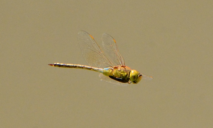
Adult males are unmistakable. The combination of brown thorax with a pair of diagonal lime-green stripes, brilliant blue eyes and large, bright blue saddle are diagnostic.
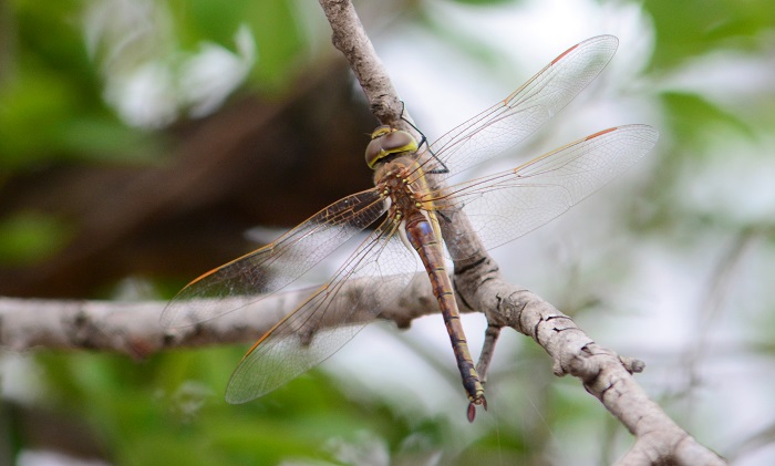
Female and young male Evening Hawkers with greenish eyes, could be confused with other Hawker species. They are most likely to be mistaken for Pinheyschna subpupillata (Stream Hawker) or Zosteraeschna minuscula (Friendly Hawker). The Evening Hawker can be distinguished by the lack of green patches on the ‘shoulders’ of the thorax and by their diagnostic forehead markings.
Click here for more details on identification of the Evening Hawker.
Evening HawkerAnaciaeschna triangulifera – Female Near Hluhluwe, KwaZulu-Natal Photo by Ryan Tippett
Habitat
Habitat – Muzi Pan, iSimangaliso Wetland Park, KwaZulu-Natal Photo by Ryan Tippett
The Evening Hawker is associated with forest and dense woodland adjoining wetlands such as lakes, marshes, rivers and pans. It is usually seen hunting over reed beds, marshes, grassy clearings, and around tree canopies at dusk. During the day the Evening Hawker rests away from water in dense, shaded areas.
Habitat – Kosi Bay, iSimangaliso Wetland Park, KwaZulu-Natal Photo by Ryan Tippett
Behaviour
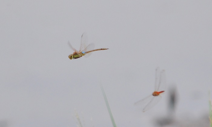
The Evening Hawker is crepuscular, and is therefore most active during twilight. It is often gregarious when hunting and frequently joins mixed species feeding swarms at dusk. Evening Hawkers are also quite active on humid days, before and after rain. They spend most of the daylight hours at rest in dense shaded vegetation. The evening Hawker hangs vertically from a perch while resting.
Evening HawkerAnaciaeschna triangulifera – Male Enseleni Nature Reserve, KwaZulu-Natal Photo by Ryan Tippett
Status and Conservation
The Evening Hawker is scarce to locally common in South Africa. It is listed as of Least Concern in the IUCN Red List of Threatened Species. Anaciaeschna triangulifera is moderately sensitive to habitat disturbance. It can, however, be found at suitable man-made habitats, and in areas with some alien plants.
Evening HawkerAnaciaeschna triangulifera – Male Kosi Bay, iSimangaliso Wetland Park, KwaZulu-Natal Photo by Ryan Tippett
Distribution
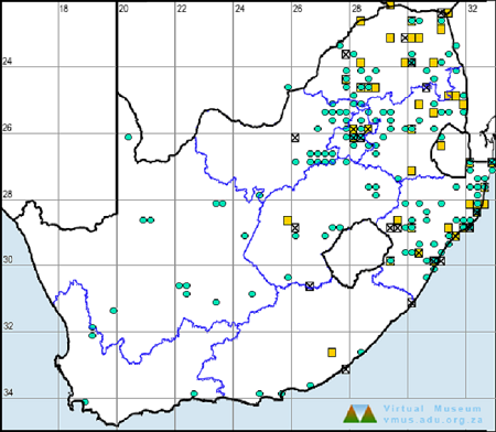
The Evening Hawker is found in sub-Saharan Africa, but mainly in Southern and East Africa, From Ethiopia in the north down to the Western Cape in South Africa. The species also occurs on Madagascar. In South Africa, the Evening Hawker is most widespread along the eastern and southern coastal regions, from northern KwaZulu-Natal down to the Western Cape. It is also present in Gauteng, Limpopo, and Mpumalanga. The Evening Hawker avoids the dry central and western regions of the country.
Below is a map showing the distribution of records for Evening Hawker in the OdonataMAP database as at February 2020.
Below is a map showing the distribution of records for Evening Hawker in the OdonataMAP database as at December 2024.
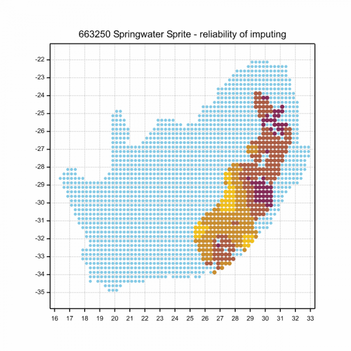
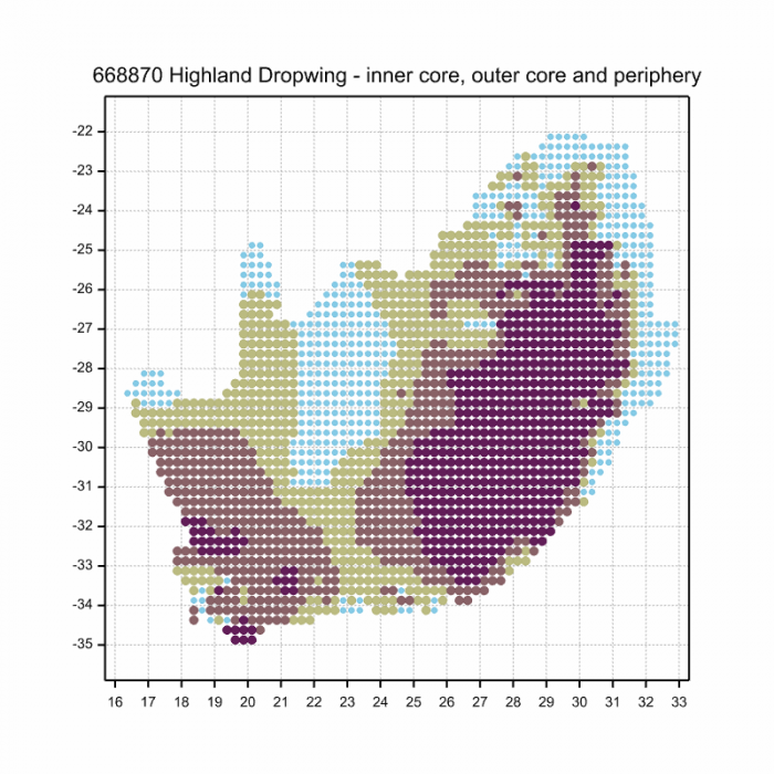
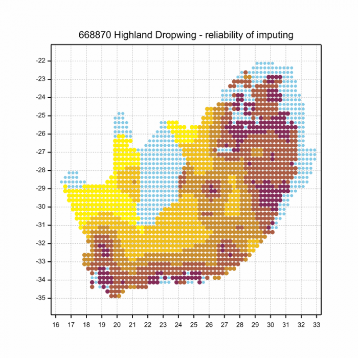
The next map below is an imputed map, produced by an interpolation algorithm, which attempts to generate a full distribution map from the partial information in the map above. This map will be improved by the submission of records to the OdonataMAP section of the Virtual Museum.
Ultimately, we will produce a series of maps for all the odonata species in the region. The current algorithm is a new algorithm. The objective is mainly to produce “smoothed” maps that could go into a field guide for odonata. This basic version of the algorithm (as mapped above) does not make use of “explanatory variables” (e.g. altitude, terrain roughness, presence of freshwater — we will be producing maps that take these variables into account soon). Currently, it only makes use of the OdonataMAP records for the species being mapped, as well as all the other records of all other species. The basic maps are “optimistic” and will generally show ranges to be larger than what they probably are.
These maps use the data in the OdonataMAP section of the Virtual Museum, and also the database assembled by the previous JRS funded project, which was led by Professor Michael Samways and Dr KD Dijkstra.
Evening HawkerAnaciaeschna triangulifera – Young male False Bay, iSimangaliso Wetland Park, KwaZulu-Natal Photo by Ryan Tippett
Further Resources
The use of photographs by Diana Russell is acknowledged. All other photographs by Ryan Tippett.
Recommended citation format: Loftie-Eaton M; Navarro R; Tippett RM; Underhill L. 2025. Evening Hawker Anaciaeschna triangulifera. Biodiversity and Development Institute. Available online at https://thebdi.org/2020/04/30/evening-hawker-anaciaeschna-triangulifera/
References: Tarboton, M; Tarboton, W. (2019). A Guide to the Dragonflies & Damselflies of South Africa. Struik Nature.
Samways, MJ. (2008). Dragonflies and Damselflies of South Africa. Pensoft
Samways, MJ. (2016). Manual of Freshwater Assessment for South Africa: Dragonfly Biotic Index. Suricata 2. South African National Biodiversity Institute, Pretoria
Martens, A; Suhling, F. (2007). Dragonflies and Damselflies of Namibia. Gamsberg Macmillan.
Evening HawkerAnaciaeschna triangulifera – Male Enseleni Nature Reserve, KwaZulu-Natal Photo by Ryan Tippett
Find this species in the FBIS database (Freshwater Biodiversity Information System) here.
Family Libellulidae
Identification
Russet DropwingTrithemis pluvialis Mkuze River, KwaZulu-Natal Photo by Ryan Tippett
Small size
Length up to 37mm; Wingspan attains 62mm.
Male Russet Dropwings resemble the Red-veined Dropwing (Trithemis arteriosa), but are orange-red in general colour and have brownish-red eyes. The two species also differ in the black patterning on the abdomen.
Males may also be mistaken for the Elegant Dropwing (Trithemis werneri). Both are an overall orange colour but the Elegant Dropwing has more extensive black markings on the abdomen and thorax.
Females can be easily confused with those of several other Trithemis species. Trithemis pluvialis females can be identified by the large amber patches in the hindwings and the diagnostic black patterning on the abdomen.
The Russet Dropwing is a species of well-vegetated, flowing rivers and streams, often in rugged, hilly environments. Trithemis pluvialis prefers wooded habitats over most of its range. In the Western Cape, it also inhabits rivers in fynbos.
Habitat – Mkuze River, KwaZulu-Natal Photo by Rowan Poortier
Behaviour
The Russet Dropwing often perches conspicuously on overhanging trees. They will also sit on rocks, as well as emergent or bankside reeds, grass, and sedges. The Russet Dropwing is most often found singly.
Russet DropwingTrithemis pluvialis Mkuze River, KwaZulu-Natal Photo by Ryan Tippett
Status and Conservation
In South Africa, the Russet Dropwing is scarce and localised with a patchy distribution. It is listed as of Least Concern in the IUCN Red List of Threatened Species. Trithemis pluvialis occurs mostly at undisturbed sites.
Russet DropwingTrithemis pluvialis Mkuze River, KwaZulu-Natal Photo by Ryan Tippett
Distribution
The Russet Dropwing occurs across southern, central, and East Africa. It ranges from Kenya and Uganda in the north across to Zambia and central Angola, and down to South Africa.
In South Africa Trithemis pluvialis is found in two disjunct populations. It occurs in north-eastern Limpopo, Gauteng, Mpumalanga, and KwaZulu-Natal. It is also present in the Western Cape and adjoining parts of the Eastern Cape. This population is apparently isolated from the populations further to the north.
Below is a map showing the distribution of records for Russet Dropwing in the OdonataMAP database as at February 2020.
Below is a map showing the distribution of records for Russet Dropwing in the OdonataMAP database as of December 2024.
The next map below is an imputed map, produced by an interpolation algorithm, which attempts to generate a full distribution map from the partial information in the map above. This map will be improved by the submission of records to the OdonataMAP section of the Virtual Museum.
Ultimately, we will produce a series of maps for all the odonata species in the region. The current algorithm is a new algorithm. The objective is mainly to produce “smoothed” maps that could go into a field guide for odonata. This basic version of the algorithm (as mapped above) does not make use of “explanatory variables” (e.g. altitude, terrain roughness, presence of freshwater — we will be producing maps that take these variables into account soon). Currently, it only makes use of the OdonataMAP records for the species being mapped, as well as all the other records of all other species. The basic maps are “optimistic” and will generally show ranges to be larger than what they probably are.
These maps use the data in the OdonataMAP section of the Virtual Museum, and also the database assembled by the previous JRS funded project, which was led by Professor Michael Samways and Dr KD Dijkstra.
Russet DropwingTrithemis pluvialis Mkuze River, KwaZulu-Natal Photo by Ryan Tippett
Further Resources
The use of photographs by Andries de Vries is acknowledged. Other photographs by Ryan Tippett.
Russet DropwingTrithemis pluvialisFörster, 1906
Other common names: River Dropwing (Alt. English); Rosbruinvalvlerkie (Afrikaans)
Recommended citation format: Loftie-Eaton M; Navarro R; Tippett RM; Underhill L. 2025. Russet Dropwing Trithemis pluvialis. Biodiversity and Development Institute. Available online at https://thebdi.org/2020/04/29/russet-dropwing-trithemis-pluvialis/
References: Tarboton, M; Tarboton, W. (2019). A Guide to the Dragonflies & Damselflies of South Africa. Struik Nature.
Samways, MJ. (2008). Dragonflies and Damselflies of South Africa. Pensoft
Samways, MJ. (2016). Manual of Freshwater Assessment for South Africa: Dragonfly Biotic Index. Suricata 2. South African National Biodiversity Institute, Pretoria
Martens, A; Suhling, F. (2007). Dragonflies and Damselflies of Namibia. Gamsberg Macmillan.
Russet DropwingTrithemis pluvialis Mkuze River, KwaZulu-Natal Photo by Ryan Tippett
Find the Silhouette Dropwing in the FBIS database (Freshwater Biodiversity Information System) here.
Family Libellulidae
Identification
Silhouette DropwingTrithemis hecate – Male Linyanti, Botswana Photo by Ryan Tippett
Small size
Length up to 43mm; Wingspan attains 68mm.
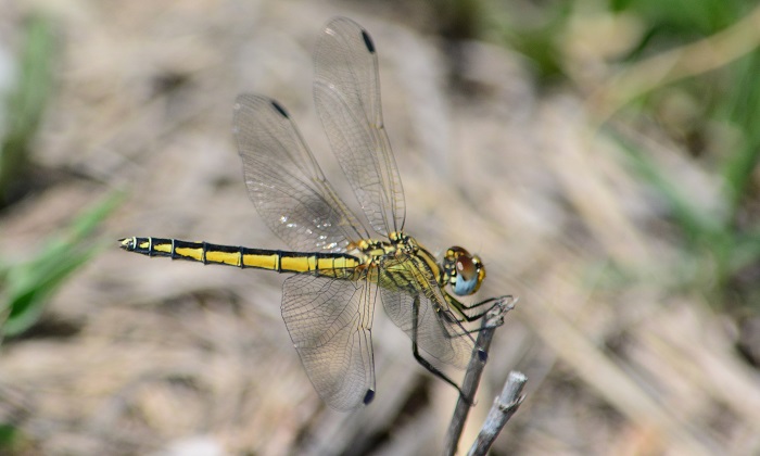
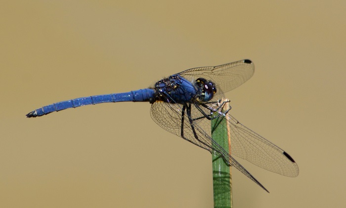
The Silhouette Dropwing is a slender, dark blue species. The thin abdomen easily differentiates it from other dark blue dropwings like Trithemis furva (Navy Dropwing) and Trithemis dorsalis (Highland Dropwing). It is closest to Trithemis aconita (Halfshade Dropwing) in appearance. Both species have slender abdomens but are easily told apart by their very different habitat choices.
Additionally, Trithemis hecate is the only dark blue dropwing in the region with pale pterostigmas.
Females are easily confused with other Trithemis species. They are best identified by their association with the males.
Click here for more details on identification of the Silhouette Dropwing.
Silhouette DropwingTrithemis hecate – Female Linyanti, Botswana Photo by Ryan Tippett
Habitat
The natural habitats of the Silhouette Dropwing are subtropical and tropical pans, floodplains, and marshes. It prefers standing or still water with emergent plant growth such as reeds, grass, or sedges. The Silhouette Dropwing is frequently found perched on trees and bushes a short distance from the water, especially during the hottest time of the day.
Habitat – Near Kosi By, KwaZulu-Natal Photo by Ryan Tippett
Behaviour
Breeding male Silouette Dropwings typically perch on emergent stems, often far from the shore, on the last reeds before the open water starts. From this position, they appear all dark and silhouetted, hence the common name. Females and non-breeding males are found on trees and bushes surrounding the wetlands, often some distance from the water.
Silhouette DropwingTrithemis hecate – Male Linyanti, Botswana Photo by Ryan Tippett
Status and Conservation
In South Africa, the Silhouette Dropwing is scarce and erratic in occurence but can be abundant at sites further north, such as the Okavango Delta in Botswana. It is listed as of Least Concern in the IUCN Red List of Threatened Species. This species is found mostly in pristine habitat and is fairly sensitive to habitat degradation.
Silhouette DropwingTrithemis hecate – Female Okavango Delta, Botswana Photo by Ryan Tippett
Distribution
The Silhouette Dropwing is widespread in tropical and subtropical Africa. It has been recorded in Botswana, Chad, the Democratic Republic of the Congo, Gambia, Guinea, Kenya, Liberia, Malawi, Mozambique, Namibia, Senegal, South Africa, Tanzania, Uganda, Zambia, Zimbabwe, and possibly Burundi. It also occurs on Madagascar. In South Africa, the Silhouette Dropwing is restricted to the warmer regions in the north and east.
Silhouette DropwingTrithemis hecate – Male Linyanti, Botswana Photo by Ryan Tippett
Below is a map showing the distribution of records for Silhouette Dropwing in the OdonataMAP database as at February 2020.
Below is a map showing the distribution of records for Silhouette Dropwing in the OdonataMAP database as of December 2024.
The next map below is an imputed map, produced by an interpolation algorithm, which attempts to generate a full distribution map from the partial information in the map above. This map will be improved by the submission of records to the OdonataMAP section of the Virtual Museum.
Ultimately, we will produce a series of maps for all the odonata species in the region. The current algorithm is a new algorithm. The objective is mainly to produce “smoothed” maps that could go into a field guide for odonata. This basic version of the algorithm (as mapped above) does not make use of “explanatory variables” (e.g. altitude, terrain roughness, presence of freshwater — we will be producing maps that take these variables into account soon). Currently, it only makes use of the OdonataMAP records for the species being mapped, as well as all the other records of all other species. The basic maps are “optimistic” and will generally show ranges to be larger than what they probably are.
These maps use the data in the OdonataMAP section of the Virtual Museum, and also the database assembled by the previous JRS funded project, which was led by Professor Michael Samways and Dr KD Dijkstra.
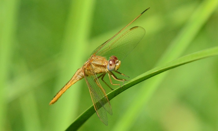
Silhouette DropwingTrithemis hecate – Male Linyanti, Botswana Photo by Ryan Tippett
Further Resources
The use of photographs by Gregg Darling is acknowledged.
Silhouette DropwingTrithemis hecateRis, 1912
Other common names: Hecate Dropwing (Alt. English); Skraalvalvlerkie (Afrikaans).
Recommended citation format: Loftie-Eaton M; Navarro R; Tippett RM; Underhill L. 2025. Silhouette Dropwing Trithemis hecate. Biodiversity and Development Institute. Available online at https://thebdi.org/2020/04/29/silhouette-dropwing-trithemis-hecate/
References: Tarboton, M; Tarboton, W. (2019). A Guide to the Dragonflies & Damselflies of South Africa. Struik Nature.
Samways, MJ. (2008). Dragonflies and Damselflies of South Africa. Pensoft
Samways, MJ. (2016). Manual of Freshwater Assessment for South Africa: Dragonfly Biotic Index. Suricata 2. South African National Biodiversity Institute, Pretoria
Martens, A; Suhling, F. (2007). Dragonflies and Damselflies of Namibia. Gamsberg Macmillan.
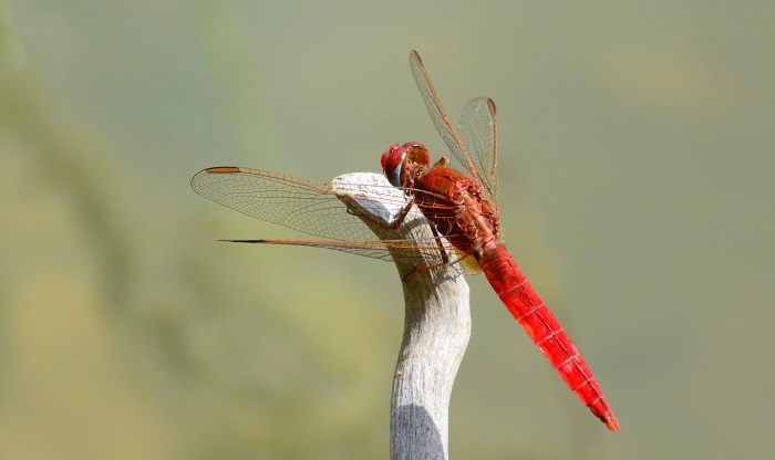
Silhouette DropwingTrithemis hecate – Immature male Linyanti, Botswana Photo by Ryan Tippett
Find this species in the FBIS database (Freshwater Biodiversity Information System) here.
Family Libellulidae
Identification
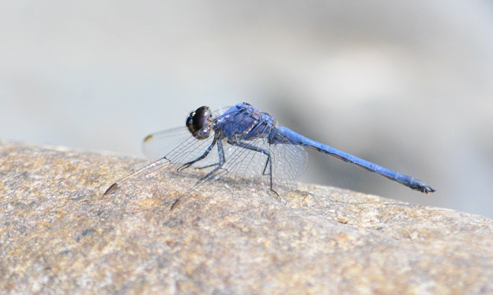
Navy DropwingTrithemis furva – Male Near Mosselbay, Western Cape Photo by Ryan Tippett
Small to Medium size
Length up to 41mm; Wingspan attains 67mm.
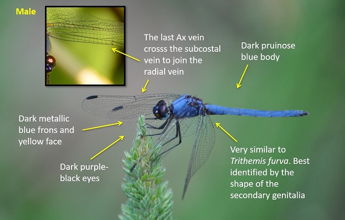
The Navy Dropwing is only likely to be confused with the very similar Trithemis dorsalis (Highland Dropwing). Males of the two are best identified in the hand by examining the shape of the secondary genitalia. In addition, the males can (mostly) be told apart by checking the last Ax vein in the front wings. In Trithemis furva the last Ax vein extends as far as the subcostal vein and does not reach the radial vein. Trithemis dorsalis shows Ax veins that cross the subcostal vein to meet up with the radial vein.
The two species can also be tentatively identified based on their preferred habitat choice. Although they co-occur at many sites, the Navy Dropwing is more numerous than the Highland Dropwing at lower altitudes.
Navy Dropwing males could also be confused with the Denim Dropwing (Trithemis donaldsoni), but that species is larger and paler blue in colouration.
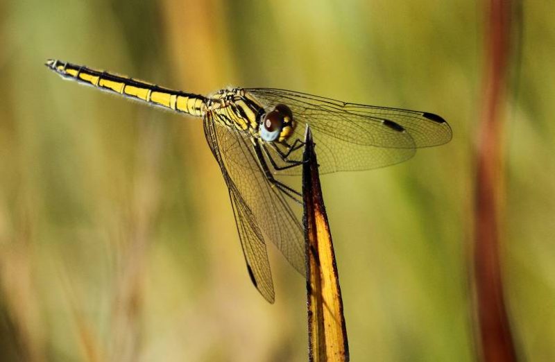
The Female Navy dropwing is readily identified by the black ‘smudged’ markings on the sides of the thorax.
Click here for more details on identification of the Navy Dropwing.
Navy DropwingTrithemis furva – Female Quaggaskloof Dam, Western Cape Photo by Ryan Tippett
Habitat
The Navy Dropwing is a species of rivers and streams. It favours stretches of shallow, flowing water with exposed rocks and fringing grass, reeds and sedge for perching on. The Navy Dropwing is less frequent along still or slow-moving sections. Occasionally also found along the verges of dams and lakes.
Habitat – Oribi Gorge Nature Reserve, KwaZulu-Natal Photo by Ryan Tippett
Behaviour
The Navy Dropwing is a conspicuous species that perches in the open on rocks and emergent or fringing vegetation. Perches with its wings drooped forward like others in the genus. The Navy Dropwing is mostly found below 700m above sea level, but it is known to occur up to 1700m above sea level in some places.
On the wing from October to May but sometimes found all year in warmer areas.
Navy DropwingTrithemis furva – Male Orange River near Prieska, Northern Cape Photo by Ryan Tippett
Status and Conservation
The Navy Dropwing is a common species throughout its range. It is listed as of Least Concern in the IUCN Red List of Threatened Species.
Navy DropwingTrithemis furva – Female Cedarberg, Western Cape Photo by Ryan Tippett
Distribution
The Navy Dropwing is found throughout much of Southern, Central, and East Africa. It is largely absent from West and North Africa.
Trithemisfurva occurs widely in South Africa. It is only absent from the central Karoo and Kalahari, likely due to the lack of perennial rivers.
Navy DropwingTrithemis furva – Male Palmiet Nature Reserve, KwaZulu-Natal Photo by Ryan Tippett
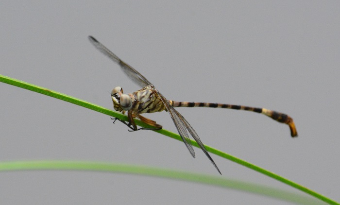
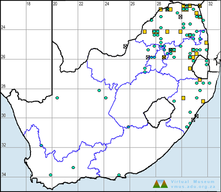
Below is a map showing the distribution of records for Navy Dropwing in the OdonataMAP database as at February 2020.
Below is a map showing the distribution of records for Navy Dropwing in the OdonataMAP database as of December 2024.
The next map below is an imputed map, produced by an interpolation algorithm, which attempts to generate a full distribution map from the partial information in the map above. This map will be improved by the submission of records to the OdonataMAP section of the Virtual Museum.
Ultimately, we will produce a series of maps for all the odonata species in the region. The current algorithm is a new algorithm. The objective is mainly to produce “smoothed” maps that could go into a field guide for odonata. This basic version of the algorithm (as mapped above) does not make use of “explanatory variables” (e.g. altitude, terrain roughness, presence of freshwater — we will be producing maps that take these variables into account soon). Currently, it only makes use of the OdonataMAP records for the species being mapped, as well as all the other records of all other species. The basic maps are “optimistic” and will generally show ranges to be larger than what they probably are.
These maps use the data in the OdonataMAP section of the Virtual Museum, and also the database assembled by the previous JRS funded project, which was led by Professor Michael Samways and Dr KD Dijkstra.
Navy DropwingTrithemis furva – Male Gamka River, Western Cape Photo by Ryan Tippett
Further Resources
The use of photographs by Sharon Stanton is acknowledged. All other photographs by Ryan Tippett.
Navy DropwingTrithemis furva Karsch, 1899
Other common names: Blouvalvlerkie (Afrikaans)
Recommended citation format: Loftie-Eaton M; Navarro R; Tippett RM; Underhill L. 2025. Navy Dropwing Trithemis furva. Biodiversity and Development Institute. Available online at https://thebdi.org/2020/04/28/navy-dropwing-trithemis-furva/
References: Tarboton, M; Tarboton, W. (2019). A Guide to the Dragonflies & Damselflies of South Africa. Struik Nature.
Samways, MJ. (2008). Dragonflies and Damselflies of South Africa. Pensoft
Samways, MJ. (2016). Manual of Freshwater Assessment for South Africa: Dragonfly Biotic Index. Suricata 2. South African National Biodiversity Institute, Pretoria
Martens, A; Suhling, F. (2007). Dragonflies and Damselflies of Namibia. Gamsberg Macmillan.
Navy DropwingTrithemis furva – Male Quaggaskloof Dam, Western Cape Photo by Ryan Tippett
Find this species in the FBIS database (Freshwater Biodiversity Information System) here.
Family Libellulidae
Identification
Red-veined DarterSympetrum fonscolombii – Male Richards Bay, KwaZulu-Natal Photo by Diana Russel
Small size
Length up to 40mm; Wingspan attains 66mm.
The Red-veined Darter or Nomad is easily mistaken for other smallish red dragonflies such as the Red-veined Dropwing (Trithemis arteriosa), Broad Scarlet (Crocothemis erythraea) or Little Scarlet (Crocothemis sanguinolenta). The Red-veined Darter can, however, be easily identified by the pale diagonal stripe on each side of the thorax. The small black marking on the last abdominal segments and the small number of AX veins in the forewings are additional aids in identification.
Female Red-veined Darters are pale browni to yellowish. They are also readily identified by the two broad, diagonal pale markings on the thorax sides. These pale markings are often thinly outlined in black. Females also show the small black markings on the last few abdominal segments, and the reduced number of AX veins in the forewings.
Red-veined DarterSympetrum fonscolombii – Female Near Hluhluwe, KwaZulu-Natal Photo by Ryan Tippett
Habitat
The Red-veined Darter breeds in a wide range of habitats including seasonal and permanent waters. It inhabits pans, marshes, lakes, ponds, dams, and rivers. It is most numerous in ephemeral habitats. In arid regions, it readily occupies livestock drinking troughs and cement water reservoirs. The Red-veined Darter is quickly able to recolonise dry areas after rainfall.
Habitat – Mkuze Game Reserve, KwaZulu-Natal Photo by Ryan Tippett
Behaviour
The Red-veined Darter hunts from a perch with a fast, direct flight, frequently returning to the same perch. They tend to be somewhat gregarious when present in good numbers, and both sexes occur in the same vicinity. The Red-veined Darter flies year-round in some areas, although it is less numerous in the cold winter months. In many locations, especially those with high species diversity, the Red-veined Darter is an early and/or late season specialist. This is likely an adaptation to avoid competition with other species.
The Red-veined Darter flies year-round in warmer regions, but is mainly an early Summer species (September to January) in more temperate regions.
Red-veined DarterSympetrum fonscolombii – Male Near Williston, Northern Cape Photo by Ryan Tippett
Status and Conservation
The Red-veined Darter is an abundant and widespread species. It is listed as of Least Concern in the IUCN Red List of Threatened Species. The Red-veined Darter is a very adaptable species that readily utilises disturbed and man-made habitats.
Red-veined DarterSympetrum fonscolombii – Female Near Vosburg, Northern Cape Photo by Ryan Tippett
Distribution
Sympetrum fonscolombii is very widely distributed, being found throughout most of Africa, Europe, the Middle East and much of Asia. In Africa, it is most common in the drier regions of northern, eastern and particularly southern Africa where it can be very common. The Red-veined Darter is present throughout southern Africa.
Red-veined DarterSympetrum fonscolombii – Male Near Hluhluwe, KwaZulu-Natal Photo by Ryan Tippett
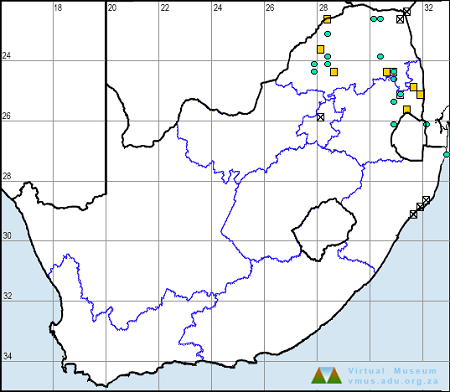
Below is a map showing the distribution of records for Red-veined Darter in the OdonataMAP database as at February 2020.
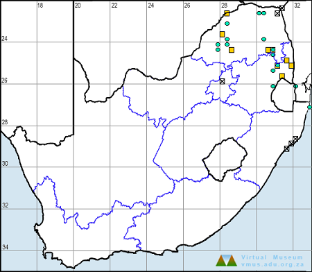
Below is a map showing the distribution of records for Red-veined Darter in the OdonataMAP database as of December 2024.
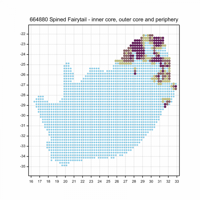
The next map below is an imputed map, produced by an interpolation algorithm, which attempts to generate a full distribution map from the partial information in the map above. This map will be improved by the submission of records to the OdonataMAP section of the Virtual Museum.
Ultimately, we will produce a series of maps for all the odonata species in the region. The current algorithm is a new algorithm. The objective is mainly to produce “smoothed” maps that could go into a field guide for odonata. This basic version of the algorithm (as mapped above) does not make use of “explanatory variables” (e.g. altitude, terrain roughness, presence of freshwater — we will be producing maps that take these variables into account soon). Currently, it only makes use of the OdonataMAP records for the species being mapped, as well as all the other records of all other species. The basic maps are “optimistic” and will generally show ranges to be larger than what they probably are.
These maps use the data in the OdonataMAP section of the Virtual Museum, and also the database assembled by the previous JRS funded project, which was led by Professor Michael Samways and Dr KD Dijkstra.
Red-veined DarterSympetrum fonscolombii – Pair Near Hluhluwe, KwaZulu-Natal Photo by Ryan Tippett
Further Resources
The use of photographs by Diana Russell and Mark Stanton is acknowledged. All other photographs by Ryan Tippett.
Other common names: Nomad (Alt. English); Swerwertjie (Afrikaans)
Recommended citation format: Loftie-Eaton M; Navarro R; Tippett RM; Underhill L. 2025. Red-veined Darter Sympetrum fonscolombi. Biodiversity and Development Institute. Available online at https://thebdi.org/2020/04/28/red-veined-darter-sympetrum-fonscolombii/
References: Tarboton, M; Tarboton, W. (2019). A Guide to the Dragonflies & Damselflies of South Africa. Struik Nature.
Samways, MJ. (2008). Dragonflies and Damselflies of South Africa. Pensoft
Samways, MJ. (2016). Manual of Freshwater Assessment for South Africa: Dragonfly Biotic Index. Suricata 2. South African National Biodiversity Institute, Pretoria
Martens, A; Suhling, F. (2007). Dragonflies and Damselflies of Namibia. Gamsberg Macmillan.
Red-veined DarterSympetrum fonscolombii – Immature male Near Hluhluwe, KwaZulu-Natal Photo by Ryan Tippett
Find the Elegant Dropwing in the FBIS database (Freshwater Biodiversity Information System) here.
Family Libellulidae
Identification
Elegant DropwingTrithemis werneri – Male Ndumo Game Reserve, KwaZulu-Natal Photo by Ryan Tippett
Small size
Length up to 40mm; Wingspan attains 66mm.
Male Elegant Dropwings are readily identified. The orange to mustard-yellow colouration with black markings and large amber hindwing patches are diagnostic.
Females are less distinctive and are most similar to Trithemis annulata (Violet Dropwing) and Trithemis pluvialis (Russet Dropwing). They can be identified based on abdomen and thorax patterns, and the amber patches at the base of the hind wings. Some females also have small amber patches in the outer wings.
Elegant DropwingTrithemis werneri – Female Ndumo Game Reserve, KwaZulu-Natal Photo by Ryan Tippett
Habitat
Large tropical and subtropical rivers in hot savanna regions are the natural habitat of the Elegant Dropwing. It inhabits well-wooded areas with large trees along the upper banks. The Elegant Dropwing is frequently found along river sections with steep banks.
Habitat – Usutu River, Ndumo Game Reserve, KwaZulu-Natal Photo by Ryan Tippett
Behaviour
The Elegant Dropwing is most often found perched on trees and large bushes away from water, frequently above the riverbanks. Individuals may be found more than 100m from the river. Both sexes occur in the same vicinity. The Elegant Dropwing typically perches high up in the outer canopy of riverine trees where it is inconspicuous. It is known to ‘skypoint’ from the tips of branches during the heat of the day. The Elegant Dropwing is seldom encountered at the water’s edge.
Elegant DropwingTrithemis werneri – Male Ndumo Game Reserve, KwaZulu-Natal Photo by Ryan Tippett
Status and Conservation
Trithemis werneri is uncommon and very localised in South Africa. This species is only known from undisturbed habitats and is not tolerant of habitat degradation. It is listed as of Least Concern in the IUCN Red List of Threatened Species. The South African population, however, is considered Near Threatened due to its marginal occurrence and dependence on pristine habitats.
Elegant DropwingTrithemis werneri – Male Ndumo Game Reserve, KwaZulu-Natal Photo by Ryan Tippett
Distribution
The Elegant Dropwing is sparsely distributed and is found mostly in eastern and southern Africa. It occurs from southern Sudan down to extreme northern KwaZulu-Natal in South Africa. There are also outlying populations in Angola and north-western Namibia.
Elegant DropwingTrithemis werneri – Female Ndumo Game Reserve, KwaZulu-Natal Photo by Ryan Tippett
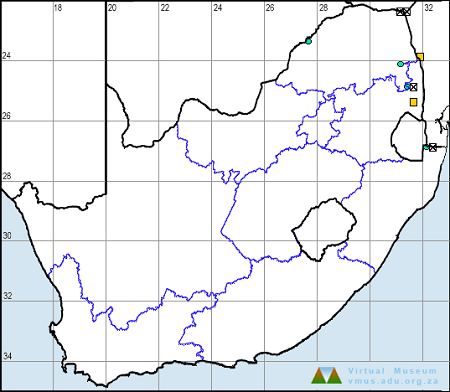
Below is a map showing the distribution of records in South Africa for Trithemis werneri. Taken from the OdonataMAP database as at February 2020.
Below is a map showing the distribution of records in South Africa for Trithemis werneri. Taken from the OdonataMAP database as of December 2024.
The next map below is an imputed map, produced by an interpolation algorithm, which attempts to generate a full distribution map from the partial information in the map above. This map will be improved by the submission of records to the OdonataMAP section of the Virtual Museum.
Ultimately, we will produce a series of maps for all the odonata species in the region. The current algorithm is a new algorithm. The objective is mainly to produce “smoothed” maps that could go into a field guide for odonata. This basic version of the algorithm (as mapped above) does not make use of “explanatory variables” (e.g. altitude, terrain roughness, presence of freshwater — we will be producing maps that take these variables into account soon). Currently, it only makes use of the OdonataMAP records for the species being mapped, as well as all the other records of all other species. The basic maps are “optimistic” and will generally show ranges to be larger than what they probably are.
These maps use the data in the OdonataMAP section of the Virtual Museum, and also the database assembled by the previous JRS funded project, which was led by Professor Michael Samways and Dr KD Dijkstra.
Elegant DropwingTrithemis werneri – Male Ndumo Game Reserve, KwaZulu-Natal Photo by Ryan Tippett
Further Resources
The use of photographs by Eugene Troskie is acknowledged.
Elegant DropwingTrithemis werneriRis, 1912
Other common names: Werner’s Dropwing (Alt. English); Siervalvlerkie (Afrikaans).
Recommended citation format: Loftie-Eaton M; Navarro R; Tippett RM; Underhill L. 2025. Elegant Dropwing Trithemis werneri. Biodiversity and Development Institute. Available online at https://thebdi.org/2020/04/24/elegant-dropwing-trithemis-werneri/
References: Tarboton, M; Tarboton, W. (2019). A Guide to the Dragonflies & Damselflies of South Africa. Struik Nature.
Samways, MJ. (2008). Dragonflies and Damselflies of South Africa. Pensoft
Samways, MJ. (2016). Manual of Freshwater Assessment for South Africa: Dragonfly Biotic Index.Suricata 2. South African National Biodiversity Institute, Pretoria
Martens, A; Suhling, F. (2007). Dragonflies and Damselflies of Namibia. Gamsberg Macmillan.
Elegant DropwingTrithemis werneri – Male Ndumo Game Reserve, KwaZulu-Natal Photo by Ryan Tippett
Find the Red Basker in the FBIS database (Freshwater Biodiversity Information System) here.
Family Libellulidae
Identification
Red BaskerUrothemis assignata – Male Mpempe Pan, KwaZulu-Natal Photo by Ryan Tippett
Medium sized
Length up to 44mm; Wingspan reaches 75mm.
The Red Basker is deep red species with conspicuous dark patches at the base of the hind wings. Males are easily confused with Urothemis luciana (St. Lucia Basker), but are smaller and less robust. Additionally the Red Basker shows less extensive amber patches at the base of the forewings. This amber is in fact, often absent in U. assignata. Both sexes of Urothemis assignata have 7 Ax veins in the forewing (Urothemis luciana has 8 or 9 Ax veins in the forewing).
Females are dull rufous in colouration. They can be mistaken for the females of Urothemis luciana (St. Lucia Basker) and Urothemis edwardsii (Blue Basker). They can be recognised by the number of Ax-veins in the forewing and by the shape of the dark patches in the hind wings.
Click here for more details on identification of the Red Basker.
Red BaskerUrothemis assignata – Female Muzi Pan, KwaZulu-Natal Photo by Ryan Tippett
Habitat
The Red Basker’s natural habitats are freshwater lakes, pans, dams, marshes, and slow-flowing sections of rivers. They prefer still-water habitats with abundant plant growth like reeds and sedges. Non-breeding individuals can often be found in open grassy areas away from water.
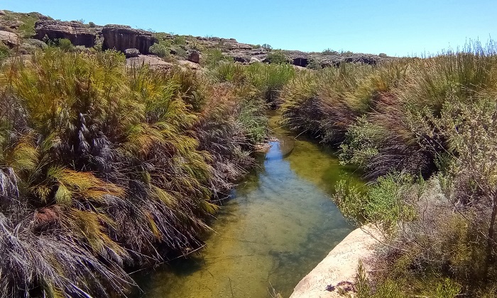
Habitat – Mkuze Game Reserve, KwaZulu-Natal Photo by Ryan Tippett
Behaviour
Red Baskers are perch hunters and spend as much time perched as they do darting off to intercept prey, or to chase off a rival. Urothemis assignata has a powerful, swift flight. They like to sit in open, sunny positions, conspicuously perched on top of a reed or bush, etc. During the heat of the day, they can often be seen in the obelisk position, pointing their abdomens at the sun to reduce the amount of direct sunlight on their bodies. Females are most often seen a short distance away from the water.
The Red Basker is on the wing from October to May in South Africa.
Red BaskerUrothemis assignata – Male Kosi Bay, iSimangaliso Wetland Park, KwaZulu-Natal Photo by Ryan Tippett
Status and Conservation
The Red Basker is a locally common species. It is listed as of Least Concern in the IUCN Red List of Threatened Species. The Red Basker is fairly resistant to habitat degradation and commonly occupies man-made habitats, providing its habitat requirements are met.
Red BaskerUrothemis assignata – Male Carnarvon district, Northern Cape Photo by Ryan Tippett
Distribution
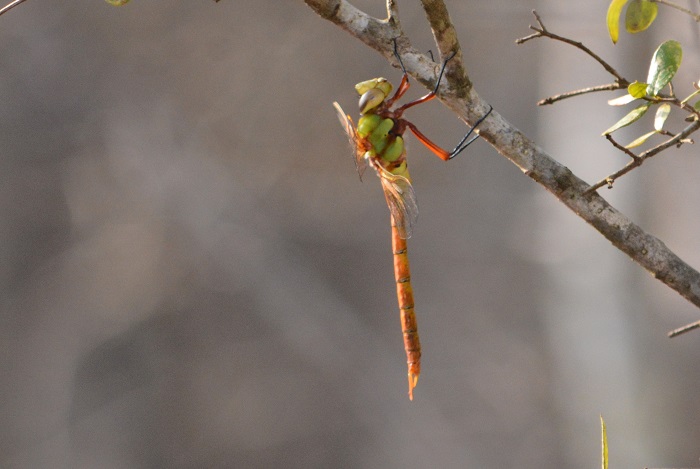
The Red Basker is widespread throughout much of Sub-Saharan Africa. In South Africa, it is most abundant in the wetter savanna regions of the north and east. However, vagrants are liable to turn up almost anywhere.
Below is a map showing the distribution of records for Red Basker in the OdonataMAP database as at February 2020.
Below is a map showing the distribution of records for Red Basker in the OdonataMAP database as of December 2024.
The next map below is an imputed map, produced by an interpolation algorithm, which attempts to generate a full distribution map from the partial information in the map above. This map will be improved by the submission of records to the OdonataMAP section of the Virtual Museum.
Ultimately, we will produce a series of maps for all the odonata species in the region. The current algorithm is a new algorithm. The objective is mainly to produce “smoothed” maps that could go into a field guide for odonata. This basic version of the algorithm (as mapped above) does not make use of “explanatory variables” (e.g. altitude, terrain roughness, presence of freshwater — we will be producing maps that take these variables into account soon). Currently, it only makes use of the OdonataMAP records for the species being mapped, as well as all the other records of all other species. The basic maps are “optimistic” and will generally show ranges to be larger than what they probably are.
These maps use the data in the OdonataMAP section of the Virtual Museum, and also the database assembled by the previous JRS funded project, which was led by Professor Michael Samways and Dr KD Dijkstra.
Red BaskerUrothemis assignata – Male Kosi Bay, iSimangaliso Wetland Park, KwaZulu-Natal Photo by Ryan Tippett
Further Resources
The use of photographs by Georg Jacobs is acknowledged. Other photographs by Ryan Tippett.
Red BaskerUrothemis assignata(Selys, 1872)
Other common names: Rooisonvangertjie (Afrikaans)
Recommended citation format: Loftie-Eaton M; Navarro R; Tippett RM; Underhill L. 2025. Red Basker Urothemis assignata. Biodiversity and Development Institute. Available online at https://thebdi.org/2020/04/24/red-basker-urothemis-assignata/
References: Tarboton, M; Tarboton, W. (2019). A Guide to the Dragonflies & Damselflies of South Africa. Struik Nature.
Samways, MJ. (2008). Dragonflies and Damselflies of South Africa. Pensoft
Samways, MJ. (2016). Manual of Freshwater Assessment for South Africa: Dragonfly Biotic Index. Suricata 2. South African National Biodiversity Institute, Pretoria
Martens, A; Suhling, F. (2007). Dragonflies and Damselflies of Namibia. Gamsberg Macmillan.
Red BaskerUrothemis assignata – Male Mpempe Pan, KwaZulu-Natal Photo by Ryan Tippett
Find the Rock Malachite in the FBIS database (Freshwater Biodiversity Information System) here.
Family Synlestidae
Identification
Rock MalachiteEcchlorolestes peringueyi – Male Jonkershoek Nature Reserve, Western Cape Photo by Desire Darling
Large size
Length up to 52mm; Wingspan attains 65mm.
The Rock Malachite is a distinctive and unmistakable species. It is more robust than other malachites. This combined with its cryptic, mottled colouration and specialised habitat render the Rock Malachite easy to identify.
It is closely related to Ecchlorolestes nylephtha (Queen Malachite), but the two species are not known to co-occur.
The sexes are closely similar but males tend to be more slender than females.
The Rock Malachite is restricted to headwater streams and rivers in mountainous terrain. It requires clear, running water with pools and large boulders or exposed rock-faces, festooned with lichen on which to perch.
Habitat – Jonkershoek Nature Reserve, Western Cape Photo by Corne Rautenbach
Behaviour
The Rock Malachite is well camouflaged and easily overlooked, as it sits against a rock surface adjacent to streams. It occasionally perches on twigs over the water. The Rock Malachite is fairly reluctant to fly as it relies on cryptic colouration to avoid detection.
On the wing primarily from February to May (See Phenology below).
Status and Conservation
The Rock Malachite is uncommon and very localised. It is listed as Near Threatened in the IUCN Red List of Threatened Species. The Rock Malachite is not tolerant of damage to its habitat and only occurs at pristine sites.
Distribution
The Rock Malachite is endemic to the Western Cape province of South Africa, where it occurs from Kogelberg in the South to the Cedarberg in the North.
Below is a map showing the distribution of records for Rock Malachite in the OdonataMAP database as at February 2020.
Below is a map showing the distribution of records for Rock Malachite in the OdonataMAP database as of December 2024.
The next map below is an imputed map, produced by an interpolation algorithm, which attempts to generate a full distribution map from the partial information in the map above. This map will be improved by the submission of records to the OdonataMAP section of the Virtual Museum.
Ultimately, we will produce a series of maps for all the odonata species in the region. The current algorithm is a new algorithm. The objective is mainly to produce “smoothed” maps that could go into a field guide for odonata. This basic version of the algorithm (as mapped above) does not make use of “explanatory variables” (e.g. altitude, terrain roughness, presence of freshwater — we will be producing maps that take these variables into account soon). Currently, it only makes use of the OdonataMAP records for the species being mapped, as well as all the other records of all other species. The basic maps are “optimistic” and will generally show ranges to be larger than what they probably are.
These maps use the data in the OdonataMAP section of the Virtual Museum, and also the database assembled by the previous JRS funded project, which was led by Professor Michael Samways and Dr KD Dijkstra.
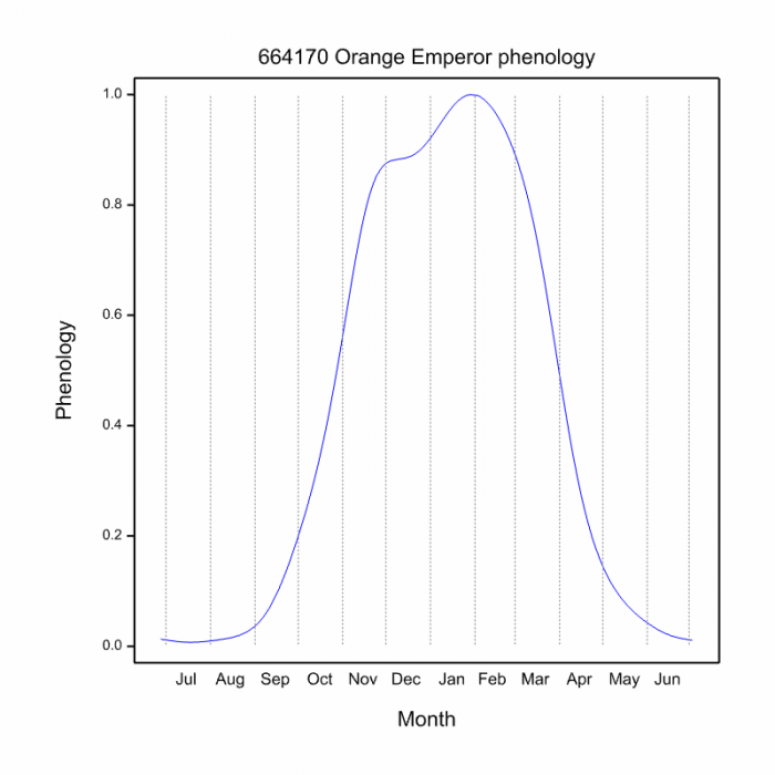
The next two graphs shows how the occurrence of Rock Malachites varies within the year, i.e. the phenology. There are only 28 records in the database for this species, so these results need to be treated as tentative. The first plot shows the number of records in each pentade, five-day periods, which start on 1 July and end on 30 June the following year. The maximum number of records in a pentade is five, in mid-March. The blue line is generated by a smoother, an algorithm which aims to separate the “signal” from the “noise”, and shows the pattern of seasonality for this species. The second plot shows only the blue line, and it is scaled to lie between zero and one, for easy comparison between species.
Phenology
Tentatively (because the sample size is only 28), this phenology plot shows that the Rock Malachite is in flight for a relatively short period in late-summer, from February to April. The peak of the flight period appears to be in March. The peak appears to be quite sharp, but this might be a consequence of the small sample size.
To improve the quality of the phenology, a lot more records of this species are needed.
Further Resources
The use of photographs by Corne Rautenbach, Desire DarlingFelicity Grundlingh is acknowledged.
Rock MalachiteEcchlorolestes peringueyi(Ris, 1921)
Other Common Names: Marbled Malachite (Alt. English); Rotsmalagiet (Afrikaans).
Recommended citation format: Loftie-Eaton M; Navarro R; Tippett RM; Underhill L. 2025. Rock Malachite Ecchlorolestes peringueyi. Biodiversity and Development Institute. Available online at https://thebdi.org/2020/04/23/rock-malachite-ecchlorolestes-peringueyi/
References: Tarboton, M; Tarboton, W. (2019). A Guide to the Dragonflies & Damselflies of South Africa. Struik Nature.
Samways, MJ. (2008). Dragonflies and Damselflies of South Africa. Pensoft
Samways, MJ. (2016). Manual of Freshwater Assessment for South Africa: Dragonfly Biotic Index. Suricata 2. South African National Biodiversity Institute, Pretoria