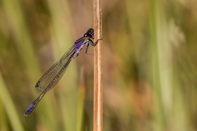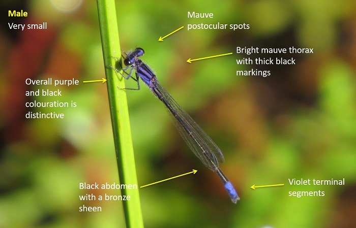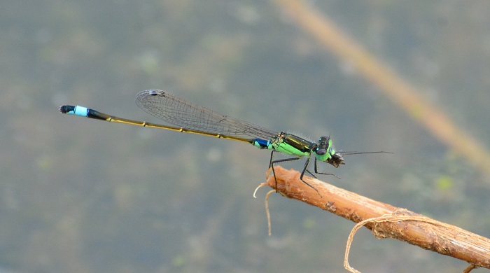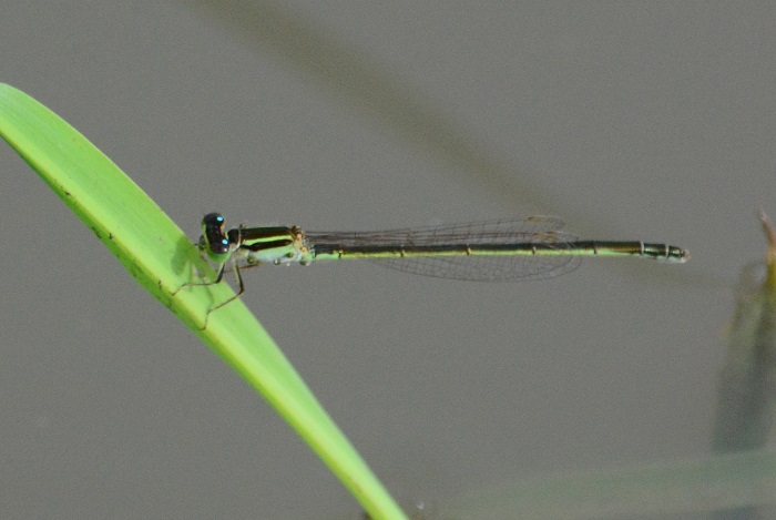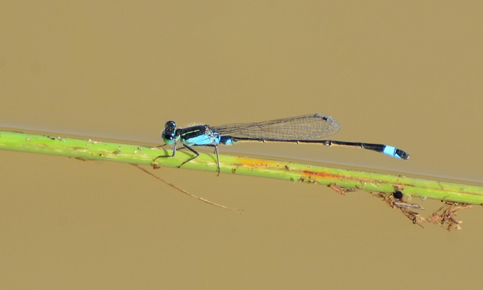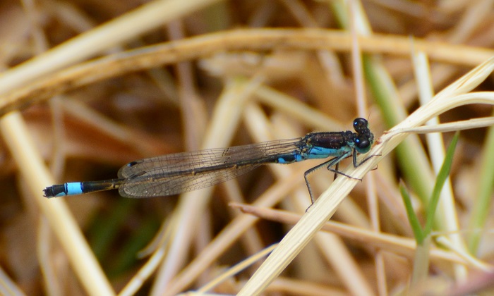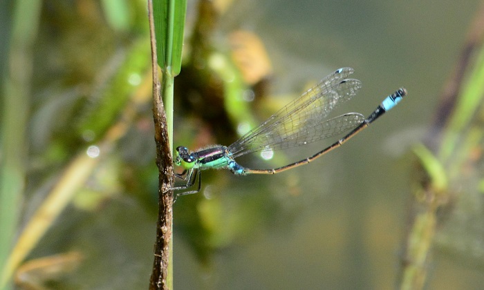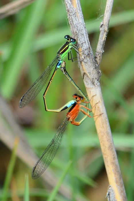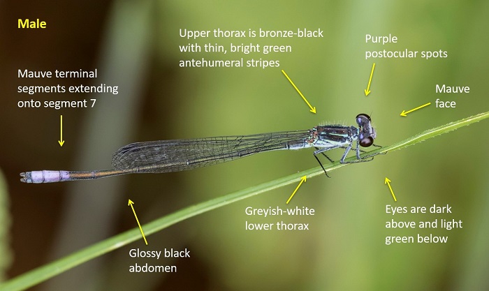
Zambezi Siphontail (Neurogomphus zambeziensis)

Cover photo by Bart Wursten.

Find the Zambezi Siphontail in the FBIS database (Freshwater Biodiversity Information System) here.

Family Gomphidae

Identification

Zambezi Siphontail Neurogomphus zambeziensis – Male
Zambezi National Park, Zimbabwe
Photo by Bart Wursten

Large size

Length attains 57mm; Wingspan up to 73mm.

The Zambezi Siphontail is strikingly marked in lime-green and brown. The thorax is green with narrow brown lines on the top and sides. The abdomen is mostly brown with yellow-green ‘triangular’ markings down the sides. There is a diagnostic yellow band around the eighth segment on the abdomen. The males have modest foliations on segments eight and nine.

Females resemble the males but have reduced foliations on the abdomen and are more robust.

The Zambezi Siphontail is most similar to Phyllogomphus selysi (Bold Leaftail), but that species is noticeably larger and darker in appearance, with thicker black markings and larger foliations on the abdomen.

Click here for more details on identification of the Zambezi Siphontail.

Habitat

The natural habitat of the Zambezi Siphontail is subtropical or tropical lowland savannas, where it inhabits the fringes of larger rivers. It favours rivers with well-wooded banks.

Habitat – Ndumo Game Reserve, KwaZulu-Natal
Photo by Ryan Tippett

Behaviour

The Zambezi Siphontail hunts from a perch and has a relatively slow, weak flight. Hunting is done from bushes and other low vegetation. The Zambezi Siphontail is often found some distance from the water.

Status and Conservation

The Zambezi Siphontail is a rare species in South Africa. It is listed as Vulnerable in the IUCN Red List of Threatened Species.

Distribution

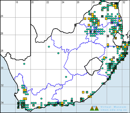
Neurogomphus zambeziensis is found over a relatively small area of south-eastern Africa where it has been recorded in Botswana, Mozambique, Namibia, South Africa, Zambia, Zimbabwe, and possibly Tanzania.

In South Africa it occurs marginally along larger, east-flowing rivers in Limpopo, Mpumalanga and extreme northern KwaZulu-Natal.

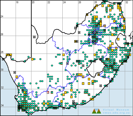
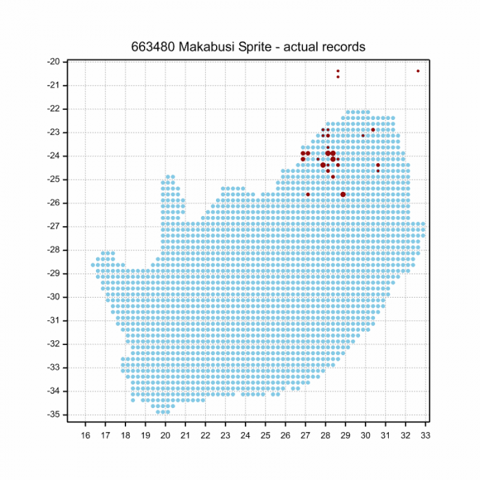
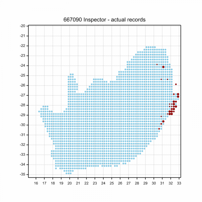
Below is a map showing the distribution of records for Zambezi Siphontail in the OdonataMAP database as at February 2020.

Below is a map showing the distribution of records for Zambezi Siphontail in the OdonataMAP database as of December 2024.

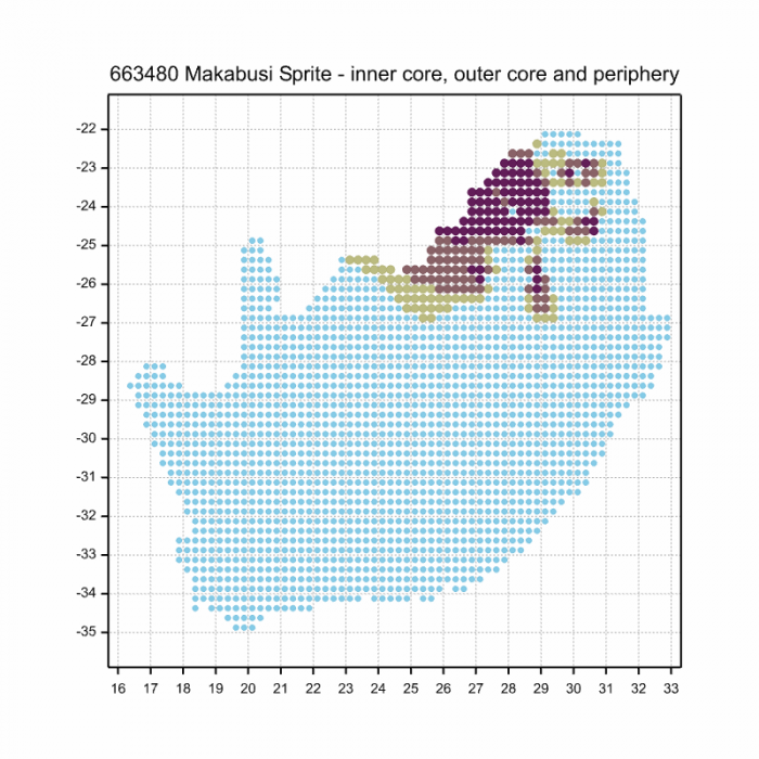
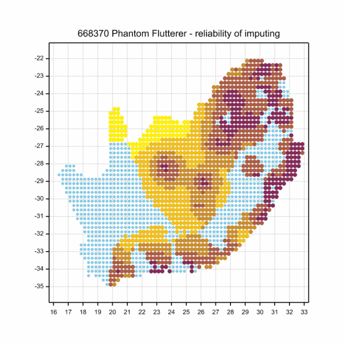
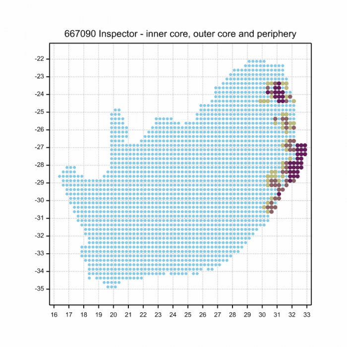
The next map below is an imputed map, produced by an interpolation algorithm, which attempts to generate a full distribution map from the partial information in the map above. This map will be improved by the submission of records to the OdonataMAP section of the Virtual Museum.

Ultimately, we will produce a series of maps for all the odonata species in the region. The current algorithm is a new algorithm. The objective is mainly to produce “smoothed” maps that could go into a field guide for odonata. This basic version of the algorithm (as mapped above) does not make use of “explanatory variables” (e.g. altitude, terrain roughness, presence of freshwater — we will be producing maps that take these variables into account soon). Currently, it only makes use of the OdonataMAP records for the species being mapped, as well as all the other records of all other species. The basic maps are “optimistic” and will generally show ranges to be larger than what they probably are.

These maps use the data in the OdonataMAP section of the Virtual Museum, and also the database assembled by the previous JRS funded project, which was led by Professor Michael Samways and Dr KD Dijkstra.

Phenology

Further Resources

The use of photographs by Bart Wursten is acknowledged.

Zambezi Siphontail Neurogomphus zambeziensis Cammaerts, 2004

Other Common Names: Zambezihewelstert (Afrikaans).

Recommended citation format: Loftie-Eaton M; Navarro R; Tippett RM; Underhill L. 2025. Zambezi Siphontail Neurogomphus zambeziensis. Biodiversity and Development Institute. Available online at https://thebdi.org/2020/05/11/zambezi-siphontail-neurogomphus-zambeziensis/

References: Tarboton, M; Tarboton, W. (2019). A Guide to the Dragonflies & Damselflies of South Africa. Struik Nature.

Samways, MJ. (2008). Dragonflies and Damselflies of South Africa. Pensoft

Samways, MJ. (2016). Manual of Freshwater Assessment for South Africa: Dragonfly Biotic Index. Suricata 2. South African National Biodiversity Institute, Pretoria

Martens, A; Suhling, F. (2007). Dragonflies and Damselflies of Namibia. Gamsberg Macmillan.

Similar Species

Orange Emperor (Anax speratus)

Cover photo by Kate Braun.

Find the Orange Emperor in the FBIS database (Freshwater Biodiversity Information System) here.

Family Aeshnidae

Identification

Orange Emperor Anax speratus – Male
False Bay, iSimangaliso Wetland Park, KwaZulu-Natal
Photo by Ryan Tippett

Very large

Length up to 84mm; Wingspan attains 122mm.

The Orange Emperor is the second largest dragonfly in Southern Africa. Males are entirely bright orange, including the eyes and wing veins. Females are similar but have a pale greenish-orange thorax.

In South Africa, the combination of its large size and distinctive colouration renders both sexes of the Orange Emperor unmistakable.

The Orange Emperor is very similar to the Swamp Emperor (Anax bangweuluensis). The Swamp Emperor is a rare species found only in the Okavango Delta (Botswana), the Caprivi Strip (Namibia), and the Bangweulu Swamp (Zambia). The Orange Emperor is larger and frequents flowing rivers and streams. The Swamp Emperor inhabits large, tropical marshlands. The ranges of the two species are not known to overlap.

Click here for more details on identification.

Orange Emperor Anax speratus – Female
Amakhosi Game Reserve, KwaZulu-Natal
Photo by Ryan Tippett

Habitat

The Orange Emperor inhabits flowing rivers and streams, often in hilly or mountainous areas. It favours river stretches that are interspersed with pools or rapids, and with well vegetated banks. In South Africa, the Orange Emperor is found in the Fynbos, Grassland, Forest, and Savanna biomes. It is found from sea level to over 1700m.

Habitat – Gifberg, Western Cape
Photo by Ryan Tippett
Habitat – Mkuze River, KwaZulu-Natal
Photo by Rowan Poortier

Behaviour

Orange Emperors are most often seen in flight as they patrol back and forth along a chosen stretch of river. Flies low over the water, occasionally darting to tree-top height to intercept prey. When at rest, the Orange Emperor hangs vertically from a perch. It is a bold hunter and frequently preys on other dragonfly species.

The Orange Emperor is most active from October to April, but is on the wing year round at some sites. See Phenology below.

Orange Emperor Anax speratus – Male
False Bay, iSimangaliso Wetland Park, KwaZulu-Natal
Photo by Ryan Tippett

Status and Conservation

The Orange Emperor is common within its southern African range. It is listed as of Least Concern in the IUCN Red List of Threatened Species. As a riverine species, Anax speratus does not usually make use of man-made habitats.

Orange Emperor Anax speratus – Male
Amakhosi Game Reserve, KwaZulu-Natal
Photo by Ryan Tippett

Distribution

Anax speratus is widespread throughout most of Southern, central and East Africa. In South Africa it is restricted to the higher rainfall regions in the south and East. The Orange Emperor avoids the arid to semi-arid central interior.

Below is a map showing the distribution of records for Orange Emperor in the OdonataMAP database as at February 2020.

Below is a map showing the distribution of records for Orange Emperor in the OdonataMAP database as of December 2024.

The next map below is an imputed map, produced by an interpolation algorithm, which attempts to generate a full distribution map from the partial information in the map above. This map will be improved by the submission of records to the OdonataMAP section of the Virtual Museum.

Ultimately, we will produce a series of maps for all the odonata species in the region. The current algorithm is a new algorithm. The objective is mainly to produce “smoothed” maps that could go into a field guide for odonata. This basic version of the algorithm (as mapped above) does not make use of “explanatory variables” (e.g. altitude, terrain roughness, presence of freshwater — we will be producing maps that take these variables into account soon). Currently, it only makes use of the OdonataMAP records for the species being mapped, as well as all the other records of all other species. The basic maps are “optimistic” and will generally show ranges to be larger than what they probably are.

These maps use the data in the OdonataMAP section of the Virtual Museum, and also the database assembled by the previous JRS funded project, which was led by Professor Michael Samways and Dr KD Dijkstra.

Phenology

Orange Emperor Anax speratus – Male
Dassieshoek Nature Reserve, Western Cape
Photo by Ryan Tippett

Further Resources

The use of photographs by Kate Braun and Rowan Poortier is acknowledged. All other photographs by Ryan Tippett.

Orange Emperor Anax speratus Hagen, 1867

Other common names: Oranjekeiser (Afrikaans)

Recommended citation format: Loftie-Eaton M; Navarro R; Tippett RM; Underhill L. 2025. Orange Emperor Anax speratus. Biodiversity and Development Institute. Available online at https://thebdi.org/2020/05/08/orange-emperor-anax-speratus/

References: Tarboton, M; Tarboton, W. (2019). A Guide to the Dragonflies & Damselflies of South Africa. Struik Nature.

Samways, MJ. (2008). Dragonflies and Damselflies of South Africa. Pensoft

Samways, MJ. (2016). Manual of Freshwater Assessment for South Africa: Dragonfly Biotic Index. Suricata 2. South African National Biodiversity Institute, Pretoria

Martens, A; Suhling, F. (2007). Dragonflies and Damselflies of Namibia. Gamsberg Macmillan.

Orange Emperor Anax speratus – Male
False Bay, iSimangaliso Wetland Park, KwaZulu-Natal
Photo by Ryan Tippett

Similar Species

Vagrant Emperor (Anax ephippiger)

Cover photo by Jaco Botes.

Find the Vagrant Emperor in the FBIS database (Freshwater Biodiversity Information System) here.

Family Aeshnidae

Identification

Vagrant Emperor Anax ephippiger – Male
Near Hluhluwe, KwaZulu-Natal
Photo by Ryan Tippett

Large size

Length up to 67mm; Wingspan attains 110mm.

The Vagrant Emperor is unlike any other species in Southern Africa. The yellow brown colouration and bright blue saddle of the males render them unmistakable.

Females in flight may be mistaken for Pantala flavescens (Wandering Glider), the two species often occur side by side. The wandering glider is smaller, often orange to red in colour and has a distinctive, tapered body shape.

Click here for more details on identification.

Vagrant Emperor Anax ephippiger – Female
Amakhosi Game Reserve, KwaZulu-Natal
Photo by Ryan Tippett

Habitat

The favoured breeding habitat of the Vagrant Emperor is seasonal pools, pans and dams which it rapidly colonises after rain. This species is liable to turn up almost anywhere after rain.

Habitat – Near Kosi Bay, KwaZulu-Natal
Photo by Ryan Tippett

Behaviour

The Vagrant Emperor is a highly nomadic and opportunistic species. It typically appears in an area shortly before or after rain, where it may breed if conditions are favourable, before moving on.

The Vagrant Emperor is highly aerial and spends long periods on the wing. It often forms or joins mixed species hunting swarms at dusk. The Vagrant Emperor is often seen singly but is also frequently gregarious. As with other Anax species, the Vagrant Emperor rests by hanging vertically from a perch.

Most active from September to May (see Phenology below).

Vagrant Emperor Anax ephippiger – Male
Mkuze River, KwaZulu-Natal
Photo by Ryan Tippett

Status and Conservation

The Vagrant Emperor is common to abundant when present. It often inhabits degraded and ephemeral habitats and is therefore listed as of Least Concern in the IUCN Red List of Threatened Species.

Vagrant Emperor Anax ephippiger – Male
Near Hluhluwe, KwaZulu-Natal
Photo by Ryan Tippett

Distribution

The Vagrant Emperor is distributed widely across Africa, Europe, and central and southern Asia. It also occurs on many of the Indian Ocean islands.

The South African range is centered around the wetter northern and eastern regions, although vagrants can turn up almost anywhere.

Vagrant Emperor Anax ephippiger – Male
Muzi Pan, KwaZulu-Natal
Photo by Ryan Tippett

Below is a map showing the distribution of records for Vagrant Emperor in the OdonataMAP database as at February 2020.

Below is a map showing the distribution of records for Vagrant Emperor in the OdonataMAP database as of December 2024.

The next map below is an imputed map, produced by an interpolation algorithm, which attempts to generate a full distribution map from the partial information in the map above. This map will be improved by the submission of records to the OdonataMAP section of the Virtual Museum.

Ultimately, we will produce a series of maps for all the odonata species in the region. The current algorithm is a new algorithm. The objective is mainly to produce “smoothed” maps that could go into a field guide for odonata. This basic version of the algorithm (as mapped above) does not make use of “explanatory variables” (e.g. altitude, terrain roughness, presence of freshwater — we will be producing maps that take these variables into account soon). Currently, it only makes use of the OdonataMAP records for the species being mapped, as well as all the other records of all other species. The basic maps are “optimistic” and will generally show ranges to be larger than what they probably are.

These maps use the data in the OdonataMAP section of the Virtual Museum, and also the database assembled by the previous JRS funded project, which was led by Professor Michael Samways and Dr KD Dijkstra.

Vagrant Emperor Anax ephippiger – Male
Carnarvon district, Northern Cape
Photo by Ryan Tippett

Phenology

Vagrant Emperor Anax ephippiger – Female
False Bay, iSimangaliso Wetland Park, KwaZulu-Natal
Photo by Ryan Tippett

Further Resources

The use of photographs by Jaco Botes is acknowledged. All other photographs by Ryan Tippett.

Vagrant Emperor Anax ephippiger (Burmeister, 1839)

Other common names: Blourugkeiser (Afrikaans)

Recommended citation format: Loftie-Eaton M; Navarro R; Tippett RM; Underhill L. 2025. Vagrant Emperor Anax ephippiger. Biodiversity and Development Institute. Available online at https://thebdi.org/2020/05/08/vagrant-emperor-anax-ephippiger/

References: Tarboton, M; Tarboton, W. (2019). A Guide to the Dragonflies & Damselflies of South Africa. Struik Nature.

Samways, MJ. (2008). Dragonflies and Damselflies of South Africa. Pensoft

Samways, MJ. (2016). Manual of Freshwater Assessment for South Africa: Dragonfly Biotic Index. Suricata 2. South African National Biodiversity Institute, Pretoria

Martens, A; Suhling, F. (2007). Dragonflies and Damselflies of Namibia. Gamsberg Macmillan.

Vagrant Emperor Anax ephippiger – Male
Near Hluhluwe, KwaZulu-Natal
Photo by Ryan Tippett

Similar Species

Springwater Sprite (Pseudagrion caffrum)

Cover photo by Gregg Darling.

Find the Springwater Sprite in the FBIS database (Freshwater Biodiversity Information System) here.

Family Coenagrionidae

Identification

Springwater Sprite Pseudagrion caffrum – Male
Near Estcourt, KwaZulu-Natal
Photo by Alan Manson

Small size

Length reaches 36mm; Wingspan attains 47mm.

Pseudagrion caffrum is one of three ‘yellow-faced’ sprites in the region. The other two are The Yellow-faced Sprite (Pseudagrion citricola) and the Great Sprite (Pseudagrion gamblesi). The Great Sprite is easily distinguished by its significantly larger size and bright blue terminal segments. The Springwater Sprite is most similar to the Yellow-faced Sprite, but is differentiated by lacking postocular spots and bright blue terminal segments on the abdomen.

Female Springwater Sprites are among the more distinctive in the genus. They can be told by the combination of bright green thorax sides and red-brown upper thorax.

Click here for more details on identification.

Habitat

The Springwater Sprite inhabits shallow, rocky streams in grasslands where it is found mostly in hilly uplands along the escarpment. The Springwater Sprite favours sites with rich sedges and grass growth, and soggy ground. It occurs at medium to high altitudes, mostly between 1400 and 2200m above sea level.

Habitat – Montane stream surrounded by dense grass and boggy ground.
Near Himeville, KwaZulu-Natal
Photo by Corne Rautenbach

Behaviour

The Springwater Sprite is a cryptic species and is easily overlooked. It mostly sits low down among dense grass and is normally reluctant to fly.

The Springwater Sprite is most active from October to May (see Phenology below).

Status and Conservation

The Springwater Sprite is fairly common but localised. It is listed as of Least Concern in the IUCN Red List of Threatened Species. It is sensitive to habitat degradation and only occurs in pristine, undisturbed habitats.

Distribution

Pseudagrion caffrum is endemic to South Africa. It is distrubuted along the eastern side of the Drakensberg escarpment from the central Eastern cape, up through KwaZulu-Natal, Mpumalanga and Marginally into Limpopo.

Below is a map showing the distribution of records for Springwater Sprite in the OdonataMAP database as at February 2020.

Below is a map showing the distribution of records for Springwater Sprite in the OdonataMAP database as of December 2024.

The next map below is an imputed map, produced by an interpolation algorithm, which attempts to generate a full distribution map from the partial information in the map above. This map will be improved by the submission of records to the OdonataMAP section of the Virtual Museum.

Ultimately, we will produce a series of maps for all the odonata species in the region. The current algorithm is a new algorithm. The objective is mainly to produce “smoothed” maps that could go into a field guide for odonata. This basic version of the algorithm (as mapped above) does not make use of “explanatory variables” (e.g. altitude, terrain roughness, presence of freshwater — we will be producing maps that take these variables into account soon). Currently, it only makes use of the OdonataMAP records for the species being mapped, as well as all the other records of all other species. The basic maps are “optimistic” and will generally show ranges to be larger than what they probably are.

These maps use the data in the OdonataMAP section of the Virtual Museum, and also the database assembled by the previous JRS funded project, which was led by Professor Michael Samways and Dr KD Dijkstra.

Phenology

Further Resources

The use of photographs by Alan Manson and Gregg Darling is acknowledged.

Springwater Sprite Pseudagrion caffrum (Burmeister, 1839)

Other Common Names: Fonteingesie (Afrikaans).

Recommended citation format: Loftie-Eaton M; Navarro R; Tippett RM; Underhill L. 2025. Springwater Sprite Pseudagrion caffrum. Biodiversity and Development Institute. Available online at https://thebdi.org/2020/05/08/springwater-sprite-pseudagrion-caffrum/

References: Tarboton, M; Tarboton, W. (2019). A Guide to the Dragonflies & Damselflies of South Africa. Struik Nature.

Samways, MJ. (2008). Dragonflies and Damselflies of South Africa. Pensoft

Samways, MJ. (2016). Manual of Freshwater Assessment for South Africa: Dragonfly Biotic Index. Suricata 2. South African National Biodiversity Institute, Pretoria

Similar Species

Highland Spreadwing (Lestes plagiatus)

Cover photo by Peter Webb.

Find the Highland Spreadwing in the FBIS database (Freshwater Biodiversity Information System) here.

Family Lestidae

Identification

Highland Spreadwing Lestes plagiatus – Male
Lake Naverone, KwaZulu-Natal
Photo by Ryan Tippett

Medium sized

Length up to 48mm; Wingspan reaches 60mm.

The Highland Spreadwing is most similar to Lestes virgatus (Smoky Spreadwing). The two differ in the amount of metallic green on the thorax, with Lestes virgatus having larger and broader green stripes. Lestes plagiatus has plain coloured, brownish pterostigmas, while L. virgatus has pale pterostigmas with dark borders. The two species also have very different clasper structures.

Click here for more details on identification.

Highland Spreadwing Lestes plagiatus – Female
Amakhosi Game Reserve, KwaZulu-Natal
Photo by Ryan Tippett

Habitat

The Highland Spreadwing inhabits the edges of still water habitats such as ponds, pools, dams, and slow-moving sections of rivers and streams. It favours sites with emergent and fringing grass, sedges, or reeds.

The Highland Spreadwing occurs near the coast in some places but is mostly found from 700 to 1400m above sea level.

Habitat – Wakkerstroom, Mpumalanga
Photo by Rowan Poortier

Behaviour

The Highland Spreadwing flits between emergent grass and sedge stems. It perches on plant stems with its wings outstretched, usually with the abdomen pointed downwards. Both sexes are found in the same vicinity.

The Highland Spreadwing is most Active from October to May (See Phenology below).

Highland Spreadwing Lestes plagiatus – Male
Elands River, Boston, KwaZulu-Natal
Photo by Ryan Tippett

Status and Conservation

The Highland Spreadwing is common and widespread in South Africa. It is listed as of Least Concern in the IUCN Red List of Threatened Species. The Highland Spreadwing is an adaptable species that has widely benefited from suitable man-made habitats like dams and ponds.

Highland Spreadwing Lestes plagiatus – Immature male
iXopo district, KwaZulu-Natal
Photo by Ryan Tippett

Distribution

Lestes plagiatus is widespread in eastern and southern Africa. In south Africa it is found primarily in the east where it is common. Marginal in the Northern and Western Cape.

Highland Spreadwing Lestes plagiatus – Female
Amakhosi Game Reserve, KwaZulu-Natal
Photo by Ryan Tippett

Below is a map showing the distribution of records for Highland Spreadwing in the OdonataMAP database as at February 2020.

Below is a map showing the distribution of records for Highland Spreadwing in the OdonataMAP database as of December 2024.

The next map below is an imputed map, produced by an interpolation algorithm, which attempts to generate a full distribution map from the partial information in the map above. This map will be improved by the submission of records to the OdonataMAP section of the Virtual Museum.

Ultimately, we will produce a series of maps for all the odonata species in the region. The current algorithm is a new algorithm. The objective is mainly to produce “smoothed” maps that could go into a field guide for odonata. This basic version of the algorithm (as mapped above) does not make use of “explanatory variables” (e.g. altitude, terrain roughness, presence of freshwater — we will be producing maps that take these variables into account soon). Currently, it only makes use of the OdonataMAP records for the species being mapped, as well as all the other records of all other species. The basic maps are “optimistic” and will generally show ranges to be larger than what they probably are.

These maps use the data in the OdonataMAP section of the Virtual Museum, and also the database assembled by the previous JRS funded project, which was led by Professor Michael Samways and Dr KD Dijkstra.

Highland Spreadwing Lestes plagiatus – Immature female
Lake Naverone, KwaZulu-Natal
Photo by Ryan Tippett

Phenology

The next two graphs shows how the occurrence of the Highland Spreadwing varies within the year, i.e. the phenology. There are 873 records in the database for this species, so these results are likely to be reliable. They show the overall phenology within the range. The first plot shows the number of records in each pentade, five-day periods, which start on 1 July and end on 30 June the following year. The blue line is generated by a smoother, an algorithm which aims to separate the “signal” from the “noise”, and shows the pattern of seasonality for this species. The second plot shows only the blue line, and it is scaled to lie between zero and one, for easy comparison between species.

This phenology plot shows, reliably because of the large sample size, that Highland Spreadwings are mainly in flight from October to May. This is well-known; what is new is the shortness of the period of peak abundance, in December. The plot suggests a rapidly and accelerating build up of numbers, starting slowly in September. After the December peak, the decrease through late-summer, autumn and early winter is slower than the increase in spring. The numbers of Highland Spreadwings per pentade in the late-winter months are tiny.

With its large range, this species is a candidate for regional phenology plots. The more data available, the larger the number of regions, especially altitudinal bands, that can be reliably compared. Please keep submitting Highland Spreadwings to the OdonataMAP database.

Highland Spreadwing Lestes plagiatus – Male
Amakhosi Game Reserve, KwaZulu-Natal
Photo by Ryan Tippett

Further Resources

The use of photographs by Peter Webb and Rowan Poortier is acknowledged. All other photographs by Ryan Tippett.

Highland Spreadwing Lestes plagiatus (Burmeister, 1839)

Other common names: Gewone Spanvlerkie (Afrikaans)

Recommended citation format: Loftie-Eaton M; Navarro R; Tippett RM; Underhill L. 2025. Highland Spreadwing Lestes plagiatus. Biodiversity and Development Institute. Available online at https://thebdi.org/2020/05/08/highland-spreadwing-lestes-plagiatus/

References: Tarboton, M; Tarboton, W. (2019). A Guide to the Dragonflies & Damselflies of South Africa. Struik Nature.

Samways, MJ. (2008). Dragonflies and Damselflies of South Africa. Pensoft

Samways, MJ. (2016). Manual of Freshwater Assessment for South Africa: Dragonfly Biotic Index. Suricata 2. South African National Biodiversity Institute, Pretoria

Martens, A; Suhling, F. (2007). Dragonflies and Damselflies of Namibia. Gamsberg Macmillan.

Highland Spreadwing Lestes plagiatus – Male
Wakkerstroom, Mpumalanga
Photo by Ryan Tippett

Similar Species

Pinhey’s Wisp (Agriocnemis pinheyi)

Cover photo by Gert Bensch.

Find Pinhey’s Wisp in the FBIS database (Freshwater Biodiversity Information System) here.

Family Coenagrionidae

Identification

Pinhey’s Wisp Agriocnemis pinheyi – Male
Near Underberg, KwaZulu-Natal
Photo by Ryan Tippett

Very small size

Length up to 21mm; Wingspan attains 26mm.

Pinhey’s Wisp is most like Agriocnemis exilis (Little Wisp). They are similar in size and are, in fact, the two smallest damselflies in the region. Pinhey’s Wisp has an unbroken green line across the face and an incomplete green line across the prothorax. The Little Wisp shows the exact opposite, having a broken green moustache and an unbroken green line on the prothorax.

Females are variable and best told by their association with the males.

Click here for more details on identification.

Pinhey’s Wisp Agriocnemis pinheyi – Female
Near Underberg, KwaZulu-Natal
Photo by Ryan Tippett

Habitat

Pinhey’s Wisp inhabits the dense grass and sedge margins of pools, dams, seeps, and marshes, as well as the fringes of slow-moving streams. It is found at a fairly high altitude, from 1200m to 1600m above sea level.

Habitat – Middelburg, Mpumalanga
Photo by Andries De Vries

Behaviour

Pinhey’s Wisp usually perches vertically on a sedge or grass stem. It typically sits low down, close to the water, among vegetation, where it is unobtrusive and easily overlooked.

Pinhey’s Wisp is on the wing from October to April (See Phenology below).

Pinhey’s Wisp Agriocnemis pinheyi – An aged female
Near Underberg, KwaZulu-Natal
Photo by Ryan Tippett

Status and Conservation

Pinhey’s Wisp is fairly common but localised. It is listed as of Least Concern in the IUCN Red List of Threatened Species.

Distribution

Pinhey’s Wisp occurs in southern, central, and eastern Africa. In South Africa, it is found inland, in the eastern parts of the country, from the Eastern Cape up to Limpopo.

Pinhey’s Wisp Agriocnemis pinheyi – Male
Near Underberg, KwaZulu-Natal
Photo by Ryan Tippett

Below is a map showing the distribution of records for Pinhey’s Wisp in the OdonataMAP database as at February 2020.

Below is a map showing the distribution of records for Pinhey’s Wisp in the OdonataMAP database as of December 2024.

The next map below is an imputed map, produced by an interpolation algorithm, which attempts to generate a full distribution map from the partial information in the map above. This map will be improved by the submission of records to the OdonataMAP section of the Virtual Museum.

Ultimately, we will produce a series of maps for all the odonata species in the region. The current algorithm is a new algorithm. The objective is mainly to produce “smoothed” maps that could go into a field guide for odonata. This basic version of the algorithm (as mapped above) does not make use of “explanatory variables” (e.g. altitude, terrain roughness, presence of freshwater — we will be producing maps that take these variables into account soon). Currently, it only makes use of the OdonataMAP records for the species being mapped, as well as all the other records of all other species. The basic maps are “optimistic” and will generally show ranges to be larger than what they probably are.

These maps use the data in the OdonataMAP section of the Virtual Museum, and also the database assembled by the previous JRS funded project, which was led by Professor Michael Samways and Dr KD Dijkstra.

Phenology

Pinhey’s Wisp Agriocnemis pinheyi – Male
Near Underberg, KwaZulu-Natal
Photo by Ryan Tippett

Further Resources

The use of photographs by Andries De Vries and Gert Bensch is acknowledged. Other photographs by Ryan Tippett.

Pinhey’s Wisp Agriocnemis pinheyi Balinsky, 1963

Other common names: Pinhey-soetjie (Afrikaans)

Recommended citation format: Loftie-Eaton M; Navarro R; Tippett RM; Underhill L. 2025. Pinhey’s Wisp Agriocnemis pinheyi. Biodiversity and Development Institute. Available online at https://thebdi.org/2020/05/08/pinheys-wisp-agriocnemis-pinheyi/

References: Tarboton, M; Tarboton, W. (2019). A Guide to the Dragonflies & Damselflies of South Africa. Struik Nature.

Samways, MJ. (2008). Dragonflies and Damselflies of South Africa. Pensoft

Samways, MJ. (2016). Manual of Freshwater Assessment for South Africa: Dragonfly Biotic Index. Suricata 2. South African National Biodiversity Institute, Pretoria

Similar Species

Denim Dropwing (Trithemis donaldsoni)

Cover photo by John Wilkinson).

Find the Denim Dropwing in the FBIS database (Freshwater Biodiversity Information System) here.

Family Libellulidae

Identification

Trithemis donaldsoni – Male
Mkuze River, KwaZulu-Natal
Photo by Ryan Tippett

Medium-sized

Length up to 44mm; Wingspan reaches 71mm.

Male Denim Dropwings are recognisable by the uniformly pale blue body colouration and contrasting dark head and eyes. The black terminal segments on the abdomen are also a useful aid in identification.

Males could be confused with several other all-blue dragonflies, such as Skimmers (Orthetrum spp.) and the other blue dropwings (Trithemis spp.).

The Denim Dropwing is most similar to the Navy Dropwing (Trithemis furva), Highland Dropwing (Trithemis dorsalis), Silhouette Dropwing (Trithemis hecate) and Halfshade Dropwing (Trithemis aconita). The Denim dropwing can be told apart by its slightly larger size, paler blue colouration, contrasting black eyes, and black terminal tail segments.

Click here for more details on identification of the Denim Dropwing.

Trithemis donaldsoni – Female
Mkuze River, KwaZulu-Natal
Photo by Ryan Tippett

Habitat

The Denim Dropwing inhabits shallow, rocky, and fast-flowing rivers, mostly in hot savanna regions. It requires rocks in or near the mid-stream for perching on. Denim Dropwing males are seldom found away from such sites. Females are generally found some distance from water in the surrounding woodland.

Habitat – Mkuze River, KwaZulu-Natal
Photo by Ryan Tippett

Behaviour

Males perch close to the water on rocks, mostly where there is fast-flowing and turbulent water. The Denim Dropwing will occasionally also sit on plant stems over the water. They are alert and can be difficult to approach. Females are seldom encountered.

Trithemis donaldsoni – Male
Gamka River, Western Cape
Photo by Ryan Tippett

Status and Conservation

The Denim Dropwing is localised and generally scarce, but is listed as of Least Concern in the IUCN Red List of Threatened Species. Due to its habitat choice Trithemis donaldsoni does not make use of man-made habitats.

Trithemis donaldsoni – Young Male
Mkuze River, KwaZulu-Natal
Photo by Ryan Tippett

Distribution

The Denim Dropwing is widely distributed in Southern and East Africa, ranging from South
Africa up to Kenya and Uganda. Also occurs in northern and eastern Botswana and across to northern Namibia and Angola.

In South Africa, the Denim Dropwing is mostly found in the north and east where it is recorded from the Limpopo, North-West, Gauteng, Mpumalanga, and KwaZulu-Natal provinces. It is also present along the length of the Orange River where it may have previously been overlooked. The Denim Dropwing has also been recorded at a few sites in the Western and Eastern Cape where it may also have been overlooked in the past.

Below is a map showing the distribution of records for Denim Dropwing in the OdonataMAP database as at February 2020.

Below is a map showing the distribution of records for Denim Dropwing in the OdonataMAP database as of December 2024.

The next map below is an imputed map, produced by an interpolation algorithm, which attempts to generate a full distribution map from the partial information in the map above. This map will be improved by the submission of records to the OdonataMAP section of the Virtual Museum.

Ultimately, we will produce a series of maps for all the odonata species in the region. The current algorithm is a new algorithm. The objective is mainly to produce “smoothed” maps that could go into a field guide for odonata. This basic version of the algorithm (as mapped above) does not make use of “explanatory variables” (e.g. altitude, terrain roughness, presence of freshwater — we will be producing maps that take these variables into account soon). Currently, it only makes use of the OdonataMAP records for the species being mapped, as well as all the other records of all other species. The basic maps are “optimistic” and will generally show ranges to be larger than what they probably are.

These maps use the data in the OdonataMAP section of the Virtual Museum, and also the database assembled by the previous JRS funded project, which was led by Professor Michael Samways and Dr KD Dijkstra.

Trithemis donaldsoni – Male and female
Mkuze River, KwaZulu-Natal
Photo by Ryan Tippett

Further Resources

The use of photographs by Alan Manson is acknowledged. All other photographs by Ryan Tippett.

Denim Dropwing Trithenis donaldsoni (Calvert, 1899)

Other common names: Denimvalvlerkie (Afrikaans)

Recommended citation format: Loftie-Eaton M; Navarro R; Tippett RM; Underhill L. 2025. Denim Dropwing Trithenis donaldsoni. Biodiversity and Development Institute. Available online at https://thebdi.org/2020/05/08/denim-dropwing-trithemis-donaldsoni/

References: Tarboton, M; Tarboton, W. (2019). A Guide to the Dragonflies & Damselflies of South Africa. Struik Nature.

Samways, MJ. (2008). Dragonflies and Damselflies of South Africa. Pensoft

Samways, MJ. (2016). Manual of Freshwater Assessment for South Africa: Dragonfly Biotic Index. Suricata 2. South African National Biodiversity Institute, Pretoria

Martens, A; Suhling, F. (2007). Dragonflies and Damselflies of Namibia. Gamsberg Macmillan.

Trithemis donaldsoni – Male
Mkuze River, KwaZulu-Natal
Photo by Ryan Tippett

Similar Species

Highland Dropwing (Trithemis dorsalis)

The photo above (by Alan Manson) can be viewed in OdonataMAP here.

Find this species in the FBIS database (Freshwater Biodiversity Information System) here.

Family Libellulidae

Identification

Highland Dropwing Trithemis dorsalis – Male
Elands River, KwaZulu-Natal
Photo by Ryan Tippett

Small to medium size

Length up to 40mm; Wingspan attains 65mm.

The Highland Dropwing is most likely to be confused with the very similar Navy Dropwing (Trithemis furva). Males of the two are best identified in the hand by examining the shape of the secondary genitalia. The males can also (mostly) be told apart by checking the last Ax vein in the front wings. In Trithemis furva the last Ax vein extends as far as the subcostal vein and does not reach the radial vein. Trithemis dorsalis shows Ax veins that cross the subcostal vein to meet up with the radial vein.

In addition, the two species can be tentatively identified based on their preferred habitat choice. Although they co-occur at many sites, the Highland Dropwing is far more numerous than the navy dropwing at higher altitudes.

The Denim Dropwing (Trithemis donaldsoni) is also similar but is larger and distinctly paler in colour.

The Female Highland Dropwing is readily identified by the narrow, wavy black stripes on the sides of the thorax.

Click here for more details on identification of the Highland Dropwing.

Highland Dropwing Trithemis dorsalis – Female
Lake Naverone, KwaZulu-Natal
Photo by Ryan Tippett

Habitat

The Highland Dropwing inhabits the fringes of rivers, streams and dams. It prefers slow moving sections of rivers and is far less regular along fast flowing stretches. Highland Dropwings are common along the vegetated fringes of dams that are lined with reeds, grasses, and sedges.

Habitat – Wakkerstroom, Mpumalanga
Photo by Rowan Poortier

Behaviour

The Highland Dropwing is a conspicuous species that perches openly on emergent or fringing vegetation. At rest, it sits with its wings drooped downwards in typical ‘dropwing’ fashion. The Highland Dropwing is most common above 700m above sea level, but is regular at lower altitudes in the Western Cape.

The Highland Dropwing is on the wing from October to May.

Highland Dropwing Trithemis dorsalis – Male
Lake Naverone, KwaZulu-Natal
Photo by Ryan Tippett

Status and Conservation

In South Africa, the Highland Dropwing is common, particularly in higher-altitude areas. It is listed as of Least Concern in the IUCN Red List of Threatened Species. The Highland Dropwing readily makes use of man-made and degraded habitats.

Highland Dropwing Trithemis dorsalis – Female
Gifberg, Western Cape
Photo by Ryan Tippett

Distribution

The Highland Dropwing is locally distributed across the highland regions of eastern and southern Africa. It is found in Angola, the Democratic Republic of the Congo, Guinea, Kenya, Mozambique, Sierra Leone, South Africa, Tanzania, Uganda, Zambia, Zimbabwe, and possibly also Burundi and Malawi.

In South Africa Trithemis dorsalis is predominantly a species of the Drakensberg and Highveld, but is widespread in mid to high altitude regions, from the south-western Cape to northern Limpopo.

Highland Dropwing Trithemis dorsalis – Male
Seweweekspoort, Western Cape
Photo by Ryan Tippett

Below is a map showing the distribution of records for Highland Dropwing in the OdonataMAP database as at February 2020.

Below is a map showing the distribution of records for Highland Dropwing in the OdonataMAP database as of December 2024.

The next map below is an imputed map, produced by an interpolation algorithm, which attempts to generate a full distribution map from the partial information in the map above. This map will be improved by the submission of records to the OdonataMAP section of the Virtual Museum.

Ultimately, we will produce a series of maps for all the odonata species in the region. The current algorithm is a new algorithm. The objective is mainly to produce “smoothed” maps that could go into a field guide for odonata. This basic version of the algorithm (as mapped above) does not make use of “explanatory variables” (e.g. altitude, terrain roughness, presence of freshwater — we will be producing maps that take these variables into account soon). Currently, it only makes use of the OdonataMAP records for the species being mapped, as well as all the other records of all other species. The basic maps are “optimistic” and will generally show ranges to be larger than what they probably are.

These maps use the data in the OdonataMAP section of the Virtual Museum, and also the database assembled by the previous JRS funded project, which was led by Professor Michael Samways and Dr KD Dijkstra.

Highland Dropwing Trithemis dorsalis – Female
Wilge River, Free State
Photo by Ryan Tippett

Further Resources

The use of photographs by Alan Manson and Rowan Poortier is acknowledged. All other photographs by Ryan Tippett.

Highland Dropwing Trithemis dorsalis (Rambur, 1842)

Other common names: Dorsal Dropwing (Alt. English); Hooglandvalvlerkie (Afrikaans

Recommended citation format: Loftie-Eaton M; Navarro R; Tippett RM; Underhill L. 2025. Highland Dropwing Trithemis dorsalis. Biodiversity and Development Institute. Available online at https://thebdi.org/2020/05/08/highland-dropwing-trithemis-dorsalis/

References: Tarboton, M; Tarboton, W. (2019). A Guide to the Dragonflies & Damselflies of South Africa. Struik Nature.

Samways, MJ. (2008). Dragonflies and Damselflies of South Africa. Pensoft

Samways, MJ. (2016). Manual of Freshwater Assessment for South Africa: Dragonfly Biotic Index. Suricata 2. South African National Biodiversity Institute, Pretoria

Martens, A; Suhling, F. (2007). Dragonflies and Damselflies of Namibia. Gamsberg Macmillan.

Highland Dropwing Trithemis dorsalis – Male
Wilge River, Free State
Photo by Ryan Tippett

Similar Species

Violet Dropwing (Trithemis annulata)

Cover photo by Neels Jackson.

Find this species in the FBIS database (Freshwater Biodiversity Information System) here.

Family Libellulidae

Identification

Violet Dropwing Trithemis annulata – Male
Near Hluhluwe, KwaZulu-Natal
Photo by Ryan Tippett

Small size

Length attains 38mm; Wingspan reaches 64mm.

Male Violet Dropwings are unmistakable, being brilliant violet-red with red veins in the wings. Violet Dropwing males could perhaps be confused with the male Red-veined Dropwing (Trithemis arteriosa). Red-veined Dropwings often show a violet hue on the thorax, but are distinctly red in overall colouration. The two can be further separated by the shape, colouration, and patterning of the abdomen.

Female Violet Dropwings are yellow and brown. They are distinguishable from other dropwings by the characteristic black markings on the last two abdominal segments.

Click here for more details on identification.

Violet Dropwing Trithemis annulata – Female
Near Hluhluwe, KwaZulu-Natal
Photo by Ryan Tippett
Habitat

The Violet Dropwing inhabits a range of freshwater habitats, including lakes, marshes, ponds, dams, and rivers. It prefers still or slow-moving waters and is mostly found in the warmer savanna regions.

Habitat – Mkuze Game Reserve, KwaZulu-Natal
Photo by Ryan Tippett
Behaviour

Male Violet Dropwings are very conspicuous as they perch at prominent, exposed sites over the water. They often also sit on rocks closer to the ground. Like others in the genus, they received the common name of ‘dropwings’ because of their habit of immediately lowering their wings after landing on a perch. Females occupy the same areas as the males, but can also be found some distance from the water.

Violet Dropwing Trithemis annulata – Male
St. Lucia, KwaZulu-Natal
Photo by Ryan Tippett
Status and Conservation

The Violet Dropwing is a common and widespread species. It is listed as of Least Concern in the IUCN Red List of Threatened Species. The Violet Dropwing is a hardy and adaptable species. It readily makes use of man-made and somewhat degraded habitats.

Violet Dropwing Trithemis annulata – Male
Near Hluhluwe, KwaZulu-Natal
Photo by Ryan Tippett
Distribution

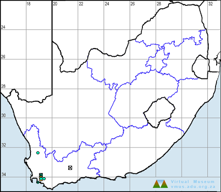
Trithemis annulata is found virtually throughout Africa and also occurs in the Middle East, the Arabian Peninsula, and southern Europe. The Violet Dropwing is widespread in South Africa. It is most common in the north and east, but scattered records exist over most of the country.

Violet Dropwing Trithemis annulata – Female
Linyanti, Botswana
Photo by Ryan Tippett

Below is a map showing the distribution of records for Violet Dropwing in the OdonataMAP database as at February 2020.

Below is a map showing the distribution of records for Violet Dropwing in the OdonataMAP database as of December 2024.

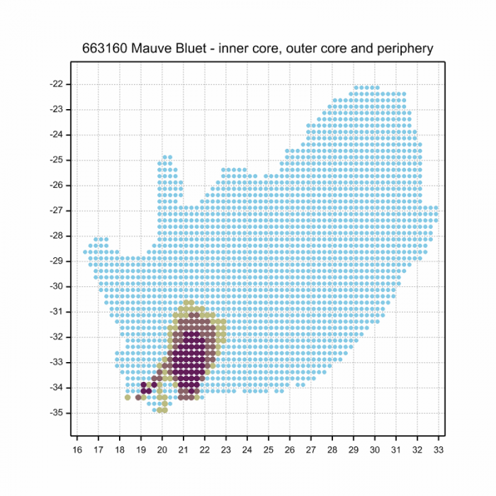
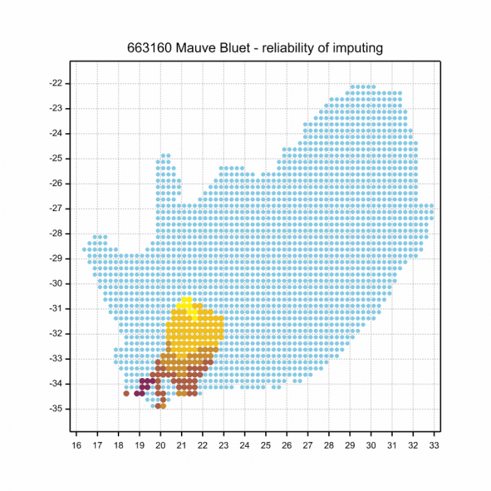
The next map below is an imputed map, produced by an interpolation algorithm, which attempts to generate a full distribution map from the partial information in the map above. This map will be improved by the submission of records to the OdonataMAP section of the Virtual Museum.

Ultimately, we will produce a series of maps for all the odonata species in the region. The current algorithm is a new algorithm. The objective is mainly to produce “smoothed” maps that could go into a field guide for odonata. This basic version of the algorithm (as mapped above) does not make use of “explanatory variables” (e.g. altitude, terrain roughness, presence of freshwater — we will be producing maps that take these variables into account soon). Currently, it only makes use of the OdonataMAP records for the species being mapped, as well as all the other records of all other species. The basic maps are “optimistic” and will generally show ranges to be larger than what they probably are.

These maps use the data in the OdonataMAP section of the Virtual Museum, and also the database assembled by the previous JRS funded project, which was led by Professor Michael Samways and Dr KD Dijkstra.

Violet Dropwing Trithemis annulata – Male
Near Hluhluwe, KwaZulu-Natal
Photo by Ryan Tippett
Further Resources

The use of photographs by Neels Jackson is acknowledged. Other photographs by Ryan Tippett.

Violet Dropwing Trithemis annulata (Palisot de Beauvois, 1807)

Other common names: Purpervalvlerkie (Afrikaans)

Recommended citation format: Loftie-Eaton M; Navarro R; Tippett RM; Underhill L. 2025. Violet Dropwing Trithemis annulata. Biodiversity and Development Institute. Available online at https://thebdi.org/2020/05/07/violet-dropwing-trithemis-annulata/

References: Tarboton, M; Tarboton, W. (2019). A Guide to the Dragonflies & Damselflies of South Africa. Struik Nature.

Samways, MJ. (2008). Dragonflies and Damselflies of South Africa. Pensoft

Samways, MJ. (2016). Manual of Freshwater Assessment for South Africa: Dragonfly Biotic Index. Suricata 2. South African National Biodiversity Institute, Pretoria

Martens, A; Suhling, F. (2007). Dragonflies and Damselflies of Namibia. Gamsberg Macmillan.

Violet Dropwing Trithemis annulata – Male
Orange River, Upington, Northern Cape
Photo by Ryan Tippett

Similar Species

Rock Scarlet (Crocothemis divisa)

Cover photo by Bertie Brink.

Find this species in the FBIS database (Freshwater Biodiversity Information System) here.

Family Libellulidae

Identification

Rock Scarlet Crocothemis divisa – Male
Selous Game Reserve, Tanzania
Photo by Walter Jubber

Small Size

Length up to 39mm; Wingspan attains 68mm.

The Rock Scarlet most resembles the Little Scarlet (Crocothemis sanguinolenta). The Rock Scarlet can be told apart by lacking any amber in the wings, by its very long, red pterostigmas and by the plain brownish thorax with a red wash on top. The habitat choice of Crocothemis divisa is also diagnostic.

Click here for more details on identification.

Habitat

The Rock Scarlet inhabits rocky pools and streams in dry woodlands. The streams it frequents are typically flanked by large rock outcroppings.

Behaviour

The Rock Scarlet usually perches on the top and sides of rocks and boulders. It is generally alert and difficult to approach closely.

In South Africa, the Rock Scarlet has been recorded from September to June.

Status and Distribution

The Rock Scarlet is rare and erratic in South Africa. It is listed as of Least Concern in the IUCN Red List of Threatened Species. Most of the localities where the Rock Scarlet has been recorded in South Africa are in protected areas.

Distribution

The Rock Scarlet is widespread through much of tropical Sub-Saharan Africa and it also occurs in Madagascar.

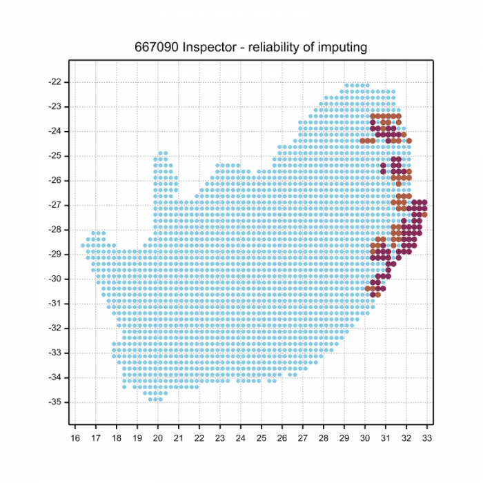
In South Africa, the Rock Scarlet is only known from a handful of sites on the Waterberg plateau in Limpopo and along the Blyde River on the boundary region between Mpumalanga and Limpopo. Recently the Rock Scarlet was also found to occur in the Northern Cape near the southern edge of the Kalahari (see the 2nd distribution map below).

Below is a map showing the distribution of records for Rock Scarlet in the OdonataMAP database as at February 2020.

Below is a map showing the distribution of records for Rock Scarlet in the OdonataMAP database as of December 2024.

The next map below is an imputed map, produced by an interpolation algorithm, which attempts to generate a full distribution map from the partial information in the map above. This map will be improved by the submission of records to the OdonataMAP section of the Virtual Museum.

Ultimately, we will produce a series of maps for all the odonata species in the region. The current algorithm is a new algorithm. The objective is mainly to produce “smoothed” maps that could go into a field guide for odonata. This basic version of the algorithm (as mapped above) does not make use of “explanatory variables” (e.g. altitude, terrain roughness, presence of freshwater — we will be producing maps that take these variables into account soon). Currently, it only makes use of the OdonataMAP records for the species being mapped, as well as all the other records of all other species. The basic maps are “optimistic” and will generally show ranges to be larger than what they probably are.

These maps use the data in the OdonataMAP section of the Virtual Museum, and also the database assembled by the previous JRS funded project, which was led by Professor Michael Samways and Dr KD Dijkstra.

Further Resources

The use of photographs by Bertie Brink and Walter Jubber is acknowledged.

Rock Scarlet Crocothemis divisa Baumann, 1898

Other common names: Divisa Scarlet (Alt. English);  Rotsblosie (Afrikaans)

Recommended citation format: Loftie-Eaton M; Navarro R; Tippett RM; Underhill L. 2025. Rock Scarlet Crocothemis divisa. Biodiversity and Development Institute. Available online at https://thebdi.org/2020/05/05/rock-scarlet-crocothemis-divisa/
References: Tarboton, M; Tarboton, W. (2019). A Guide to the Dragonflies & Damselflies of South Africa. Struik Nature.

Samways, MJ. (2008). Dragonflies and Damselflies of South Africa. Pensoft

Samways, MJ. (2016). Manual of Freshwater Assessment for South Africa: Dragonfly Biotic Index.Suricata 2. South African National Biodiversity Institute, Pretoria

Martens, A; Suhling, F. (2007). Dragonflies and Damselflies of Namibia. Gamsberg Macmillan.

Similar Species