

Cover photo by Andries de Vries.
Find this species in the FBIS database (Freshwater Biodiversity Information System) here.
Family Libellulidae
Identification

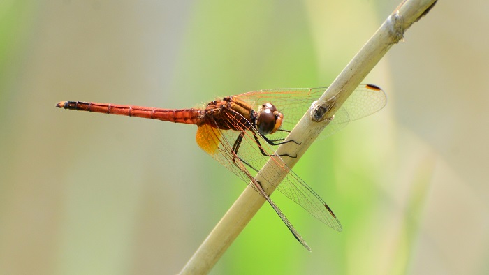
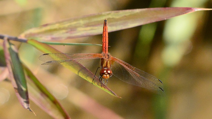
Mkuze River, KwaZulu-Natal
Photo by Ryan Tippett
Small size
Length up to 37mm; Wingspan attains 62mm.
Male Russet Dropwings resemble the Red-veined Dropwing (Trithemis arteriosa), but are orange-red in general colour and have brownish-red eyes. The two species also differ in the black patterning on the abdomen.
Males may also be mistaken for the Elegant Dropwing (Trithemis werneri). Both are an overall orange colour but the Elegant Dropwing has more extensive black markings on the abdomen and thorax.
Females can be easily confused with those of several other Trithemis species. Trithemis pluvialis females can be identified by the large amber patches in the hindwings and the diagnostic black patterning on the abdomen.
Click here for more details on identification.
Habitat
The Russet Dropwing is a species of well-vegetated, flowing rivers and streams, often in rugged, hilly environments. Trithemis pluvialis prefers wooded habitats over most of its range. In the Western Cape, it also inhabits rivers in fynbos.

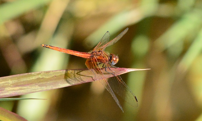
Photo by Rowan Poortier
Behaviour
The Russet Dropwing often perches conspicuously on overhanging trees. They will also sit on rocks, as well as emergent or bankside reeds, grass, and sedges. The Russet Dropwing is most often found singly.
Mkuze River, KwaZulu-Natal
Photo by Ryan Tippett
Status and Conservation
In South Africa, the Russet Dropwing is scarce and localised with a patchy distribution. It is listed as of Least Concern in the IUCN Red List of Threatened Species. Trithemis pluvialis occurs mostly at undisturbed sites.
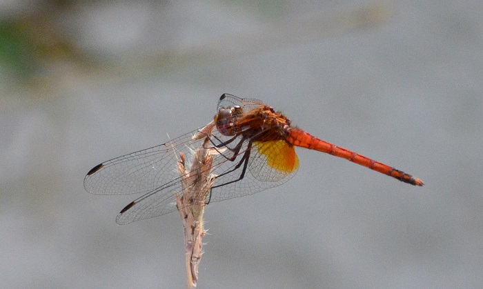
Mkuze River, KwaZulu-Natal
Photo by Ryan Tippett
Distribution
The Russet Dropwing occurs across southern, central, and East Africa. It ranges from Kenya and Uganda in the north across to Zambia and central Angola, and down to South Africa.
In South Africa Trithemis pluvialis is found in two disjunct populations. It occurs in north-eastern Limpopo, Gauteng, Mpumalanga, and KwaZulu-Natal. It is also present in the Western Cape and adjoining parts of the Eastern Cape. This population is apparently isolated from the populations further to the north.
Below is a map showing the distribution of records for Russet Dropwing in the OdonataMAP database as at February 2020.

Below is a map showing the distribution of records for Russet Dropwing in the OdonataMAP database as of December 2024.
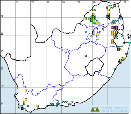
The next map below is an imputed map, produced by an interpolation algorithm, which attempts to generate a full distribution map from the partial information in the map above. This map will be improved by the submission of records to the OdonataMAP section of the Virtual Museum.


Ultimately, we will produce a series of maps for all the odonata species in the region. The current algorithm is a new algorithm. The objective is mainly to produce “smoothed” maps that could go into a field guide for odonata. This basic version of the algorithm (as mapped above) does not make use of “explanatory variables” (e.g. altitude, terrain roughness, presence of freshwater — we will be producing maps that take these variables into account soon). Currently, it only makes use of the OdonataMAP records for the species being mapped, as well as all the other records of all other species. The basic maps are “optimistic” and will generally show ranges to be larger than what they probably are.
These maps use the data in the OdonataMAP section of the Virtual Museum, and also the database assembled by the previous JRS funded project, which was led by Professor Michael Samways and Dr KD Dijkstra.
Mkuze River, KwaZulu-Natal
Photo by Ryan Tippett
Further Resources
The use of photographs by Andries de Vries is acknowledged. Other photographs by Ryan Tippett.
Russet Dropwing Trithemis pluvialis Förster, 1906
Other common names: River Dropwing (Alt. English); Rosbruinvalvlerkie (Afrikaans)
Recommended citation format: Loftie-Eaton M; Navarro R; Tippett RM; Underhill L. 2025. Russet Dropwing Trithemis pluvialis. Biodiversity and Development Institute. Available online at https://thebdi.org/2020/04/29/russet-dropwing-trithemis-pluvialis/
References: Tarboton, M; Tarboton, W. (2019). A Guide to the Dragonflies & Damselflies of South Africa. Struik Nature.
Samways, MJ. (2008). Dragonflies and Damselflies of South Africa. Pensoft
Samways, MJ. (2016). Manual of Freshwater Assessment for South Africa: Dragonfly Biotic Index. Suricata 2. South African National Biodiversity Institute, Pretoria
Martens, A; Suhling, F. (2007). Dragonflies and Damselflies of Namibia. Gamsberg Macmillan.
Mkuze River, KwaZulu-Natal
Photo by Ryan Tippett