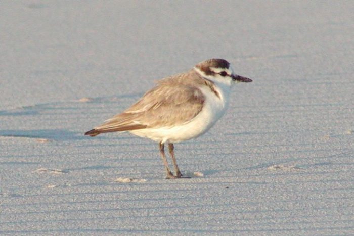
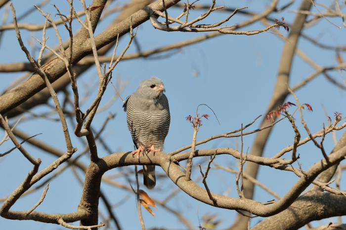
On 14 November 2016 Kyle Walker collected Peregrine pellets in Scarborough, Cape Town, in on-going monitoring of Peregrine nests on the Cape Peninsula. Kyle was surprised to find a bird ring in the pellet. Peregrines prey on birds, especially on doves and pigeons, but finding a ring in a pellet is nevertheless exciting. In this case, the ring (number FH02254) had been placed on the leg of a White-fronted Plover by Penn Lloyd on Noordhoek Beach, some 8km from where the ring was later found. Penn had colour ringed many of these plovers in a short study of impact of beach-goers with dogs on the breeding success of the plovers.
Peregrine with prey
Two new insights arise from Kyle finding the ring in the
pellet. While Peregrines take a wide range of birds, this is the first record
of White-fronted Plover in its diet. Other unusual prey species listed in
Roberts 7 include Cape Cormorant and Little Grebe.
Secondly, this is the White-fronted Plover with the greatest longevity to date, at around 17 years elapsed time between ringing and finding. The predation date is not known, but the Peregrine nest site was previously checked in November 2015. Thus the true elapsed time is anything between 16 years 3 months and 17 years 3 months. The plover was caught as an adult, so the longevity would be a bit more than the elapsed time. The minimum longevity of 16 years for the White-fronted Plover supersedes the previous record of 10 years.
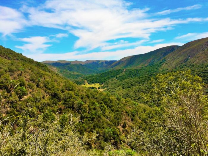
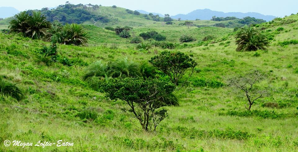
Today our journey continues onward to the KwaZulu-Natal and Eastern Cape midlands. The midlands are mostly undulating, moist grasslands, but there are lovely ‘mist-belt’ forests too. Most of South Africa’s eastern coastal belt is subtropical in climate, but towards the south it becomes cooler and drier.
Around the area of Port Elizabeth, there is a ‘break’ in the moist coastal belt, and drier landscapes appear. In this region a wonderful mix of vegetation types are found – almost everything in South Africa is represented: Karoo-type semi-desert vegetation, grassland, savanna, bushveld, thicket, forests, and even fynbos! The moister vegetation types are found on the slopes of hills and mountains that face the sea, while the drier types are found on the plains or ‘rain shadows’ in the lee of the mountain slopes or steep valleys and gorges.
A typical Albany Thicket landscape – photo credit of SANParks
One of the most fascinating and diverse vegetation types is that of the Albany Thicket. Thickets in the Eastern Cape are comprised of dense impenetrable vegetation dominated by spiny, often succulent trees and shrubs. The ‘canopy’ is low and mostly formed of tough, thorny trees and shrubs, and in the dappled shade one finds a great diversity of other delicate plants. This vegetation type used to be called Valley Bushveld. A fine example of this thicket is the Addo Bush, found in the Addo Elephant National Park.
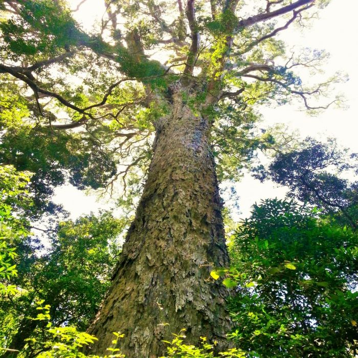
South and west of the Port Elizabeth region, the coastal plain becomes moist again. In the Knysna-Tsitsikamma region, the plain broadens and is covered by an extensive, moist forest. Unlike the subtropical forests to the north and east, this one is considered a Temperate Forest, being quite cool and even on the cold side in winter. Nevertheless, frosts are rare, and plants grow luxuriantly. Some of the largest indigenous trees in South Africa are found in the Knysna Forest, such as the Outeniqua Yellowwood Podocarpus falcatus, which can exceed 30 m in height and spread, with a massively thick trunk.
From the southern to the western Cape, the coastal plain is covered by a unique kind of vegetation – Fynbos (directly translated into English, it means ‘fine bush’). Coastal fynbos is also called ‘renosterveld’ (rhino-field). Named after one of the dominant plant species, the rhinoceros bush Dicerothamnus rhinocerotis, a shrubby member of the daisy family.
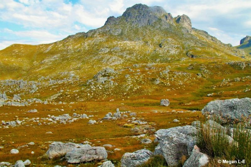
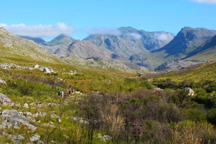
The southern and western Cape also sports an extensive and complicated array of mountain ranges. These are not part of the mountainous ‘rim’ that borders the interior plateau, but are a wealth of separate ranges, most being ‘fold’ mountains, formed by the buckling of the Earth’s crust. These mountain ranges can be very rugged; particularly spectacular examples include the Cederberg, the Little and Great Swartberg, the Hex River Mountains, and the Groot Winterhoek Mountains.
The Cape Fold Mountains host the most diverse vegetation type in South Africa – and one of the most diverse in the world: Mountain Fynbos. This consists mainly of low shrubby plants from the Protea, Erica and Restio family – but there are also vast numbers of other plant species. Up in the mountains, fynbos grows on shallow and rather infertile soil. Plant cover is sparse, making the rocks and geological formations of the mountains easily visible. Fynbos doesn’t support many large mammal species, but a number of small mammals are restricted to fynbos habitat. Insect diversity in this region is fantastic.
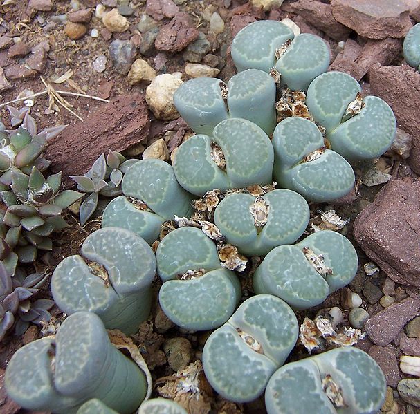
The northern regions of the Cape Fold Mountains are drier than the southern regions, such as the Little Karoo, and the Worcester-Robertson Karoo, which are semi-desert areas. Here the plant growth is low and shrubby, with a wonderful diversity of succulent species. Towards the north and the west, this constitutes the Succulent Karoo, which is the world’s richest succulent region. Interestingly, most of the succulent species found here are very small, the Mesemb family providing the greatest number of species. Particularly charming are the many species that mimic rocks and pebbles, such as Lithops, Conophytum, Argyroderma, Bijlia, Pleiospilos, Lapidaria, Dinteranthus and many more.
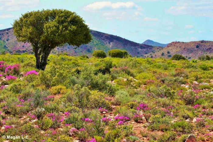
Klein Karoo in full bloom – photo by Megan Loftie-Eaton
In the north and west, the Succulent Karoo reaches the ocean, forming ‘Strandveld’ and to the north, Namaqualand and the Richtersveld. It’s a region of dunes close to the sea and rolling hills, with occasional large, domed inselbergs, further inland. Namaqualand is famous for its display of flowers. This region receives very little rain on average – but it varies. Some years – most years, actually – there’s hardly any rainfall, but every now and then, the rains are abundant. When this happens, the landscape explodes into colour! A great many seeds of annual plants that have been lying dormant in the sand, suddenly germinate and in a very short period of time, grow to adulthood and flower. Bulbs that have been buried deep in the soil, waiting for moisture to penetrate, sprout leaves and flower too. Even small perennial herbs and shrubs, that might have seemed dry and dead, suddenly burst into life. The end result being that for a few weeks, the entire desert becomes covered in a carpet of white, yellow, orange, red and purple flowers. People flock to Namaqualand to admire this wonder of nature.
In the northernmost reaches the Namaqualand merges into the Richtersveld, one of the driest and most barren desert regions of South Africa. This is where the Orange River meets the sea. In its lower reaches the Orange River carves its course through a mountainous landscape, which in our border country of Namibia includes the spectacular Fish River Canyon (the Fish River being a tributary of the Orange), and in South Africa, the Augrabies Falls, a voluminous and powerful waterfall, where the entire Orange River is constrained to rush through a fairly narrow, rocky gorge.
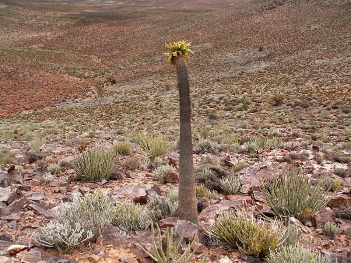
The Richtersveld, though extremely dry and barren, hosts one of the richest succulent floras in the world. Here, unlike in the Succulent Karoo, large and strange-looking succulents are found, like the Giant Quiver Tree Aloe pillansii, and the Halfmens or Elephant-trunk Pachypodium namaquanum. Together with the flora, this region also has spectacular rock formations, forming landscapes that might as well belong to a different planet. A surprising number of mammals, birds, reptiles and even amphibians have successfully adapted to this forbidding desert region.
Pachypodium namaquanum – photo by Winfried Bruenken
And that brings us to the end of our journey! This was just a small glimpse into the natural landscapes of South Africa. We live in beautiful country, there is so much to explore….so what are you waiting for? 🙂 And if you missed it, here is part one and two.
How did you become a citizen scientist? What was the catalyst that got you going?
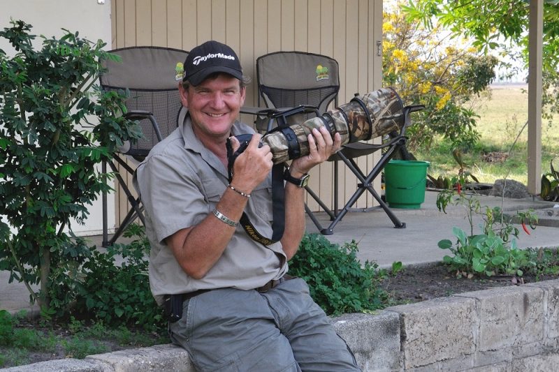
Having spent my early years growing up on a farm in Zimbabwe, then spending many years as a geologist in the field in South Africa and Zambia, and having the privilege of being able to spend time outdoors with a camera during my later years I developed a real interest in the fauna and flora around me. Sometimes I feel maybe too late as there were many opportunities missed to collect even more photographic records during my working career and travels!
I started taking photos of almost anything and everything, particularly wildlife and birds and this has rolled over to moths and butterflies, so I had collected many photos with no real agenda other than, “nice to have”. I did try and send a few photos for inclusion in calendars and publications, but realised soon enough from the feedback that perhaps I should just do it for fun. My wonderful wife, Caddy shares our common interest in birding and the great outdoors, making our exploration trips very special. So when the opportunity came to share our photos and records on the various Facebook groups and the Virtual Museum, the platform was set and the catalyst ignited to share our passion with others “out there” that appreciate nature as well.
To be honest I don’t remember how I heard about the Virtual Museum, but being able to upload photos in order to help research and to show the diversity and range of various species; in particular where we live in Ndola, Zambia has added a special meaning to getting out and about. There is a sense of excitement and satisfaction when a new bird species, moth or butterfly is found and photographed. It is great when our records are identified by the panel of experts and then to see that certain records have never been recorded in Zambia, or can be added to our list of birds at home or “Life list”, is rewarding!
What does the term “citizen scientist” mean to you?
As a member of the general public with access to the outdoors, and the willingness to share information, photographs and other resources with professional scientists in their respective fields of study has been amazing. To know that we are able to assist with data gathering for scientific research makes me proud to be called a “Citizen Scientist”.
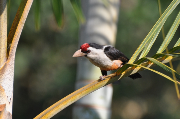
Lybius minor — Black-backed Barbet — One of Chris’ many awesome BirdPix records
What are you still hoping to achieve? This might be in terms of species, coverage, targets …
Right now, the goal is to continue taking photos of anything and everything and to upload as many of these new and historical photographic records into the various Virtual Museum projects. And with the hope that in time the unknown specimens can be identified too and that the records can be used in future research projects to update species distribution maps.
What resources have been the most helpful? (And how can they be made better?)
From my short time as a Citizen Scientist, the people behind the scenes that take time to identify and interpret the uploaded records have been the most helpful to me as an amateur photographer and novice conservationist, perhaps I have interpreted this question incorrectly but they are the unsung heroes of an initiative like this, so my profound thanks to everyone involved, keep up the good work.
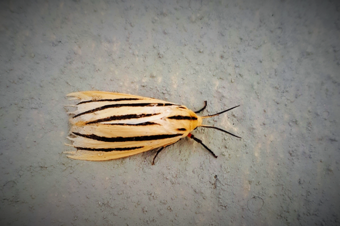
Coenina poecilaria — Wisp Wing — LepiMAPed by Chris in Ndola, Zambia
How do you react to the statement that “Being a citizen scientist is good for my health, both physical and mental!”?
Just for the record, thank you for referring to me as a Citizen Scientist, it makes me feel proud to be recognised for my small contribution to a really big and diverse field of research and conservation.
Being able to get out into the bush and doing what we enjoy as husband and wife, sometimes with friends too, is especially invigorating. The clean air and being able to walk around and to put the stresses of work aside for just a few hours is very important, to feel challenged to get a clear photo or to make sure the GPS position is recorded correctly and captured in the Virtual Museum or BirdLasser App is really enjoyable. We love that citizen science challenges us both physically and mentally.
Kaupifalco monogrammicus — Lizard Buzzard or Akkedisvalk — BirdPix record by Chris
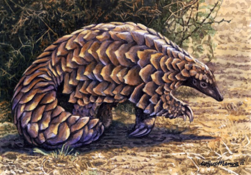
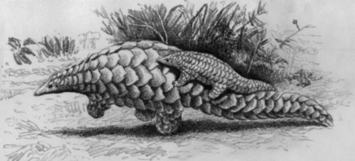
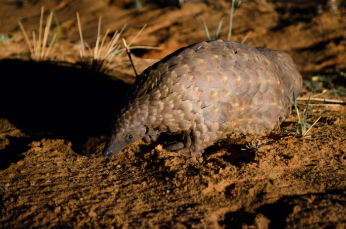
Many of you might be aware that pangolins are, at present, the most illegally-trafficked mammals in the world, mainly because of the illusory medicinal value of their scales. But rather than talk about the plight of these precious creatures I want to share some of my pangolin drawings and fascinating pangolin facts with you, to show you how unique, wonderful and worth-fighting-for pangolins are.
Today, there are eight species of pangolin: four occur in Asia, in the genus Manis; four in Africa, the two small tree pangolins in the genus Phataginus, and the two larger ground pangolins in the genus Smutsia. These species range in size from 30 to 100 cm in length. My illustrations in this blog are all of the African Ground Pangolin, Smutsia temminckii, the only species to occur in South Africa.
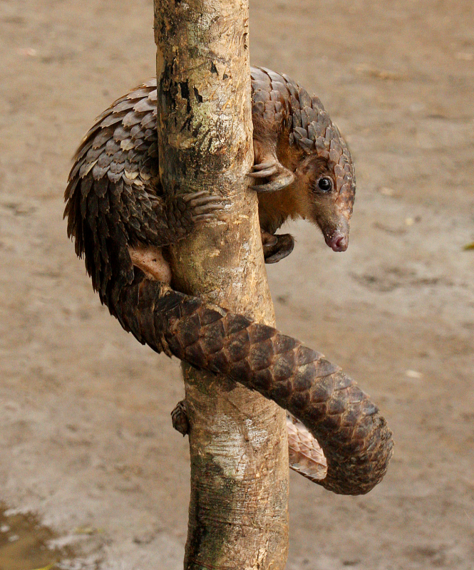
Phataginus tricuspis — White-bellied Pangolin — MammalMAPped by Bart Wursten in Democratic Republic of Congo
Pangolins are instantly recognizable by their scaly skin. They have large, protective keratin (the same substance as in human fingernails) scales covering their bodies; they are the only known mammals with this feature. You could, in effect, think of a pangolin as having fingernails growing all over its body! These scales are very hard and tough, and protect pangolins in the wild even against lions and tigers.
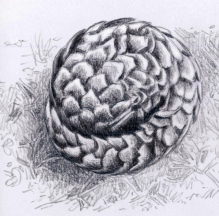
The pangolin’s main defense mechanism is to curl up into a tight ball when threatened. The name pangolin comes from the Malay word pengguling, meaning “one who rolls up”. A mother will enfold her baby into her protective ball of scales as she rolls up. In addition to the hardness of the scales, their sharp edges also offer defense. The scales are sharp, providing extra defense from predators.
Pangolins are insectivores, eating mainly ants and termites, which they find using their keen sense of smell. Their heads have thick, swollen skin around their eye and ear openings, protecting them against bites while they feed. They have incredibly long tongues that are coated in sticky saliva. Pangolins have to generate large quantities of saliva every day, and therefor most species need easy access to water. The African Ground Pangolin is unique in being able to exist in fairly dry regions though; most other species are restricted to moist rain forests. The pangolin’s sticky tongue has an attachment that goes down beyond the throat, all the way back to the rear of the abdominal cavity! It is supported by a prong-like structure that is formed from highly modified cartilaginous ribs, located in the thorax between the sternum and the trachea. Large pangolins can extend their tongues by as much as 40 cm.
Because of their diet of ants and termites, sucked up on their sticky tongues, pangolins don’t need big mouths or strong jaws. Their lower jaw is reduced to slender bone struts and they don’t have any teeth. Instead, they have a gizzard, like those of birds, in which the ingested insects collect. This gizzard has an inner surface covered in keratinous (yes, just like the scales) spines, to grind up the insects, aided by sand and soil that the pangolins ingest along with their prey. Pangolins have very large and tough claws on their forefeet, to rip and tear into ant and termite nests.
Pangolin tails are special. Tree-dwelling pangolins have tails that are prehensile, that is, they are muscular and able to grasp onto things, helping them to climb up and down trees. There is a sensitive, naked, finger-like pad at the tip of their tails. The African long-tailed pangolin has 47 tail vertebrae, more than any other mammal! The larger ground pangolins have blunt, heavy tails; the giant pangolin can defend itself by wielding its tail like a club. The smaller ground pangolin uses its tail as a counterweight while walking. It is unique in that it can walk on its hind legs, tucking its forelegs close to its chest. This manner of walking, with the front of the body balanced by the long tail stretched out to the rear, is likely how the extinct bipedal dinosaurs walked, but today it is only the pangolin that walks like this. Lastly, a mother pangolin often carries her baby clinging to the upper surface of her tail.
So numerous and extreme are the adaptations of pangolins that it has been difficult to work out where to place them taxonomically. In days of yore they were thought to be related to the edentates (Order Edentata), mammals having few or no teeth, including the sloths, armadillos, and New World anteaters. But pangolins are only very distantly related to these species. At present, it seems their closest relatives are the members of the Order Carnivora, which include the cats, dogs, bears, skunks, raccoons, otters, badgers, weasels, mongooses, genets and civets, as well as the marine carnivores, the walruses, sea-lions and seals. Pangolins have a fossil history going back about 50 million years, some beautifully-preserved ancestors are known from sites such as the Messel Pit in Germany. One of these, Eurotamandua, was indeed first thought to be an ancient tamandua (a South American anteater), but is now considered a very old pangolin relative. Pangolin fossils show that in the past they were more widespread, having occurred in Europe and not just in Africa and Asia. Some fossil species were even larger than the present-day giant pangolin.
Ecologically, pangolins are important predators of ants and termites. In the rain forests of Africa and Asia, pangolins are the chief predators of ants and termites, keeping their population numbers in check. This means that pangolins are likely to be ‘keystone species’ in tropical rain forests; without them the ecological integrity of these habitats could be at risk. In the savannas, the ground pangolin plays a similar role, but is aided here by Aardvark Orycteropus afer and Aardwolf Proteles cristata.
Smutsia temminckii — African Ground Pangolin — MammalMAPped by Kyle Finn at Tswalu Kalahari Reserve
A few final fascinating pangolin facts:
They mark their territories with anal secretions and urine, some lifting up one hind leg like a dog would do;
They mate side-to-side, sometimes intertwining their tails;
Some pangolins like to wallow in mud, or even dung;
Some squirt a noxious fluid like that of skunks from their backsides to deter predators or anything that threatens them.
Though mostly silent, pangolins can growl and hiss.
The word needs to get out about pangolins. The living animals are immensely valuable and special creatures. Nobody needs the pangolin’s scales except the pangolin, let’s protect them and keep it that way!
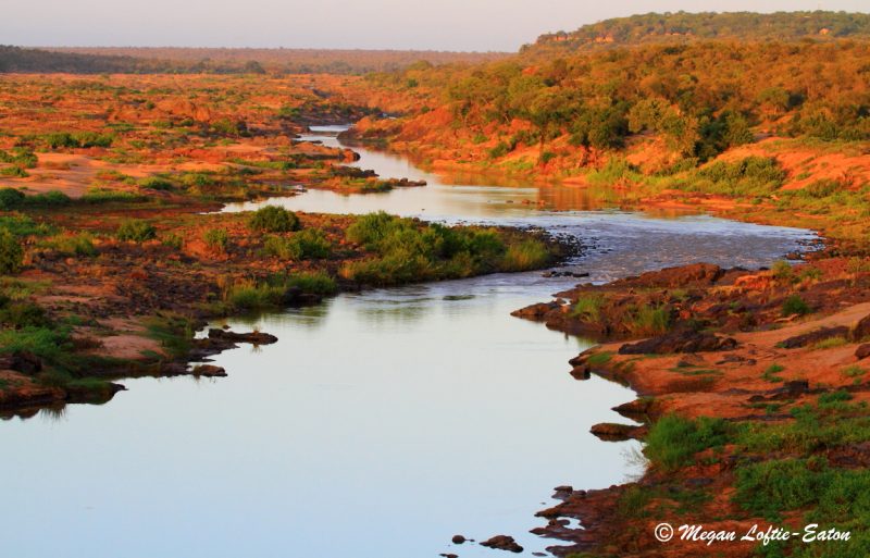
Last week we took a look at the wonderful landscapes of the central plateau of South Africa. From the vast open plains of the central Karoo to the rolling red dunes of the Kalahari. Today we continue our journey through the lowlands that surround the central plateau. Let’s start in the north. The Limpopo River forms the northern border of South Africa, it has carved out a low-lying valley that forms an arc around the northern central plateau. The climate of the northern Limpopo valley is extremely dry and hot. This is where the huge Baobabs Adansonia digitata are found! Towards the east, the Limpopo descends into a vast lowland region, most of which is in the neighbouring country of Mozambique.
The eastern lowlands of South Africa are known as the Lowveld. The Lowveld is mostly savanna, with good grazing, and larger trees, such as Mopane Colophospermum mopane, Marula Sclerocarya birrea, and Leadwood Combretum imberbe. The climate of this region is characterized by mild winters from May to September and hot summers from November to March. Precipitation mostly occurs in the summer months in the form of high-energy thunderstorms.
A green Lowveld scene – Manyeleti Game Reserve
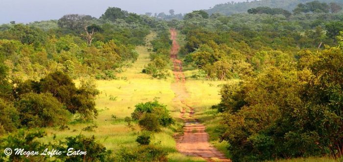
The Lowveld is the only part of South Africa where most of the large mammals still remain. The Kruger National Park, a jewel in the national heritage crown of South Africa, encompasses much of the eastern Lowveld. There are many other smaller national, municipal and private game reserves in the region too.
Between the Lowveld, Highveld and Bushveld, there is a rim of mountains forming a barrier. These include the northern Drakensberg mountain range; the Wolkberg range; and the Soutpansberg range. This rim of mountains blocks moisture-bearing rains towards the west and north, forming a ‘rain shadow’. By contrast, the eastern and southern slopes receive a lot of rainfall. In these moist regions forests are found – these form only a tiny proportion of South Africa’s surface area, but are lovely and magical. Some of the best forest habitats are in Magoebaskloof, only a short drive from Polokwane. On average, Magoebaskloof receives 2,500 mm of rainfall per year, providing for the luxuriant growth of trees, ferns, shrubs, mosses, lichens and other amazing plants. From above, the forest canopy looks soft and billowing, with various different greens and leafy textures; underneath the canopy, the forests are shady, the crooked trunks and branches clothed in soft mosses and lichens and the forest floor covered in ferns. Frequent mists turn the forests into a magical and mysterious place. These forests do not have many large mammals, but there are some, such as Bushpigs Potamochoerus larvatus, Red Duikers Cephalophus natalensis and Samango Monkeys Cercopithecus albogularis. Birds are abundant and diverse, as are the insects.
The beautiful forests of Magoebaskloof – photos by Megan Loftie-Eaton
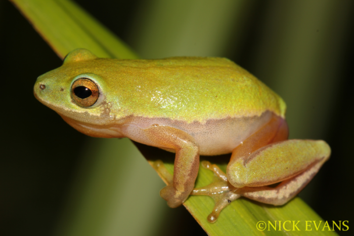
South of the Lowveld lies the coastal plains of Kwazulu-Natal. Moisture from the Indian Ocean sustains a dense coastal forest. On the more exposed dunes, the forests are replaced by rolling grasslands. Unfortunately, in many places these forests have been converted to sugarcane plantations, but there are some areas under conservation too. The coastal forest is characterized by low-growing trees and shrubs with dense crowns. Some of the interesting plants of note include the Wild Date Phoenix reclinata and Lala Palm Hyphaene coriacea trees, Strelitzias Strelitzia nicolai, and coastal Aloes. Dune forests also have high insect, reptile and amphibian diversity, like the Endangered Pickersgill’s Reed FrogHyperolius pickersgilli.
Pickersgill’s Reed Frog Hyperolius pickersgilli – FrogMAPped by Nick Evans
Trumpeter Hornbill Bycanistes bucinator – iSimangaliso Wetland Park
In and around the coastal estuaries, a special kind of forest called Mangrove Forest is found. This consists of salt-resistant trees that are adapted to root in the soft mud and sand of the tidal flats. Some of these trees have stilt-roots, others have ‘upside down’ roots (pencil-like ‘fingers’ that poke out from the mud and allows the tree to ‘breathe’) or knee-roots. Mangrove trees include members of the genera Bruguiera and Avicennia, and the lovely Powder-Puff Tree Barringtonia racemosa. Mangroves are very important for protecting the coastline from erosion and ocean surges, they also help to “trap” soil that would otherwise wash out to sea. Unfortunately, lots of mangroves have been destroyed to make way for harbours and coastal cities.
Powder-puff Tree — Poeierkwasboom — TreeMAPped by Pieter Cronje
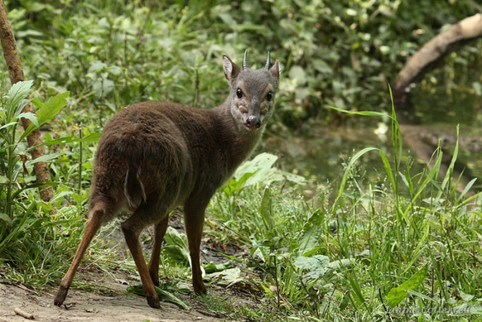
In a few places along the coast, the forest becomes taller and includes some large forest trees such as the Water BerrySyzygium cordatum and the Red Milkwood Mimusops caffra. Coastal forests have a somewhat greater diversity of mammals and birds than the forests further inland, including interesting species like the Tree Dassie Dendrohyrax arboreus (yes, an arboreal hoofed mammal!) and the tiny Blue Duiker Philantomba monticola.
Blue Duiker Philantomba monticola — MammalMAPped by Janine Cotterrell
The northern parts of the coastal plain broaden into a region called Maputaland. Maputaland is bordered by the Ubombo Mountains in the west and the Indian Ocean in the east. It covers an area of about 10,000 square kilometers, stretching approximately from the town of Hluhluwe and the northern section of Lake St. Lucia (actually a huge estuary) to the southern border of Mozambique with South Africa. This region is almost tropical in climate and is home to plant species that aren’t found anywhere else in South Africa. Wildlife is also abundant as much of the region is conserved in the iSmangaliso Wetland Park.
The green glades of Cape Vidal – iSimangaliso Wetland Park
In PART THREE of this blog series we keep traveling through the rainbow of landscapes that is South Africa, along the midlands towards the Cape Fold Mountains. Watch this space!
Abubakar Surajo Ringim obtained his MSc in Conservation Biology from the University of Dar es Salaam. He is a keen bird atlaser and BioMAPper and he is actively involved with the Nigerian Bird Atlas Project (NiBAP). We met Abubakar at a bird atlas and Virtual Museum workshop at the A.P. Leventis Ornithological Research Institute (APLORI) in Jos, Nigeria back in November 2017. APLORI is the only field station dedicated to ornithological research and conservation training in West Africa. The Institute contributes directly to knowledge infrastructure, especially in West African countries, while also providing a unique base from which to set up long-term ecological research projects. APLORI is a key partner in the Nigerian Bird Atlas.
Abubakar Surajo Ringim out in the field
How did you become a citizen scientist? What was the catalyst that got you going?
I became a citizen scientist because of my strong passion for biodiversity conservation. The major catalysts that keep me going is the amazing support that I get from APLORI, especially with the Nigeria Bird Atlas Project in order to achieve bird conservation in Nigeria.
What has been the highlight for you?
Every part of citizen science is cool and amazing for me, but birds and butterflies are definitely my favourite.
How has being a citizen scientist changed your view of the world?
Before starting my citizen science journey, I was engaged locally in collecting data on biodiversity for my own research. But ever since getting involved in citizen science projects my enthusiasm for biodiversity conservation has sky rocketed, mainly because of the Virtual Museum. The Virtual Museum has really opened my eyes to the power of citizen science in mapping the distribution of species for conservation.
The beautiful granite hills that surround APLORI
What does the term “citizen scientist” mean to you?
It means everything to me. It has helped me so much and it has given me a lot of encouragement, skills, knowledge and respect for the natural world.
What are you still hoping to achieve? This might be in terms of species, coverage, targets …
I hope to cover as many grid cells and record as many species as possible. I also hope to make some amazing discoveries through my observations. My main goal is to map the distributions of butterflies in Nigeria.
Vanessula milca buechneri – Lady’s Maid butterfly – LepiMAPped by Abubakar on the Obudu Cattle Ranch near Cross River National Park, Nigeria
What resources have been the most helpful? (And how can they be made better?)
For me, the Virtual Museum is a fantastic resource! It would be nice if the website could be a bit more user friendly/intuitive. This would certainly help in mapping species distribution, awareness raising and species conservation at local or national levels.
How do you react to the statement that “Being a citizen scientist is good for my health, both physical and mental!”?
I totally agree, it has been proven that time spent in nature, e.g. listening to bird songs and looking at plants helps to improve one’s mental health and reduces stress. Bird atlasing and BioMAPping also helps to keep one physically active as you walk countless steps snapping and mapping birds, butterflies, spiders etc.
What do you see as the role which citizen science plays in biodiversity conservation? What is the link?
It plays an absolutely critical role, because in conservation we often have limited time, funds and expertise to provide data on biodiversity. Citizen science is especially important now as we are losing biodiversity at an alarming rate globally. Citizen scientist play a vital role in providing scientists with data which can be used in environmental policy and decision-making.
Diplacodes luminans Barbet Percher – OdonataMAPped by Abubakar near Bunkure, Nigeria
It has been an exciting few months at the BDI. From our first bird ringing expedition to the birth of PanGoPod Alpha, and everything in between. We are grateful to the awesome citizen scientist community in South Africa, and the rest of Africa, for continuing to be ambassadors for biodiversity.
Upcoming event: Winter Warmer BioMAP Record Refresher July 2019. Oh the weather outside might be frightful, but biomapping makes it all very delightful! Please help us to refresh the records in the Virtual Museum by revisiting your regular stomping grounds or favourite patches and snapping and mapping any and all critters that you might come across. Up to date data and species distribution maps are the key ingredients to successful biodiversity monitoring and conservation!
Bird Ringing Expedition
Fynbos Estate, a very special place, lies tucked away in the Paardeberg. It is just an hour’s drive north of Cape Town and it is a nature lover’s paradise! A tranquil and beautiful spot, it really feels like a home away from home. We are extremely thankful to the team at Fynbos Estate for welcoming us on their farm and for providing us with the first field testing site of PanGoPod Alpha (more on this later).
Earlier this year we had our first bird ringing expedition on the farm. We were five bird ringers on this pioneer expedition. From the perspective of the bird ringer, Fynbos Estate is paradise. There are lots and lots of distinct ringing sites, in a variety of habitats, providing a nice diversity of bird species.
The Fynbos Estate property has two sections. The lower section is agricultural, and they produce fantastic organic wines under the label Dragonridge. The winery is artisanal, and the wines are made using traditional and time-honoured methods. The farm uses no chemicals, which means the birdlife in the area is amazing. The upper section of the property is the Simson-Simons Nature Reserve, and consists of marvellous fynbos on the slopes and summit of the Paardeberg.
We also ringed at some other sites. During the pioneering expedition we teamed up with the ringers of the Tygerberg Ringing Group. On one of these joint events, we ringed at the confluence of the Diep and Mosselbank Rivers, on the farm Goedeontmoeting.
In total, the pioneering expedition processed a total of 375 birds of 27 species at Fynbos Estate itself. 136 birds were ringed at the two satellite ringing sites and we collected lots of valuable data on moult. For more information on how you can join in on one of these awesome bird ringing expeditions see http://thebdi.org/about/african-ringing-expeditions/
Karoo Gariep Nature Reserve
The Karoo Gariep Nature Reserve lies almost exactly halfway between Johannesburg and Cape Town along the N1. New Holme Guest Farm lies in the reserve, 7 km off the N1. This is the perfect spot to break the long journey between the cities. The food is amazing, the biodiversity is awesome and the hospitality of PC Ferreira and his family is world-class.
So we are very excited to welcome PC to the BDI family. PC has a passion for nature conservation and wants to share his love for the Karoo with the world. We have started a project at New Holme to renovate accommodation within the Karoo Gariep Nature Reserve. This is planned to be available for travellers in summer, starting this coming summer (2019), and after that it will be used by BDI researchers through the remainder of the year. Watch BDInsight for exciting unfolding information.
PanGoPod – Just Roll Up
In June this year we celebrated the launch of PanGoPod Alpha, our first eco-friendly, off-grid, mobile home! From its infant stage as a steel structure to a fully-fledged eco-home, the PanGoPod was incubated over a few months at our premises in Unit 4, Gunner’s Park in Epping, Cape Town. Pete Laver and Hendrik Louwrens hand raised PanGoPod Alpha, putting in many long hours, blood, sweat and some tears to produce an absolutely stunning and high-quality eco-home.
The PanGoPod is an attempt to prototype alternative housing that meets people’s basic needs, is healthy to live in, and has a relatively low impact on the environment. We also think that the PanGoPod will help us get researchers into remote locations where biodiversity research is needed.
We are so grateful to a long list of people, without whom this dream project would not have been possible. We would like to give a big thank you to our handful of private investors who have taken a chance on us as we try to blaze a tiny home trail in South Africa. Elbie Pretorius from Alexander Forbes has been instrumental in the initial stages of the process.
We want to thank Mano Caldis from CIA Property Specialists, who persuaded the owners of Gunner’s Park that it was a good idea to rent this space to us – a brand-new non-profit company. Mitchell Walker from Futurecon construction has been incredibly supportive throughout this process, from supplying the PanGoPod’s light steel frame to helping with some of the structural design elements. Mitchell has also gone out of his way to provide advice on almost every aspect of the build.
Robert Burger and Dennis Leeds from InTempo Trailers have gone above and beyond in manufacturing a beast of a trailer for us to transport PanGoPod Alpha. They also helped with additional associated engineering projects. Keith Watkins from Brights Hardware Store has been a massive help in sourcing materials and tools for the build. Keith even delivered items personally when we needed a rush order.
The team from Inov8 have been awesome neighbours at Gunner’s Park, dropping in to check on our progress and provide advice on a regular basis. They also created some super cool BDI and PanGoPod insignias for us (see the photo below). Caroline Wright of Caroline Wright Interiors gave us amazing advice on the interior design of the space. She also made up fabulous cushions for us (Romo and Hertex fabrics) which tie the space together, making it feel like a home.
Diana and Johan from Fynbos Estate have been ever supportive – they have provided a wonderful base for our bird ringing expeditions, and now they are providing a beautiful site for PanGoPod Alpha’s field testing. It has been so great to meet people like them who have a real passion for conserving the environment and promoting biodiversity research.
Lesego Gaotshetse helped paint and spruce up the pod in the lead up to the mini launch. Many people gave invaluable advice along the way, including Seppie Geldenhuys, Andrew and Tania Hood from Crafteeze, Dominic van Schouwen, Peter Rose, Eugene Moll, and Leal Wright. It is the collective effort of all these awesome folks mentioned (and the many who have gone unmentioned) that makes this exciting venture both possible and worthwhile.
Namaqua BioBASH
A group of enthusiastic citizen scientists went on a biomapping adventure to the Namaqualand region in the Northern Cape. On Wednesday, June 12th, a team of six citizen scientists (Jerome Ainsley, Chris Cheetham, Tino Herselman, Salome Willemse, Les Underhill, and Karis Daniel) gathered in Handvol Gruis guesthouse near Calvinia for a 5-day BioBash. The aim of a BioBash is to gather as much biodiversity data as possible for areas that we have no species distribution data.
Gathering biodiversity data in far flung places like this would not be possible without the incredible help from citizen scientists! The dedication and love that goes into BioBASH events like these are awesome to see. Biodiversity conservation relies on the efforts of caring citizens, aka ambassadors for biodiversity, across the country. Every record counts. Thank you!
Biodiversity can be assessed at several levels. We can look at genetic diversity at species level, we can look at the diversity among different species, or we can look at the diversity of natural systems in which different species interact – this is known as ecosystems. We can look at broader groupings of ecosystems, and finally we can look at the biodiversity of the planet as a whole. Someday, we may even be able to look further than that – we may find life on other planets and may one day be able to speak of the living diversity of the milky way as a whole and of other galaxies. But for now, let’s look at diversity on a level we can appreciate at a visual level – that of landscapes. Landscapes are formed through the interaction of living and non-living elements. South Africa is blessed with an incredible diversity of landscapes, all on a relatively small part of the planet.
As a country, South Africa is mostly high and dry! High, in that most of the country consists of a central plateau, with relatively narrow coastal plains surrounding it. Dry, in that more than half of the country gets less than 500 mm (20″) of precipitation per year, on average. Thus, South African landscapes tend to be mountainous, rocky, and rather barren. But there are savannas, grasslands and forest patches as well.
Let’s consider the central plateau first. This vast plateau stretches throughout all of South Africa’s nine provinces. Towards the south and west, it is a semi-desert region known as the Karoo – which in itself consists of several different vegetation zones. The northern and eastern Karoo is grassier, while the southern and western regions are characterized by succulents and shrubby plants. The typical Karoo is a flat, high plain, with widespread flat-topped hills. The hills are remnants of an even higher plateau most of which has eroded away over millions of years. The Karoo is ancient, and has sedimentary rocks dating back to over 300 million years in which fascinating fossils are found of our own ancient ancestors, the so-called ‘mammal-like reptiles’ or proto-mammals. These rocks are remnants of sediments kilometers in depth that were deposited when the Karoo was a vast inland sea! Over time the inland sea dried up as the landscape was uplifted by thousands of meters through the process of plate tectonics.
The amazing Karoo landscape – photo taken by Megan Loftie-Eaton at Garingboom Guest Farm
Though barren looking, the Karoo has extremely interesting wildlife, and a wealth of succulent plant species. In dry years, the rocks and open patches of soil are evident, but a season of good rain transforms the landscape into a lush and green plant paradise. In the past the Karoo abounded with herds of large mammals, like springbok and black wildebeest, but their numbers were decimated through over-hunting by humans. Today the Karoo is known mainly for its big herds of domestic sheep. There is little cultivation in the Karoo as the average rainfall is so low and erratic. Small wild animals still remain, some of them being quite rare and threatened like the riverine rabbit.
Riverine Rabbit Bunolagus monticularis – photographed and submitted to MammalMAP by Trevor and Margaret Hardaker
The northern-central portion of the plateau is lower in elevation, and hotter. This basin extends into Botswana to form the Kalahari Desert. Not a true desert; it is a region of dry and sparse savanna woodland and deep, mostly reddish sandy soils. There are some extensive and occasionally very tall sand dunes in the driest parts of the Kalahari. The Kgalagadi Transfrontier Park, between Botswana and South Africa, comprises an area of over 3,6 million hectares which is one of very few conservation areas of this magnitude left in the world!
A typical Kalahari scene – a herd of springbok grazing in the riverbed
The park is known for its large herds of springbok, gemsbok and blue wildebeest. Rivers, lined with large Camel Thorn trees, only flow in years of exceptional rainfall. But plants like the succulent Tsamma melons, and a variety of tubers growing in the deep sand, store water that can be exploited by animals and humans. The San People, or Bushmen, thrived in this region for thousands of years as hunter-gatherers with a truly minimal impact on the environment, but their traditional way of life is threatened by the advancement of our modern 21st century lifestyles.
The red sand of the Kalahari – photo by Victor Loftie-Eaton
To the north and east, the plateau receives higher rainfall. The central regions, most of which are in the Free State Province, are high, cold grasslands. Much of this is farmland now, but there are still pristine areas. These high grasslands are known as the “highveld”. A typical highveld landscape is vast and flat, with tall grass waving in the wind. Trees are only found on the occasional rocky hills, or along the banks of rivers and streams. Towards the eastern Free State, western KwaZulu-Natal, and the country of Lesotho, the plateau rises up into the highest mountains in southern Africa, the Drakensberg Mountains. The Drakensberg consists of volcanic rocks that poured out of huge cracks in the Earth’s crust about 200 million years ago. The highest peaks exceed 3,000 m (10 000 ft) in height. They are truly spectacular, with sheer, dark grey, basalt cliffs over a kilometer in vertical height in many places. The annual rainfall here is very high, over 1 000 mm/40″ per year. Despite the high rainfall, there are few forests, because of the dry and cold winters and frequent fires. The Drakensberg has some of the prettiest flowers to be found in South Africa, and a host of endemic species.
Monks Cowl, Drakensberg Mountains, KwaZulu-Natal Province – photo by Megan Loftie-Eaton
Grasslands are the most threatened habitats in South Africa and worldwide. Much of South Africa’s grasslands have been lost to agriculture or forestry. This has been very harmful to the ecology and biodiversity in these areas. Grasslands are not just grass! They contain a wealth of other plant species: soft herbs and low shrubs, succulents, orchids and other flowering plant species, some with underground bulbs. Just after the first spring rains, when almost everything bursts into flower, these grasslands are fabulously colourful. They also support large numbers of wildlife, including the big and remarkable giant girdled lizard or sungazer, numerous mammals and a great variety of birds, including some endemic lark species. The marshy grasslands host elusive birds like cranes, flufftails and many others. The draining of wetlands as well as pollution from mining and other human activities have placed a lot of stress on these ecosystems and its wildlife.
North of the Magaliesberg range (Gauteng and North-West Province), and to the west of the northern Drakensberg, the ‘highveld’ gives way to ‘bushveld’, which is a savanna landscape of grass dotted with trees. Most of the trees are thorn trees, such as the flat-crowned Umbrella Thorn, which is typical of much of the savannas of Africa. Other typical bushveld trees include Silver Cluster-leaf, Red Bushwillow, Buffalo Thorn, Karee, and Marula. A particular feature of the bushveld are the many isolated rocky hills. These are often inhabited by rock hyraxes, small rodent-like creatures that are actually relics of a primitive kind of hoofed mammal that was once very diverse in Africa and included species as large as small horses! The rocky hills have unique plant life including many succulents, huge examples of which are the Aloes and Tree Euphorbias.
Tree Euphorbia or Naboom Euphorbia ingens – photographed and submitted to TreeMAP by Christopher Willis
In PART TWO of this blog series we keep traveling through the rainbow of landscapes that is South Africa. Watch this space!
This blog was written by guest blogger by Willem van der Merwe. Willem is a wildlife artist based in Polokwane, South Africa. He says, “my aim is simply to express the beauty and wonder that is in Nature, and to heighten people’s appreciation of plants, animals and the wilderness. I’m fascinated by wild things from all over the world.”
Traditionally, we have used the quarter-degree grid scale to generate distribution maps in biodiversity atlases. In southern Africa, this convention started with the Bird Atlas of Natal, published in 1980, four decades ago. There is no explanation in the book as to why Digby Cyrus and Nigel Robson, the project team and co-authors, chose this grid scale. It was adopted by almost all subsequent biodiversity atlas projects.
The butterfly species which is used to illustrate this blog is the Common Dotted Border Mylothris agathina. The photo shows the “dotted border”. There is a total of 3,290 records of this species in the LepiMAP section of the Virtual Museum. This record was made by citizen scientist Vincent Parker on 27 June 2019, from the Humansdorp district of the Eastern Cape. The record is curated at http://vmus.adu.org.za/?vm=LepiMAP-688850
This blog explores a range of alternative grid scales. But, as distribution maps go, it is a restricted range. These are all simple presence-absence distribution maps for the butterfly species, Common Dotted Border Mylothris agathina, featured above. If this species of butterfly was recorded anywhere within a grid cell, the grid cell is shaded. The species might have been recorded only once, or multiple times; this is not shown in any way. If the species was not recorded, the grid cell is not shaded. These maps do not attempt to show relative abundance. They are analogous to the “on-off” distribution maps in field guides, which are generally reproduced at much the same size as postage stamps.
The blog steadily works its way inwards from two extremes. The first map presented uses a 60 minute grid and the second uses a one minute grid. Then it goes to 30 and three, etc.
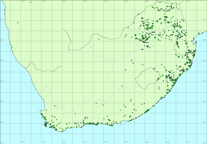
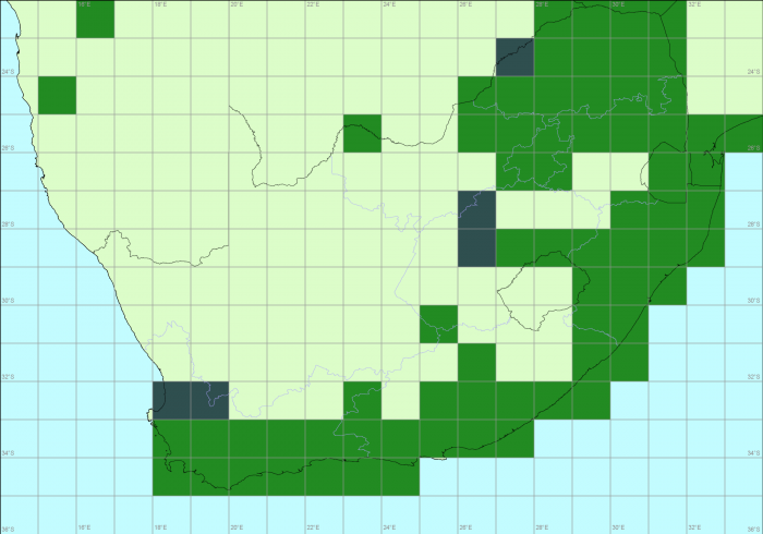
This is the distribution map for the Common Dotted Border, on a one-degree grid scale (or 60 minutes). If the species was recorded at least once, anywhere within the grid cell, it is shaded. (If there is a photographic Virtual Museum record, the grid cell is shaded green; if there are only specimen records, the shading is dark grey.)
At first glance, the next map looks blank. You need to look at it carefully. The distribution of the Common Dotted Border is shown on a one-minute grid:
This map, using the one-minute grid, is essentially marking the exact points at which Common Dotted Borders have been recorded. But the individual dots are so small that, unless there is a cluster of them, they are hard to see. Below is the one-minute grid scale map for just KwaZulu-Natal. With this enlarged map, the individual points are visible.
Do either of these maps give an accurate impression of the “truth”? In this case, the “truth” is the overall set of places where this butterfly occurs. The one-minute grid in KZN represents “truth” in the sense that this species has occurred in every one of these tiny grid cells (assuming of course that they have been accurately documented). But we also know that, if we went and looked for it, we would find this species in many (or even most) of the little gaps between the points where it has been seen and reported. In technical terms, the one-minute map is riddled with false negatives, places where the species does occurs but where it has not (yet) been recorded. So, although the one-minute grid cell map is telling the truth, it is not telling the whole truth! It does not show all the places where the species occurs.
The trick now is to argue that if a species is recorded at a point, it probably also occurs in the “neighbourhood” of that point. But as soon as we start implementing this gimmick, we introduce false positives. These are places where the species does not occur, but where the distribution map shows it as present. On the grid maps we are considering in this blog, “neighbourhood” is defined in a precise way. Every point belongs to a grid cell, and that grid cell is its “neighbourhood”. If we define neighbourhoods in this way, using a one-degree (60-minute) grid, then just a single record within the grid cell results in the entire degree square being shaded. In the KwaZulu-Natal map, there is only one record of Common Dotted Border in degree cell 2730 (which has 27°S and 30°E in its northwest corner). This is the cell that straddles the border between KwaZulu-Natal and Mpumalanga. This record is on the eastern edge of the one-degree cell. On the map above with the one-minute grid, the “neighbourhood” of the point, the one-degree cell 2730, is shaded. This strategy undoubtedly introduces false positives. Defining the “neighbourhood” as a whole degree cell is just too big.
Let us step down to a 30-minute grid (or we could talk about a half-degree grid cell, but grasp that there are four half-degree grid cells in a one-degree grid cell):
The general impression given by this map is of a species with a continuous distribution. Lots and lots of gaps between individual records have been filled in. The species is now characterized by having a distribution through most of the savanna in the north and along the southern coastal areas, continuing northwards along the west coast to about Velddrif and the estuary of the Berg River. There might be lots of false positives, with the “neighbourhood” system pushing the species into areas where it does not occur. At the same time, there are unlikely to be any false negatives! If the distribution of the Common Dotted Border really is continuous, this map might not be far from reality!
The map below is on a three-minute grid. With the map produced at this resolution, the points of occurrence of the Common Dotted Border are now easily visible.
Like the one-minute grid, this map clearly also suffers from false negatives. The true distribution is certainly far more “continuous” than this. It is not clear whether the areas with intriguing patterns of records (such as across Limpopo and Mpumalanga in northern South Africa) are due to “biological factors” or “distribution of citizen scientists”. It is possible to disentangle these factors, and for many serious researchers this map would be fascinating. They would be looking at in conjunction with maps showing relief, vegetation types and human population density.
Next up is the traditional map, made on a fifteen-minute grid, also known as the quarter-degree grid:
Compared with the distribution map on the 30-minute grid, this map is beginning to suggest a somewhat fragmented distribution. Look, for example, at the distribution in the savanna regions of Limpopo and Mpumalanga. The gaps are not random, but seem to occur in patches. By looking at this map, we cannot tell whether these are real, or represent regional variation in observer effort.
Here is the distribution map made with a five-minute grid. This is the grid scale in use by the Second Southern African Bird Atlas Project, where the cells are known as pentads. There are nine pentads in a quarter-degree grid cell.
The pentad scale probably keeps the impact of false positives to a manageable level. But most people would look at this and say: “With a bit of effort, a lot of the little gaps could be covered.” So there are false negatives too. Maybe, this choice of grid represents a balance between the false negatives and the false positives.
The Appendix to this blog presents maps on a few more grid scales.
There are many other strategies for producing maps. But that is a topic for another blog. For example, you could put a circular disc around each point and define “neighbourhood” in this way. Define the distribution as the total area covered by discs. You can then experiment with what happens when you vary the diameter of the disc. There are also families of statistical methods, which use “explanatory variables” such as altitude, rainfall and temperature. These methods try to uncover the ranges of values of these variables at the points where the species occurs, and then extrapolate the distribution to the full set of points with these values for the explanatory variables. The bottom line is that no matter what you do, you end up with false positives and false negatives.
This has been a fascinating blog to produce. We have not done exercises like this before, and I had no idea which grid cell would be the “best” choice. The reality is that it is impossible to choose. To make a choice, we would need to know the true distribution. But that is precisely what we are trying to find!
This exercise has been done on a single species. So this is a sample of size one, an anecdote, and it is dangerous to draw conclusions from an anecdote. We would probably need a sample of at least 20 or 30 carefully chosen species. The species should be chosen by lepidopterists who know the species from fieldwork experience. One of the main criteria would be to select a range of species, from species with distributions known to be near-continuous to those with highly fragmented distributions.
The choice also depends on the application for which you need the distribution maps. Your selection depends on whether you are the author of a field guide (and need a simple map), a biogeographer or macroecologist (and want to look at patterns of distribution on a continental scale), a Red List evaluator (and require an estimate of the area of the range of the species so as to allocate a threat status) or an environmental impact assessor (needing to know whether a species occurs at a particular plot of land earmarked for development). There are many other categories of users who all have specific desires for their distribution maps.
Finally, this exercise has also been a bit unfair to the Virtual Museum data. The data were assembled with mapping at a quarter-degree grid in mind. It is a bit shabby now to plot maps at finer scales, but it is interesting that quarter-degree grid patterns are not in evidence at all.
Perhaps the take-home message for Virtual Museumers is this. Please do not hesitate to submit repeat records for a species in the same quarter-degree grid cell, but try to get them spread over the grid cell.
Appendix
And just for completeness sake, here are maps at a series of intermediate grid scales to those presented above.
10 minute grid:
20 minute grid:
40 minute grid:
And finally, here is the distribution map at the two minute grid:
Overall, in this blog, maps have been presented at these grid scales: 1, 2, 3, 5, 10, 15, 20, 30, 40 and 60 minutes.
The shrikes, bush-shrikes and helmet-shrikes were formerly all classed together in one family, but have been split into separate bird families (shrikes, bush-shrikes) and the helmet-shrikes have been moved into the Vangidae family. After a brief description of each of these groups, the ringing numbers and longevities will be presented.
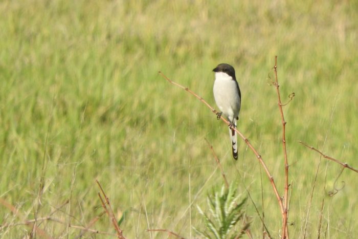
The true shrikes (family Laniidae) are predatory passerines – the family name derives from the Latin word for “butcher”, referring to their feeding habits. Shrikes are known for catching insects and small vertebrates and impaling these on thorns, barbed-wire fences, or other sharp points. This allows them to tear the prey into smaller pieces, and serves as a cache for feeding on later. Most shrike species are found in Eurasia and Africa, although two species occur in North America.
Common Fiscal
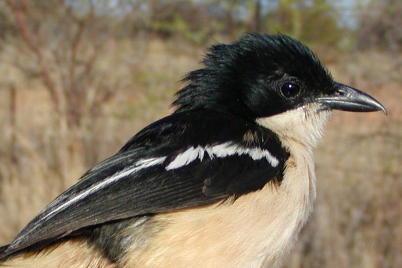
The bush-shrikes (family Malaconotidae) are insectivorous species are found in Africa, in scrub or open woodland. They are similar in habits to shrikes, hunting insects and other small prey from a perch on a bush. The bush-shrikes are either colourful species or largely black; some species are quite secretive. The bush-shrikes include the Brubru, puffbacks, tchagras and boubous.
Southern Boubou, greatest longevity in southern Africa of the “shrike” groups
The helmet-shrikes are now separated from that group into the family Vangidae. These African birds are found in scrub or open woodland. They are similar in feeding habits to shrikes, hunting insects and other small prey from a perch on a bush or tree. They are colourful species with the distinctive crests or other head ornaments, such as wattles, from which they get their name. Helmet-shrikes are noisy and sociable birds, some of which breed in loose colonies.
White Helmet-shrike
Ringing
Relative to commonly ringed birds in southern Africa, few shrikes have been ringed over the last 7 decades. The highest ringing totals are for the widespread Common Fiscal, with over 7000 ringed. This species also has the highest recapture number although the Southern Boubou has a slightly higher recapture rate (12.6%). The Southern Boubou has the highest longevity record in the SAFRING database, at 16 years.
Table – ringing data for shrikes from the SAFRING database, extracted 5/7/2019.


 The PanGoPod is an attempt to prototype alternative housing that meets people’s basic needs, is healthy to live in, and has a relatively low impact on the environment. We also think that the PanGoPod will help us get researchers into remote locations where biodiversity research is needed.


 This is the distribution map for the Common Dotted Border, on a one-degree grid scale (or 60 minutes). If the species was recorded at least once, anywhere within the grid cell, it is shaded. (If there is a photographic Virtual Museum record, the grid cell is shaded green; if there are only specimen records, the shading is dark grey.)