
Cover photo by Gregg Darling.
Find the Silhouette Dropwing in the FBIS database (Freshwater Biodiversity Information System) here.
Family Libellulidae
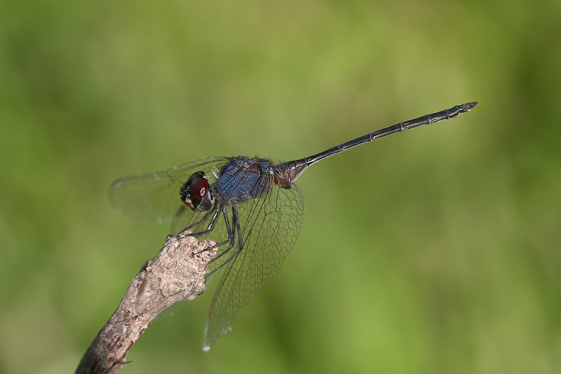
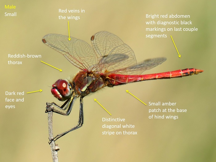
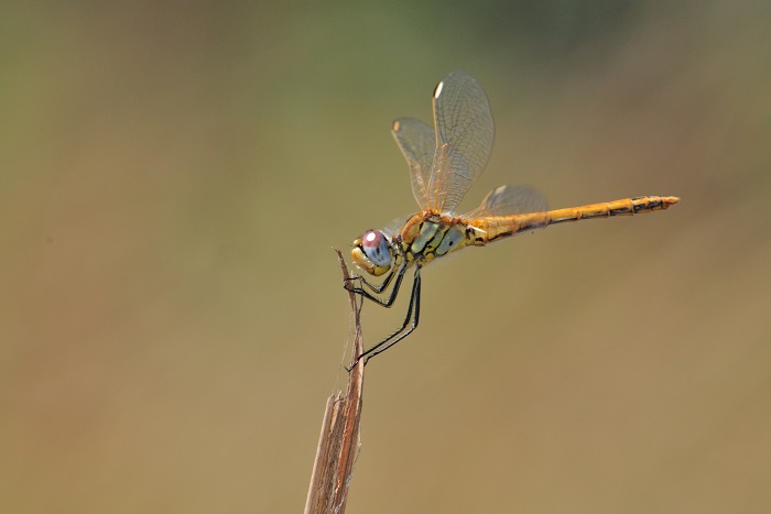
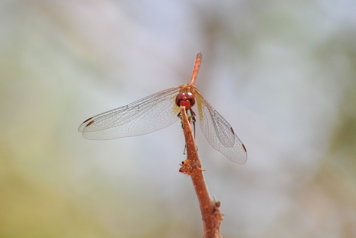
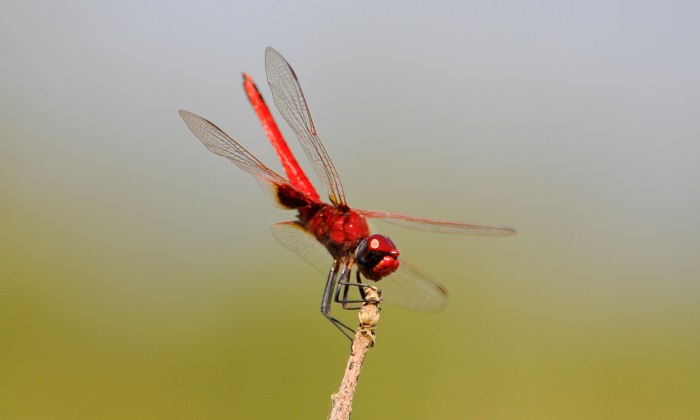
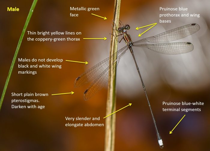
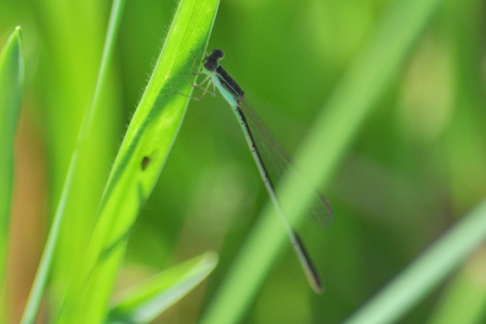
Identification

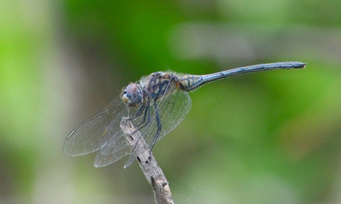
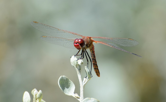
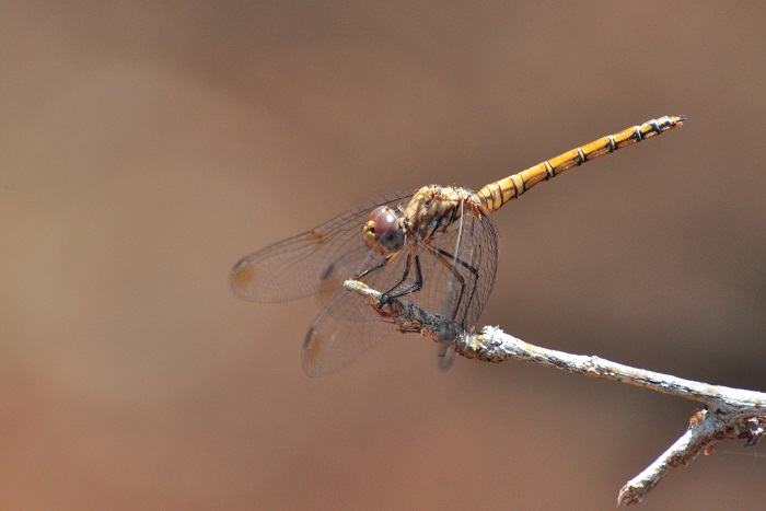
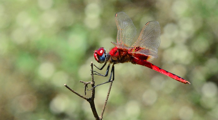
Linyanti, Botswana
Photo by Ryan Tippett
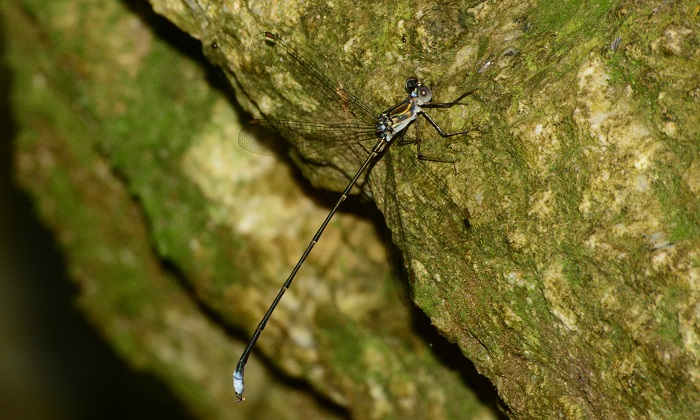
Small size
Length up to 43mm; Wingspan attains 68mm.
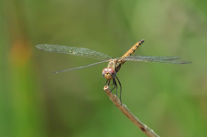
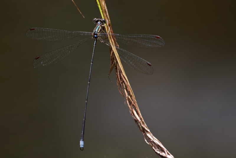
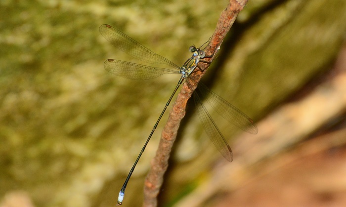
The Silhouette Dropwing is a slender, dark blue species. The thin abdomen easily differentiates it from other dark blue dropwings like Trithemis furva (Navy Dropwing) and Trithemis dorsalis (Highland Dropwing). It is closest to Trithemis aconita (Halfshade Dropwing) in appearance. Both species have slender abdomens but are easily told apart by their very different habitat choices.
Additionally, Trithemis hecate is the only dark blue dropwing in the region with pale pterostigmas.
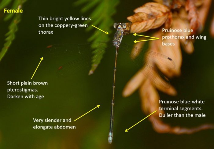
Females are easily confused with other Trithemis species. They are best identified by their association with the males.
Click here for more details on identification of the Silhouette Dropwing.
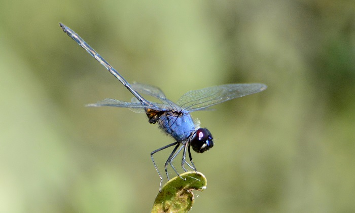
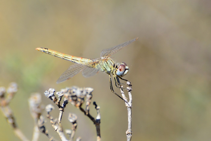
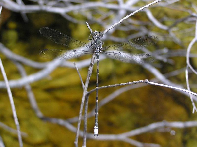
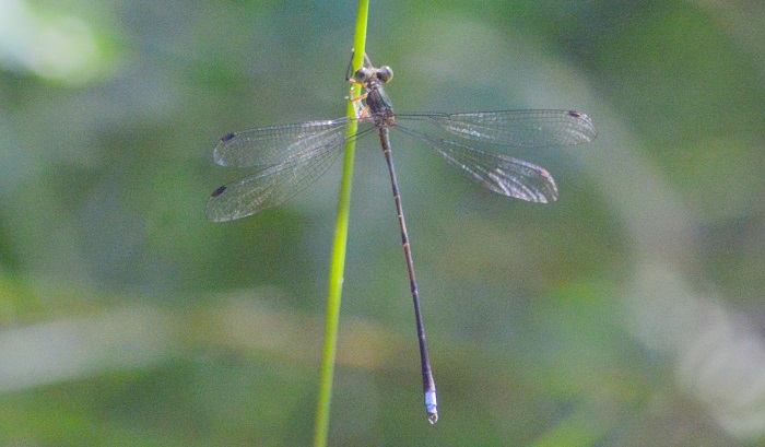
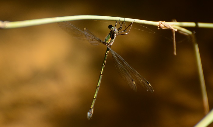
Linyanti, Botswana
Photo by Ryan Tippett
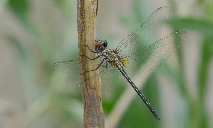
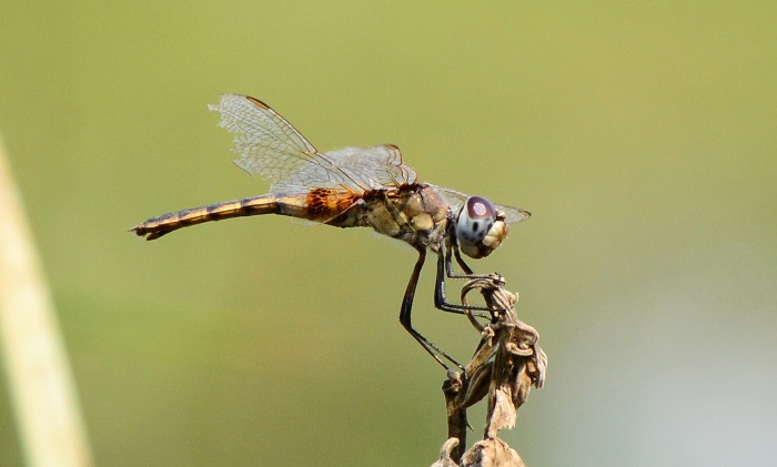
Habitat
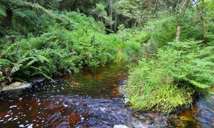
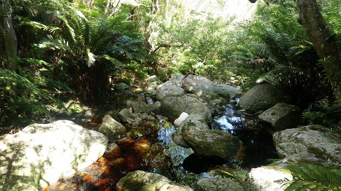
The natural habitats of the Silhouette Dropwing are subtropical and tropical pans, floodplains, and marshes. It prefers standing or still water with emergent plant growth such as reeds, grass, or sedges. The Silhouette Dropwing is frequently found perched on trees and bushes a short distance from the water, especially during the hottest time of the day.
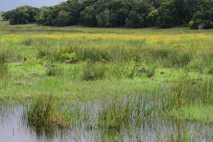
Photo by Ryan Tippett
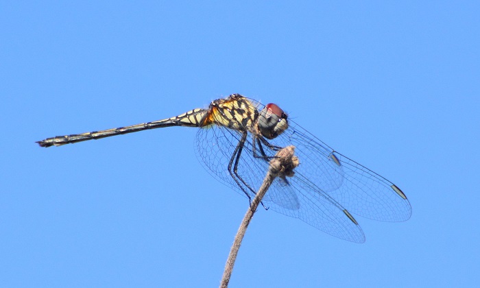
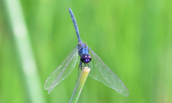
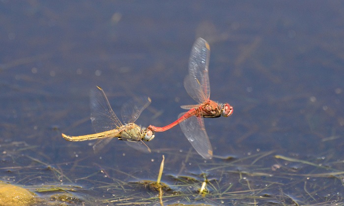
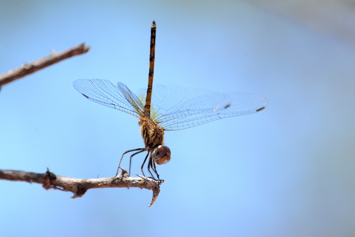
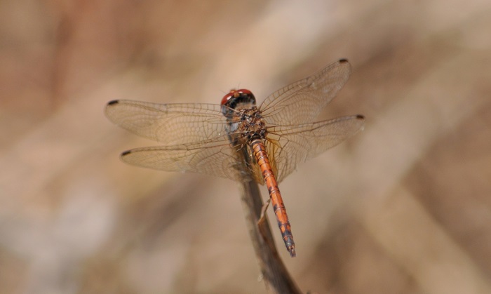
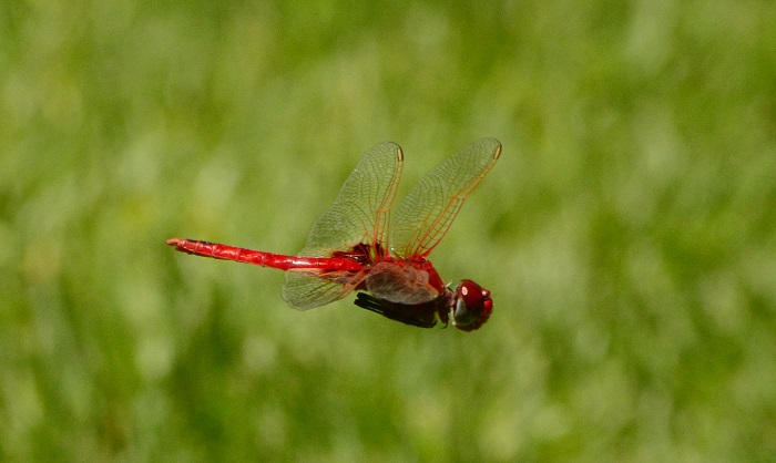
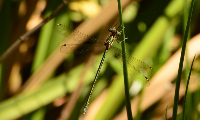
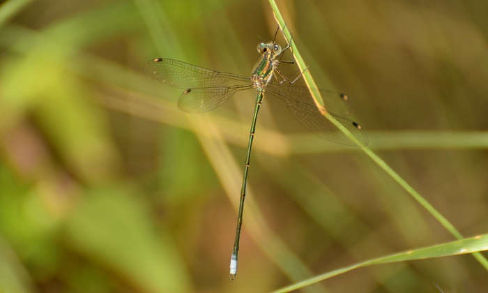
Behaviour
Breeding male Silouette Dropwings typically perch on emergent stems, often far from the shore, on the last reeds before the open water starts. From this position, they appear all dark and silhouetted, hence the common name. Females and non-breeding males are found on trees and bushes surrounding the wetlands, often some distance from the water.
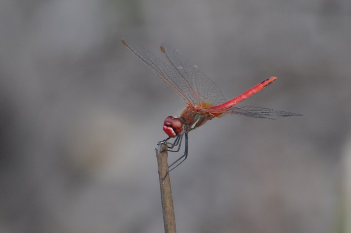
Linyanti, Botswana
Photo by Ryan Tippett
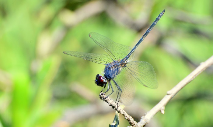
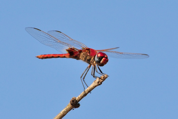
Status and Conservation
In South Africa, the Silhouette Dropwing is scarce and erratic in occurence but can be abundant at sites further north, such as the Okavango Delta in Botswana. It is listed as of Least Concern in the IUCN Red List of Threatened Species. This species is found mostly in pristine habitat and is fairly sensitive to habitat degradation.
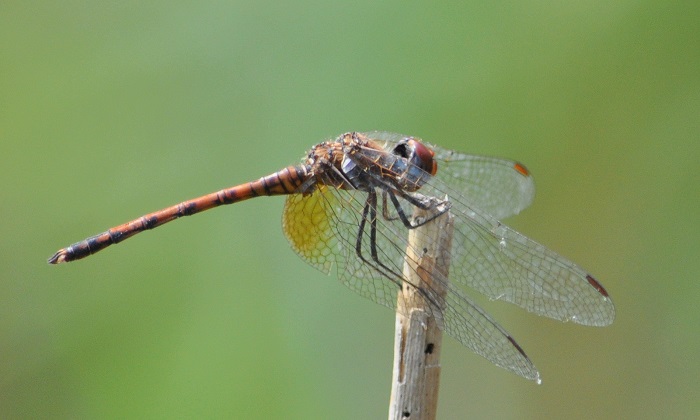
Okavango Delta, Botswana
Photo by Ryan Tippett
Distribution
The Silhouette Dropwing is widespread in tropical and subtropical Africa. It has been recorded in Botswana, Chad, the Democratic Republic of the Congo, Gambia, Guinea, Kenya, Liberia, Malawi, Mozambique, Namibia, Senegal, South Africa, Tanzania, Uganda, Zambia, Zimbabwe, and possibly Burundi. It also occurs on Madagascar. In South Africa, the Silhouette Dropwing is restricted to the warmer regions in the north and east.
Linyanti, Botswana
Photo by Ryan Tippett
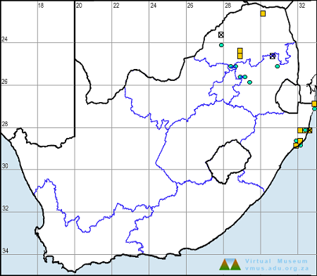
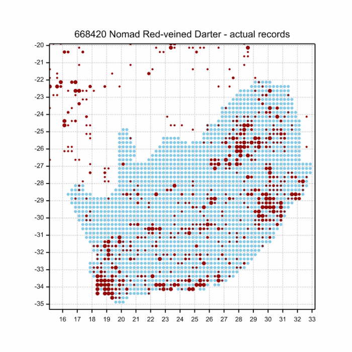
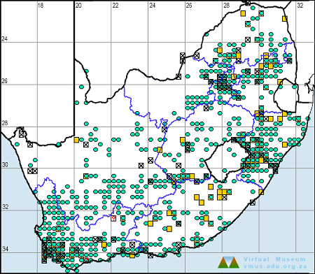
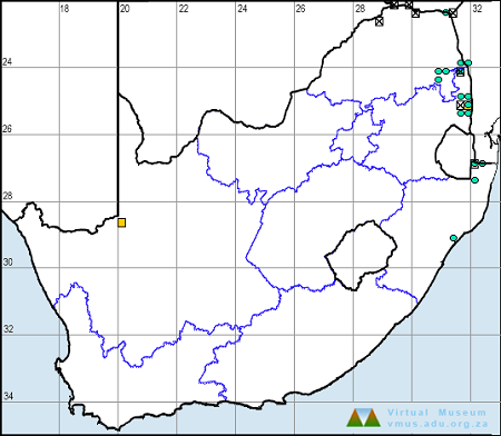
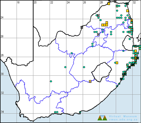
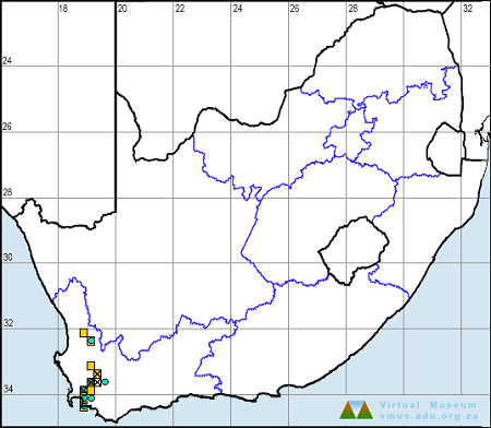
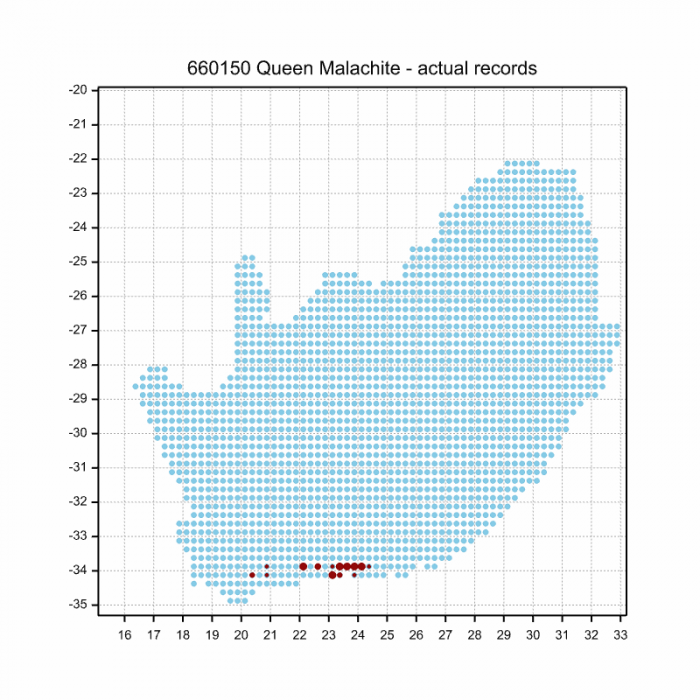
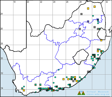
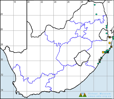
Below is a map showing the distribution of records for Silhouette Dropwing in the OdonataMAP database as at February 2020.

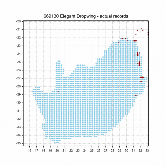
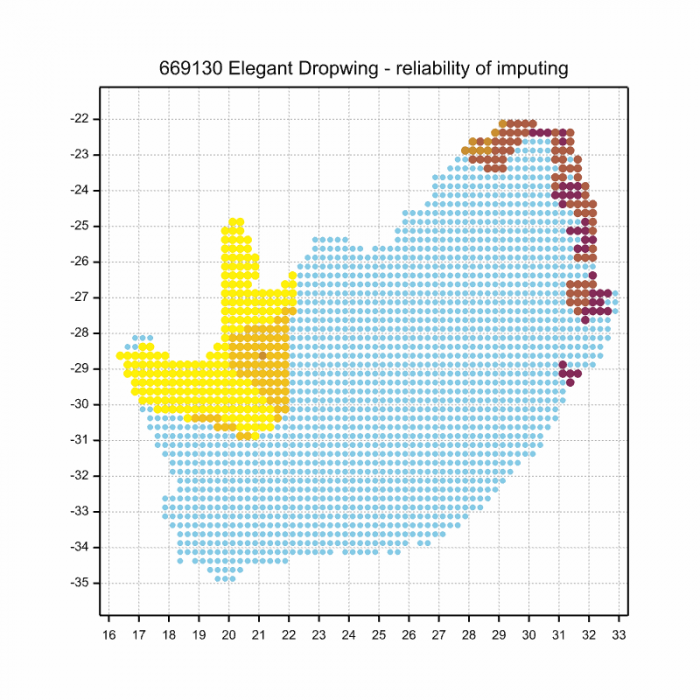
Below is a map showing the distribution of records for Silhouette Dropwing in the OdonataMAP database as of December 2024.
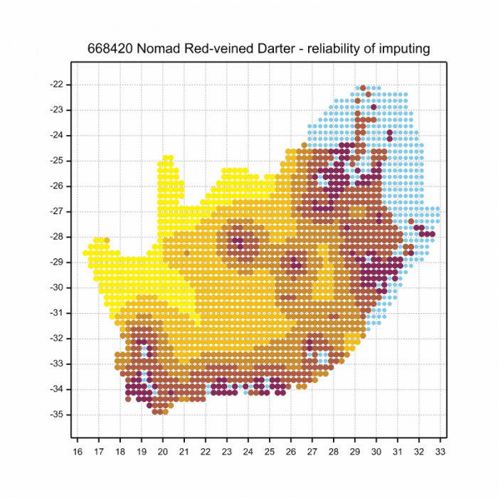
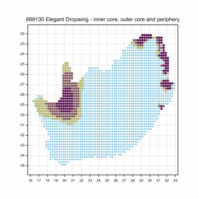
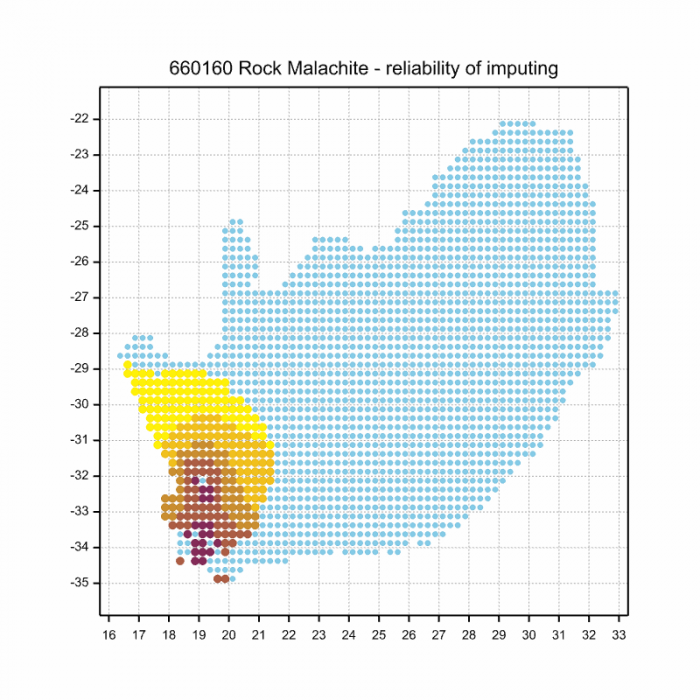
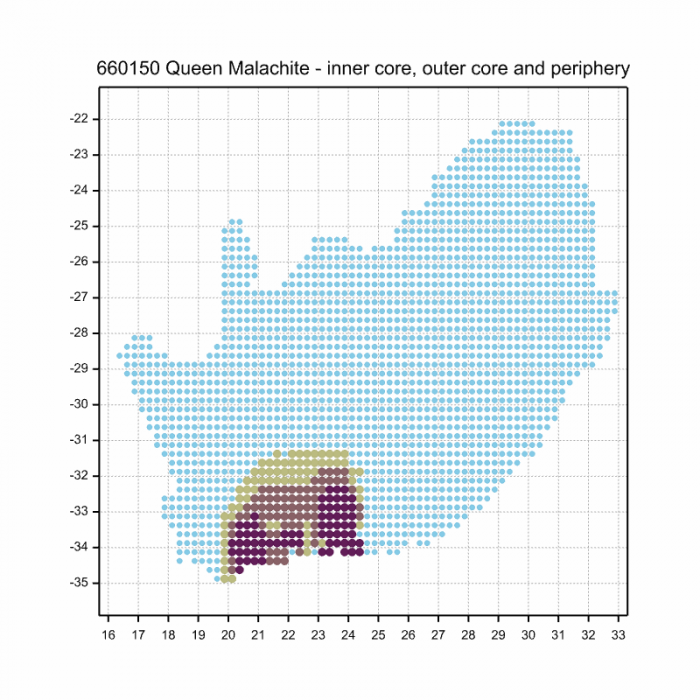
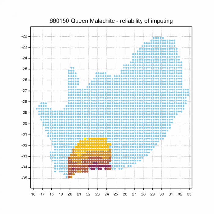
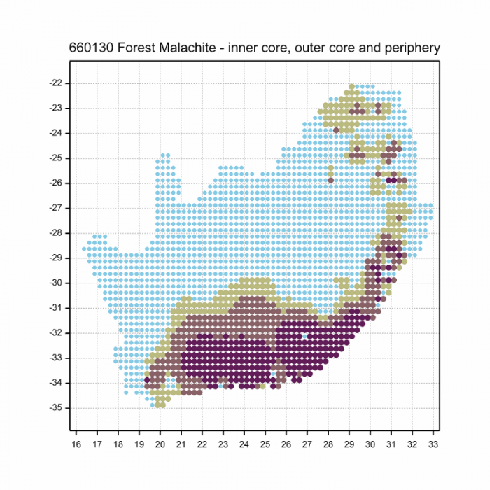
The next map below is an imputed map, produced by an interpolation algorithm, which attempts to generate a full distribution map from the partial information in the map above. This map will be improved by the submission of records to the OdonataMAP section of the Virtual Museum.
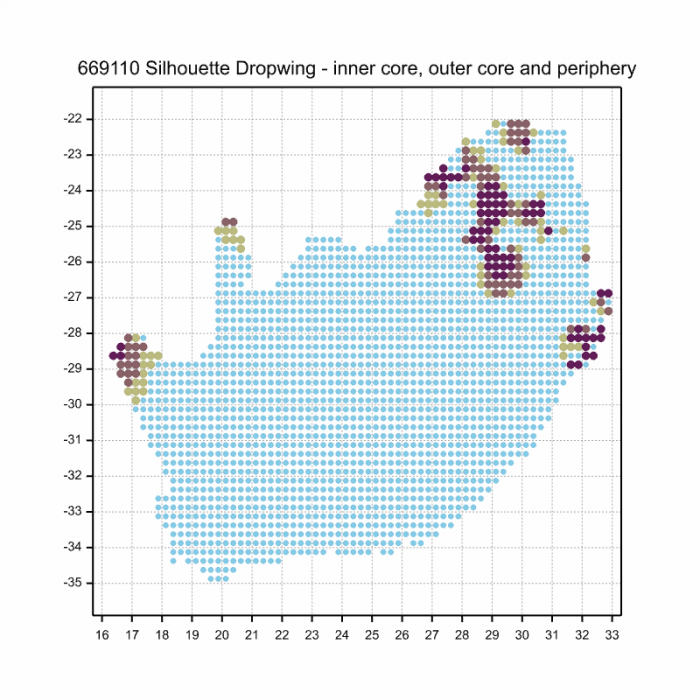
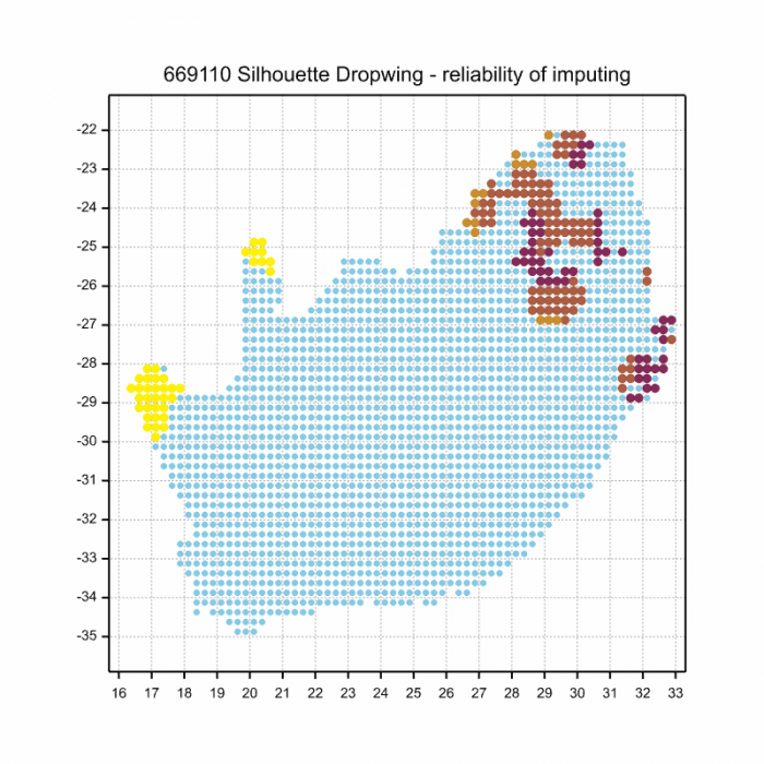
Ultimately, we will produce a series of maps for all the odonata species in the region. The current algorithm is a new algorithm. The objective is mainly to produce “smoothed” maps that could go into a field guide for odonata. This basic version of the algorithm (as mapped above) does not make use of “explanatory variables” (e.g. altitude, terrain roughness, presence of freshwater — we will be producing maps that take these variables into account soon). Currently, it only makes use of the OdonataMAP records for the species being mapped, as well as all the other records of all other species. The basic maps are “optimistic” and will generally show ranges to be larger than what they probably are.
These maps use the data in the OdonataMAP section of the Virtual Museum, and also the database assembled by the previous JRS funded project, which was led by Professor Michael Samways and Dr KD Dijkstra.
Linyanti, Botswana
Photo by Ryan Tippett
Further Resources
The use of photographs by Gregg Darling is acknowledged.
Silhouette Dropwing Trithemis hecate Ris, 1912
Other common names: Hecate Dropwing (Alt. English); Skraalvalvlerkie (Afrikaans).
Recommended citation format: Loftie-Eaton M; Navarro R; Tippett RM; Underhill L. 2025. Silhouette Dropwing Trithemis hecate. Biodiversity and Development Institute. Available online at https://thebdi.org/2020/04/29/silhouette-dropwing-trithemis-hecate/
References: Tarboton, M; Tarboton, W. (2019). A Guide to the Dragonflies & Damselflies of South Africa. Struik Nature.
Samways, MJ. (2008). Dragonflies and Damselflies of South Africa. Pensoft
Samways, MJ. (2016). Manual of Freshwater Assessment for South Africa: Dragonfly Biotic Index. Suricata 2. South African National Biodiversity Institute, Pretoria
Martens, A; Suhling, F. (2007). Dragonflies and Damselflies of Namibia. Gamsberg Macmillan.
Linyanti, Botswana
Photo by Ryan Tippett


