Cover photo by Neels Jackson.
Find the Common Tigertail in the FBIS database (Freshwater Biodiversity Information System) here.
Family Gomphidae
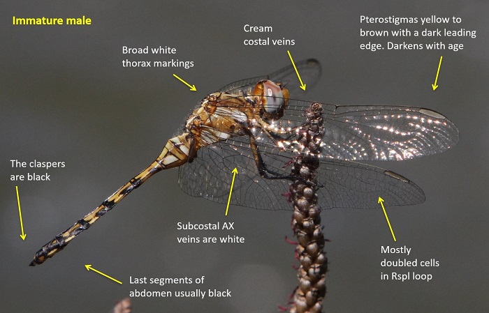
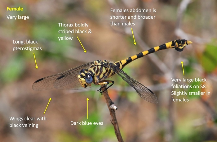
Identification

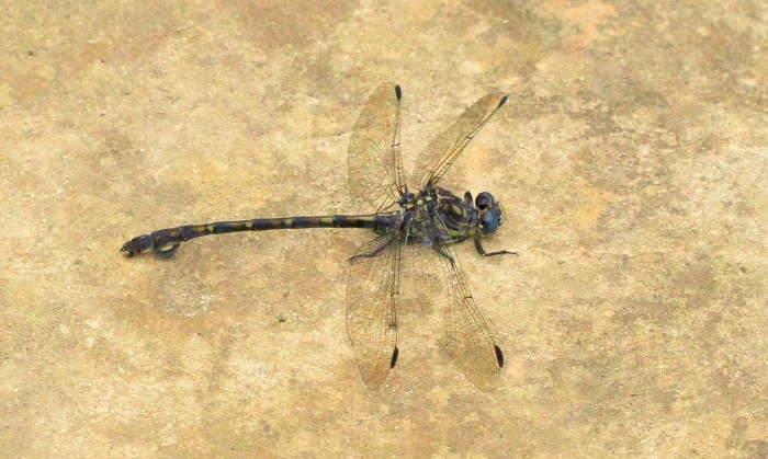
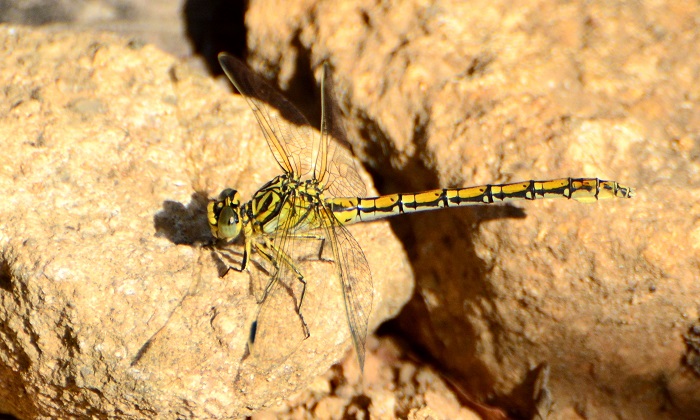
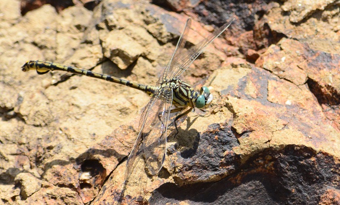
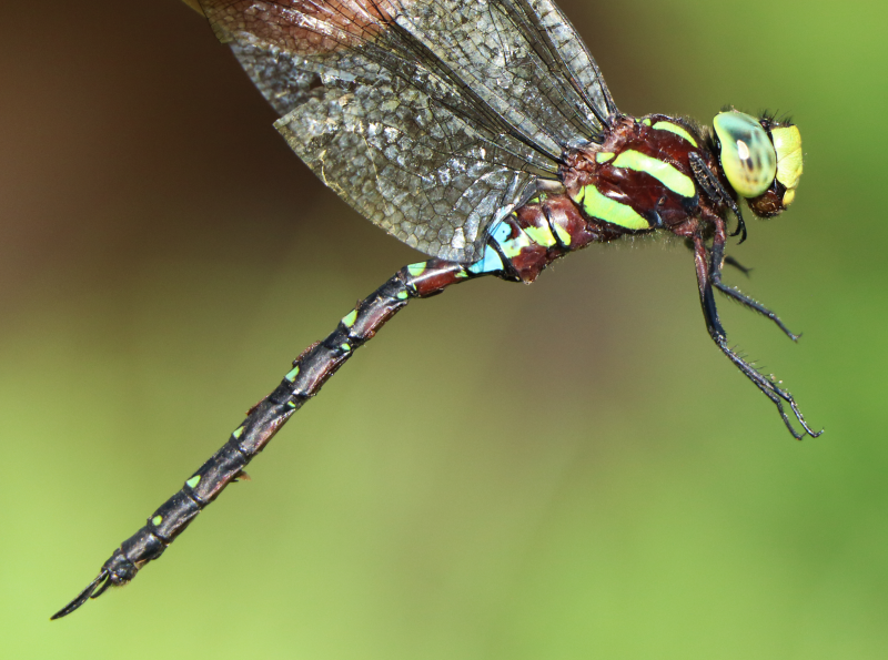
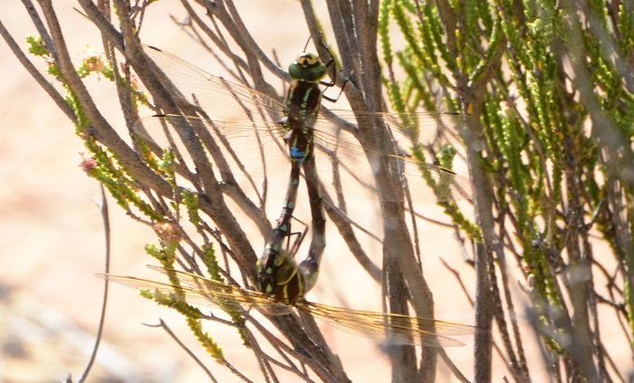
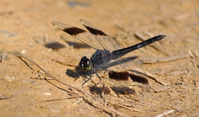
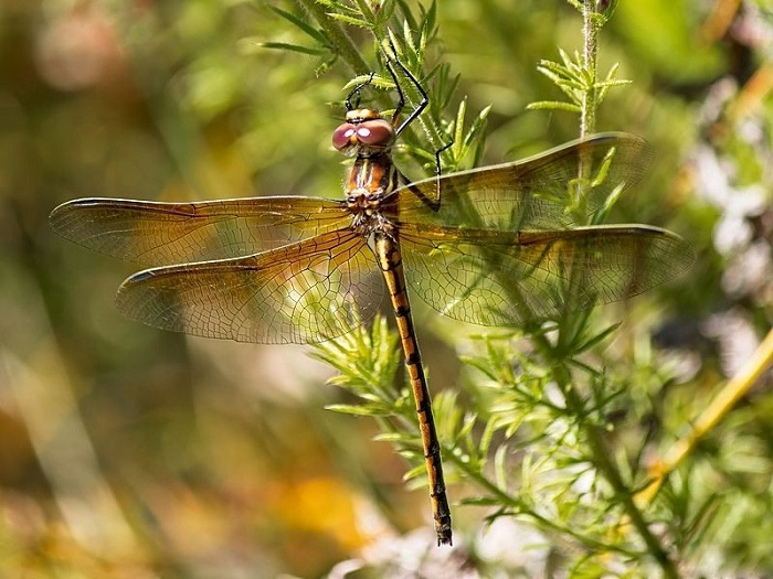
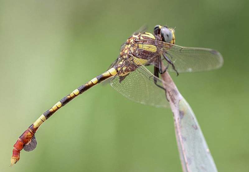
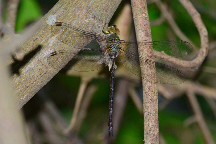
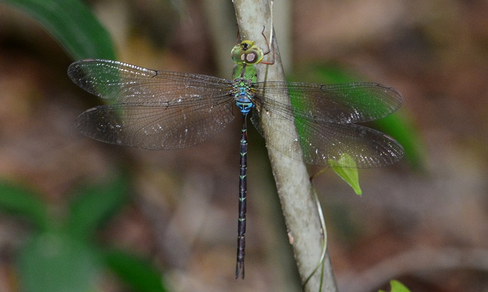
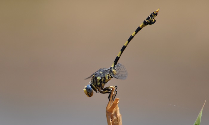
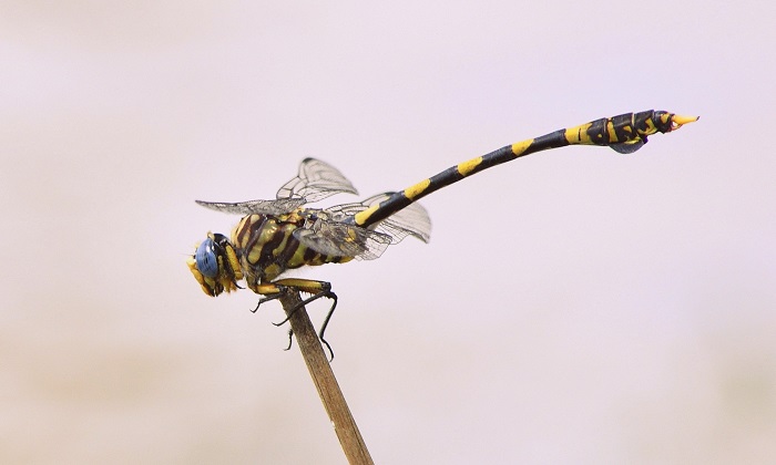
Mpempe Pan, KwaZulu-Natal
Photo by Ryan Tippett
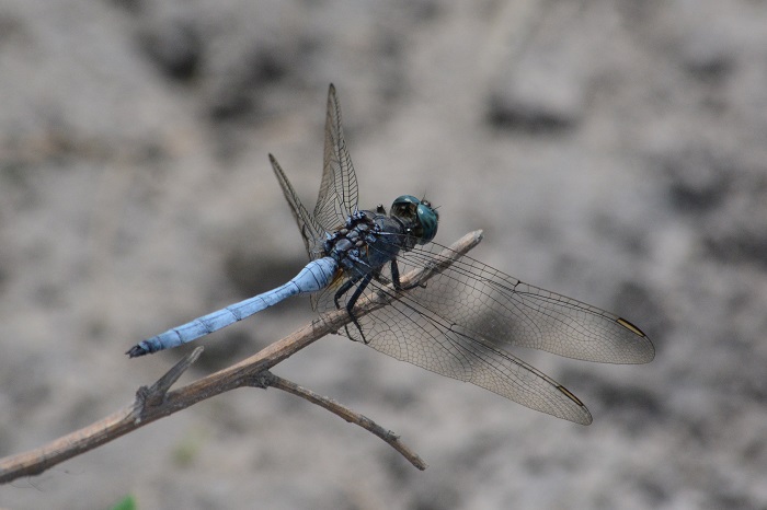
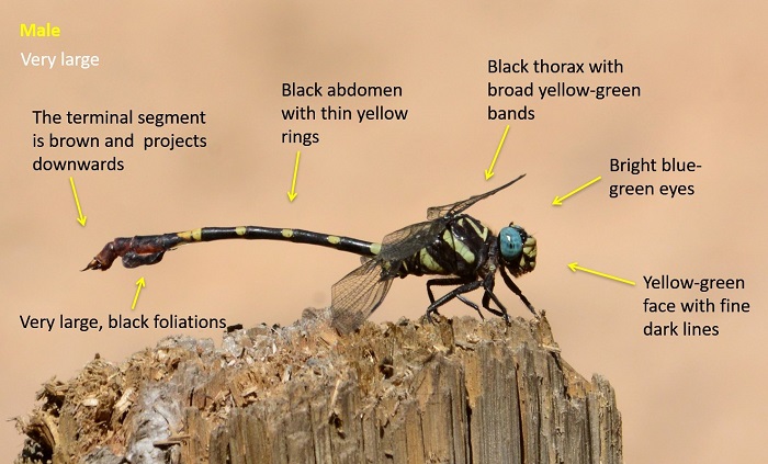
Very Large
Length up to 95mm; Wingspan attains 101mm.
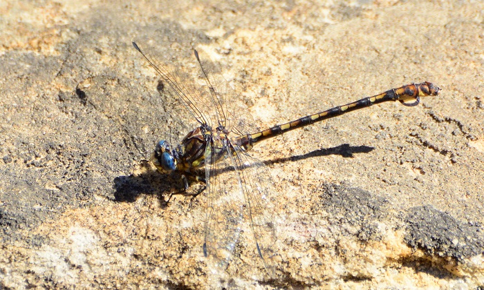
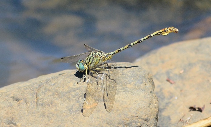
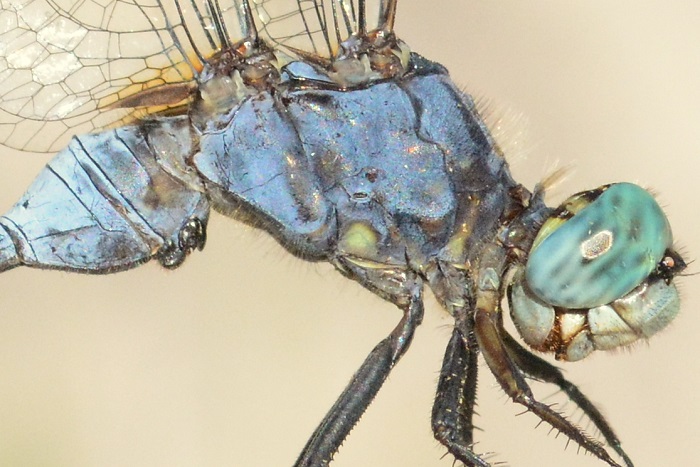
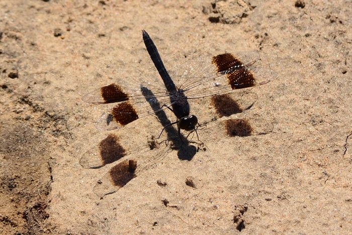
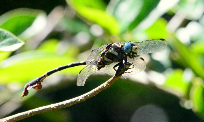
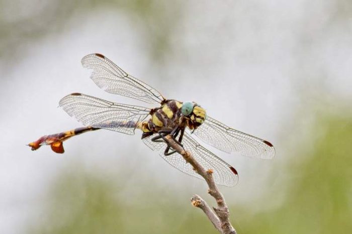
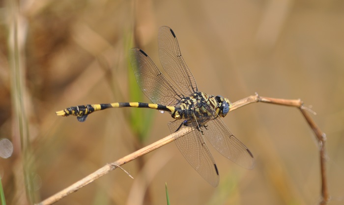
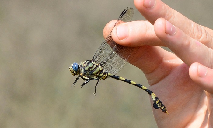
The Common Tigertail is the largest member of the family Gomphidae in the region. Both sexes are readily identifiable by their very large size, large black foliations near the abdomen tip, and bold black and yellow colouration.
The Common Tigertail is most similar to Gomphidia quarrei (Southern Fingertail), but that species is smaller, more slender, and lacks the large foliations on the abdomen.
Click here for more details on identification of the Common Tigertail.
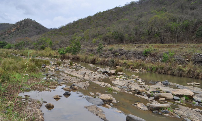
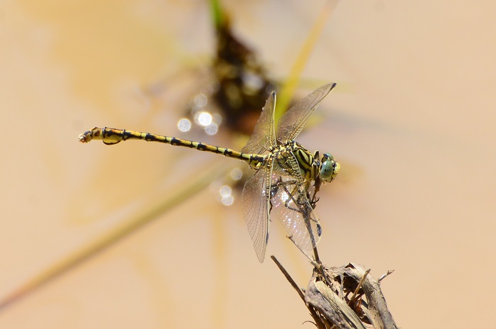
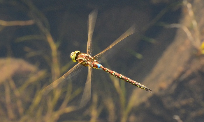
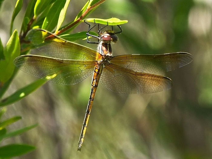
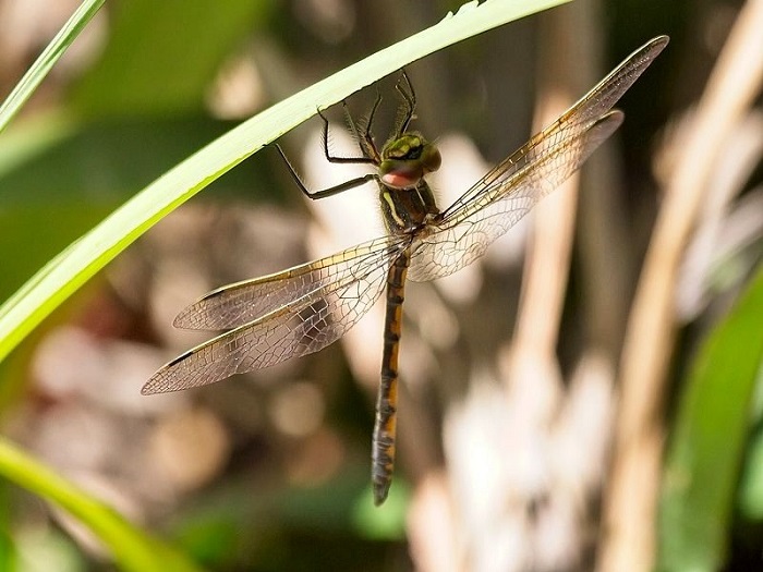
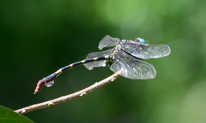
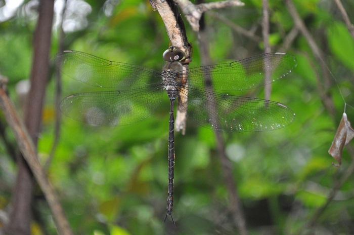
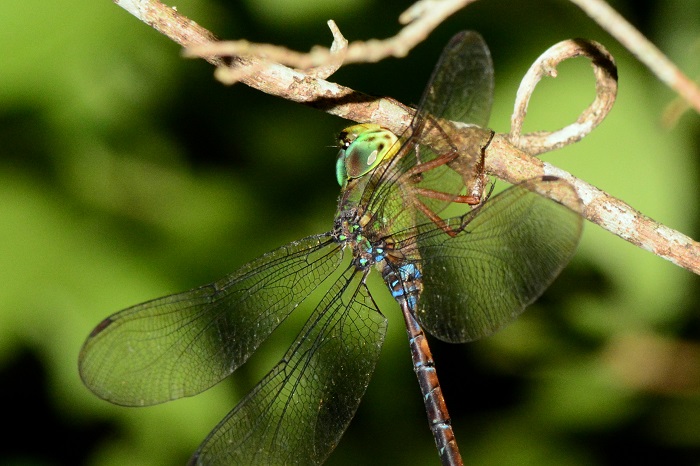
Hluhluwe River Floodplain, KwaZulu-Natal
Photo by Ryan Tippett
Habitat
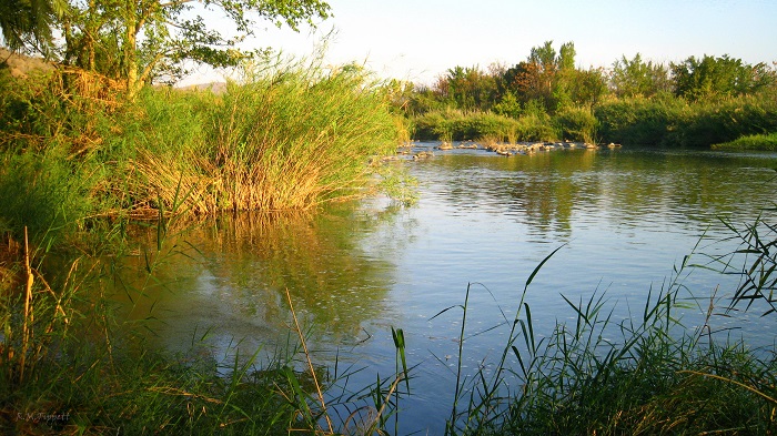
The Common Tigertail inhabits the margins of rivers, lakes, pans, marshes, and dams. It is mostly confined to the warmer savanna regions. The Common Tigertail can be found at both still and flowing water, prefering areas lined with tall grasses, sedges, and especially Phragmites reeds. This is the only large Gomphid in South Africa that commonly inhabits the fringes of large still-water habitats.
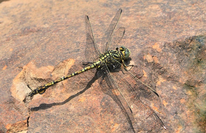
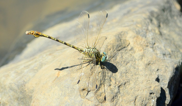
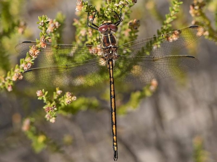
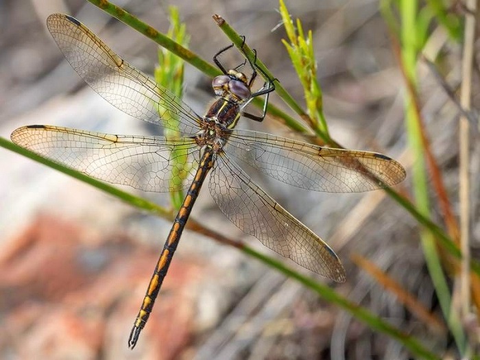
Pongola River, KwaZulu-Natal
Photo by Ryan Tippett
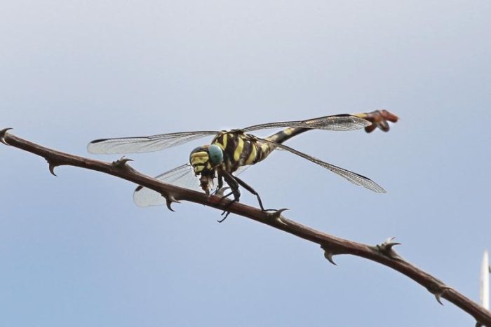
Behaviour
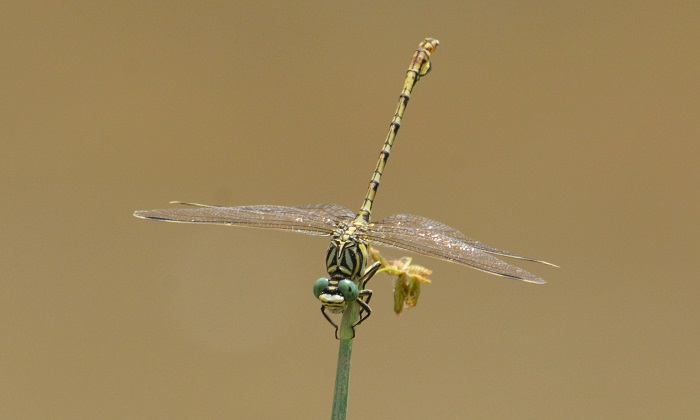
The Common Tigertail is conspicuous as it sits prominently in the open on reeds or other similar perches. It hunts from a perch, returning to their post after each foray to chase down prey or a potential rival. The flight is swift and powerful. The Common Tigertail often skypoints during the heat of the day to reduce the amount of the body in direct sunlight. Females and non-breeding males are mostly found further from the water. Females are seen less frequently than males.
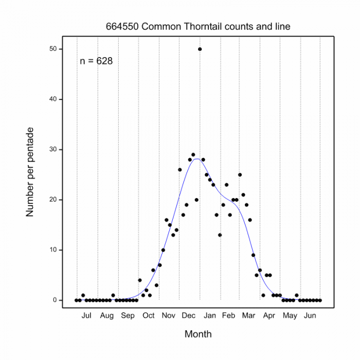
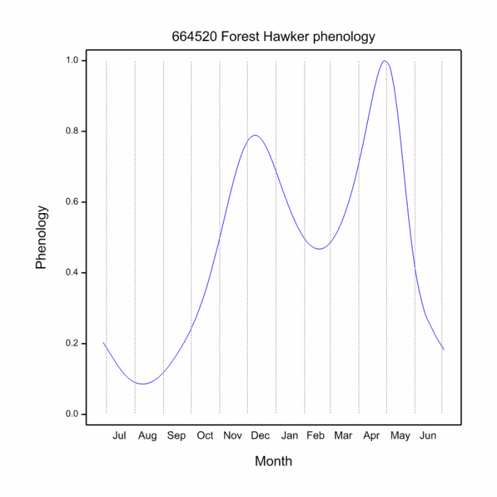
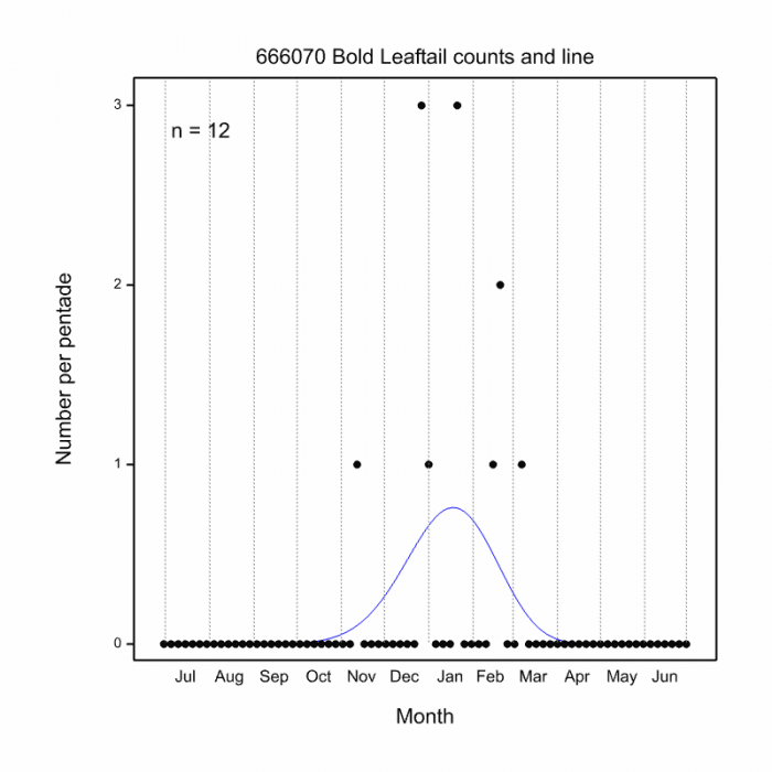
The Common Tigertail is active from September to May (See phenology below).
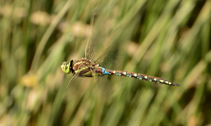
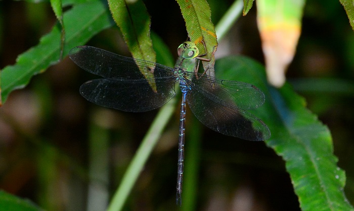
Mkuze Dam, KwaZulu-Natal
Photo by Ryan Tippett
Status and Conservation
Ictinogomphus ferox is common in the northern and eastern parts of South Africa. Vagrants may occasionally be found in other parts of the country. It is listed as of Least Concern in the IUCN Red List of Threatened Species. The Common Tigertail is fairly tolerant of habitat degradation. It occurs commonly at man-made dams and reservoirs, provided they offer suitable habitat.

Hluhluwe district, KwaZulu-Natal
Photo by Ryan Tippett
Distribution
The Common Tigertail is found almost throughout sub-Saharan Africa, although it appears to be less common in West Africa. In South Africa, it is mostly confined to the northeast of the country.
Mpempe Pan, KwaZulu-Natal
Photo by Ryan Tippett
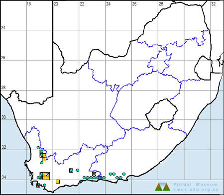
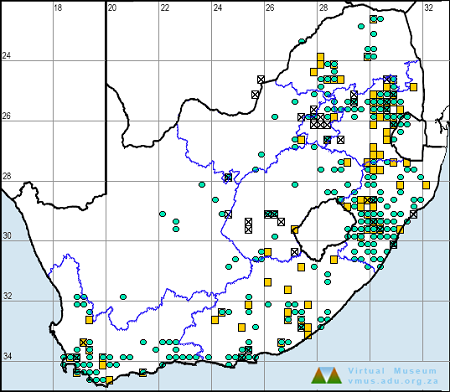
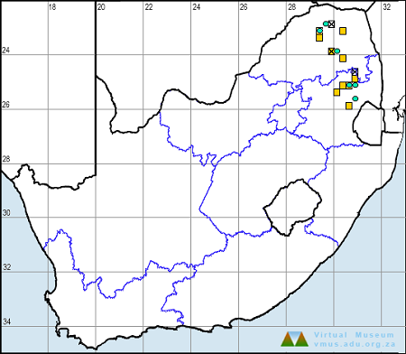
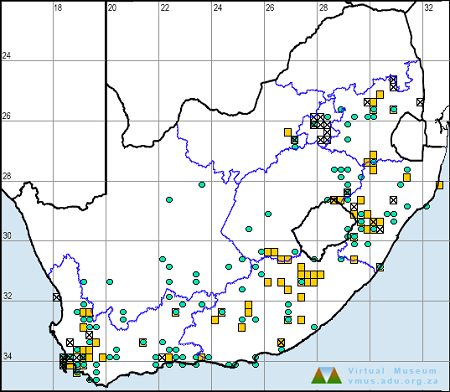
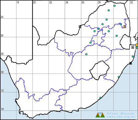
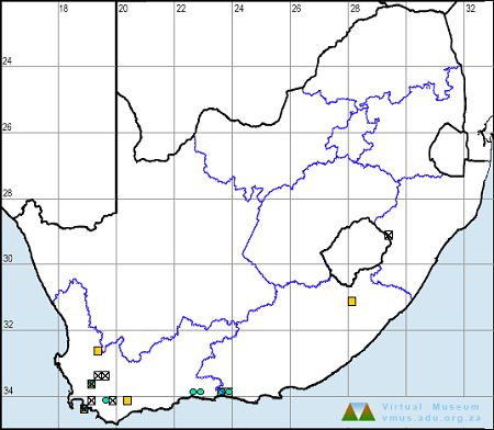
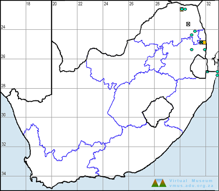
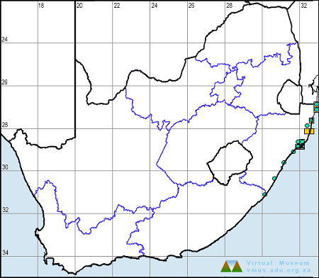
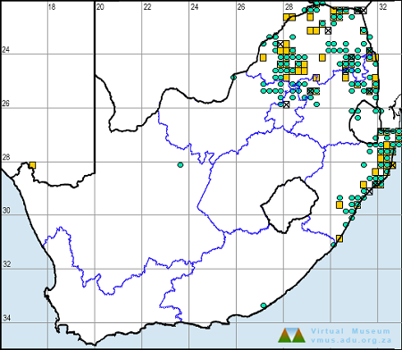
Below is a map showing the distribution of records for Common Tigertail in the OdonataMAP database as at February 2020.

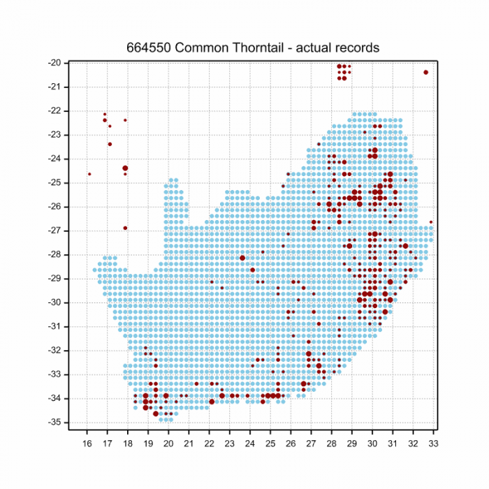
Below is a map showing the distribution of records for Common Tigertail in the OdonataMAP database as of December 2024.
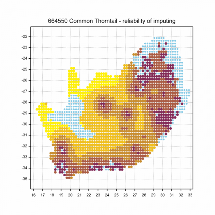
The next map below is an imputed map, produced by an interpolation algorithm, which attempts to generate a full distribution map from the partial information in the map above. This map will be improved by the submission of records to the OdonataMAP section of the Virtual Museum.

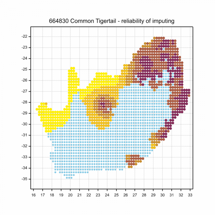
Ultimately, we will produce a series of maps for all the odonata species in the region. The current algorithm is a new algorithm. The objective is mainly to produce “smoothed” maps that could go into a field guide for odonata. This basic version of the algorithm (as mapped above) does not make use of “explanatory variables” (e.g. altitude, terrain roughness, presence of freshwater — we will be producing maps that take these variables into account soon). Currently, it only makes use of the OdonataMAP records for the species being mapped, as well as all the other records of all other species. The basic maps are “optimistic” and will generally show ranges to be larger than what they probably are.
These maps use the data in the OdonataMAP section of the Virtual Museum, and also the database assembled by the previous JRS funded project, which was led by Professor Michael Samways and Dr KD Dijkstra.
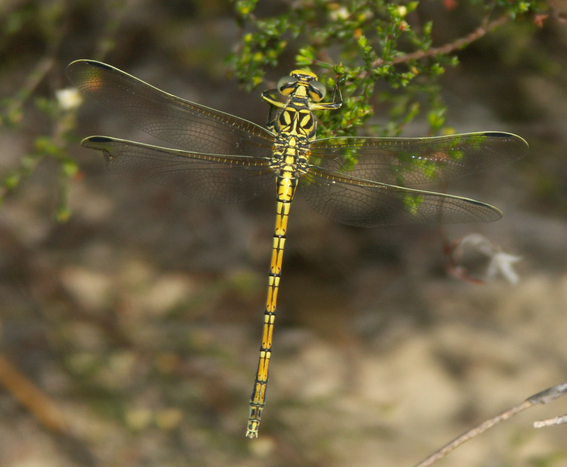
Mkuze Game Reserve, KwaZulu-Natal
Photo by Ryan Tippett
Phenology


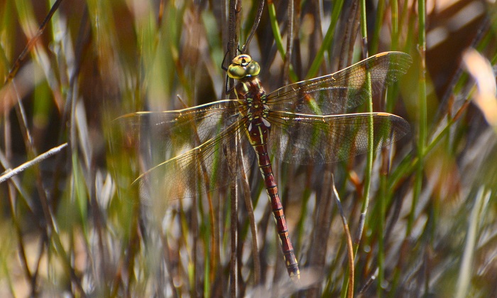
Muzi Pan, KwaZulu-Natal
Photo by Ryan Tippett
Further Resources
The use of photographs by Neels Jackson is acknowledged. Other images by Ryan Tippett.
Common Tigertail Ictinogomphus ferox (Rambur, 1842)
Other Common Names: Gewone Streepstert (Afrikaans).
Recommended citation format: Loftie-Eaton M; Navarro R; Tippett RM; Underhill L. 2025. Common Tigertail Ictinogomphus ferox. Biodiversity and Development Institute. Available online at https://thebdi.org/2020/05/27/common-tigertail-ictinogomphus-ferox/
References: Tarboton, M; Tarboton, W. (2019). A Guide to the Dragonflies & Damselflies of South Africa. Struik Nature.
Samways, MJ. (2008). Dragonflies and Damselflies of South Africa. Pensoft
Samways, MJ. (2016). Manual of Freshwater Assessment for South Africa: Dragonfly Biotic Index. Suricata 2. South African National Biodiversity Institute, Pretoria
Martens, A; Suhling, F. (2007). Dragonflies and Damselflies of Namibia. Gamsberg Macmillan.

Mkuze Game Reserve, KwaZulu-Natal
Photo by Ryan Tippett