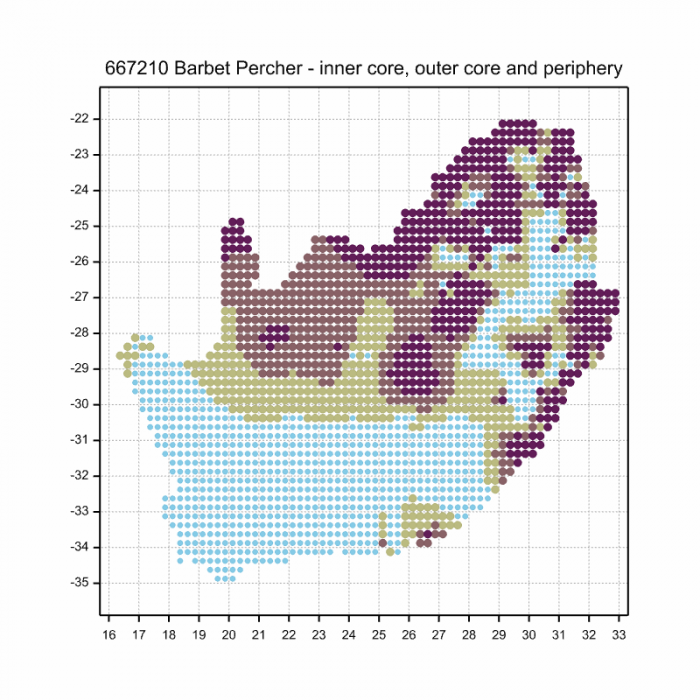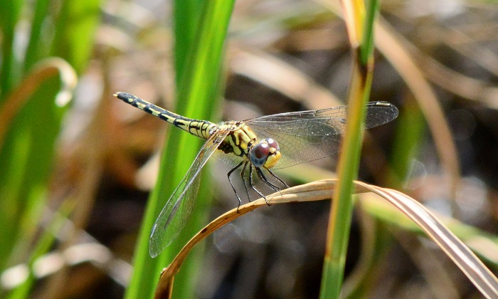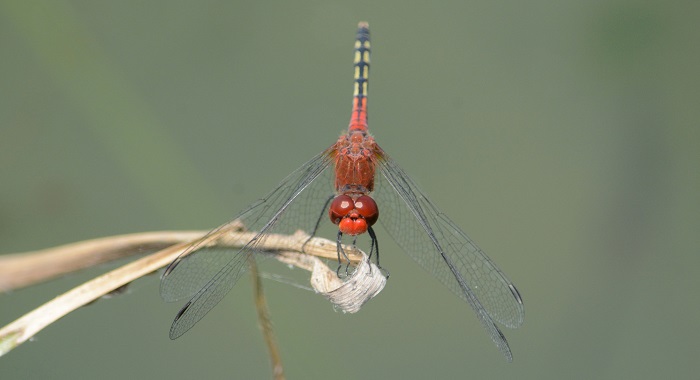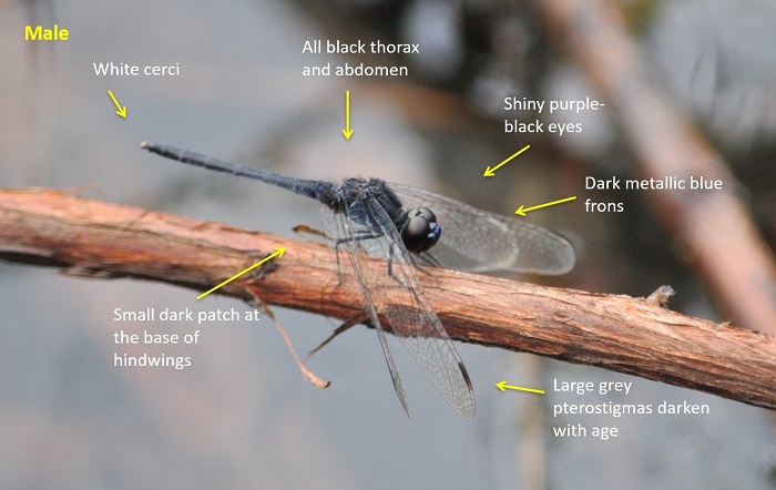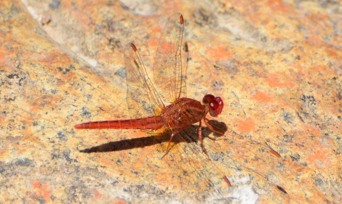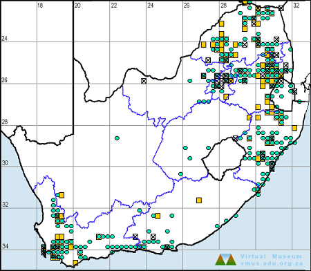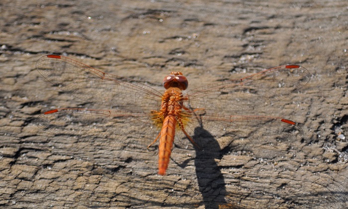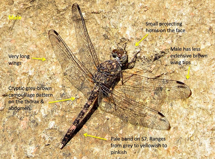
BDInsight – May 2020

It has been more than 60 days since lockdown began here in South Africa, but that has not stopped citizen scientists from biomapping! We have been overwhelmed by the determination and enthusiasm shown by citizen scientists across the country. Biodiversity data poured into the Virtual Museum as biomappers refused to let their love and passion for nature wane in the face of lockdown. Citizen scientists turned their mapping efforts to the confines of their homes and gardens (and even the blue skies up above!) and just kept on biomapping. Well done!

Coming soon: BDI BioBashes

As citizen scientists, the long lockdown has turned us into tightly coiled springs in a clockwork engine, bursting to unleash our stored up energy on biodiversity projects. The BDI will try to provide constructive outlets for this enthusiasm.

As soon as we can travel a bit more easily, we will try to arrange BioBashes. We are in contact with several suitable places from the perspective of accommodation and meals. Each day we travel out independently to places where data needs are greatest. We will interact in ways deemed appropriate.

We are currently doing the groundwork for several BioBashes. These are broad plans which have no dates attached. Once we have the go ahead to move more freely, we will do our utmost to schedule events rapidly. Watch this space.

The first of these BioBashes will almost certainly be at the Karoo Gariep Nature Reserve, near Hanover in the Northern Cape. This is where we held the BDI Citizen Science Conference in February. It is a place we know well. As coordinators of the event, we can visualize how to keep safe there. See http://thebdi.org/2020/02/29/bdinsight-february-2020/ for a report on the conference in February.

The Karoo Gariep Nature Reserve is exactly halfway between Cape Town and Johannesburg. If you have a permit to travel, and this is a useful place at which to break your journey overnight, do contact PC Ferreira at info@karoogariep.co.za, or cell 082 567 9211 and find out if he can help you.

Virtual Museum News

Up-to-date distribution maps are critical for conservation decision-making. We have all done our best during the lockdown to maintain the momentum of map building with the Virtual Museum. So it is awesome that, with five days left in May, we are at SecondBestMay. The RED dot for May only has one more line to cross to achieve BestMay.

BestMay is just 490 records away. It is still achievable, with some dedicated effort! If you have any records to send in, please upload them by Sunday 31 May 2020.

We are so close to BestMay, let’s bust a gut to get there. It is all about the “power of small numbers”. This is a power you witness regularly at the supermarket. A basketful of small items totals up to a surprisingly large amount! If we can all submit a few records, we can easily achieve BestMay.

BestMonthEver for LepiMAP

LepiMAP has had its BestMonthEver during the lockdown in April. That is amazing. We asked Fanie Rautenbach, the member of the expert panel who does almost all the formal identifications of butterflies to suggest records which he thought were especially interesting.

Two-pip Policeman or Dubbelkol-konstabel Coeliades pisistratus LepiMAP record by Stephen Ball

Fanie is an organic chemist, a researcher at the Cape Peninsula University of Technology. His research area is the chemistry of rooibos tea, especially its health value as an antioxidant. Here’s an article in the Health SA, which you can download, and there is a whole bunch of “full-text available” papers in his profile on Researchgate. It is fascinating. But what we are celebrating now is the contribution Fanie has made to LepiMAP. He has done 88,189 identifications in LepiMAP! He is also a big contributor to the rest of the Virtual Museum. We asked Fanie to select a few interesting records of butterflies submitted during Lockdown April. Read the full report here.

Common Tigertail (Ictinogomphus ferox)

Cover photo by Neels Jackson.

Find the Common Tigertail in the FBIS database (Freshwater Biodiversity Information System) here.

Family Gomphidae

Identification

Common Tigertail Ictinogomphus ferox – Male
Mpempe Pan, KwaZulu-Natal
Photo by Ryan Tippett

Very Large

Length up to 95mm; Wingspan attains 101mm.

The Common Tigertail is the largest member of the family Gomphidae in the region. Both sexes are readily identifiable by their very large size, large black foliations near the abdomen tip, and bold black and yellow colouration.

The Common Tigertail is most similar to Gomphidia quarrei (Southern Fingertail), but that species is smaller, more slender, and lacks the large foliations on the abdomen.

Click here for more details on identification of the Common Tigertail.

Common Tigertail Ictinogomphus ferox – Female
Hluhluwe River Floodplain, KwaZulu-Natal
Photo by Ryan Tippett

Habitat

The Common Tigertail inhabits the margins of rivers, lakes, pans, marshes, and dams. It is mostly confined to the warmer savanna regions. The Common Tigertail can be found at both still and flowing water, prefering areas lined with tall grasses, sedges, and especially Phragmites reeds. This is the only large Gomphid in South Africa that commonly inhabits the fringes of large still-water habitats.

Habitat – Savanna river with an abundance of tall reeds.
Pongola River, KwaZulu-Natal
Photo by Ryan Tippett

Behaviour

The Common Tigertail is conspicuous as it sits prominently in the open on reeds or other similar perches. It hunts from a perch, returning to their post after each foray to chase down prey or a potential rival. The flight is swift and powerful. The Common Tigertail often skypoints during the heat of the day to reduce the amount of the body in direct sunlight. Females and non-breeding males are mostly found further from the water. Females are seen less frequently than males.

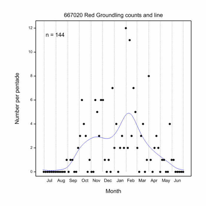
The Common Tigertail is active from September to May (See phenology below).

Common Tigertail Ictinogomphus ferox – Male
Mkuze Dam, KwaZulu-Natal
Photo by Ryan Tippett

Status and Conservation

Ictinogomphus ferox is common in the northern and eastern parts of South Africa. Vagrants may occasionally be found in other parts of the country. It is listed as of Least Concern in the IUCN Red List of Threatened Species. The Common Tigertail is fairly tolerant of habitat degradation. It occurs commonly at man-made dams and reservoirs, provided they offer suitable habitat.

Common Tigertail Ictinogomphus ferox – Male
Hluhluwe district, KwaZulu-Natal
Photo by Ryan Tippett

Distribution

The Common Tigertail is found almost throughout sub-Saharan Africa, although it appears to be less common in West Africa. In South Africa, it is mostly confined to the northeast of the country.

Common Tigertail Ictinogomphus ferox – Male
Mpempe Pan, KwaZulu-Natal
Photo by Ryan Tippett

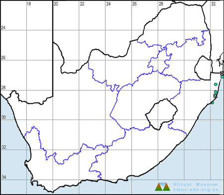
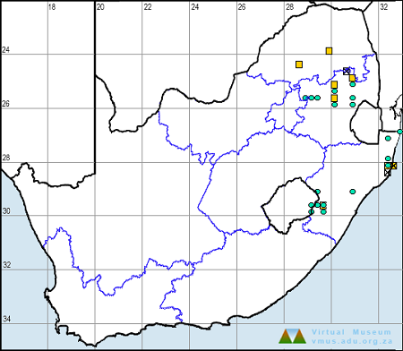
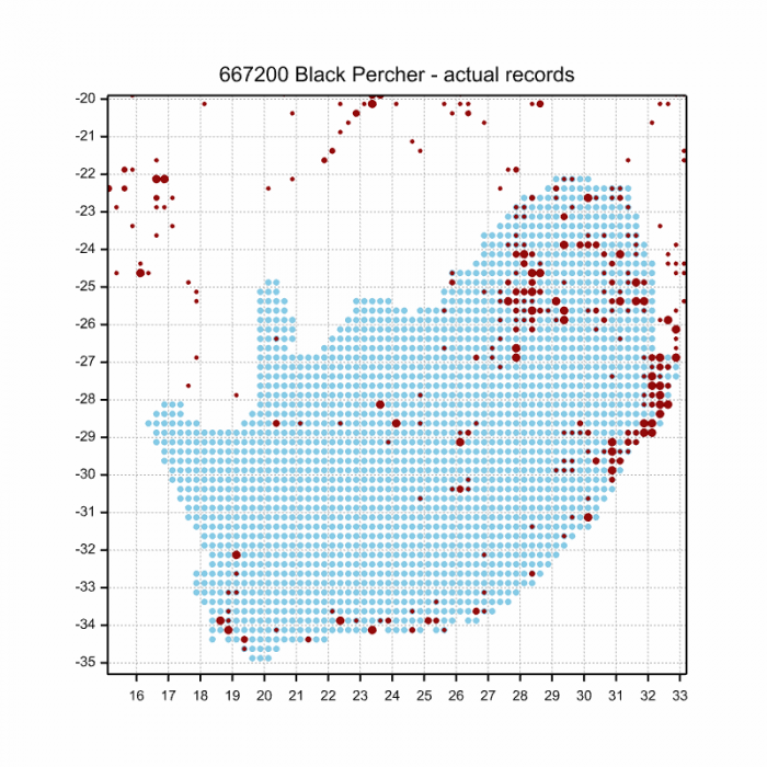
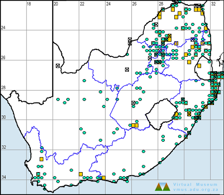
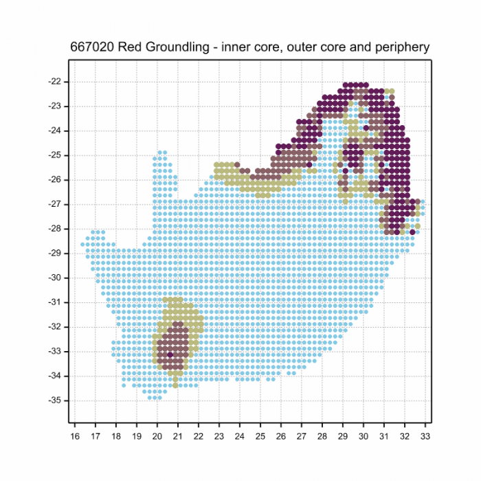
Below is a map showing the distribution of records for Common Tigertail in the OdonataMAP database as at February 2020.

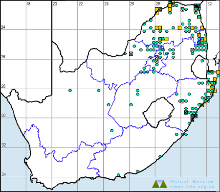
Below is a map showing the distribution of records for Common Tigertail in the OdonataMAP database as of December 2024.

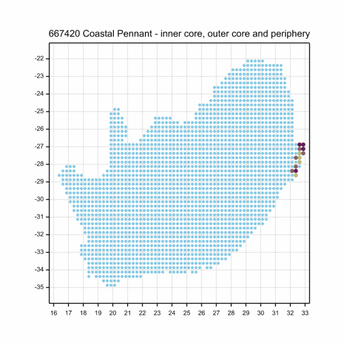
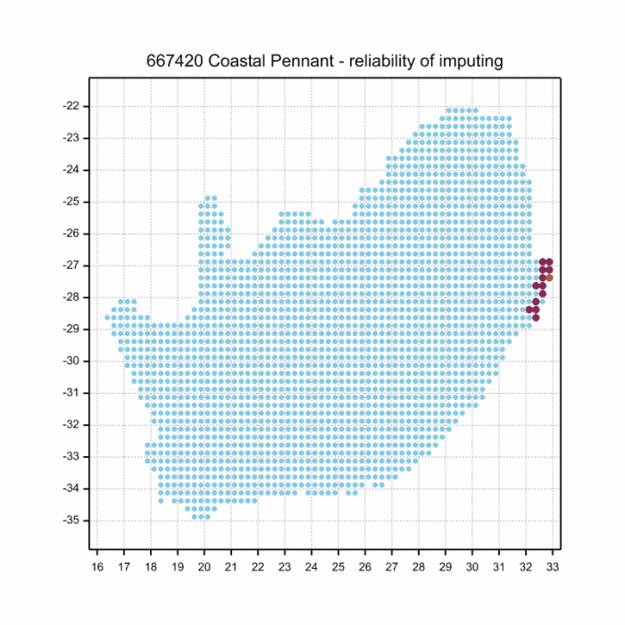
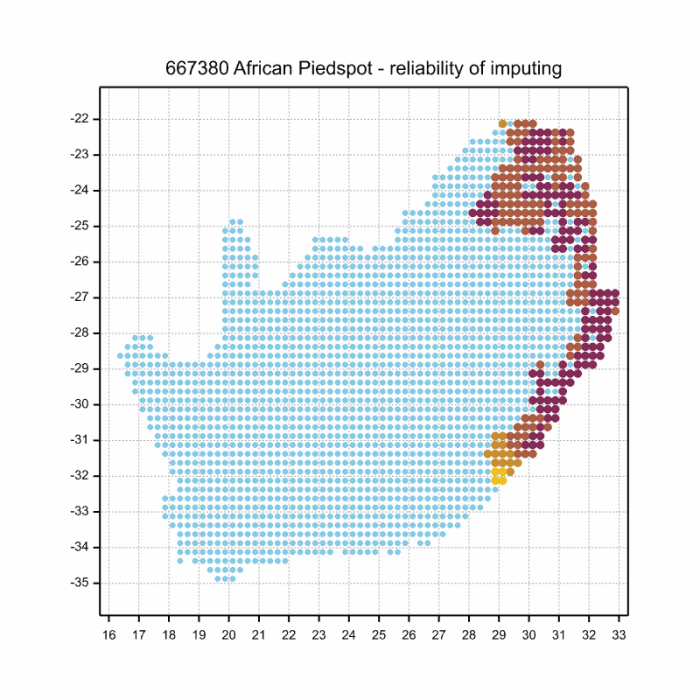
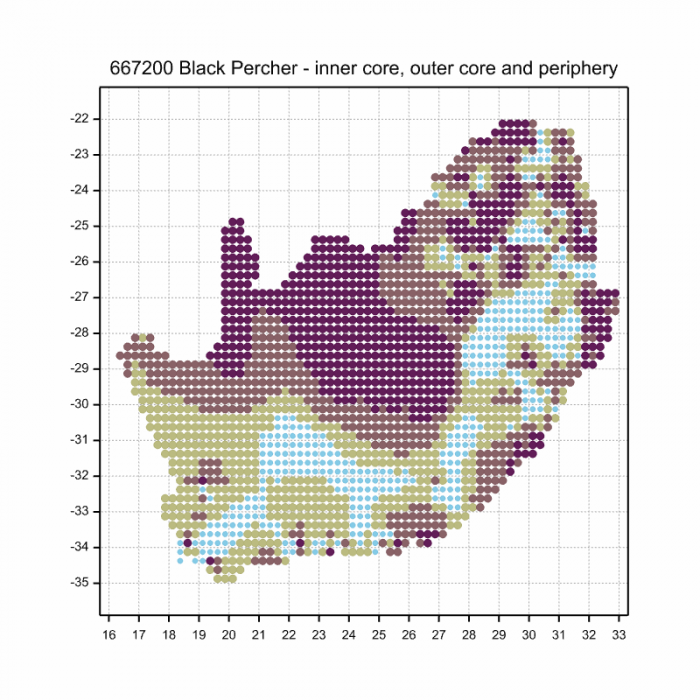
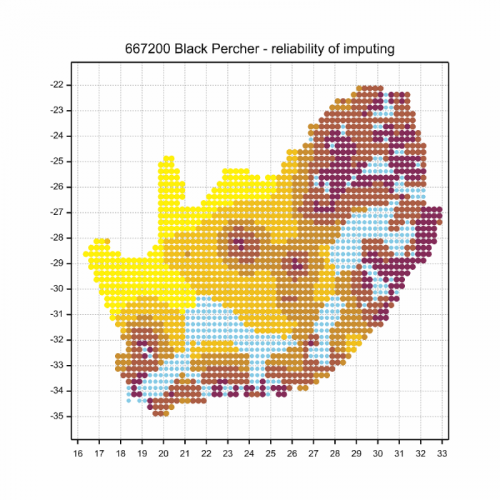
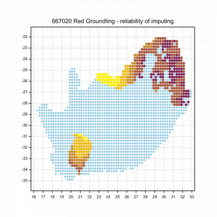
The next map below is an imputed map, produced by an interpolation algorithm, which attempts to generate a full distribution map from the partial information in the map above. This map will be improved by the submission of records to the OdonataMAP section of the Virtual Museum.

Ultimately, we will produce a series of maps for all the odonata species in the region. The current algorithm is a new algorithm. The objective is mainly to produce “smoothed” maps that could go into a field guide for odonata. This basic version of the algorithm (as mapped above) does not make use of “explanatory variables” (e.g. altitude, terrain roughness, presence of freshwater — we will be producing maps that take these variables into account soon). Currently, it only makes use of the OdonataMAP records for the species being mapped, as well as all the other records of all other species. The basic maps are “optimistic” and will generally show ranges to be larger than what they probably are.

These maps use the data in the OdonataMAP section of the Virtual Museum, and also the database assembled by the previous JRS funded project, which was led by Professor Michael Samways and Dr KD Dijkstra.

Common Tigertail Ictinogomphus ferox – Male
Mkuze Game Reserve, KwaZulu-Natal
Photo by Ryan Tippett

Phenology

Common Tigertail Ictinogomphus ferox – Male
Muzi Pan, KwaZulu-Natal
Photo by Ryan Tippett

Further Resources

The use of photographs by Neels Jackson is acknowledged. Other images by Ryan Tippett.

Common Tigertail Ictinogomphus ferox (Rambur, 1842)

Other Common Names: Gewone Streepstert (Afrikaans).

Recommended citation format: Loftie-Eaton M; Navarro R; Tippett RM; Underhill L. 2025. Common Tigertail Ictinogomphus ferox. Biodiversity and Development Institute. Available online at https://thebdi.org/2020/05/27/common-tigertail-ictinogomphus-ferox/

References: Tarboton, M; Tarboton, W. (2019). A Guide to the Dragonflies & Damselflies of South Africa. Struik Nature.

Samways, MJ. (2008). Dragonflies and Damselflies of South Africa. Pensoft

Samways, MJ. (2016). Manual of Freshwater Assessment for South Africa: Dragonfly Biotic Index. Suricata 2. South African National Biodiversity Institute, Pretoria

Martens, A; Suhling, F. (2007). Dragonflies and Damselflies of Namibia. Gamsberg Macmillan.

Common Tigertail Ictinogomphus ferox – Male
Mkuze Game Reserve, KwaZulu-Natal
Photo by Ryan Tippett

Similar Species

Cape Thorntail (Ceratogomphus triceraticus)

Cover photo by Jean Hirons.

Find the Cape Thorntail in the FBIS database (Freshwater Biodiversity Information System) here.

Family Gomphidae

Identification

Cape Thorntail Ceratogomphus triceraticus – Male
Bloukrans Pass, Eastern Cape
Photo by Desire Darling

Medium-large size

Length attains 63mm; Wingspan reaches 72mm.

The overall colouration of the Cape Thorntail is yellow and black with some brown shading. In mature males, the black markings develop a dark greyish-blue pruinosity. Males have large foliations on the underside of the 8th tail segment. Females resemble the males but are duller and have reduced tail foliations. Females are also more robust and have broader abdomens.

Cape Thorntail Ceratogomphus triceraticus – Male
Seweweekspoort, Western Cape
Photo by Ryan Tippett

The Cape Thorntail most closely resembles the Common Thorntail (Ceratogomphus pictus), but is noticeably larger and darker. The abdomen segments are predominantly yellow in C. pictus, and mainly black in C. triceraticus. Additionally, the forwards projecting ‘thorn’ near the tip of the abdomen is broader and darker in the Cape Thorntail. The foliations on the abdomen also have thick black outer edges whereas Ceratogomphus pictus has thin black edging on the foliations.

Click here for more details on identification of the Cape Thorntail.

Habitat

The Cape Thorntail frequents shallow, fast-flowing streams and rivers. It prefers rocky habitats, often with large boulders, and is usually found in fairly open and hilly countryside. The Cape Thorntail occurs on rivers up to 800m above sea level.

Habitat – Palmiet River, Western Cape
Photo by Corné Rautenbach

Behaviour

The Cape Thorntail mostly perches on the ground or on rocks and boulders, but sometimes also sits on low twigs and bushes. They are usually found at the river but the odd individual may sometimes be encountered away from water. Most hunting is done from a perch atop a rock but they occasionally also forage by flying to and fro along a chosen route. The Cape Thorntail is usually a shy and weary species that can be difficult to approach.

The Cape Thorntail is on the wing from mid-October through to mid-April (see Phenology below).

Status and Conservation

Ceratogomphus triceraticus is an uncommon and very localised species. It is listed as Near Threatened in the IUCN Red List of Threatened Species. This grading is due to its relatively small, restricted distribution and the fact that it is reliant upon undisturbed habitats.

Cape Thorntail Ceratogomphus triceraticus – Male
Vanrhynsdorp Waterfall, Western Cape
Photo by Ryan Tippett

Distribution

The Cape Thorntail is endemic to South Africa, where it is mostly restricted to the Western Cape province. It extends marginally into the Eastern Cape, reaching its eastern limit near Gqeberha (Port Elizabeth).

Below is a map showing the distribution of records for Cape Thorntail in the OdonataMAP database as at February 2020.

Below is a map showing the distribution of records for Cape Thorntail in the OdonataMAP database as at December 2024.

The next map below is an imputed map, produced by an interpolation algorithm, which attempts to generate a full distribution map from the partial information in the map above. This map will be improved by the submission of records to the OdonataMAP section of the Virtual Museum.

Ultimately, we will produce a series of maps for all the odonata species in the region. The current algorithm is a new algorithm. The objective is mainly to produce “smoothed” maps that could go into a field guide for odonata. This basic version of the algorithm (as mapped above) does not make use of “explanatory variables” (e.g. altitude, terrain roughness, presence of freshwater — we will be producing maps that take these variables into account soon). Currently, it only makes use of the OdonataMAP records for the species being mapped, as well as all the other records of all other species. The basic maps are “optimistic” and will generally show ranges to be larger than what they probably are.

These maps use the data in the OdonataMAP section of the Virtual Museum, and also the database assembled by the previous JRS funded project, which was led by Professor Michael Samways and Dr KD Dijkstra.

Phenology

Further Resources

The use of photographs by Corné Rautenbach, Desire Darling, and Jean Hirons is acknowledged.

Cape Thorntail Ceratogomphus triceraticus (Balinsky, 1963)

Other Common Names: Kaapse Doringstert (Afrikaans)

Recommended citation format: Loftie-Eaton M; Navarro R; Tippett RM; Underhill L. 2025. Cape Thorntail Ceratogomphus triceraticus.  Biodiversity and Development Institute. Available online at https://thebdi.org/2020/05/27/cape-thorntail-ceratogomphus-triceraticus/

References: Tarboton, M; Tarboton, W. (2019). A Guide to the Dragonflies & Damselflies of South Africa. Struik Nature.

Samways, MJ. (2008). Dragonflies and Damselflies of South Africa. Pensoft

Samways, MJ. (2016). Manual of Freshwater Assessment for South Africa: Dragonfly Biotic Index. Suricata 2. South African National Biodiversity Institute, Pretoria

Similar Species

Common Thorntail (Ceratogomphus pictus)

Cover photo by Chris Willis.

Find the Common Thorntail in the FBIS database (Freshwater Biodiversity Information System) here.

Family Gomphidae

Identification

Common Thorntail Ceratogomphus pictus – Male
Mkuze River, KwaZulu-Natal
Photo by Ryan Tippett
Inset by Gregg Darling

Medium-large size

Length up to 53mm; Wingspan attains 69mm.

The Common Thorntail is most similar to the Cape Thorntail (Ceratogomphus triceraticus), but is smaller and paler. Ceratogomphus pictus has thin black edging on the abdomen foliations, compared to the thick black border found on Ceratogomphus triceraticus. In addition, C. pictus has a small, thin, forward-projecting spine at the top of segment ten. In C. triceraticus this spine is broad.

The sexes are similar but females are more robust and have broader abdomens with smaller foliations.

Click here for more details on identification of the Common Thorntail.

Common Thorntail Ceratogomphus pictus – Female
Paardeberg, Western Cape
Photo by Ryan Tippett

Habitat

The Common Thorntail inhabits both still and running water habitats, including streams, rivers, and dams. It prefers open and exposed areas with bare ground and rocks. The Common Thorntail is found in all the biomes of South Africa, although it is scarce in the Succulent Karoo and Nama Karoo. It occurs up to 1200m above sea level.

Habitat – Mkuze River, KwaZulu-Natal
Photo by Ryan Tippett

Behaviour

The Common Thorntail often perches on bare ground or rocks close to the water. It sometimes also sits on low twigs or bushes along the banks. The Common Thorntail hunts from a perch and has a fast, powerful flight. Non-breeding individuals, especially females, may be found some distance from water.

The Common Thorntail is active from late September to late April (See phenology below).

Common Thorntail Ceratogomphus pictus – Male
Elands River, KwaZulu-Natal
Photo by Ryan Tippett

Status and Conservation

The Common Thorntail is common and widespread in southern Africa. It is listed as of Least Concern in the IUCN Red List of Threatened Species. The Common Thorntail readily utilises man-made habitats such as farm dams and is often present along the eroded or overgrazed margins of water-bodies.

Common Thorntail Ceratogomphus pictus – Male
Amakhosi Game Reserve, KwaZulu-Natal
Photo by Ryan Tippett

Distribution

Ceratogomphus pictus is a Southern African species extending from South Africa through Namibia, Botswana, and Zimbabwe to southern Zambia. It is widespread in South Africa but is mostly absent from the humid lowveld and coastal parts of north-eastern KwaZulu-Natal. The Common Thorntail is also absent from most of the Karoo but is present along the middle Orange River.

Common Thorntail Ceratogomphus pictus – Male
Mkuze River, KwaZulu-Natal
Photo by Ryan Tippett

Below is a map showing the distribution of records for Common Thorntail in the OdonataMAP database as at February 2020.

Below is a map showing the distribution of records for Common Thorntail in the OdonataMAP database as of December 2024.

The next map below is an imputed map, produced by an interpolation algorithm, which attempts to generate a full distribution map from the partial information in the map above. This map will be improved by the submission of records to the OdonataMAP section of the Virtual Museum.

Ultimately, we will produce a series of maps for all the odonata species in the region. The current algorithm is a new algorithm. The objective is mainly to produce “smoothed” maps that could go into a field guide for odonata. This basic version of the algorithm (as mapped above) does not make use of “explanatory variables” (e.g. altitude, terrain roughness, presence of freshwater — we will be producing maps that take these variables into account soon). Currently, it only makes use of the OdonataMAP records for the species being mapped, as well as all the other records of all other species. The basic maps are “optimistic” and will generally show ranges to be larger than what they probably are.

These maps use the data in the OdonataMAP section of the Virtual Museum, and also the database assembled by the previous JRS funded project, which was led by Professor Michael Samways and Dr KD Dijkstra.

Common Thorntail Ceratogomphus pictus – Male
iXopo district, KwaZulu-Natal
Photo by Ryan Tippett

Phenology

Common Thorntail Ceratogomphus pictus – Male
Amakhosi Game Reserve, KwaZulu-Natal
Photo by Ryan Tippett

Further Resources

The use of photographs by Christopher Willis and Gregg Darling is acknowledged. Other photos by Ryan Tippett.

Common Thorntail Ceratogomphus pictus Hagen, 1854

Other Common Names: Gewone Doringstert (Afrikaans)

Recommended citation format: Loftie-Eaton M; Navarro R; Tippett RM; Underhill L. 2025. Common Thorntail Ceratogomphus pictus.  Biodiversity and Development Institute. Available online at https://thebdi.org/2020/05/26/common-thorntail-ceratogomphus-pictus/

References: Tarboton, M; Tarboton, W. (2019). A Guide to the Dragonflies & Damselflies of South Africa. Struik Nature.

Samways, MJ. (2008). Dragonflies and Damselflies of South Africa. Pensoft

Samways, MJ. (2016). Manual of Freshwater Assessment for South Africa: Dragonfly Biotic Index. Suricata 2. South African National Biodiversity Institute, Pretoria

Martens, A; Suhling, F. (2007). Dragonflies and Damselflies of Namibia. Gamsberg Macmillan.

Common Thorntail Ceratogomphus pictus – Male
Mkuze River, KwaZulu-Natal
Photo by Ryan Tippett

Similar Species

Forest Hawker (Zosteraeschna usambarica)

Cover photo by Gerhard Diedericks.

Find the Forest Hawker in the FBIS database (Freshwater Biodiversity Information System) here.

Family Aeshnidae

Identification

Forest Hawker Zosteraeschna usambarica – Male
Near Sabi, Mpumalanga
Photographs by Gerhard Diedericks

Medium – large size

Length up to 45mm; Wingspan reaches 83mm.

The Forest Hawker is closely similar to the Friendly Hawker (Zosteraeschna minuscula), but differs in having a pentagon shaped marking on the forehead and triangle shaped green markings on the shoulders. The diagonal stripes on the sides of the thorax are also a brighter shade of green in the Forest Hawker.

The sexes are similar but females either lack the blue saddle or it is very reduced. Females also have amber outer wings.

Click here for more details on identification of the Forest Hawker.

Habitat

The Forest Hawker is associated with subtropical or tropical moist montane forests and forest-edge environments. It inhabits rivers, streams, ponds, marshes, and dams, both inside and outside the forest. It will also hunt over grasslands and high-altitude shrubland near forests. The Forest Hawker prefers indigenous forests but also makes use of exotic plantations.

Behaviour

The Forest Hawker is highly aerial, spending most of its time in flight. It patrols, to and fro along a chosen route over the wetland. The flight is fast and direct. The Forest Hawker hangs vertically from a perch while at rest.

The Forest Hawker is mainly on the wing from October to May (see Phenology below).

Status and Conservation

The Forest Hawker is rare and localised in South Africa. It is listed for South Africa as being Vulnerable in the IUCN Red List of Threatened Species. It is threatened by the loss of wetland habitats due to the spread of commercial forestry and agriculture. The Forest Hawker does occupy exotic plantations, provided associated wetlands remain intact.

Distribution

Zosteraeschna usambarica has a highly fragmented distribution that ranges from South Africa to Zimbabwe, Mozambique, Malawi, Tanzania and Kenya. In South Africa, it is restricted to isolated escarpment forests in Mpumalanga and Limpopo.

Below is a map showing the distribution of records for Forest Hawker in the OdonataMAP database as at February 2020.

Below is a map showing the distribution of records for Forest Hawker in the OdonataMAP database as of December 2024.

The next map below is an imputed map, produced by an interpolation algorithm, which attempts to generate a full distribution map from the partial information in the map above. This map will be improved by the submission of records to the OdonataMAP section of the Virtual Museum.

Ultimately, we will produce a series of maps for all the odonata species in the region. The current algorithm is a new algorithm. The objective is mainly to produce “smoothed” maps that could go into a field guide for odonata. This basic version of the algorithm (as mapped above) does not make use of “explanatory variables” (e.g. altitude, terrain roughness, presence of freshwater — we will be producing maps that take these variables into account soon). Currently, it only makes use of the OdonataMAP records for the species being mapped, as well as all the other records of all other species. The basic maps are “optimistic” and will generally show ranges to be larger than what they probably are.

These maps use the data in the OdonataMAP section of the Virtual Museum, and also the database assembled by the previous JRS funded project, which was led by Professor Michael Samways and Dr KD Dijkstra.

Further Resources

The use of photographs by Gerhard Diedericks is acknowledged.

Forest Hawker Zosteraeschna usambarica Kirby, 1896

Other names: Zosteraeschna ellioti (Alt. Scientific Name); Elliot’s Hawker (Alt. English); Vrolike Venter (Afrikaans)

Recommended citation format: Loftie-Eaton M; Navarro R; Tippett RM; Underhill L. 2025. Forest Hawker Zosteraeschna usambarica. Biodiversity and Development Institute. Available online at https://thebdi.org/2020/05/26/forest-hawker-zosteraeschna-usambarica/

References: Tarboton, M; Tarboton, W. (2019). A Guide to the Dragonflies & Damselflies of South Africa. Struik Nature.

Samways, MJ. (2008). Dragonflies and Damselflies of South Africa. Pensoft

Samways, MJ. (2016). Manual of Freshwater Assessment for South Africa: Dragonfly Biotic Index. Suricata 2. South African National Biodiversity Institute, Pretoria

Similar Species

Friendly Hawker (Zosteraeschna minuscula)

Cover photo by Gregg Darling.

Find the Friendly Hawker in the FBIS database (Freshwater Biodiversity Information System) here.

Family Aeshnidae

Identification

Friendly Hawker Zosteraeschna minuscula – Male
Seweweekspoort, Western Cape
Photo by Ryan Tippett

Large size

Length up to 62mm; Wingspan reaches 83mm.

The Friendly Hawker is closely similar to the Forest Hawker (Zosteraeschna usambarica), but differs in having an anchor-shaped marking on the forehead and straight, parallel green markings on the shoulders. The Friendly Hawker also has somewhat paler, duller green stripes on the sides of the thorax. These stripes are a brighter shade of green in the Forest Hawker.

The sexes are similar but females either lack the blue saddle or it is very reduced. Females also have amber outer wings.

Click here for more details on identification of the Friendly Hawker.

Friendly Hawker Zosteraeschna minuscula – Female
Klein Cedarberg Nature Reserve, Western Cape
Photo by Ryan Tippett

Habitat

Zosteraeschna minuscula inhabits the slow-moving or still sections of rivers, ponds, and dams. The Friendly Hawker is mostly found in open habitats in the grassland and fynbos biomes, and the southern parts of the Karoo. The Friendly Hawker is a mid-to-high-altitude species in the north of its range, but occurs down to near sea level in the Eastern and Western Cape.

Habitat – Bainskloof, Western Cape
Photo by Sharon Stanton

Behaviour

Friendly Hawkers patrol back and forth over the water and vegetated fringes. They are fairly inquisitive (hence the common name) and may approach an observer before moving off again. Individuals can often be seen hovering over one spot before quickly darting off again. The Friendly Hawker spends much of its time on the wing, and the flight is swift and powerful.

Friendly Hawker Zosteraeschna minuscula – Mating pair
Rietrivier, Western Cape
Photo by Ryan Tippett

Status and Conservation

The Friendly Hawker is fairly common and is listed as of Least Concern in the IUCN Red List of Threatened Species. It is an adaptable species, able to inhabit suitable man-made habitats and somewhat degraded waterbodies.

Friendly Hawker Zosteraeschna minuscula – Male
Kogmanskloof River, Montagu, Western Cape
Photo by Ryan Tippett

Distribution

The Friendly Hawker is Near-endemic to South Africa. It occurs in a broad band from the Western Cape northwards to the extreme southern parts of Limpopo. The Friendly Hawker is found, at least marginally, in all South African Provinces. It is also known locally from several sites in Namibia.

Below is a map showing the distribution of records for Friendly Hawker in the OdonataMAP database as at February 2020.

Below is a map showing the distribution of records for Friendly Hawker in the OdonataMAP database as of December 2024.

The next map below is an imputed map, produced by an interpolation algorithm, which attempts to generate a full distribution map from the partial information in the map above. This map will be improved by the submission of records to the OdonataMAP section of the Virtual Museum.

Ultimately, we will produce a series of maps for all the odonata species in the region. The current algorithm is a new algorithm. The objective is mainly to produce “smoothed” maps that could go into a field guide for odonata. This basic version of the algorithm (as mapped above) does not make use of “explanatory variables” (e.g. altitude, terrain roughness, presence of freshwater — we will be producing maps that take these variables into account soon). Currently, it only makes use of the OdonataMAP records for the species being mapped, as well as all the other records of all other species. The basic maps are “optimistic” and will generally show ranges to be larger than what they probably are.

These maps use the data in the OdonataMAP section of the Virtual Museum, and also the database assembled by the previous JRS funded project, which was led by Professor Michael Samways and Dr KD Dijkstra.

Friendly Hawker Zosteraeschna minuscula – Male
Seweweekspoort, Western Cape
Photo by Ryan Tippett

Further Resources

The use of photographs by Gregg Darling is acknowledged. All other photographs by Ryan Tippett.

Friendly Hawker Zosteraeschna minuscula (MacLachlan, 1896)

Other common names: Vrolike Venter (Afrikaans)

Recommended citation format: Loftie-Eaton M; Navarro R; Tippett RM; Underhill L. 2025. Friendly Hawker Zosteraeschna minuscula. Biodiversity and Development Institute. Available online at https://thebdi.org/2020/05/25/friendly-hawker-zosteraeschna-minuscula/

References: Tarboton, M; Tarboton, W. (2019). A Guide to the Dragonflies & Damselflies of South Africa. Struik Nature.

Samways, MJ. (2008). Dragonflies and Damselflies of South Africa. Pensoft

Samways, MJ. (2016). Manual of Freshwater Assessment for South Africa: Dragonfly Biotic Index. Suricata 2. South African National Biodiversity Institute, Pretoria

Martens, A; Suhling, F. (2007). Dragonflies and Damselflies of Namibia. Gamsberg Macmillan.

Similar Species

Banded Skimmer (Orthetrum brachiale)

Cover photo by Gary Brown.

Find this species in the FBIS database (Freshwater Biodiversity Information System) here.

Family Libellulidae

Identification

Banded Skimmer Orthetrum brachiale – Mature male
Near Kosi Bay, KwaZulu-Natal
Photo by Ryan Tippett

Medium sized

Length up to 57mm; Wingspan attains 82mm.

The Banded Skimmer is most like Orthetrum stemmale (Bold Skimmer). The most reliable way to differentiate between the two is by examining the morphology of the secondary genitalia. This needs to be carefully examined as the genitalia are quite similar. Additionally, the cerci/claspers of Orthetrum brachiale are mostly black, while those of Orthetrum stemmale are largely white.

Click here for more details on identification.

Banded Skimmer Orthetrum brachiale – Immature male
Katanga, Democratic Republic of the Congo
Photo by R. de Cauwer

Habitat

The Banded Skimmer is a savanna species that inhabits the grass, reed, and bush fringes of rivers, streams, pools, dams, and marshes. Non-breeding individuals are often found in woodlands away from the water.

Habitat – Near Kosi Bay, KwaZulu-Natal
Photo by Ryan Tippett

Behaviour

Breeding individuals are found on waterside vegetation, but they are often observed away from water in the surrounding woodlands. The Banded Skimmer perches on exposed twigs among bushes where it hawks insects in rapid flight.

Banded Skimmer Orthetrum brachiale – Mature male
Near Kosi Bay, KwaZulu-Natal
Photo by Ryan Tippett

Status and Conservation

Seemingly scarce in South Africa. The Banded Skimmer is listed as of Least Concern in the IUCN Red List of Threatened Species.

Banded Skimmer Orthetrum brachiale – Female
Okavango Delta, Botswana
Photo by Ryan Tippett

Distribution

The Banded Skimmer is widespread throughout much of Sub-Saharan Africa. It reaches its southern limit in the north-eastern parts of South Africa, where it has possibly been overlooked.

Banded Skimmer Orthetrum brachiale – Mature male
Near Kosi Bay, KwaZulu-Natal
Photo by Ryan Tippett

Below is a map showing the distribution of records for Banded Skimmer in the OdonataMAP database as at February 2020.

Below is a map showing the distribution of records for Banded Skimmer in the OdonataMAP database as of December 2024.
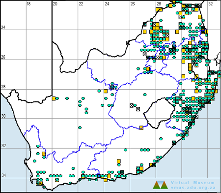
The next map below is an imputed map, produced by an interpolation algorithm, which attempts to generate a full distribution map from the partial information in the map above. This map will be improved by the submission of records to the OdonataMAP section of the Virtual Museum.

Ultimately, we will produce a series of maps for all the odonata species in the region. The current algorithm is a new algorithm. The objective is mainly to produce “smoothed” maps that could go into a field guide for odonata. This basic version of the algorithm (as mapped above) does not make use of “explanatory variables” (e.g. altitude, terrain roughness, presence of freshwater — we will be producing maps that take these variables into account soon). Currently, it only makes use of the OdonataMAP records for the species being mapped, as well as all the other records of all other species. The basic maps are “optimistic” and will generally show ranges to be larger than what they probably are.

These maps use the data in the OdonataMAP section of the Virtual Museum, and also the database assembled by the previous JRS funded project, which was led by Professor Michael Samways and Dr KD Dijkstra.

Banded Skimmer Orthetrum brachiale – Male
Selinda, Botswana
Photo by Ryan Tippett

Further Resources

The use of photographs by Gary Brown and R. de Cauwer is acknowledged. All other photographs by Ryan Tippett.

Banded Skimmer Orthetrum brachiale (Palisot de Beauvois, 1817)

Other common names: River Skimmer, Tough Skimmer, Strong Skimmer (Alt. English); Gebande Skepper (Afrikaans)

Recommended citation format: Loftie-Eaton M; Navarro R; Tippett RM; Underhill L. 2025. Banded Skimmer Orthetrum brachiale. Biodiversity and Development Institute. Available online at https://thebdi.org/2020/05/25/banded-skimmer-orthetrum-brachiale/

References: Tarboton, M; Tarboton, W. (2019). A Guide to the Dragonflies & Damselflies of South Africa. Struik Nature.

Samways, MJ. (2008). Dragonflies and Damselflies of South Africa. Pensoft

Samways, MJ. (2016). Manual of Freshwater Assessment for South Africa: Dragonfly Biotic Index. Suricata 2. South African National Biodiversity Institute, Pretoria

Martens, A; Suhling, F. (2007). Dragonflies and Damselflies of Namibia. Gamsberg Macmillan.

Banded Skimmer Orthetrum brachiale – Mature male
Near Kosi Bay, KwaZulu-Natal
Photo by Ryan Tippett

Similar Species

Southern Banded Groundling (Brachythemis leucosticta)

Cover Photo by Gareth Yearsley.

Find this species in the FBIS database (Freshwater Biodiversity Information System) here.

Family Libellulidae

Identification

Southern Banded Groundling Brachythemis leucosticta – Male
Mkhuze Game Reserve, KwaZulu-Natal
Photo by Ryan Tippett

Small size

Length up to 33mm; Wingspan attains 57mm.

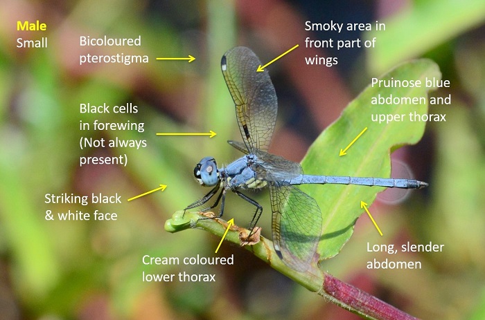
Male Banded Groundlings are distinctive and easily recognised. They are unlike any other southern African species.

Females are yellowish-brown and lack the dark wing panels of the males. They can be mistaken for a female Dropwing (Trithemis spp.) or the Banded Duskdarter (Parazyxomma flavicans). These species however, lack the bi-coloured pterostigmas and can be further differentiated by wing venation, habitat and behaviour.

Click here for more details on identification.

Southern Banded Groundling Brachythemis leucosticta – Female
Imfolozi Game Reserve, KwaZulu-Natal
Photo by Ryan Tippett

Habitat

The Southern Banded Groundling frequents open areas adjacent to almost any freshwater habitat, mostly in dry savanna areas. This includes rivers, dams, pans and marshes. The Southern Banded Groundling favours sites with bare ground such as sand, gravel and mud. Non-breeding individuals may be found far from water.

Habitat – Short grass and bare ground alongside a savanna pan.
Nsumo Pan, Mkhuze Game Reserve, KwaZulu-Natal
Photo by Ryan Tippett

Behaviour

The Southern Banded Groundling sits in exposed positions, often on or close to the ground. Breeding males sit on vegetation overhanging the water and also on waterlilies. The Southern Banded Groundling is often gregarious and females are found alongside the males. They are frequently tame and confiding. Groups or individuals regularly follow humans and animals to catch small insects that get flushed from the grass.

Most active from September to May, but may be active throughout the year in warmer regions (see Phenology below).

Southern Banded Groundling Brachythemis leucosticta – Male
Hluhluwe River Floodplain, KwaZulu-Natal
Photo by Ryan Tippett

Status and Conservation

The Southern Banded Groundling is abundant and widespread. It is listed as of Least Concern in the IUCN Red List of Threatened Species. The Southern Banded Groundling is an adaptable species that is often common in disturbed habitats.

Southern Banded Groundling Brachythemis leucosticta – Male
Near Ixopo, KwaZulu-Natal
Photo by Ryan Tippett

Distribution

The Southern Banded Groundling occurs widely through East and Central Africa and down to the northern parts of South Africa. In South Africa, it is mostly absent from the Western Cape, Karoo and colder parts of the Highveld.

Below is a map showing the distribution of records for Southern Banded Groundling in the OdonataMAP database as at February 2020.

Below is a map showing the distribution of records for Southern Banded Groundling in the OdonataMAP database as of December 2024.

The next map below is an imputed map, produced by an interpolation algorithm, which attempts to generate a full distribution map from the partial information in the map above. This map will be improved by the submission of records to the OdonataMAP section of the Virtual Museum.

Ultimately, we will produce a series of maps for all the odonata species in the region. The current algorithm is a new algorithm. The objective is mainly to produce “smoothed” maps that could go into a field guide for odonata. This basic version of the algorithm (as mapped above) does not make use of “explanatory variables” (e.g. altitude, terrain roughness, presence of freshwater — we will be producing maps that take these variables into account soon). Currently, it only makes use of the OdonataMAP records for the species being mapped, as well as all the other records of all other species. The basic maps are “optimistic” and will generally show ranges to be larger than what they probably are.

These maps use the data in the OdonataMAP section of the Virtual Museum, and also the database assembled by the previous JRS funded project, which was led by Professor Michael Samways and Dr KD Dijkstra.
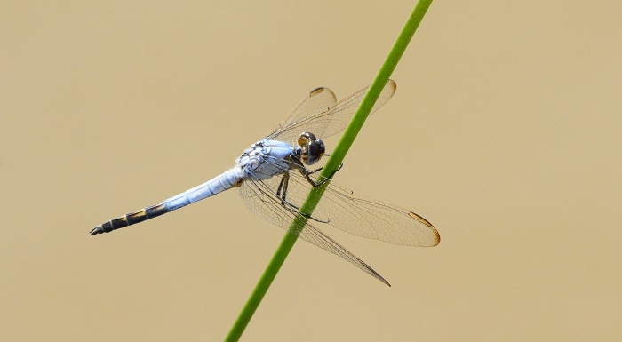
Southern Banded Groundling Brachythemis leucosticta – Male
Sappi Stanger Bird Sanctuary, KwaZulu-Natal
Photo by Ryan Tippett

Phenology

Southern Banded Groundling Brachythemis leucosticta
Amakhosi Game Reserve, KwaZulu-Natal
Photo by Ryan Tippett

Further Resources

The use of photographs by Gareth Yearsley is acknowledged. All other photographs by Ryan Tippett.

Southern Banded Groundling Brachythemis leucosticta (Burmeister, 1839)

Other common names: Banded Groundling (Alt. English); Suidelike Gebande Grondwagtertjie (Afrikaans)

Recommended citation format: Loftie-Eaton M; Navarro R; Tippett RM; Underhill L. 2025. Southern Banded Groundling Brachythemis leucosticta. Biodiversity and Development Institute. Available online at https://thebdi.org/2020/05/25/southern-banded-groundling-brachythemis-leucosticta/

References: Tarboton, M; Tarboton, W. (2019). A Guide to the Dragonflies & Damselflies of South Africa. Struik Nature.

Samways, MJ. (2008). Dragonflies and Damselflies of South Africa. Pensoft

Samways, MJ. (2016). Manual of Freshwater Assessment for South Africa: Dragonfly Biotic Index. Suricata 2. South African National Biodiversity Institute, Pretoria

Martens, A; Suhling, F. (2007). Dragonflies and Damselflies of Namibia. Gamsberg Macmillan.
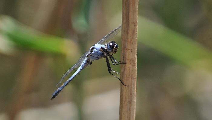
Southern Banded Groundling Brachythemis leucosticta – Male
Mpempe Pan, KwaZulu-Natal
Photo by Ryan Tippett

Similar Species

Yellow Presba (Syncordulia gracilis)

Cover photo by Gregg Darling.

Find the Yellow Presba in the FBIS database (Freshwater Biodiversity Information System) here.

Family Synthemistidae

Identification

Yellow Presba Syncordulia gracilis – Male
Kogelberg Nature Reserve, Western Cape
Photo by Niall Perrins

Medium-large size

Length up to 48mm; Wingspan attains 70mm.

The Yellow Presba is easily differentiated from other presba species by the two diagonal yellow stripes on the sides of the thorax. The sexes are similar, but females have broader abdomens and a more pronounced amber wash in the wings.

Yellow Presbas most resemble the Rustic Presba (Syncordulia Serendipator) and Gilded Presba (Syncordulia legator), however, neither of these species show well defined yellow stripes on the sides of the thorax. They also have differently patterned abdomens.

Click here for more details on identification of the Yellow Presba.

Habitat

The Yellow Presba frequents rivers and streams, in mountainous fynbos and grassland habitats. It requires clear, flowing water with rocks and bushy streamside vegetation. The Yellow Presba spends much of its time away from water, foraging over the surrounding fynbos or grasslands.

Habitat – Kogelberg Nature Reserve, Western Cape
Photo by Corné Rautenbach

Behaviour

The Yellow Presba is infrequently found at water and is most often encountered away from water, hunting over low bushy vegetation. It rests up in dense bushes where it is well camouflaged. Like other presbas, the Yellow Presba hangs from a branch when perched.

On the wing from mid October to late January. See Phenology below.

Yellow Presba Syncordulia gracilis – Female
Photo by John Wilkinson

Status and Conservation

The Yellow Presba is uncommon, but still the most regularly encountered Syncordulia species. Listed as Vulnerable in the IUCN Red List of Threatened Species. Yellow Presbas are only found in undisturbed environments and are not tolerant of habitat degradation.

Yellow Presba Syncordulia gracilis – Male
Photo by Desire Darling

Distribution

The Yellow Presba is endemic to South Africa. It is most regular in the Western Cape. Additionally, there are records of this species from the Drakensberg regions of the Eastern Cape and KwaZulu-Natal, where it is rare but likely to have been overlooked and under-recorded.

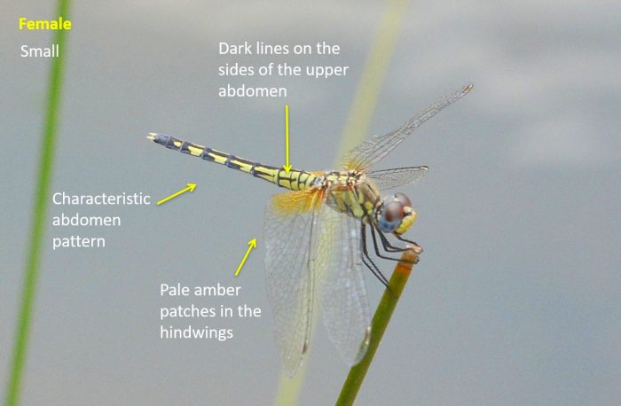
Yellow Presba Syncordulia gracilis – Female
Photo by Hesmarie Els

Below is a map showing the distribution of records for Yellow Presba in the OdonataMAP database as at February 2020.

Below is a map showing the distribution of records for Yellow Presba in the OdonataMAP database as of December 2024.

The next map below is an imputed map, produced by an interpolation algorithm, which attempts to generate a full distribution map from the partial information in the map above. This map will be improved by the submission of records to the OdonataMAP section of the Virtual Museum.

Ultimately, we will produce a series of maps for all the odonata species in the region. The current algorithm is a new algorithm. The objective is mainly to produce “smoothed” maps that could go into a field guide for odonata. This basic version of the algorithm (as mapped above) does not make use of “explanatory variables” (e.g. altitude, terrain roughness, presence of freshwater — we will be producing maps that take these variables into account soon). Currently, it only makes use of the OdonataMAP records for the species being mapped, as well as all the other records of all other species. The basic maps are “optimistic” and will generally show ranges to be larger than what they probably are.

These maps use the data in the OdonataMAP section of the Virtual Museum, and also the database assembled by the previous JRS funded project, which was led by Professor Michael Samways and Dr KD Dijkstra.

Yellow Presba Syncordulia gracilis – Female
Photo by John Wilkinson

Phenology

Yellow Presba Syncordulia gracilis – Male
Photo by Desire Darling

Further Resources

The use of photographs by Basil Boer, Corné Rautenbach, Desire Darling, Hesmarie Els, and John Wilkinson is acknowledged.

Yellow Presba Syncordulia gracilis Burmeister, 1839

Other Common names: Geelswalker (Afrikaans)

Recommended citation format: Loftie-Eaton M; Navarro R; Tippett RM; Underhill L. 2025. Yellow Presba Syncordulia gracilis. Biodiversity and Development Institute. Available online at https://thebdi.org/2020/05/25/yellow-presba-syncordulia-gracilis/
References: Tarboton, M; Tarboton, W. (2019). A Guide to the Dragonflies & Damselflies of South Africa. Struik Nature.

Samways, MJ. (2008). Dragonflies and Damselflies of South Africa. Pensoft

Samways, MJ. (2016). Manual of Freshwater Assessment for South Africa: Dragonfly Biotic Index.Suricata 2. South African National Biodiversity Institute, Pretoria

Similar Species

Bold Leaftail (Phyllogomphus selysi)

Cover photo by Ronelle White.

Find the Bold Leaftail in the FBIS database (Freshwater Biodiversity Information System) here.

Family Gomphidae

Identification

Bold Leaftail Phyllogomphus selysi – Male
Kosi Bay, KwaZulu-Natal
Photo by Ryan Tippett
Very Large

Length attains 70mm; Wingspan reaches 95mm.

The Bold Leaftail is an impressive and distinctive species. It may be confused with the slightly larger Ictinogomphus ferox (Common Tigertail), but that species is paler and appears yellow with black markings while Phyllogomphus selysi appears black-brown with yellow markings.

The Bold Leaftail may also be mistaken for Neurogomphus zambeziensis (Zambezi siphontail), but that species is decidedly smaller and paler with less conspicuous foliations on the abdomen.

Female Bold Leaftails resemble the males but are more robust and have smaller foliations on the tail, which may sometimes be absent.

Click here for more details on identification of the Bold Leaftail.

A male Bold Leaftail Phyllogomphus selysi showing the large foliations on the abdomen.
Siyadla River, KwaZulu-Natal
Photo by Ryan Tippett
Habitat
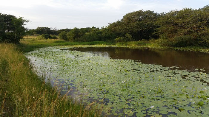
The Bold Leaftail inhabits hot savanna and forest regions where it occupies the wooded or forested fringes of rivers and streams. They appear to prefer open clearings with bushes near slow moving sections of rivers.

Habitat – Clearing next to a small river in coastal forest.
Kosi Bay, KwaZulu-Natal
Photo by Ryan Tippett
Behaviour

The Bold leaftail hunts from a perch and has a swift, powerful flight. They mostly perch on exposed twigs and branches on top of bushes, usually within two meters of the ground. Adults spend relatively little time at water and are more often found away from the river. Individuals are known to rest in the tree-tops when not hunting. The Bold Leaftail can be fairly confiding but remains alert, and will fly high and far once disturbed. Phyllogomphus selysi is elusive and seldom seen, and may be largely crepuscular in its activity.

Bold Leaftail Phyllogomphus selysi – Female
Near Tshipise, Limpopo
Photo by John Wilkinson

Status and Conservation

The Bold Leaftail is a rare and localised species in South Africa. Phyllogomphus selysi reaches its southern limit in north-eastern South Africa where it is marginal and known from relatively few sites. It is listed as of Least Concern in the IUCN Red List of Threatened species. This is due to its wide distribution in tropical Africa. The Bold Leaftail is mostly found in undisturbed habitats.

Bold Leaftail Phyllogomphus selysi – Male
Siyadla River, KwaZulu-Natal
Photo by Ryan Tippett
Distribution

Phyllogomphus selysi is a tropical species found in Central, Eastern and Southern Africa. Occuring from Cameroon across to Kenya and down through central Africa to Botswana, Zimbabwe, Mozambique, and South Africa. Its distribution in South Africa is limited to the Limpopo and Mpumalanga lowveld areas and extreme NE KwaZulu-Natal.

Below is a map showing the distribution of records for Bold Leaftail in the OdonataMAP database as at February 2020.

Below is a map showing the distribution of records for Bold Leaftail in the OdonataMAP database as at December 2024.

The next map below is an imputed map, produced by an interpolation algorithm, which attempts to generate a full distribution map from the partial information in the map above. This map will be improved by the submission of records to the OdonataMAP section of the Virtual Museum.

Ultimately, we will produce a series of maps for all the odonata species in the region. The current algorithm is a new algorithm. The objective is mainly to produce “smoothed” maps that could go into a field guide for odonata. This basic version of the algorithm (as mapped above) does not make use of “explanatory variables” (e.g. altitude, terrain roughness, presence of freshwater — we will be producing maps that take these variables into account soon). Currently, it only makes use of the OdonataMAP records for the species being mapped, as well as all the other records of all other species. The basic maps are “optimistic” and will generally show ranges to be larger than what they probably are.

These maps use the data in the OdonataMAP section of the Virtual Museum, and also the database assembled by the previous JRS funded project, which was led by Professor Michael Samways and Dr KD Dijkstra.

Phenology

Bold Leaftail Phyllogomphus selysi – Male
Near Tshipise, Limpopo
Photo by John Wilkinson

Further Resources

The use of photographs by John Wilkinson and Ronelle White is acknowledged. Other photographs by Ryan Tippett.

Bold Leaftail Phyllogomphus selysi Schouteden, 1933

Other Common Names: Lowerstert (Afrikaans).

Recommended citation format: Loftie-Eaton M; Navarro R; Tippett RM; Underhill L. 2025. Bold Leaftail Phyllogomphus selysi. Biodiversity and Development Institute. Available online at https://thebdi.org/2020/05/25/bold-leaftail-phyllogomphus-selysi/
References: Tarboton, M; Tarboton, W. (2019). A Guide to the Dragonflies & Damselflies of South Africa. Struik Nature.

Samways, MJ. (2008). Dragonflies and Damselflies of South Africa. Pensoft

Samways, MJ. (2016). Manual of Freshwater Assessment for South Africa: Dragonfly Biotic Index. Suricata 2. South African National Biodiversity Institute, Pretoria

Martens, A; Suhling, F. (2007). Dragonflies and Damselflies of Namibia. Gamsberg Macmillan.

Similar Species