View the above photo record (by Georg Jacobs) in OdonataMAP here.
Find the Little Duskhawker in the FBIS database (Freshwater Biodiversity Information System) here.
Family Aeshnidae
Gynacantha manderica – LITTLE DUSKHAWKER
Identification
Large size
Length reaches 68mm; Wingspan attains 87mm.
Despite its large size Gynacantha manderica is the smallest Gynacantha species in South Africa.
Most closely resembles Gynacantha usambarica but that species is green rather than light brown and has 21 to 27 Ax veins in the forewing. Gynacantha manderica has 13-19 Ax veins in the forewing. The two species also have differently shaped black markings on the forehead. May also be mistaken for Gynacantha villosa (Brown Duskhawker) but that species is far larger and has 22-28 Ax veins in the forewing and a four-celled anal triangle.
The sexes are similar.
Click here for more details on identification of the Little Duskhawker.

Richardsbay, KwaZulu-Natal
Photo by Diana Russell
Habitat
Frequents pools, rivers, streams and lakes surrounded by dense woodland and forests. Also found away from water, hunting in forest clearings.
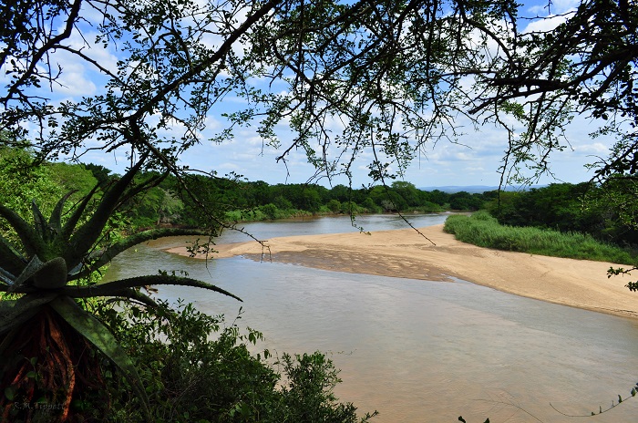
Photo by Ryan Tippett
Behaviour
Crepuscular, spending the day hidden in the shade of dense vegetation. Emerges to hunt at dawn and dusk, but also on warm overcast days. Often gregarious when foraging and frequently joins mixed species hunting swarms at dusk.
Hangs vertically from a perch when at rest.
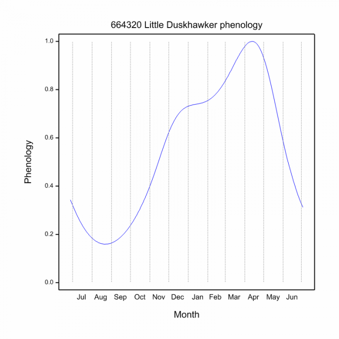
On the wing from September to April.
Status and Conservation
Uncommon and localised in South Africa. Listed as of Least Concern in the IUCN Red List of Threatened Species.
Distribution
Gynacantha manderica is confined to Sub-Saharan Africa where it is fairly widespread from West Africa, across to East Africa and down to Southern Africa.
In South Africa it is found in the North and East where it is thinly distributed.
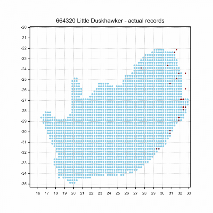
Below is a map showing the distribution of records for Little Duskhawker in the OdonataMAP database as at February 2020.
The next map below is an imputed map, produced by an interpolation algorithm, which attempts to generate a full distribution map from the partial information in the map above. This map will be improved by the submission of records to the OdonataMAP section of the Virtual Museum.
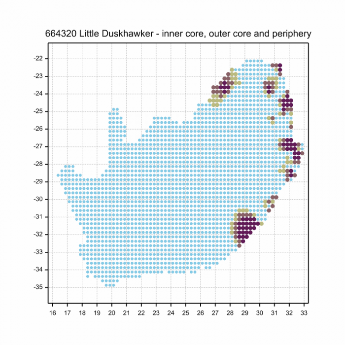
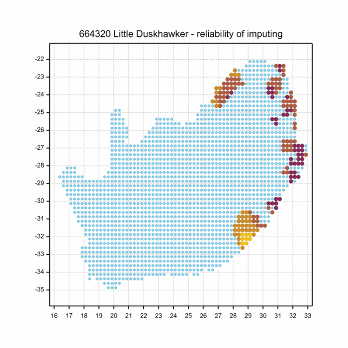
Ultimately, we will produce a series of maps for all the odonata species in the region. The current algorithm is a new algorithm. The objective is mainly to produce “smoothed” maps that could go into a field guide for odonata. This basic version of the algorithm (as mapped above) does not make use of “explanatory variables” (e.g. altitude, terrain roughness, presence of freshwater — we will be producing maps that take these variables into account soon). Currently, it only makes use of the OdonataMAP records for the species being mapped, as well as all the other records of all other species. The basic maps are “optimistic” and will generally show ranges to be larger than what they probably are.
These maps use the data in the OdonataMAP section of the Virtual Museum, and also the database assembled by the previous JRS funded project, which was led by Professor Michael Samways and Dr KD Dijkstra.