Cover photo by John Wilkinson.
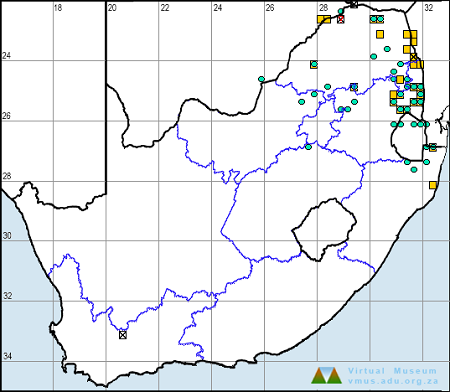
Find this species in the FBIS database (Freshwater Biodiversity Information System) here.
Family Libellulidae
Identification

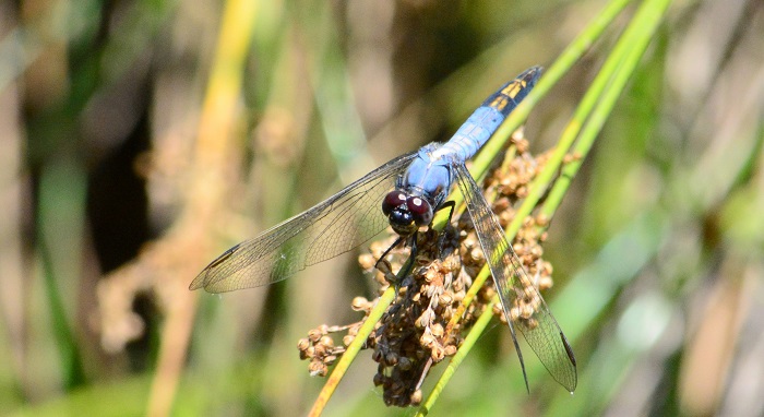
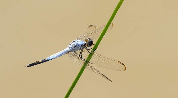
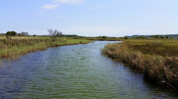
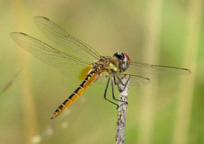
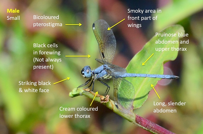
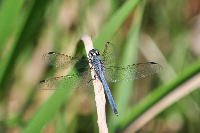
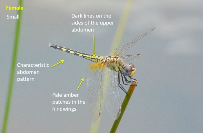
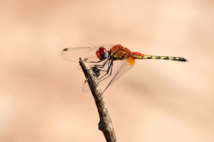
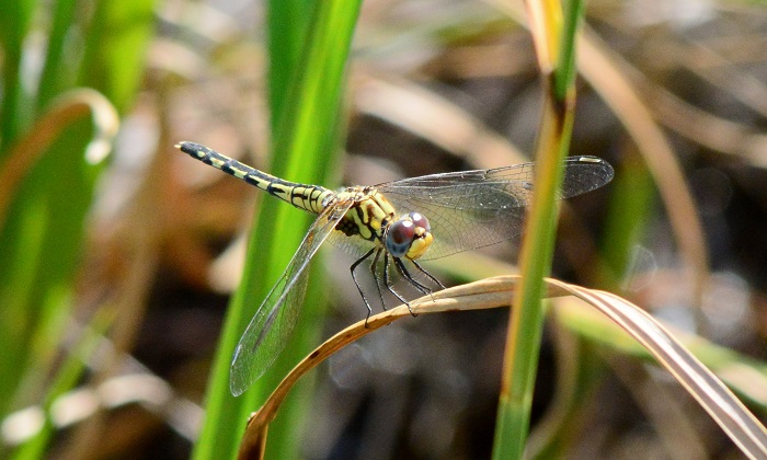
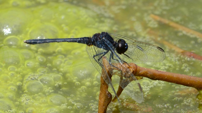
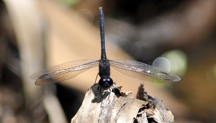
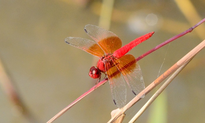
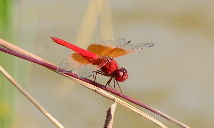
Amanzimtoti, KwaZulu-Natal
Photo by Christopher Peter Small
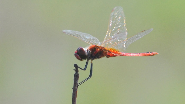
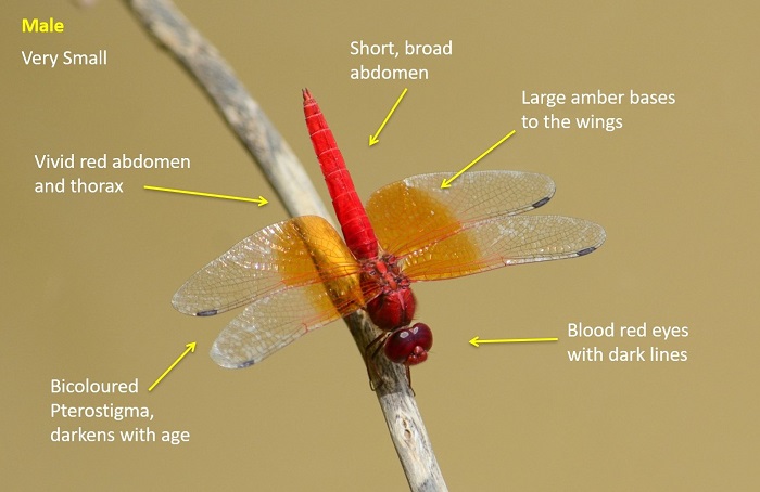
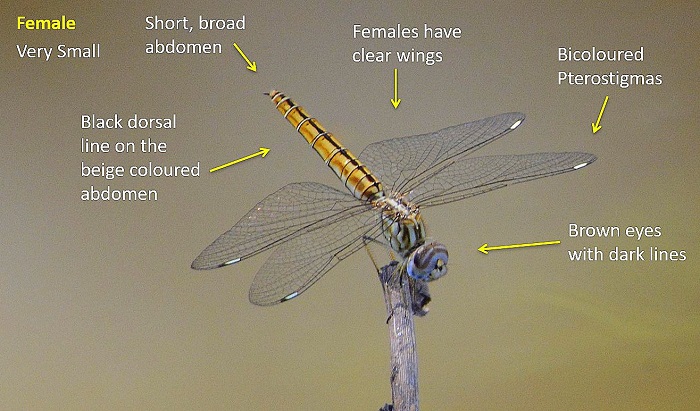
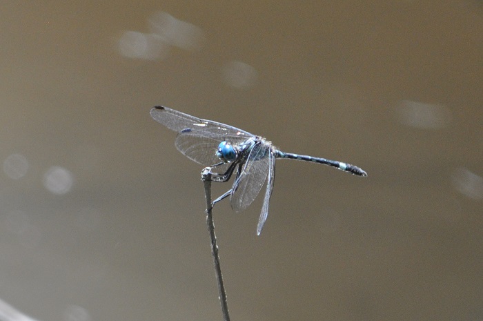
Small size
Length up to 33mm; Wingspan attains 51mm.
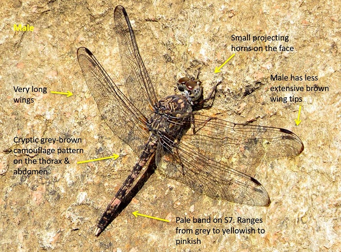
The males of this species are unmistakable within the sub-region. The combination of mottled black and blue-green colouration, bright turquoise eyes and pale band on the S7 are diagnostic.
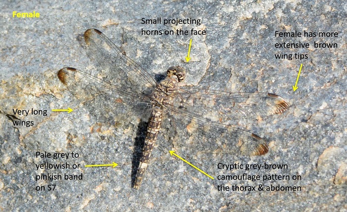
Female Eastern Forestwatchers are easily confused with those of the Black-splashed Elf (Tetrathemis polleni). The two species differ in the shape of the discoidal cell (DC) in the fore wings. Notiothemis jonesi has a triangular DC, while Tetrathemis polleni has a four-sided DC.
There is another closely related species, Notiothemis robertsi, found in the tropical forests of East, Central and West Africa.
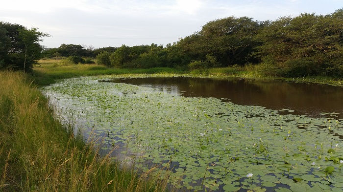
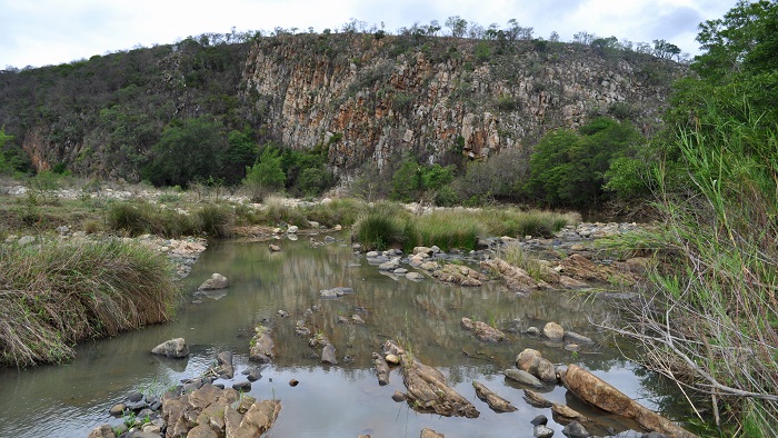
Habitat
The Eastern Forestwatcher frequents shady, slow moving stretches of forested streams and pools. It occurs in coastal, riverine, and swamp forests in South Africa.
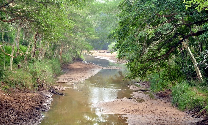
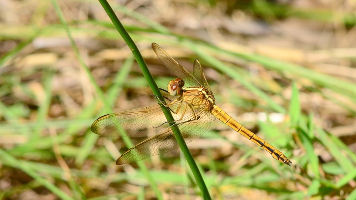
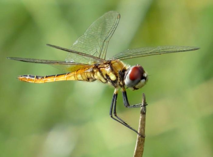
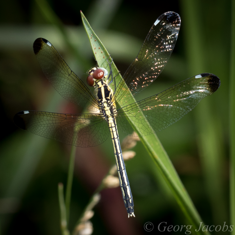
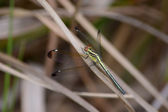
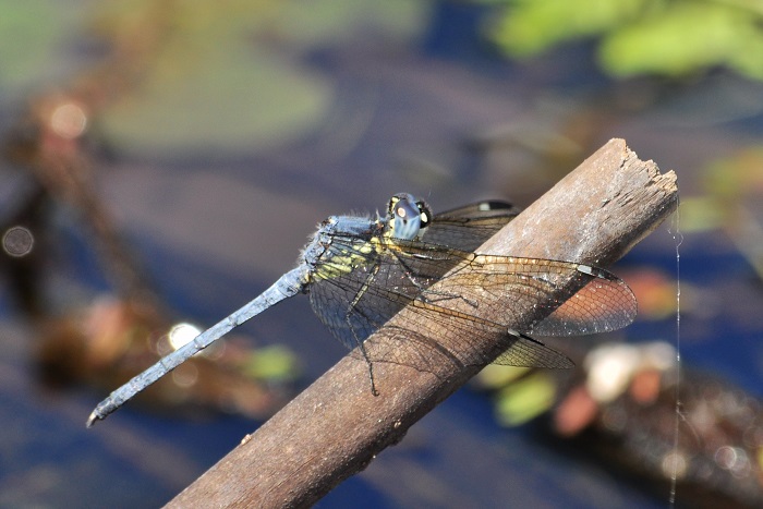
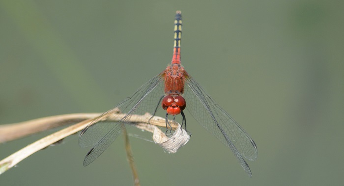
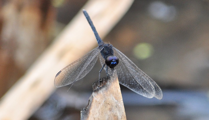
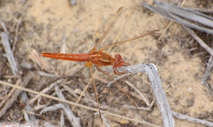
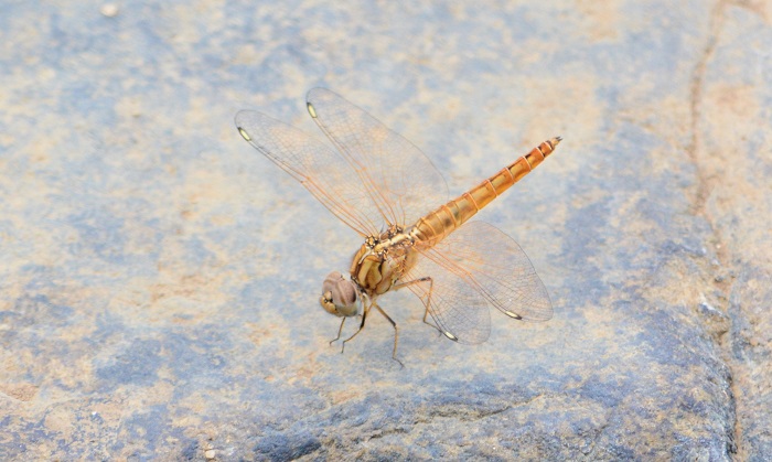
Mkuze Game Reserve, KwaZulu-Natal
Photo by Ryan Tippett
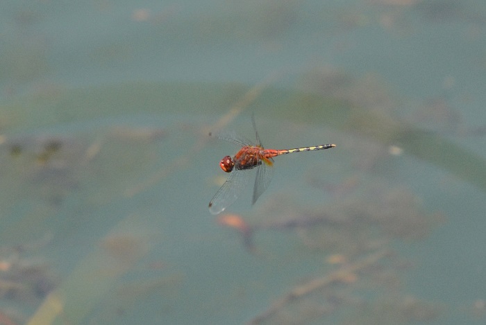
Behaviour
The Eastern Forest Watcher perches on twigs or vegetation over the water. It is usually found in areas of dappled light. The Eastern Forestwatcher is very alert and wary, heading into the canopy at the first sign of disturbance. Females are seldom encountered.
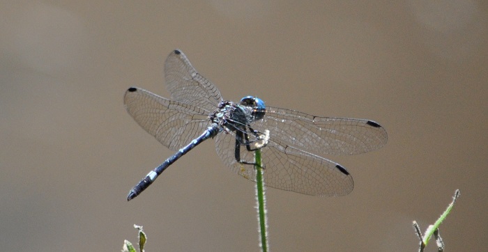
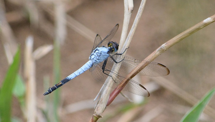
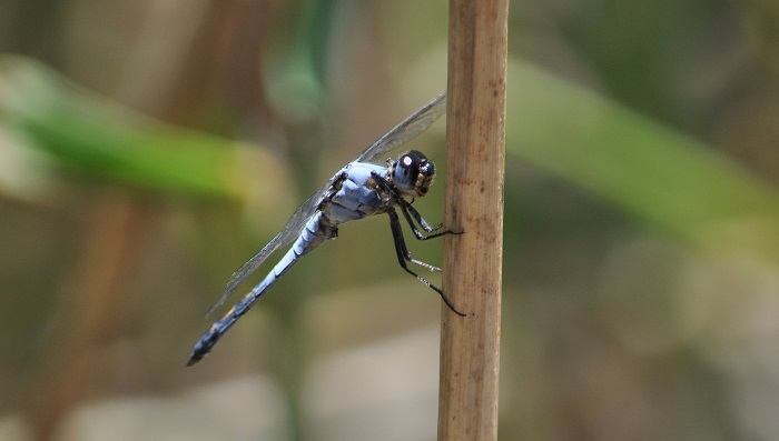
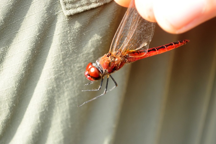
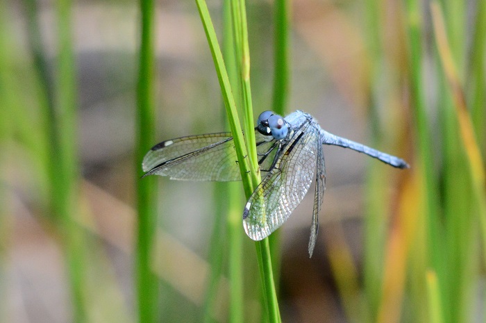
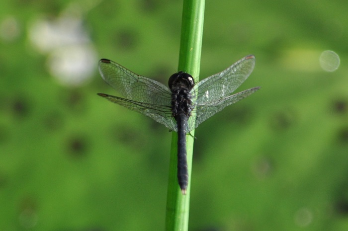
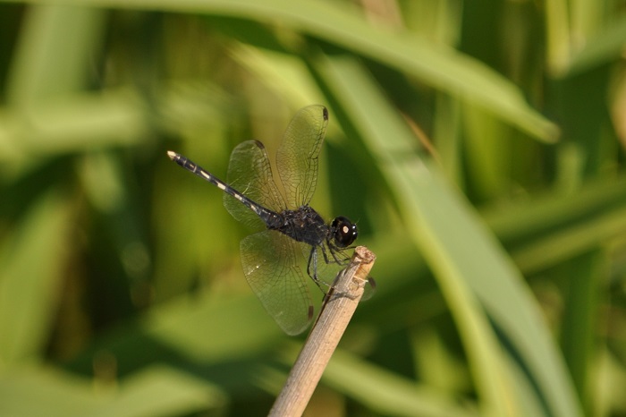
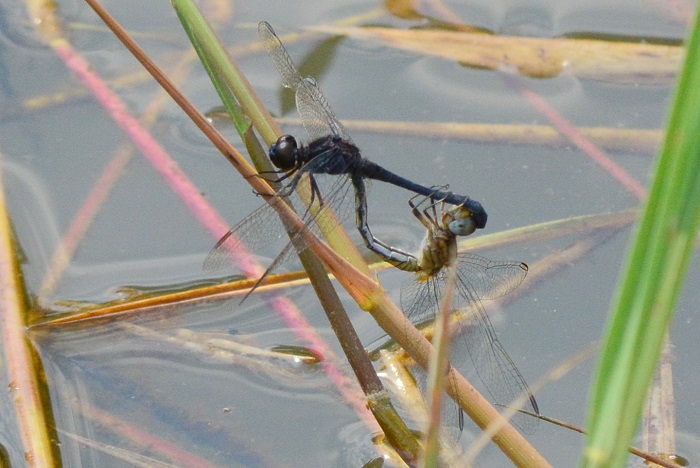
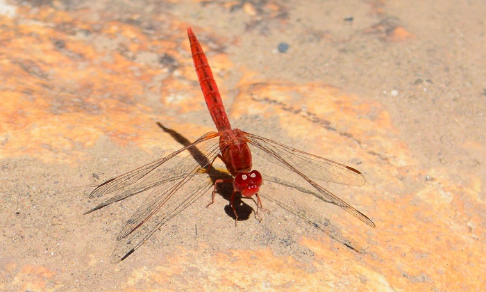
Pietermaritzburg, KwaZulu-Natal
Photo by Ryan Tippett
Status and Conservation
The Eastern Forestwatcher is uncommon and very localised in occurence. It is listed as of Least Concern in the IUCN Red List of Threatened Species. The Eastern Forestwatcher is mostly found in undisturbed habitats but does sometimes inhabit suitable man-made habitats like ornamental ponds and small, forested dams.
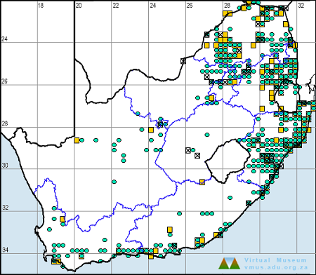
Distribution
Notiothemis jonesi is found in the tropical and subtropical parts of eastern and southern Africa. It occurs from Kenya to South Africa and has also been recorded in Swaziland, Mozambique, Zambia, Malawi, Tanzania, and Uganda.
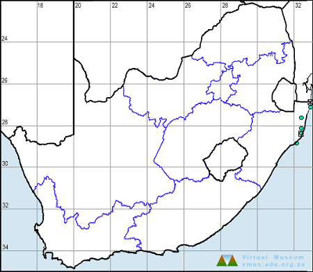
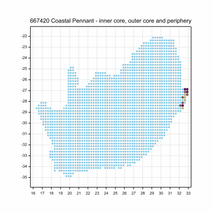
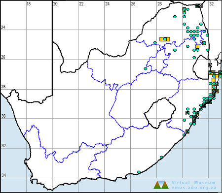
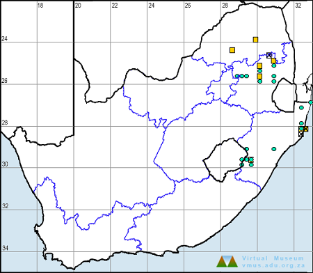
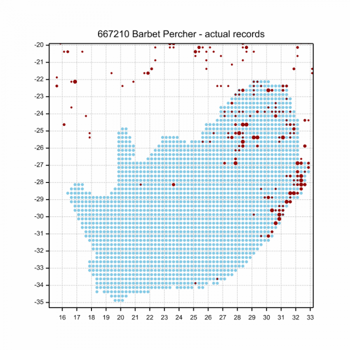
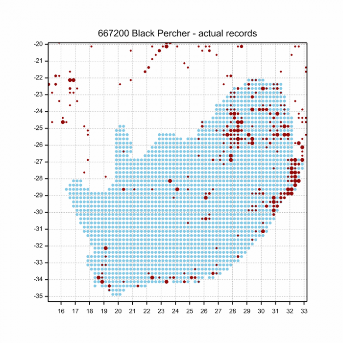
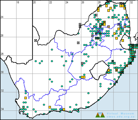
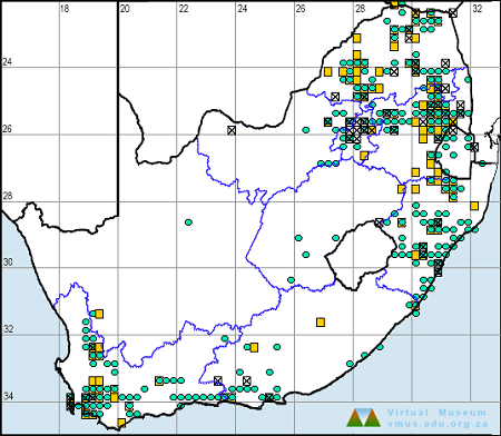
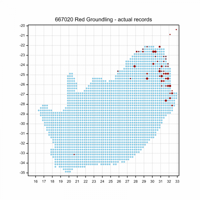
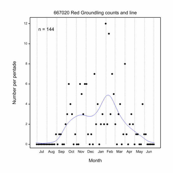
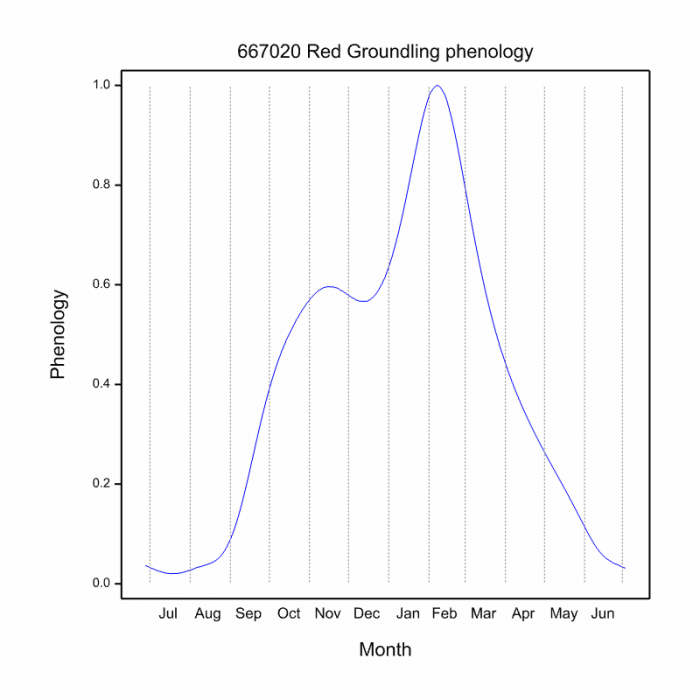
Below is a map showing the distribution of records for Eastern Forestwatcher in the OdonataMAP database as at February 2020.

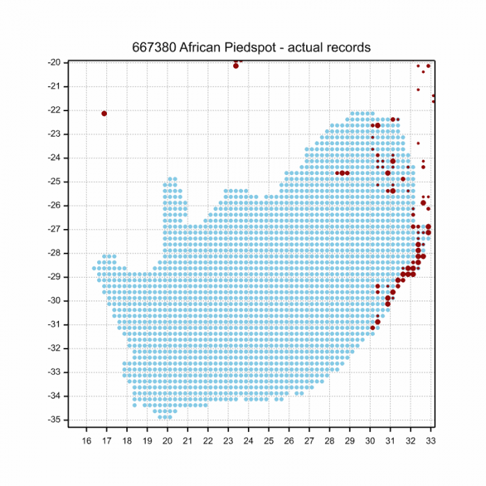
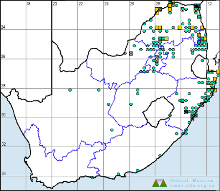
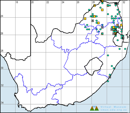
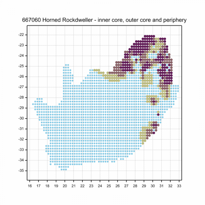
Below is a map showing the distribution of records for Eastern Forestwatcher in the OdonataMAP database as of December 2024.
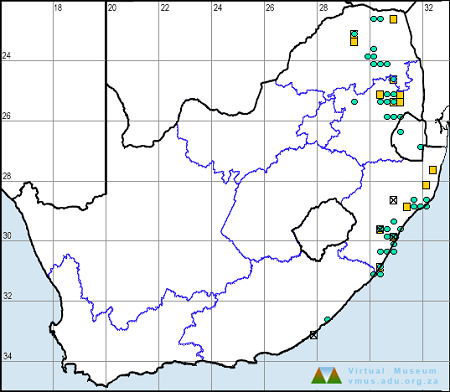
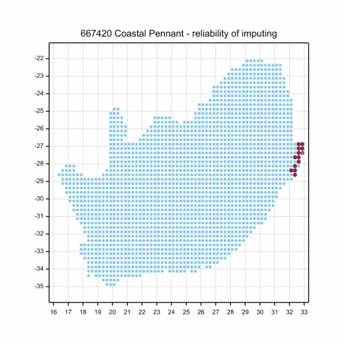
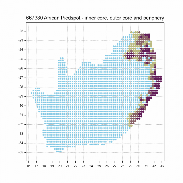
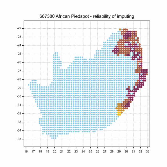
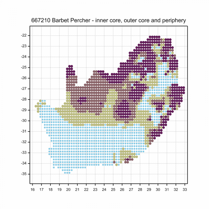
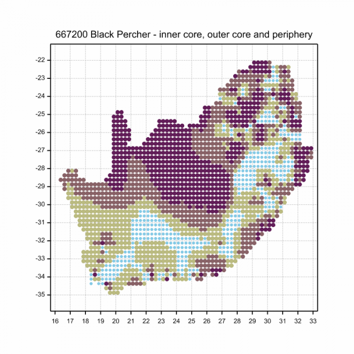
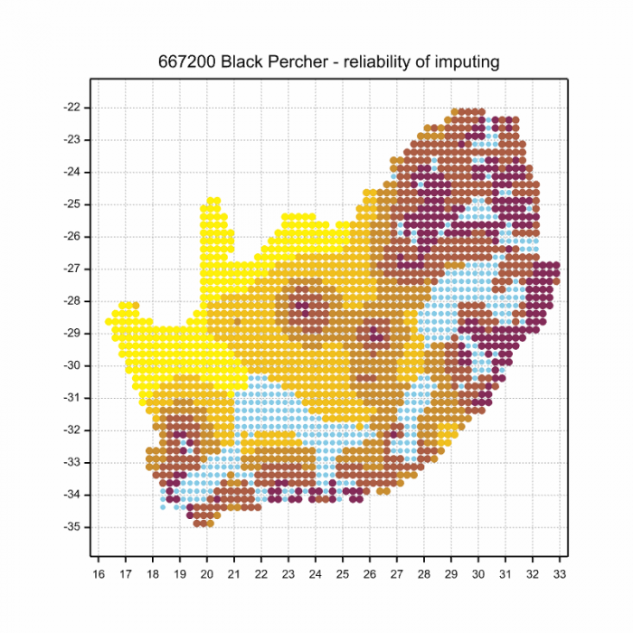
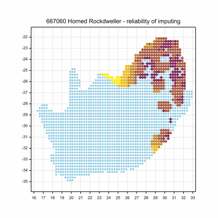
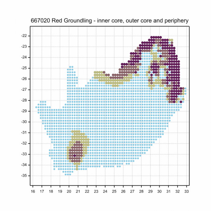
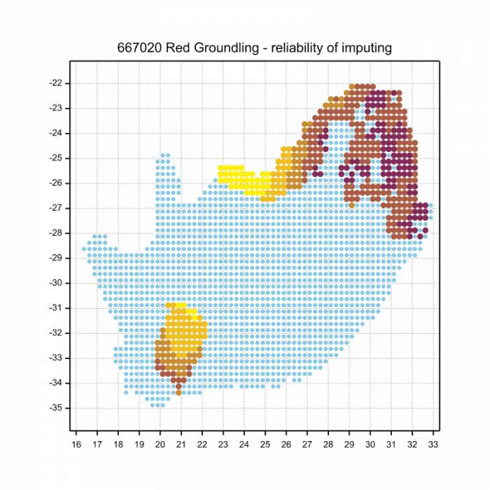
The next map below is an imputed map, produced by an interpolation algorithm, which attempts to generate a full distribution map from the partial information in the map above. This map will be improved by the submission of records to the OdonataMAP section of the Virtual Museum.


Ultimately, we will produce a series of maps for all the odonata species in the region. The current algorithm is a new algorithm. The objective is mainly to produce “smoothed” maps that could go into a field guide for odonata. This basic version of the algorithm (as mapped above) does not make use of “explanatory variables” (e.g. altitude, terrain roughness, presence of freshwater — we will be producing maps that take these variables into account soon). Currently, it only makes use of the OdonataMAP records for the species being mapped, as well as all the other records of all other species. The basic maps are “optimistic” and will generally show ranges to be larger than what they probably are.
These maps use the data in the OdonataMAP section of the Virtual Museum, and also the database assembled by the previous JRS funded project, which was led by Professor Michael Samways and Dr KD Dijkstra.
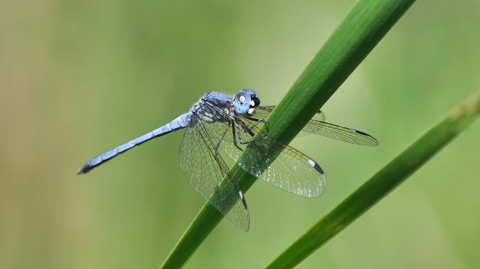
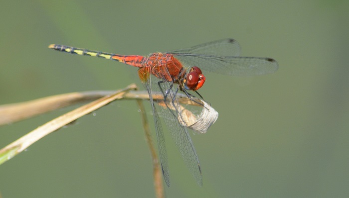
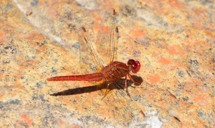
Pietermaritzburg, KwaZulu-Natal
Photo by Ryan Tippett
Further Resources
The use of photographs by Christopher Peter Small and John Wilkinson is acknowledged. Other images by Ryan Tippett.
Eastern Forestwatcher Notiothemis jonesi Ris, 1919
Other common names: Jones’s Forestwatcher (Alt. English); Boswagter (Afrikaans)
Recommended citation format: Loftie-Eaton M; Navarro R; Tippett RM; Underhill L. 2025. Eastern Forestwatcher Notiothemis jonesi. Biodiversity and Development Institute. Available online at https://thebdi.org/2020/06/19/eastern-forestwatcher-notiothemis-jonesi/
References: Tarboton, M; Tarboton, W. (2019). A Guide to the Dragonflies & Damselflies of South Africa. Struik Nature.
Samways, MJ. (2008). Dragonflies and Damselflies of South Africa. Pensoft
Samways, MJ. (2016). Manual of Freshwater Assessment for South Africa: Dragonfly Biotic Index. Suricata 2. South African National Biodiversity Institute, Pretoria