
Cover photo by Chris Willis.
Find the Highland Skimmer in the FBIS database (Freshwater Biodiversity Information System) here.
Family Libellulidae
Identification
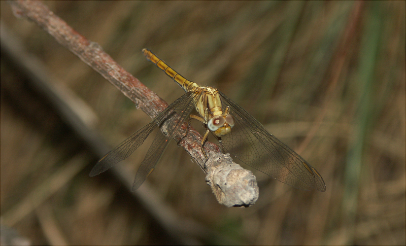
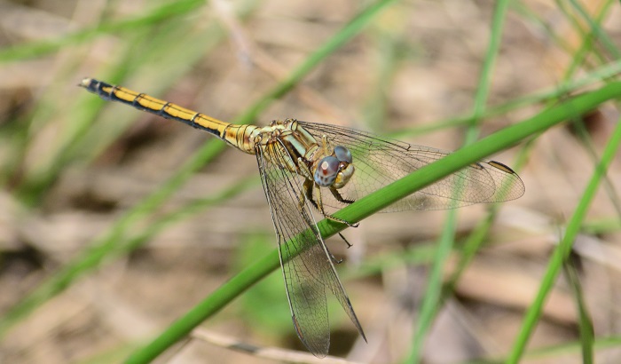
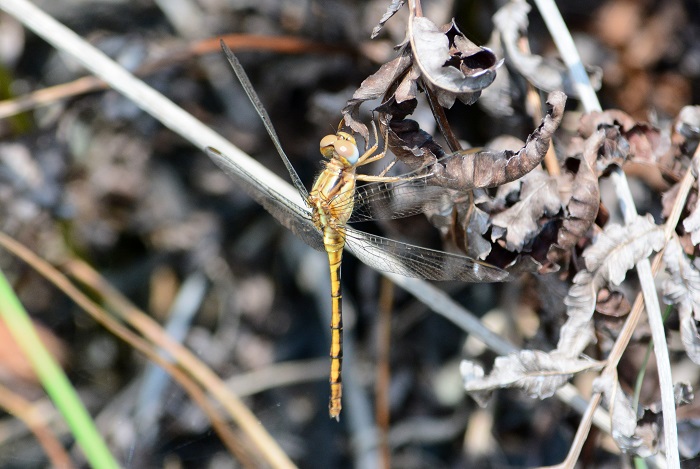
Near Helpmekaar, KwaZulu-Natal
Photo by Alan Manson
Medium sized
Length up to 44mm; Wingspan attains 66mm.
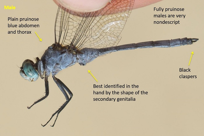
The Highland Skimmer is most similar to Orthetrum guineense (Guinea Skimmer). The two species were, until recently, thought to be conspecific. Mature males of the two species are problematic to identify in the field. They can only be identified definitively by the respective shapes of their secondary genitalia.
Immature males and females of Orthetrum machadoi can be recognised by the mostly unmarked thorax sides and the pair of truncated lines on the shoulders (diagnostic).
Click here for more details on identification of the Highland Skimmer.
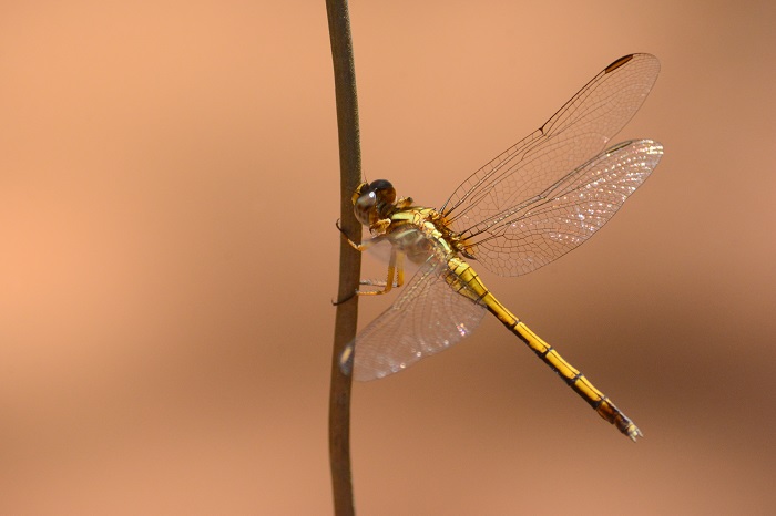
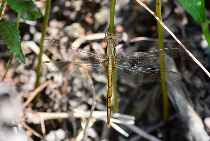
Pongola River near Jozini, KwaZulu-Natal
Photo by Ryan Tippett
Habitat
The Highland Skimmer inhabits the grass and bush fringes of floodplains, pans, marshes, dams and rivers. It is a mid altitude species in many areas but occurs to sea-level in KwaZulu-Natal.
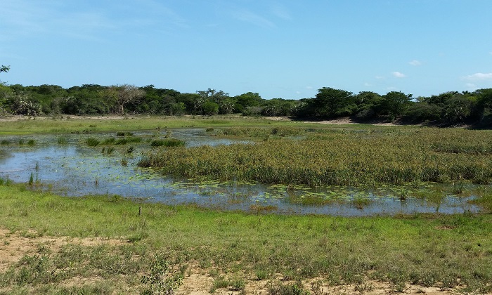
Photo by Ryan Tippett
Behaviour
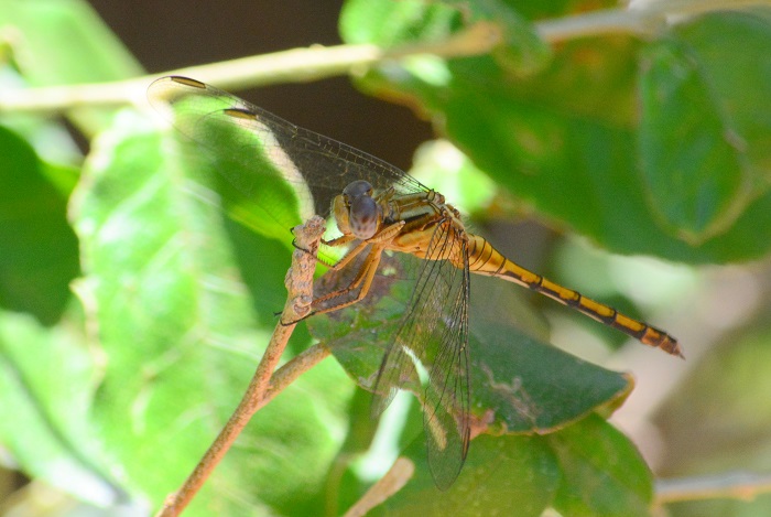
The Highland Skimmer hunts from a low perch or bare patches on the ground. It is often seen away from water in the surrounding grass and woodland. On the wing from October to April
Eastern Shores, iSimangaliso Wetland Park, KwaZulu-Natal
Photo by Ryan Tippett
Status and Conservation
The Highland Skimmer is fairly common in South Africa. It is listed as of Least Concern in the IUCN Red List of Threatened Species.
Kosi Bay, iSimangaliso Wetland Park, KwaZulu-Natal
Photo by Ryan Tippett
Distribution
Orthetrum machadoi is mainly a species of East and Southern Africa, with some scattered records across to northern Angola.
In South Africa, the Highland Skimmer is found primarily in the north and east, occuring as far south as the former Transkei, Eastern Cape. There are also scattered records from the southern parts of the Eastern Cape and the Western Cape, where the Highland Skimmer is scarce.
Pongola River near Jozini, KwaZulu-Natal
Photo by Ryan Tippett
Below is a map showing the distribution of records for Highland Skimmer in the OdonataMAP database as at February 2020.
Below is a map showing the distribution of records for Highland Skimmer in the OdonataMAP database as at February 2020.

Below is a map showing the distribution of records for Highland Skimmer in the OdonataMAP database as of December 2024.
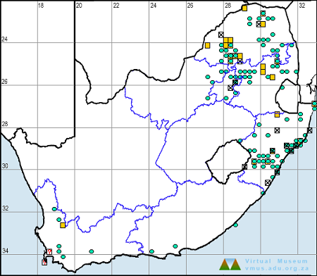
The next map below is an imputed map, produced by an interpolation algorithm, which attempts to generate a full distribution map from the partial information in the map above. This map will be improved by the submission of records to the OdonataMAP section of the Virtual Museum.
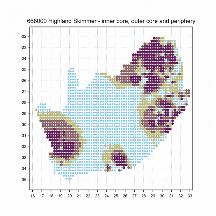
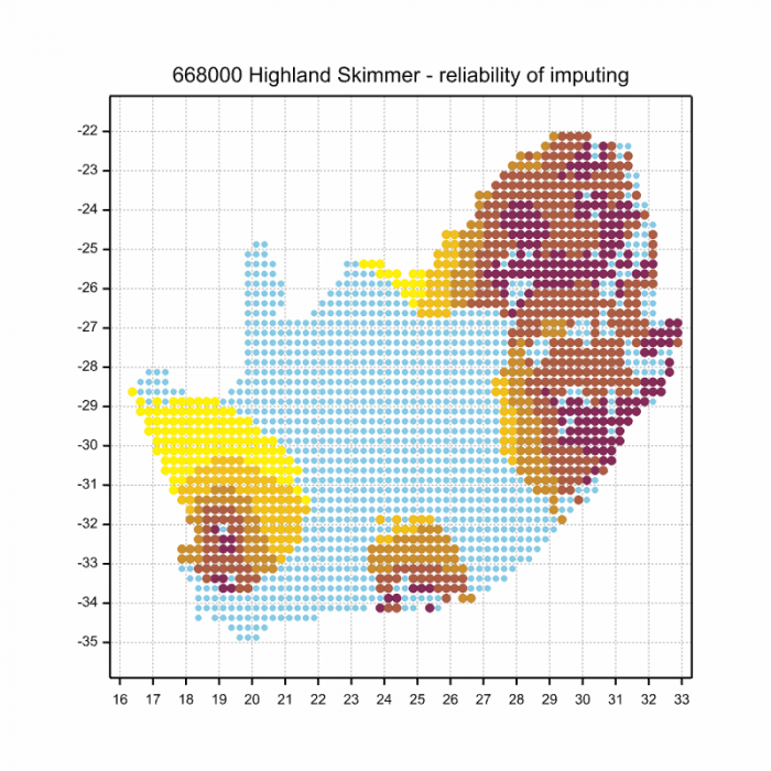
Ultimately, we will produce a series of maps for all the odonata species in the region. The current algorithm is a new algorithm. The objective is mainly to produce “smoothed” maps that could go into a field guide for odonata. This basic version of the algorithm (as mapped above) does not make use of “explanatory variables” (e.g. altitude, terrain roughness, presence of freshwater — we will be producing maps that take these variables into account soon). Currently, it only makes use of the OdonataMAP records for the species being mapped, as well as all the other records of all other species. The basic maps are “optimistic” and will generally show ranges to be larger than what they probably are.
These maps use the data in the OdonataMAP section of the Virtual Museum, and also the database assembled by the previous JRS funded project, which was led by Professor Michael Samways and Dr KD Dijkstra.
Kosi Bay, iSimangaliso Wetland Park, KwaZulu-Natal
Photo by Ryan Tippett
Further Resources
The use of photographs by Alan Manson and Christopher Willis is acknowledged. All other photographs by Ryan Tippett.
Highland Skimmer Orthetrum machadoi Longfield, 1955
Other common names: Machado’s Skimmer (Alt. English); Hooglandskepper (Afrikaans)
Recommended citation format: Loftie-Eaton M; Navarro R; Tippett RM; Underhill L. 2025. Highland Skimmer Orthetrum machadoi. Biodiversity and Development Institute. Available online at https://thebdi.org/2020/05/19/highland-skimmer-orthetrum-machadoi/
References: Tarboton, M; Tarboton, W. (2019). A Guide to the Dragonflies & Damselflies of South Africa. Struik Nature.
Samways, MJ. (2008). Dragonflies and Damselflies of South Africa. Pensoft
Samways, MJ. (2016). Manual of Freshwater Assessment for South Africa: Dragonfly Biotic Index. Suricata 2. South African National Biodiversity Institute, Pretoria
Martens, A; Suhling, F. (2007). Dragonflies and Damselflies of Namibia. Gamsberg Macmillan.