
Cover photo by John Wilkinson).
Find the Denim Dropwing in the FBIS database (Freshwater Biodiversity Information System) here.
Family Libellulidae
Identification
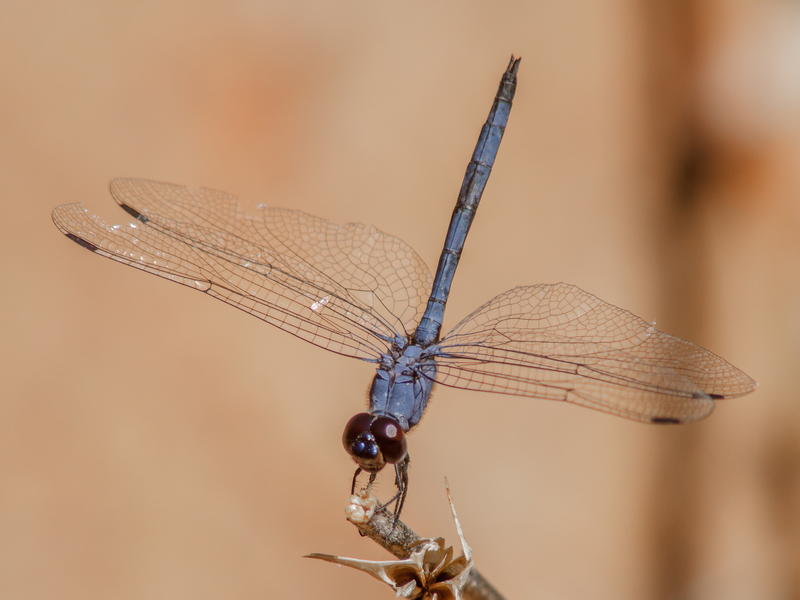
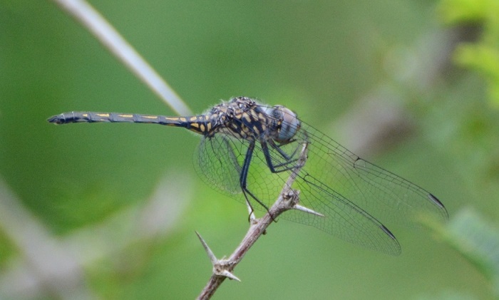
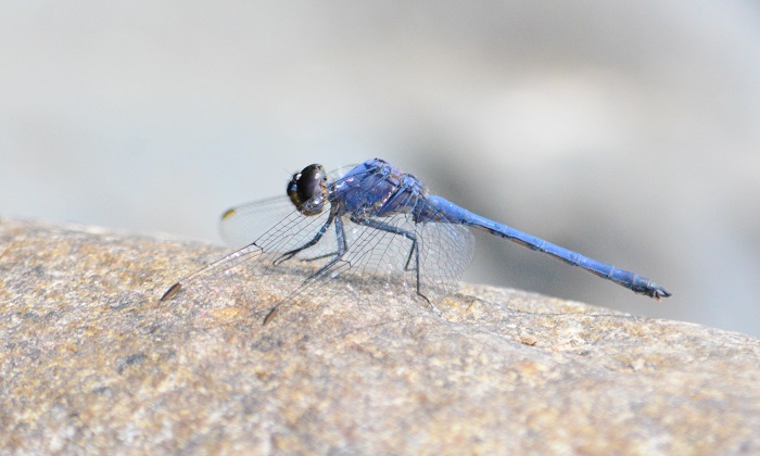
Mkuze River, KwaZulu-Natal
Photo by Ryan Tippett
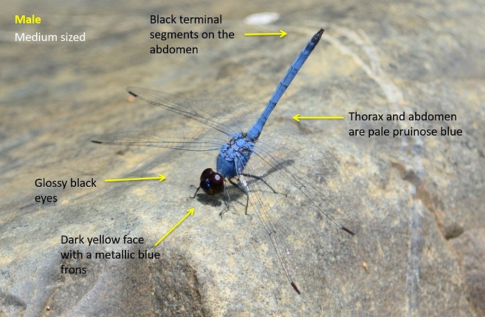
Medium-sized
Length up to 44mm; Wingspan reaches 71mm.
Male Denim Dropwings are recognisable by the uniformly pale blue body colouration and contrasting dark head and eyes. The black terminal segments on the abdomen are also a useful aid in identification.
Males could be confused with several other all-blue dragonflies, such as Skimmers (Orthetrum spp.) and the other blue dropwings (Trithemis spp.).
The Denim Dropwing is most similar to the Navy Dropwing (Trithemis furva), Highland Dropwing (Trithemis dorsalis), Silhouette Dropwing (Trithemis hecate) and Halfshade Dropwing (Trithemis aconita). The Denim dropwing can be told apart by its slightly larger size, paler blue colouration, contrasting black eyes, and black terminal tail segments.
Click here for more details on identification of the Denim Dropwing.
Mkuze River, KwaZulu-Natal
Photo by Ryan Tippett
Habitat
The Denim Dropwing inhabits shallow, rocky, and fast-flowing rivers, mostly in hot savanna regions. It requires rocks in or near the mid-stream for perching on. Denim Dropwing males are seldom found away from such sites. Females are generally found some distance from water in the surrounding woodland.
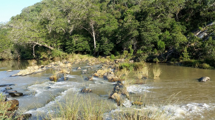
Photo by Ryan Tippett
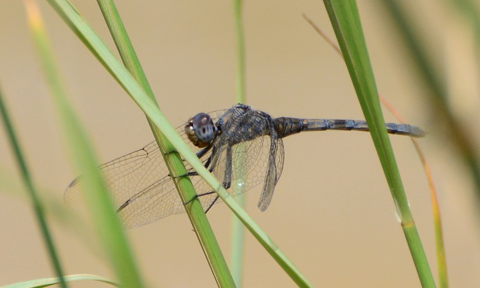
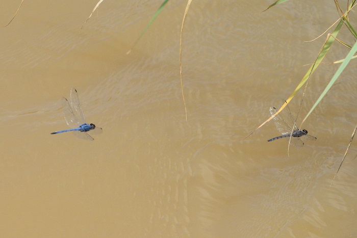
Behaviour
Males perch close to the water on rocks, mostly where there is fast-flowing and turbulent water. The Denim Dropwing will occasionally also sit on plant stems over the water. They are alert and can be difficult to approach. Females are seldom encountered.

Gamka River, Western Cape
Photo by Ryan Tippett
Status and Conservation
The Denim Dropwing is localised and generally scarce, but is listed as of Least Concern in the IUCN Red List of Threatened Species. Due to its habitat choice Trithemis donaldsoni does not make use of man-made habitats.
Mkuze River, KwaZulu-Natal
Photo by Ryan Tippett
Distribution
The Denim Dropwing is widely distributed in Southern and East Africa, ranging from South
Africa up to Kenya and Uganda. Also occurs in northern and eastern Botswana and across to northern Namibia and Angola.
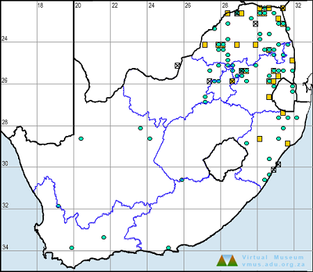
In South Africa, the Denim Dropwing is mostly found in the north and east where it is recorded from the Limpopo, North-West, Gauteng, Mpumalanga, and KwaZulu-Natal provinces. It is also present along the length of the Orange River where it may have previously been overlooked. The Denim Dropwing has also been recorded at a few sites in the Western and Eastern Cape where it may also have been overlooked in the past.
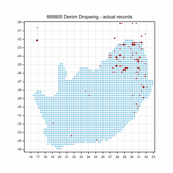
Below is a map showing the distribution of records for Denim Dropwing in the OdonataMAP database as at February 2020.
Below is a map showing the distribution of records for Denim Dropwing in the OdonataMAP database as of December 2024.
The next map below is an imputed map, produced by an interpolation algorithm, which attempts to generate a full distribution map from the partial information in the map above. This map will be improved by the submission of records to the OdonataMAP section of the Virtual Museum.


Ultimately, we will produce a series of maps for all the odonata species in the region. The current algorithm is a new algorithm. The objective is mainly to produce “smoothed” maps that could go into a field guide for odonata. This basic version of the algorithm (as mapped above) does not make use of “explanatory variables” (e.g. altitude, terrain roughness, presence of freshwater — we will be producing maps that take these variables into account soon). Currently, it only makes use of the OdonataMAP records for the species being mapped, as well as all the other records of all other species. The basic maps are “optimistic” and will generally show ranges to be larger than what they probably are.
These maps use the data in the OdonataMAP section of the Virtual Museum, and also the database assembled by the previous JRS funded project, which was led by Professor Michael Samways and Dr KD Dijkstra.
Mkuze River, KwaZulu-Natal
Photo by Ryan Tippett
Further Resources
The use of photographs by Alan Manson is acknowledged. All other photographs by Ryan Tippett.
Denim Dropwing Trithenis donaldsoni (Calvert, 1899)
Other common names: Denimvalvlerkie (Afrikaans)
Recommended citation format: Loftie-Eaton M; Navarro R; Tippett RM; Underhill L. 2025. Denim Dropwing Trithenis donaldsoni. Biodiversity and Development Institute. Available online at https://thebdi.org/2020/05/08/denim-dropwing-trithemis-donaldsoni/
References: Tarboton, M; Tarboton, W. (2019). A Guide to the Dragonflies & Damselflies of South Africa. Struik Nature.
Samways, MJ. (2008). Dragonflies and Damselflies of South Africa. Pensoft
Samways, MJ. (2016). Manual of Freshwater Assessment for South Africa: Dragonfly Biotic Index. Suricata 2. South African National Biodiversity Institute, Pretoria
Martens, A; Suhling, F. (2007). Dragonflies and Damselflies of Namibia. Gamsberg Macmillan.
Mkuze River, KwaZulu-Natal
Photo by Ryan Tippett