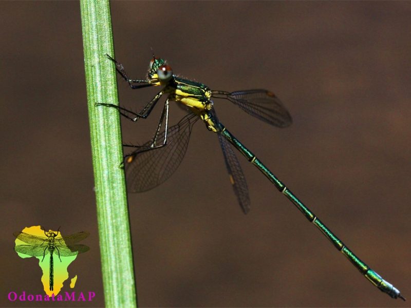
View the above photo record (by Stewart MacLachlan) in OdonataMap here.
Find the Amatola Malachite in the FBIS database (Freshwater Biodiversity Information System) here.
Family Synlestidae
Chlorolestes apricans – AMATOLA MALACHITE
Identification
Small Size
Length up to 38mm; Wingspan reaches 50mm.
The Amatola Malachite is the smallest Chlorolestes species. There is no size overlap with co-occuring species (Chlorolestes tessellatus & Chlorolestes fasciatus).
A distinctive and easily recognised species. Apart from the aforementioned size, chlorolestes apricans can be readily identified by its plain, dark yellowish pterostigmas and pruinose blue prothorax and wing bases.
Males occur in two forms. One has black and white-banded wings and the other has plain, un-banded wings.
Click here for more details on identification.
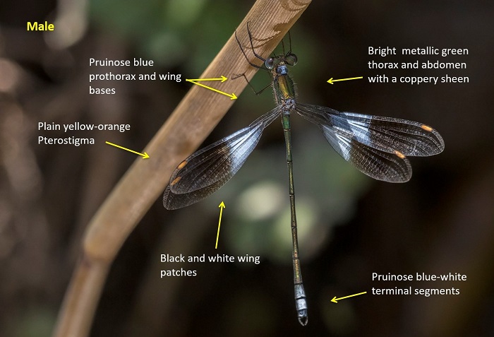
Near Stutterheim, Eastern Cape
Photo by Desire Darling
Habitat
Frequents streams and rivers in hilly areas. Requires clear, flowing water and a rich growth of reeds, grass and some scattered bushes.
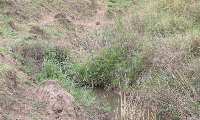
Photo by Corne Rautenbach
Behaviour
Most often observed hanging with wings outstretched, from grass stems in sunny positions over the water. Confiding and reluctant to fly.
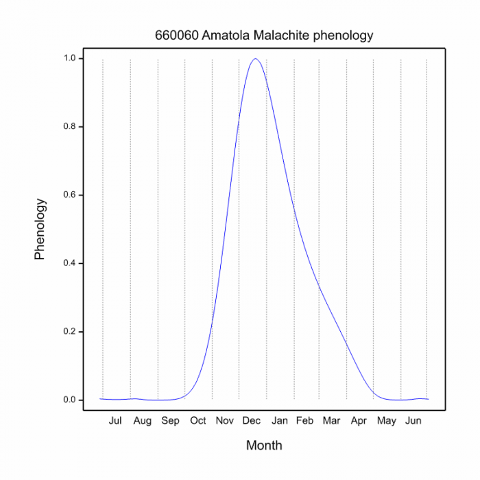
Active from October to April (See Phenology below).
Status and Conservation
Chlorolestes apricans is rare and listed as Endangered on the IUCN Red List of Threatened Species. It only occupies pristine, undamaged habitats and has a very small and restricted distribution. Not tolerant of habitat degradation.
Distribution
This damselfly is endemic to South Africa where it has a restricted range in the Eastern Cape Province. Occurs over a small area in the Amatola-Winterberg mountains.
The map below shows the distribution of records for Anax imperator in the OdonataMAP database, as at January 2020.
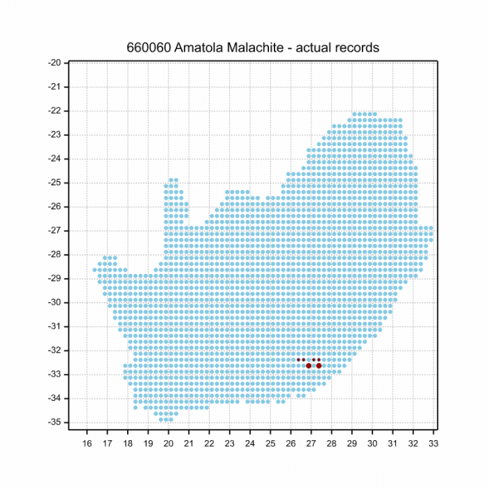
Use this link to embed this map of distribution records in OdonataMAP: http://thebdi.org/wp-content/uploads/2020/02/660060-Amatola-Malachite-actual-records-1.png
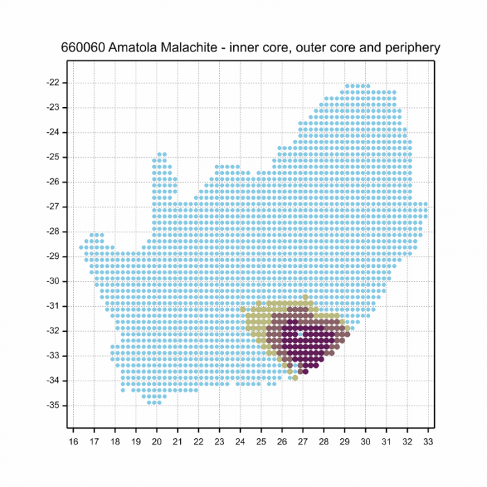
The following map below is an imputed map, produced by an interpolation algorithm, which attempts to generate a full distribution map from the partial information in the map above. This map will be improved by the submission of records to the OdonataMAP section of the Virtual Museum
Use this link to embed this imputed distribution map: http://thebdi.org/wp-content/uploads/2020/02/660060-Amatola-Malachite-inner-core-outer-core-and-periphery.png
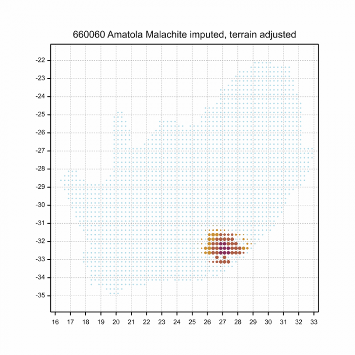
The next map below is an imputed map, produced by an interpolation algorithm, which attempts to generate a full distribution map from the partial information in the map above. This map will be improved by the submission of records to the OdonataMAP section of the Virtual Museum.
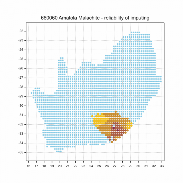
The map below shows the imputed distribution which has been adjusted for terrain roughness
Ultimately, we will produce a series of maps for all the odonata species in the region. The current algorithm is a new algorithm. The objective is mainly to produce “smoothed” maps that could go into a field guide for odonata. This basic version of the algorithm (as mapped above) does not make use of “explanatory variables” (e.g. altitude, terrain roughness, presence of freshwater — we will be producing maps that take these variables into account soon). Currently, it only makes use of the OdonataMAP records for the species being mapped, as well as all the other records of all other species. The basic maps are “optimistic” and will generally show ranges to be larger than what they probably are.
These maps use the data in the OdonataMAP section of the Virtual Museum, and also the database assembled by the previous JRS funded project, which was led by Professor Michael Samways and Dr KD Dijkstra.
Phenology
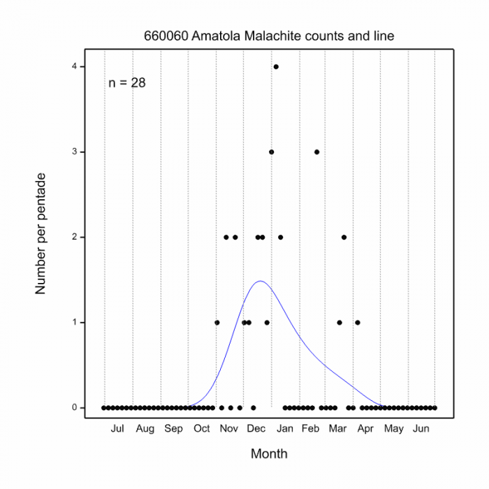
The next two graphs shows how the occurrence of Amatola Malachites varies within the year, i.e. the phenology. There are only 28 records in the database for this species, so these results need to be treated as tentative. The first plot shows the number of records in each pentade, five-day periods, which start on 1 July and end on 30 June the following year. The maximum number of records in a pentade is four, in early January. The blue line is generated by a smoother, an algorithm which aims to separate the “signal” from the “noise”, and shows the pattern of seasonality for this species. The second plot shows only the blue line, and it is scaled to lie between zero and one, for easy comparison between species.
Tentatively (because the sample size is only 28), this phenology plot shows that the earliest Amatola Malachites in flight can be anticipated in October, and the last ones in April. Most records are anticipated to be from November to March, and the peak of the flight period appears to be in Mid-December. The peak appears to be quite sharp, but this might be a consequence of the small sample size.
To improve the quality of the phenology, please start fieldwork for this species in October, and continue to April, and submit records of Amatola Malachites to OdonataMAP throughout this period. The ideal would be to have a record from each five-day period in which they are seen and photographed.

