
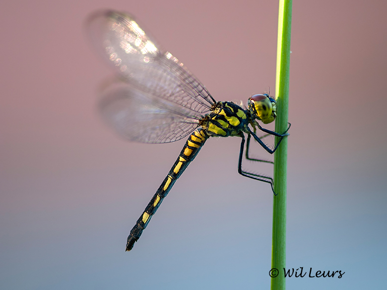
Cover photo by Wil Leurs.
Find this species in the FBIS database (Freshwater Biodiversity Information System) here.
Family Libellulidae
Identification

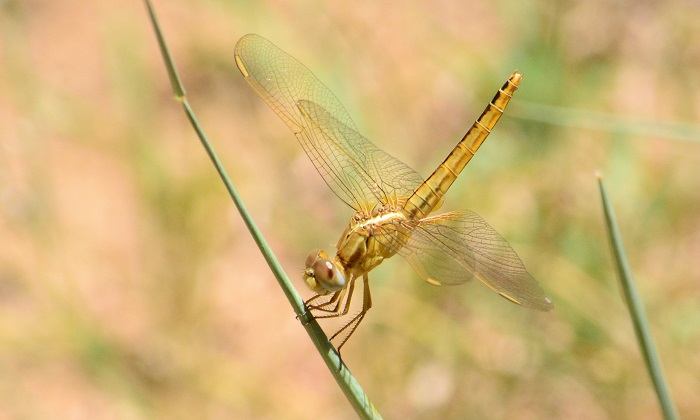
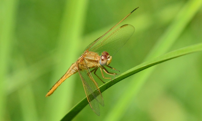
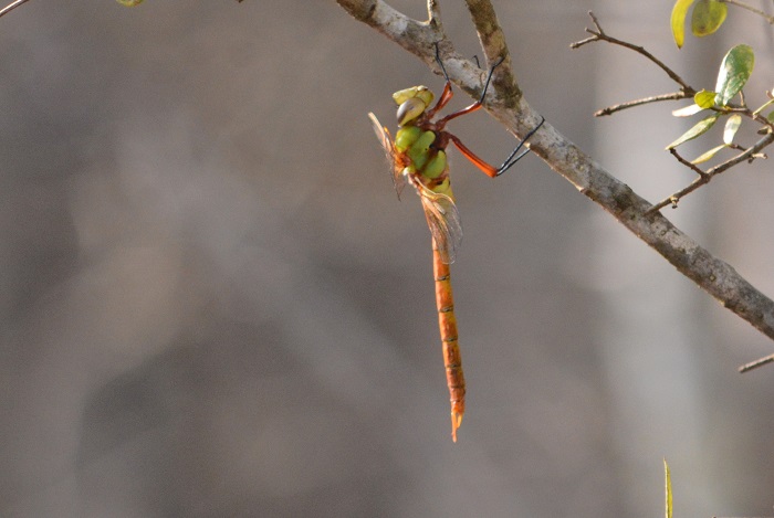
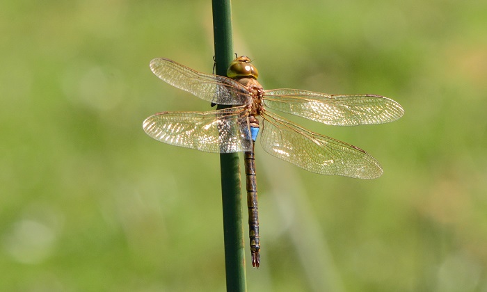
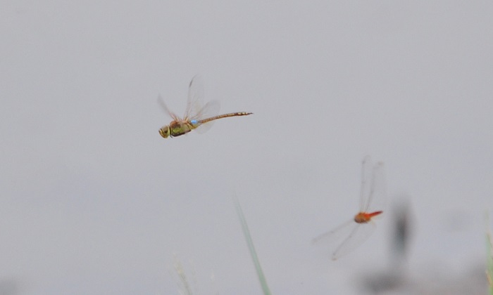
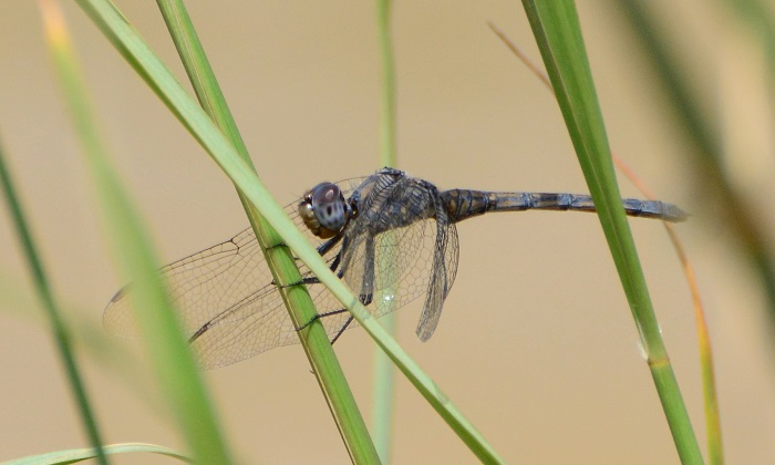
Linyanti, Botswana
Photo by Ryan Tippett
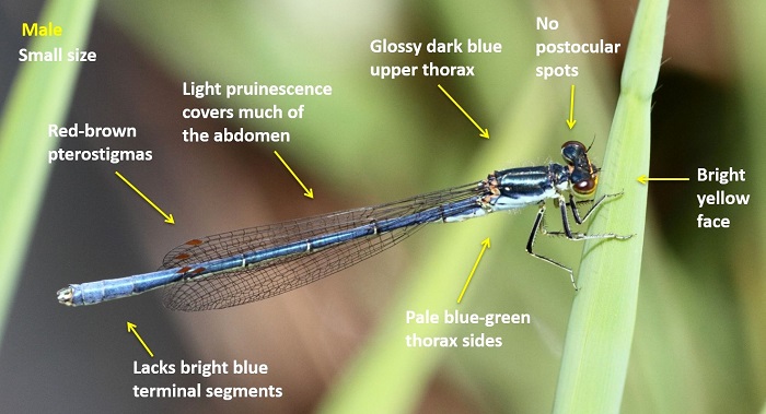
Small size
Length up to 35mm; Wingspan reaches 66mm.
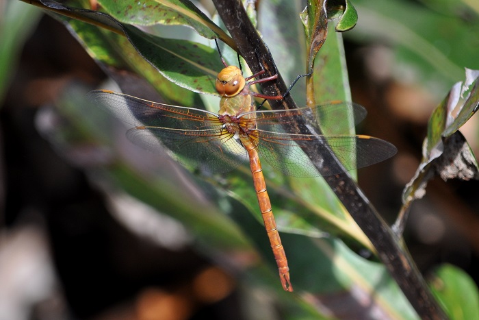
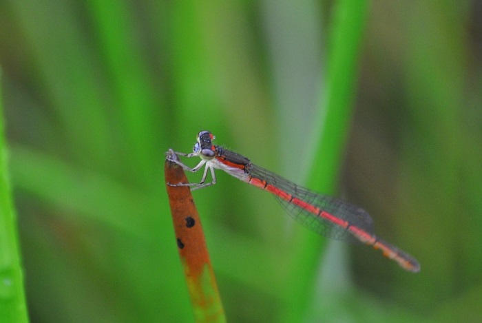
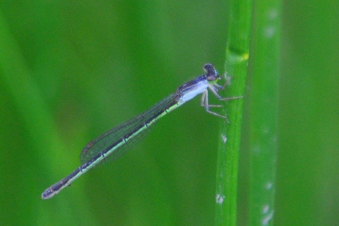
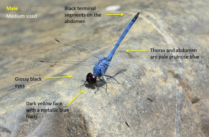
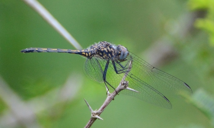
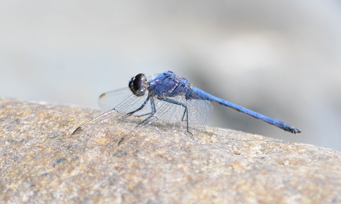
The male Inspector is a small all-pale-blue dragonfly. They are easily mistaken for an Orthetrum species or with Hemistigma albipunctum (African Piedspot). The Inspector is easily distinguished by its yellow face and bright metallic green frons. The pale pterostigmas have a dark outline and are another good identification feature. The eyes are pale blue with dark maroon caps.
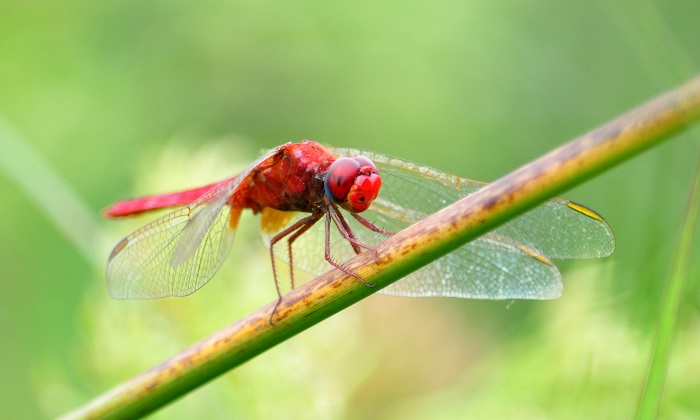
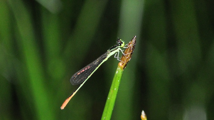
Females are quite brightly coloured in dark yellow and black. They resemble those of Notiothemis jonesi (Eastern Forestwatcher) but can be differentiated by their wing venation and the pale dark-edged pterostigmas.
Click here for more details on identification.

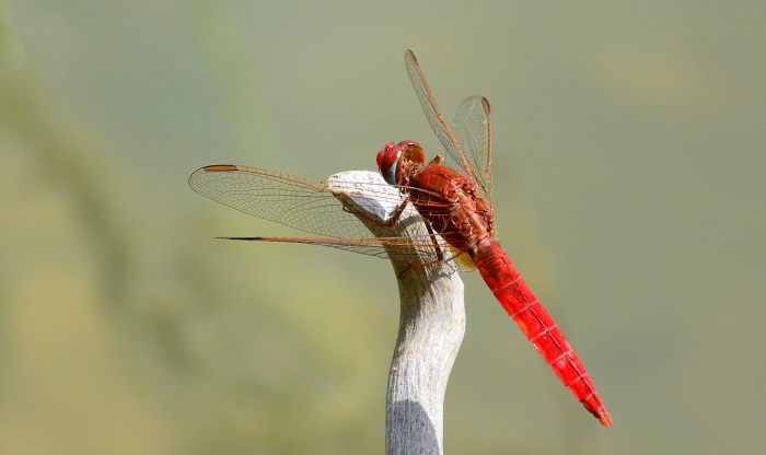
Muzi Pan, KwaZulu-Natal
Photo by Ryan Tippett
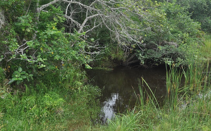
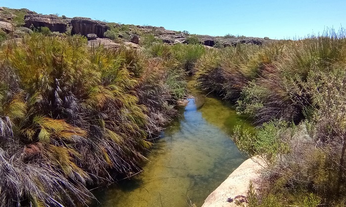
Habitat
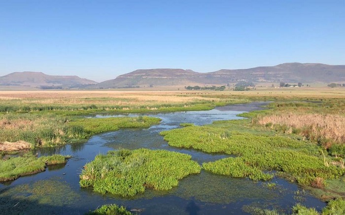
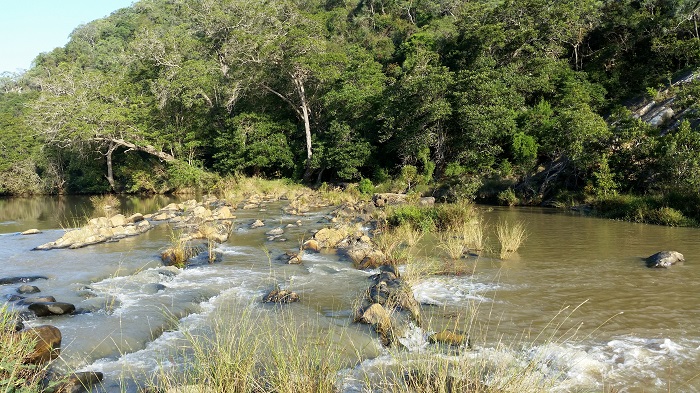
The Inspector inhabits humid forests where it frequents ponds and the still backwaters of streams and rivers. In KwaZulu-Natal, the Inspector is a typical species of swamp and coastal forest, and also occurs around the forested fringes of pans in low-lying areas. Inland it occurs in riverine and gallery forests along large savanna rivers.
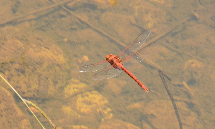
Kosi Bay, iSimangaliso Wetland Park, KwaZulu-Natal
Photo by Ryan Tippett

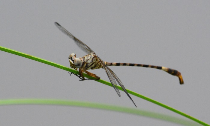
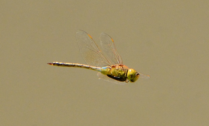
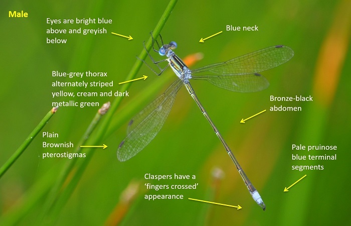
Mkhuze Game Reserve, KwaZulu-Natal
Photo by Ryan Tippett
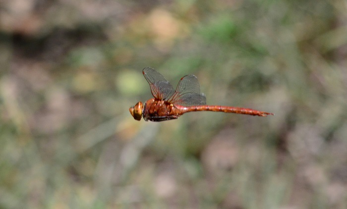
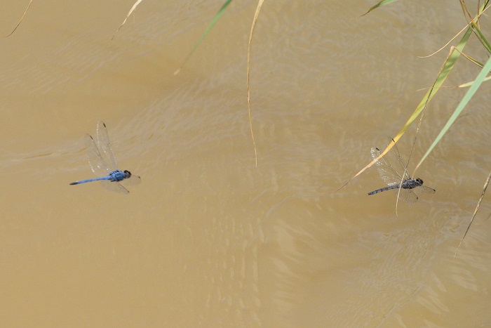
Behaviour
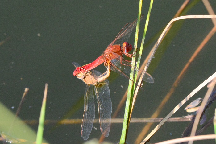
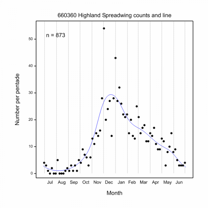
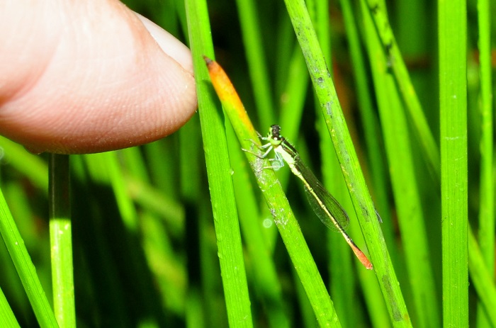
The Inspector is often found in the dappled light of forest sub-canopies where the males sit prominently on the tips of twigs and branches near water. They mostly sit between 1 to 3m above the ground or water. The females can be found in the same area as the males but are usually further away from the water. Females have been observed laying eggs in the water that collects at the centre of waterlily leaves, with the male hovering nearby.

A female laying eggs on a waterlily leaf.
Hluhluwe district, KwaZulu-Natal
Photo by Ryan Tippett
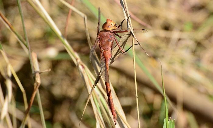
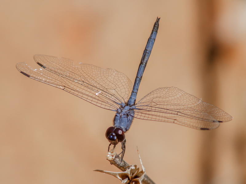
The ‘Inspector’ name is derived from its habit of moving the head at different angles when surveying its surroundings.

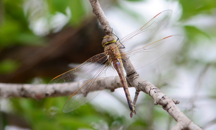
Hluhluwe district, KwaZulu-Natal
Photo by Ryan Tippett
Status and Conservation
Due to its choice of habitat, Chalcostephia flavifrons is very localised in its occurence. The Inspector seldom occurs in large numbers.
The Inspector is fairly sensitive to habitat degradation, but it does occur at some suitable man-made habitats and in places with some alien plant growth. Its habitat is threatened by agriculture in certain areas.
Chalcostephia flavifrons is listed as of Least Concern in the IUCN Red List of Threatened Species.

Hluhluwe district, KwaZulu-Natal
Photo by Ryan Tippett
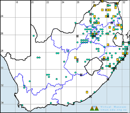
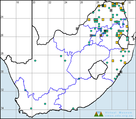
Distribution
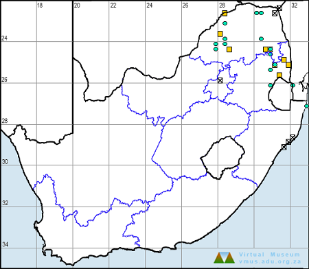
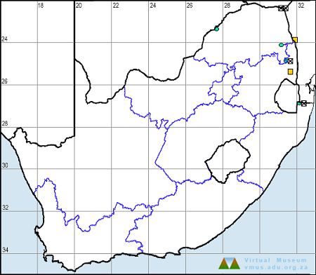
The Inspector is native to tropical Africa, where it is widespread. It occurs from West Africa across to East Africa and down to South Africa. In South Africa, it is mainly found in coastal KwaZulu-Natal and less commonly along rivers in the Limpopo and Mpumalanga Lowveld.
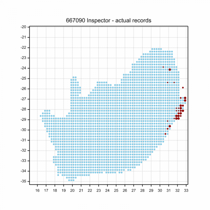
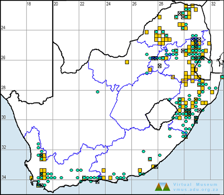
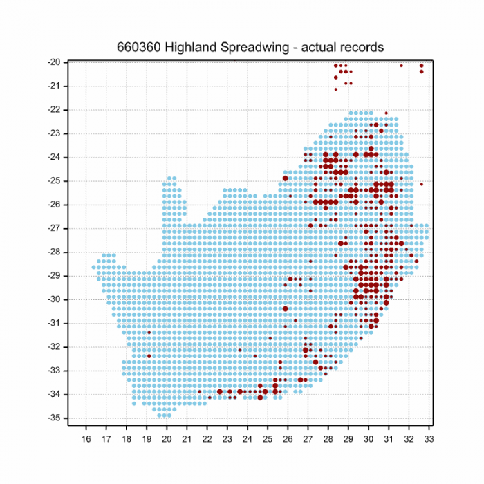
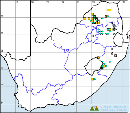
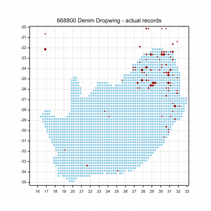
Below is a map showing the distribution of records for Inspector in the OdonataMAP database as of February 2020.
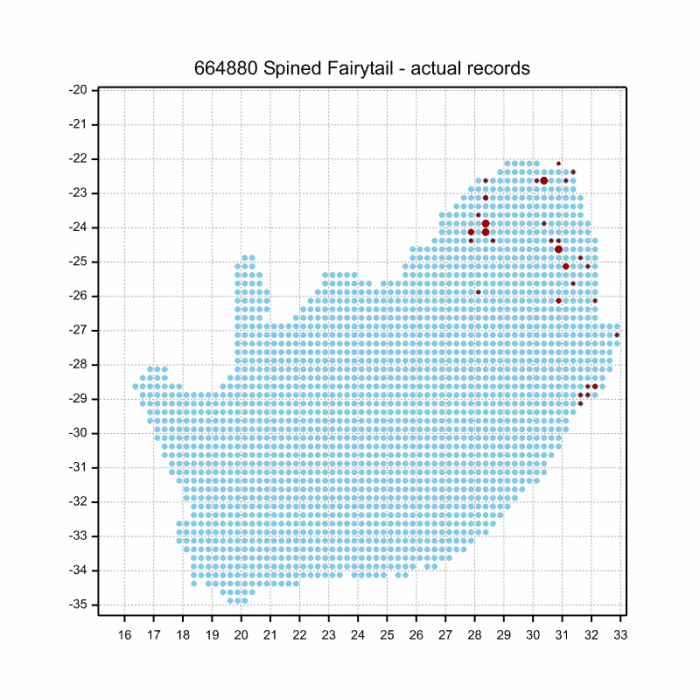
Below is a map showing the distribution of records for Inspector in the OdonataMAP database as of December 2024.

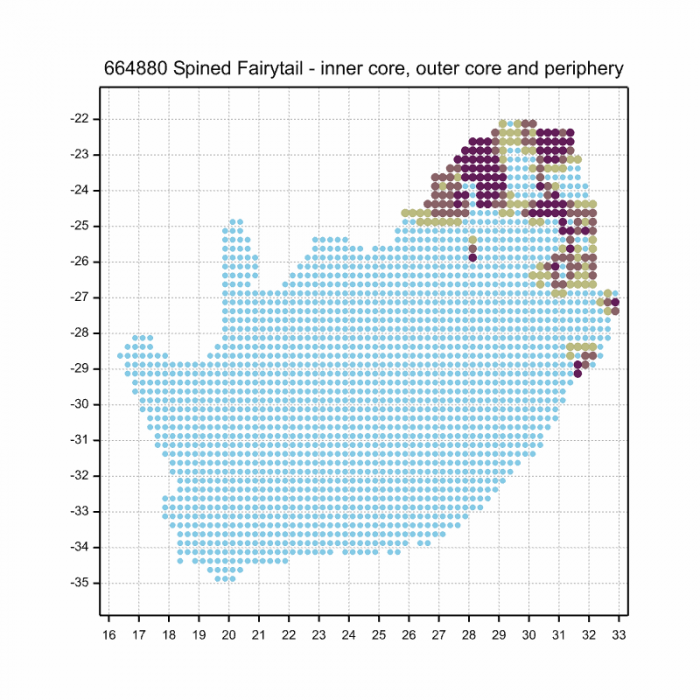
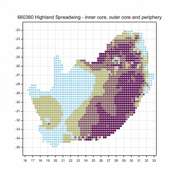
The next map below is an imputed map, produced by an interpolation algorithm, which attempts to generate a full distribution map from the partial information in the map above. This map will be improved by the submission of records to the OdonataMAP section of the Virtual Museum.
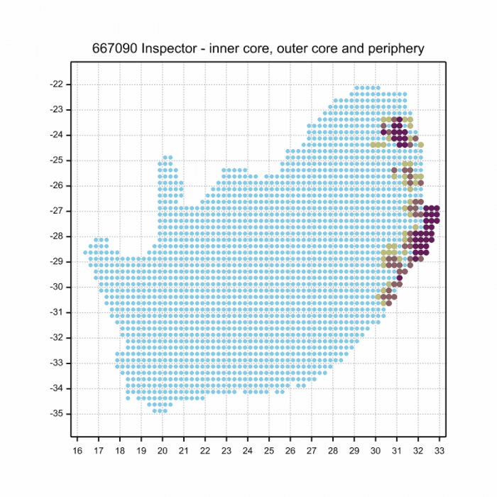
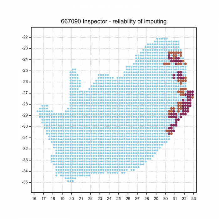
Ultimately, we will produce a series of maps for all the odonata species in the region. The current algorithm is a new algorithm. The objective is mainly to produce “smoothed” maps that could go into a field guide for odonata. This basic version of the algorithm (as mapped above) does not make use of “explanatory variables” (e.g. altitude, terrain roughness, presence of freshwater — we will be producing maps that take these variables into account soon). Currently, it only makes use of the OdonataMAP records for the species being mapped, as well as all the other records of all other species. The basic maps are “optimistic” and will generally show ranges to be larger than what they probably are.
These maps use the data in the OdonataMAP section of the Virtual Museum, and also the database assembled by the previous JRS funded project, which was led by Professor Michael Samways and Dr KD Dijkstra.

Hluhluwe district, KwaZulu-Natal
Photo by Ryan Tippett
Further Resources
The use of photographs by Desire Darling is acknowledged. All other images by Ryan Tippett.
Inspector Chalcostephia flavifrons Kirby, 1889
Other common names: Opsigter (Afrikaans)
Recommended citation format: Loftie-Eaton M; Navarro R; Tippett RM; Underhill L. 2025. Inspector Chalcostephia flavifrons. Biodiversity and Development Institute. Available online at https://thebdi.org/2020/05/11/inspector-chalcostephia-flavifrons/
References: Tarboton, M; Tarboton, W. (2019). A Guide to the Dragonflies & Damselflies of South Africa. Struik Nature.
Samways, MJ. (2008). Dragonflies and Damselflies of South Africa. Pensoft
Samways, MJ. (2016). Manual of Freshwater Assessment for South Africa: Dragonfly Biotic Index. Suricata 2. South African National Biodiversity Institute, Pretoria
Martens, A; Suhling, F. (2007). Dragonflies and Damselflies of Namibia. Gamsberg Macmillan.

Kosi Bay, iSimangaliso Wetland Park, KwaZulu-Natal
Photo by Ryan Tippett


