
Cover photo by Diana Russell.
Find the Pygmy Basker in the FBIS database (Freshwater Biodiversity Information System) here.
Family Libellulidae
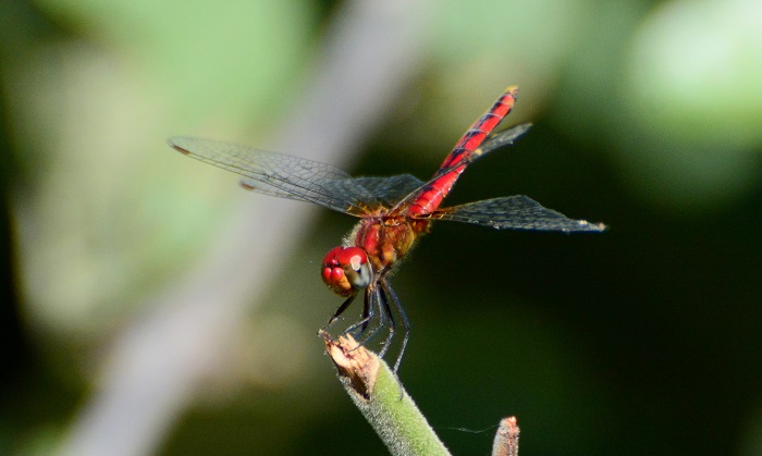
Identification

Okavango Delta, Botswana
Photo by Ryan Tippett
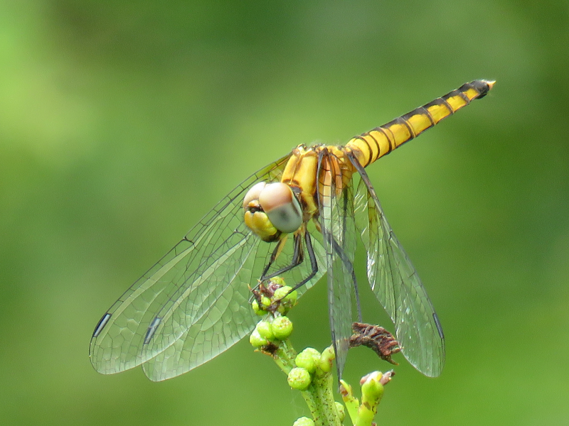
Very small size
Length up to 29mm; Wingspan attains 47mm.
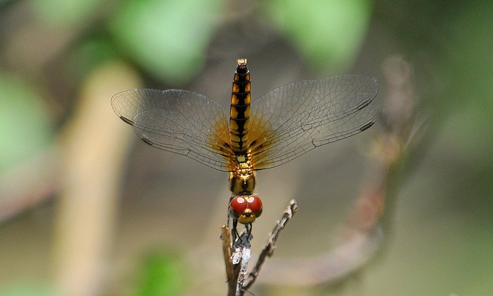
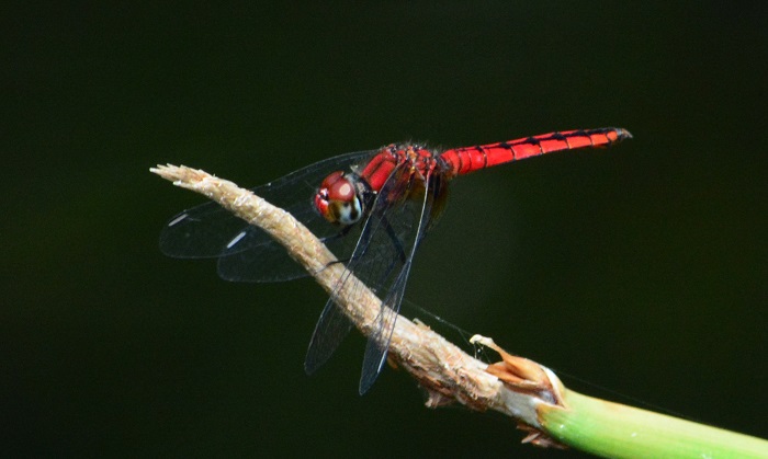
Both sexes of the Pygmy Basker are distinctive and easily recognisable.
Males are most similar to Macrodiplax cora (Coastal Pennant). That species is larger and has differently shaped markings along the top of the abdomen. In addition Macrodiplax cora has far less amber in the hind wings.
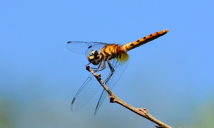
Female Pygmy Baskers share the same patterning as the males but are mustard-yellow to bright yellow in colouration.
Click here for more details on identification of the Pygmy Basker.

Okavango Delta, Botswana
Photo by Ryan Tippett
Habitat
The Pygmy Basker is primarily a coastal species in South Africa. It inhabits sedge and water lily filled ponds and pans on floodplains and in marshes. They are also found at richly vegetated oxbow ponds along meandering rivers and streams. The Pygmy basker favours still or slow-flowing waters. It is found in savanna, coastal grassland and forested environments, provided there is suitable aquatic habitat.

Photo by Ryan Tippett
Behaviour
Adult male Pygmy Baskers perch prominently over the water, usually on bare branches or sedge and reed stems. Females and immature males are mostly found away from the water perched on bushes and trees. Pygmy Baskers dart off in short, rapid flights to capture prey, often returning to the same perch. During the heat of the day they can often be seen in the ‘obelisk position’, pointing the abdomens at the sun to reduce the amount of direct sunlight on their bodies.
This species is most active from October to April (see Phenology below).
Enseleni Nature Reserve, KwaZulu-Natal
Photo by Ryan Tippett
Status and Conservation
Overall, the Pygmy Basker is an uncommon and localised species in South Africa. It is listed as of Least Concern in the IUCN Red List of Threatened Species. It is found mostly in undisturbed habitats and is not very tolerant of habitat degradation.
Kosi Bay, iSimangaliso Wetland Park, KwaZulu-Natal
Photo by Ryan Tippett
Distribution
The Pygmy Basker is widespread throughout the wetter parts of sub-Saharan Africa, from Senegal across to Kenya and down to South Africa. It is also found in parts of northern Madagascar. In South Africa it is mostly restricted to the north-eastern coastal plain of KwaZulu-Natal and low-lying parts of Mpumalanga..
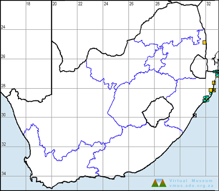
Below is a map showing the distribution of records for Pygmy Basker in the OdonataMAP database as at February 2020.
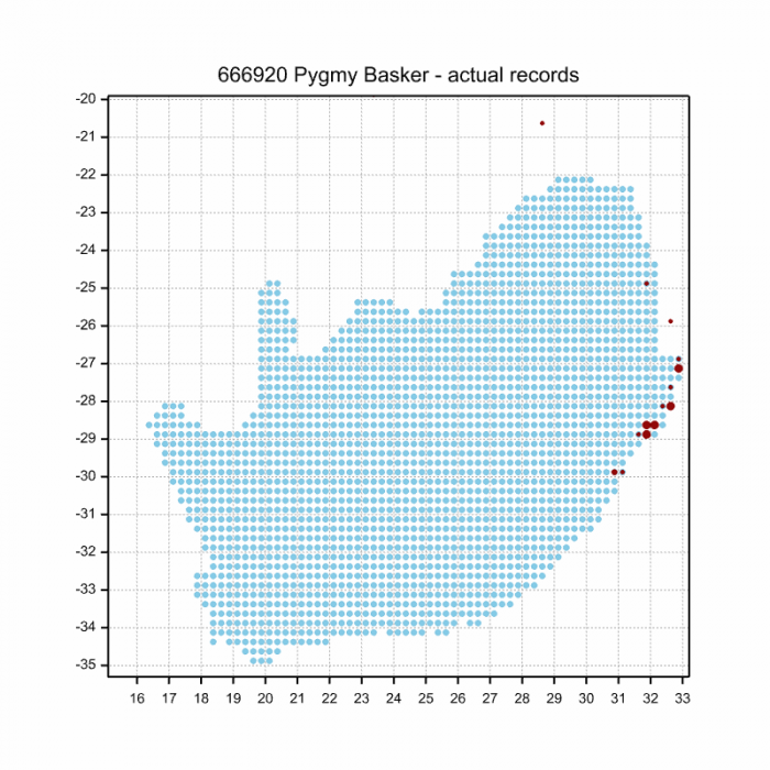
Below is a map showing the distribution of records for Pygmy Basker in the OdonataMAP database as of December 2024.
The next map below is an imputed map, produced by an interpolation algorithm, which attempts to generate a full distribution map from the partial information in the map above. This map will be improved by the submission of records to the OdonataMAP section of the Virtual Museum.

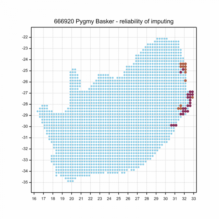
Ultimately, we will produce a series of maps for all the odonata species in the region. The current algorithm is a new algorithm. The objective is mainly to produce “smoothed” maps that could go into a field guide for odonata. This basic version of the algorithm (as mapped above) does not make use of “explanatory variables” (e.g. altitude, terrain roughness, presence of freshwater — we will be producing maps that take these variables into account soon). Currently, it only makes use of the OdonataMAP records for the species being mapped, as well as all the other records of all other species. The basic maps are “optimistic” and will generally show ranges to be larger than what they probably are.
These maps use the data in the OdonataMAP section of the Virtual Museum, and also the database assembled by the previous JRS funded project, which was led by Professor Michael Samways and Dr KD Dijkstra.
Kosi Bay, iSimangaliso Wetland Park, KwaZulu-Natal
Photo by Ryan Tippett
Phenology


Enseleni Nature Reserve, KwaZulu-Natal
Photo by Ryan Tippett
Further Resources
The use of photographs by Diana Russell is acknowledged. Other photographs by Ryan Tippett.
Pygmy Basker Aethriamanta rezia Kirby, 1889
Other common names: Dwergsonvangertjie (Afrikaans)
Recommended citation format: Loftie-Eaton M; Navarro R; Tippett RM; Underhill L. 2025. Pygmy Basker Aethriamanta rezia. Biodiversity and Development Institute. Available online at https://thebdi.org/2020/06/12/pygmy-basker-aethriamanta-rezia/
References: Tarboton, M; Tarboton, W. (2019). A Guide to the Dragonflies & Damselflies of South Africa. Struik Nature.
Samways, MJ. (2008). Dragonflies and Damselflies of South Africa. Pensoft
Samways, MJ. (2016). Manual of Freshwater Assessment for South Africa: Dragonfly Biotic Index. Suricata 2. South African National Biodiversity Institute, Pretoria
Martens, A; Suhling, F. (2007). Dragonflies and Damselflies of Namibia. Gamsberg Macmillan.
Okavango Delta, Botswana
Photo by Ryan Tippett