View the above photo record (by Andrew & Heather Hodgson) in OdonataMAP here.
Find the Slate Sprite in the FBIS database (Freshwater Biodiversity Information System) here.
Family Coenagrionidae
Pseudagrion salisburyense – SLATE SPRITE
Identification
Small size
Length attains 43mm; Wingspan up to 53mm.
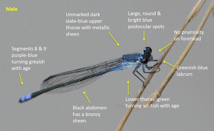
Males are most similar to Pseudagrion spernatum (Upland Sprite) and Pseudagrion draconis (Mountain Sprite). The Slate Sprite is differentiated from the fore mentioned species by lacking pruinosity on the face and by its bronze-black abdomen that mostly lacks pale pruinosity. In addition the species all have differently shaped claspers.
Females are variably coloured from pale brownish to Blueish. Best identified by their association with the males.
Click here for more details on identification.
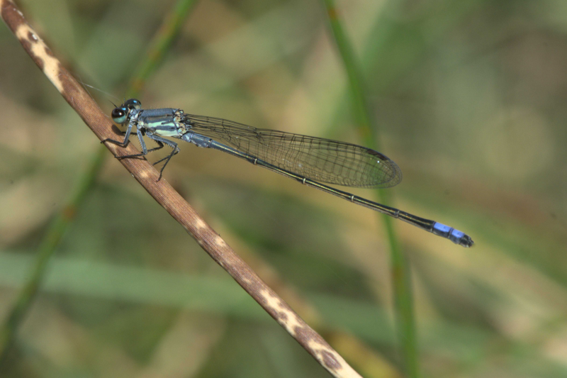
Mkuze River, KwaZulu-Natal
Photo by Ryan Tippett
Habitat
utilizes
The Slate Sprite utilizes a wide range of habitats, from rivers, streams and marshes to ponds and the fringes of large lakes and dams. Requires emergent and fringing vegetation like reeds sedge and grasses.
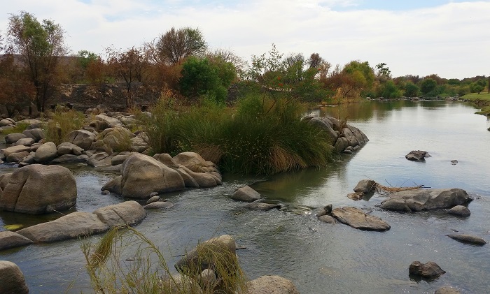
Photo by Ryan Tippett
Behaviour
Usually seen perched on vegetation close to or overhanging the water. Sometimes seen on rocks in the water.
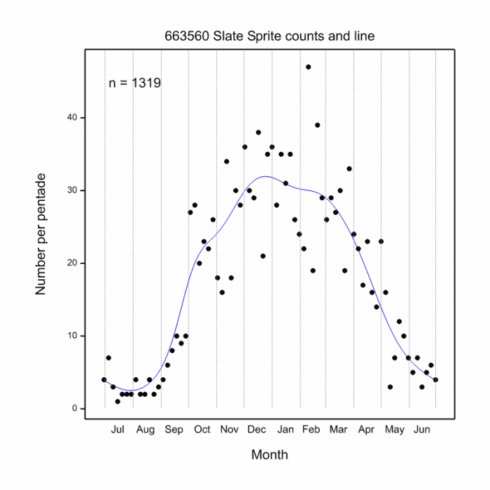
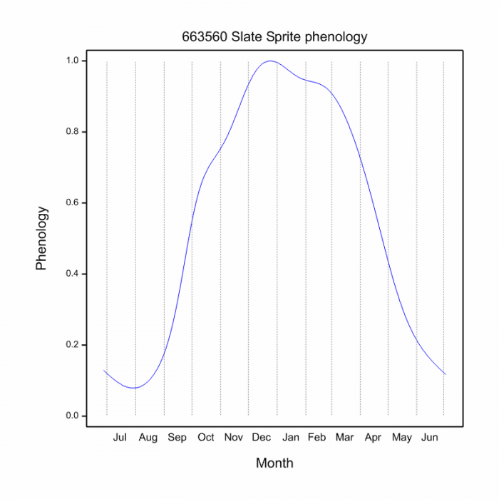
Most active from September to May. Flies all year in some places (see Phenology below).
Status and Conservation
Common to abundant. Listed as of Least Concern in the IUCN Red List of Threatened Species.
Distribution
A species of East, South-Central and Southern Africa. Occurs from Ethiopia in the North across to Angola in the west and down to South Africa.
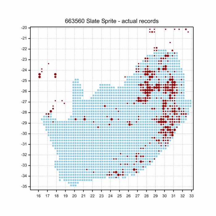
In South Africa it is most common in the north and east from Limpopo to Kwazulu-Natal. Widespread but less numerous in the Eastern Cape, Free-state and Northern Cape.
Below is a map showing the distribution of records for Slate Sprite in the OdonataMAP database as at February 2020.
The next map below is an imputed map, produced by an interpolation algorithm, which attempts to generate a full distribution map from the partial information in the map above. This map will be improved by the submission of records to the OdonataMAP section of the Virtual Museum.
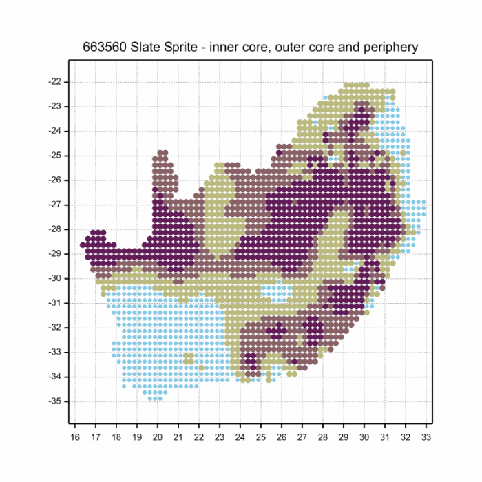
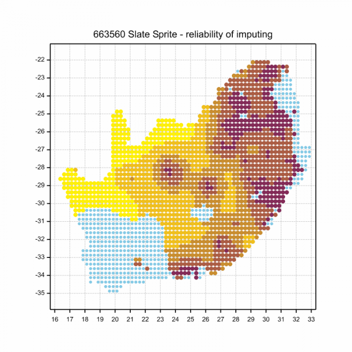
Ultimately, we will produce a series of maps for all the odonata species in the region. The current algorithm is a new algorithm. The objective is mainly to produce “smoothed” maps that could go into a field guide for odonata. This basic version of the algorithm (as mapped above) does not make use of “explanatory variables” (e.g. altitude, terrain roughness, presence of freshwater — we will be producing maps that take these variables into account soon). Currently, it only makes use of the OdonataMAP records for the species being mapped, as well as all the other records of all other species. The basic maps are “optimistic” and will generally show ranges to be larger than what they probably are.
These maps use the data in the OdonataMAP section of the Virtual Museum, and also the database assembled by the previous JRS funded project, which was led by Professor Michael Samways and Dr KD Dijkstra.
Phenology
