

Cover photo by Diana Russell.
Find this species in the FBIS database (Freshwater Biodiversity Information System) here.
Family Libellulidae
Identification

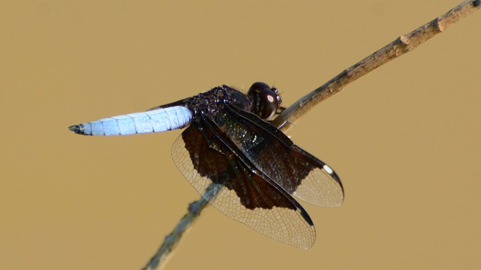
Near Hluhluwe, KwaZulu-Natal
Photo by Ryan Tippett
Small size
Length reaches 32mm; Wingspan attains 53mm.
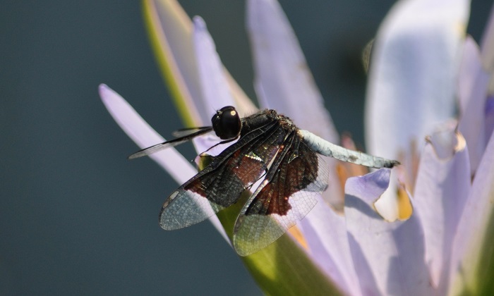
Male Lucia Widows are easily recognisable. Their extensively black wings and striking blue-white abdomens are distinctive. Most similar to Palpopleura portia, but that species has a pale pruinose blue, rather than black upper thorax. It also shows far less black in the wings.

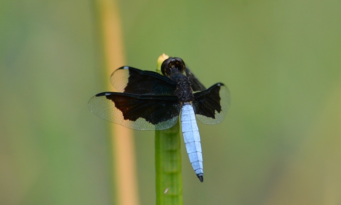
Near Kosi Bay, KwaZulu-Natal
Photo by Ryan Tippett
Females of the two species are very similar and often problematic to identify in the field. Female Lucia Widows generally show more black in the wings. They also usually have a smoky ‘shadow’ area in the hind wings surrounding the black. Females of both species variations in wing patterning and are best identified by their association with the males.
Click here for more details on identification.
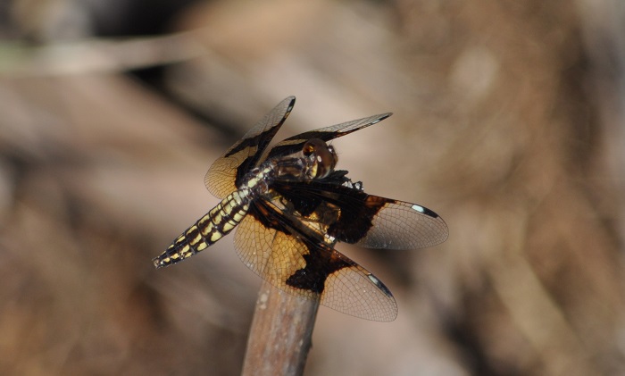
Near Hluhluwe, KwaZulu-Natal
Photo by Ryan Tippett
Habitat
Palpopleura lucia has a wide habitat tolerance. It prefers the still reaches of natural and man-made waterbodies like lakes, pans, dams, floodplains, marshes, and ponds. The Lucia Widow also occupies the quiet backwaters, pools, and slow-moving sections of rivers and streams. Favours well-vegetated habitats with abundant reeds, sedges, grass, etc. The Lucia Widow is mostly restricted to hot, humid savanna regions. It is found up to around 1400m above sea level in Gauteng but occurs mainly at lower altitudes in KwaZulu-Natal.
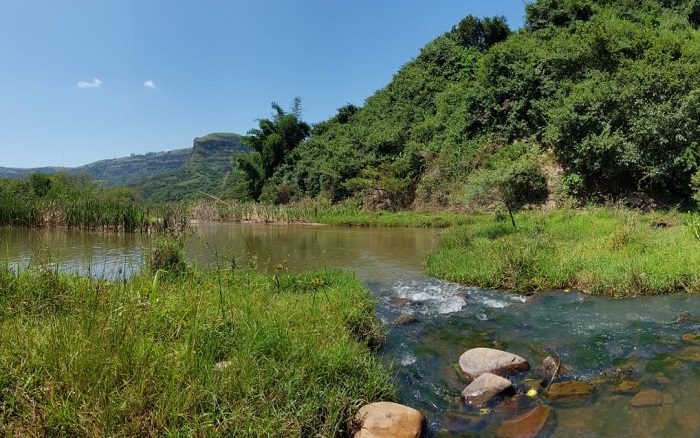
Photo by Alex Briggs
Behaviour
The Lucia Widow is a conspicuous species. Males, with their striking colours, sit prominently on exposed perches over the water and are very eye-catching. Females occur in the same areas as the males but are far less noticeable. The Lucia Widow hunts from a perch and the flight is fast and fluttering.
The Lucia Widow is on the wing from October to May, but flies year-round in many places.
Near Hluhluwe, KwaZulu-Natal
Photo by Ryan Tippett
Status and Conservation
The Lucia Widow is Common to very common and widespread. It is listed as of Least Concern in the IUCN Red List of Threatened Species. This is an adaptable species that readily makes use of man-made habitats.
Near Hluhluwe, KwaZulu-Natal
Photo by Ryan Tippett
Distribution
Palpopleura lucia is widespread over most of Sub-Saharan Africa. It is excluded only from the driest regions of NE Africa and the dry west and Winter-rainfall parts of Southern Africa.
Below is a map showing the distribution of records for Lucia Widow in the OdonataMAP database as at February 2020.

Below is a map showing the distribution of records for Lucia Widow in the OdonataMAP database as at December 2024.
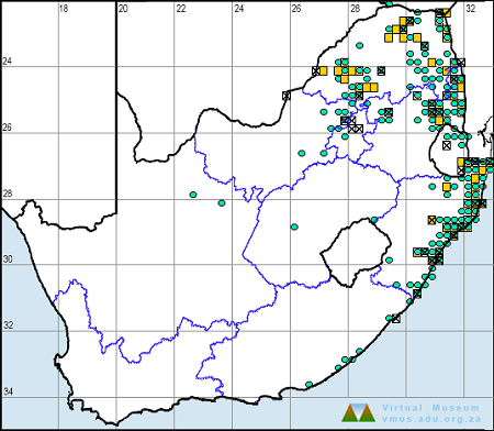
The next map below is an imputed map, produced by an interpolation algorithm, which attempts to generate a full distribution map from the partial information in the map above. This map will be improved by the submission of records to the OdonataMAP section of the Virtual Museum.


Ultimately, we will produce a series of maps for all the odonata species in the region. The current algorithm is a new algorithm. The objective is mainly to produce “smoothed” maps that could go into a field guide for odonata. This basic version of the algorithm (as mapped above) does not make use of “explanatory variables” (e.g. altitude, terrain roughness, presence of freshwater — we will be producing maps that take these variables into account soon). Currently, it only makes use of the OdonataMAP records for the species being mapped, as well as all the other records of all other species. The basic maps are “optimistic” and will generally show ranges to be larger than what they probably are.
These maps use the data in the OdonataMAP section of the Virtual Museum, and also the database assembled by the previous JRS funded project, which was led by Professor Michael Samways and Dr KD Dijkstra.
Further Resources
The use of photographs by Alex Briggs and Dianna Russel is acknowledged.
Lucia Widow Palpopleura lucia (Drury, 1773)
Other common names: Black-winged Widow (Alt. English); Lucia-weetjie (Afrikaans)
Recommended citation format: Loftie-Eaton M; Navarro R; Tippett RM; Underhill L. 2025. Lucia Widow Palpopleura lucia. Biodiversity and Development Institute. Available online at https://thebdi.org/2020/05/12/lucia-widow-palpopleura-lucia/
References: Tarboton, M; Tarboton, W. (2019). A Guide to the Dragonflies & Damselflies of South Africa. Struik Nature.
Samways, MJ. (2008). Dragonflies and Damselflies of South Africa. Pensoft
Samways, MJ. (2016). Manual of Freshwater Assessment for South Africa: Dragonfly Biotic Index. Suricata 2. South African National Biodiversity Institute, Pretoria
Martens, A; Suhling, F. (2007). Dragonflies and Damselflies of Namibia. Gamsberg Macmillan.
Near Hluhluwe, KwaZulu-Natal
Photo by Ryan Tippett