

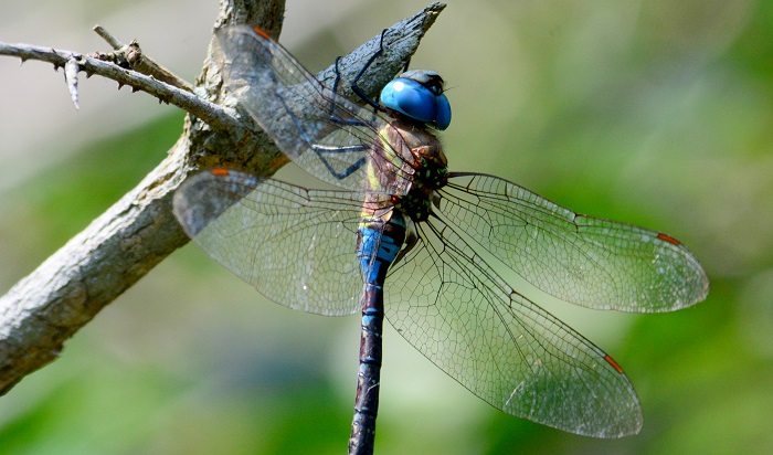
Cover photo by Peter Webb.
Find the Highland Spreadwing in the FBIS database (Freshwater Biodiversity Information System) here.
Family Lestidae
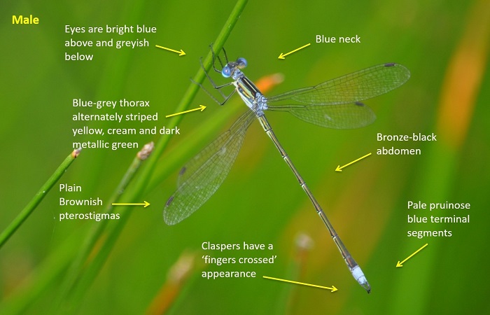
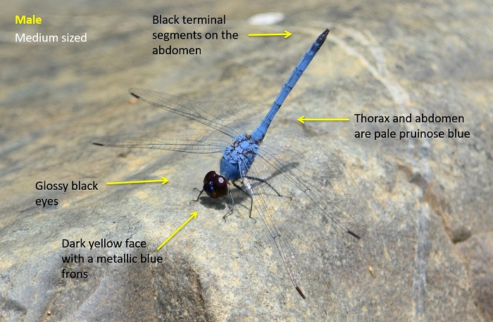
Identification
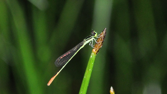
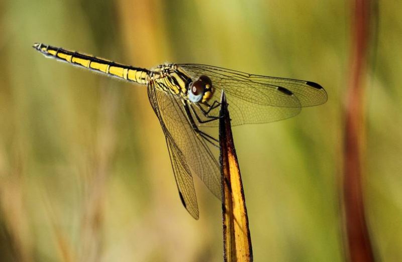
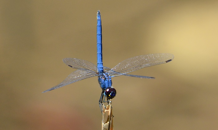
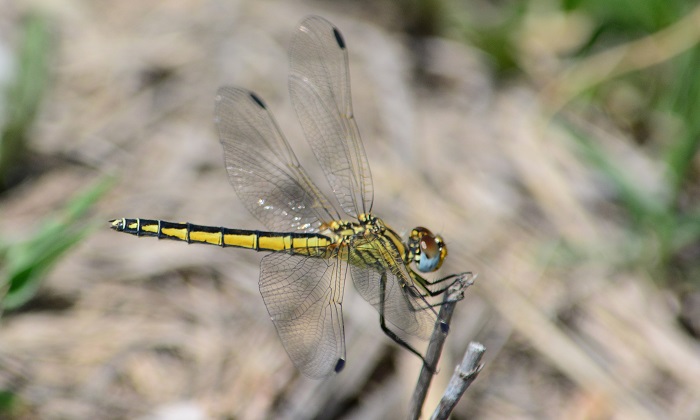
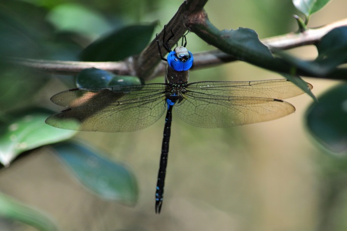
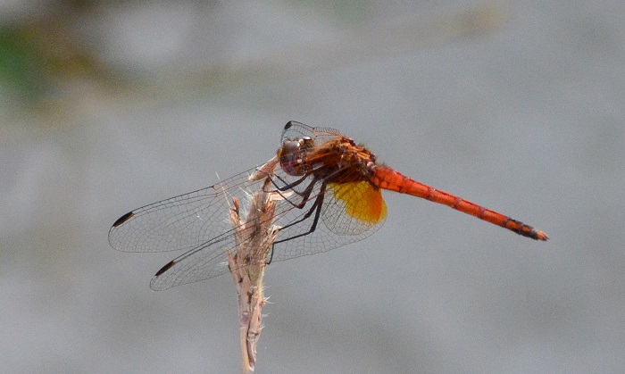
Lake Naverone, KwaZulu-Natal
Photo by Ryan Tippett
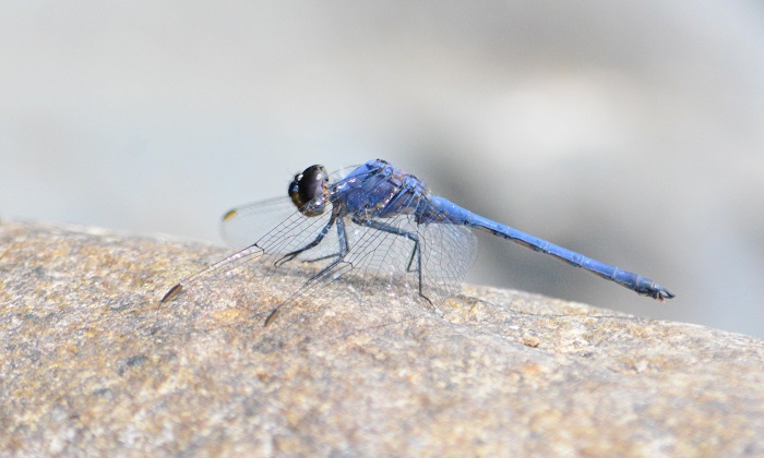
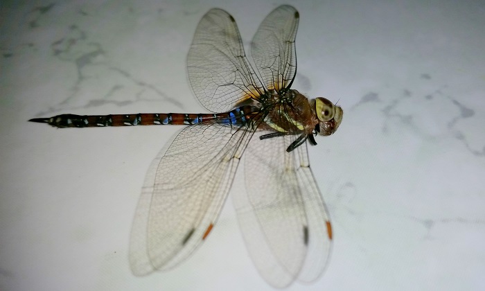
Medium sized
Length up to 48mm; Wingspan reaches 60mm.
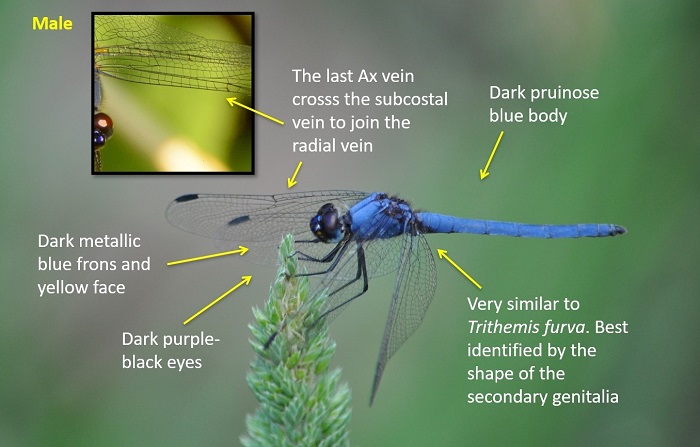
The Highland Spreadwing is most similar to Lestes virgatus (Smoky Spreadwing). The two differ in the amount of metallic green on the thorax, with Lestes virgatus having larger and broader green stripes. Lestes plagiatus has plain coloured, brownish pterostigmas, while L. virgatus has pale pterostigmas with dark borders. The two species also have very different clasper structures.
Click here for more details on identification.

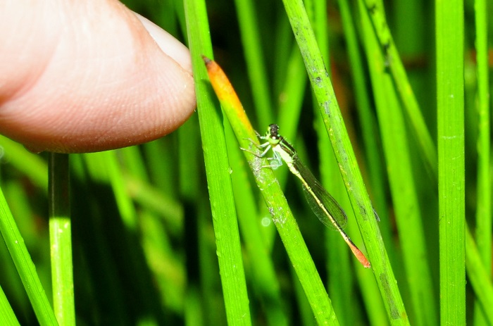
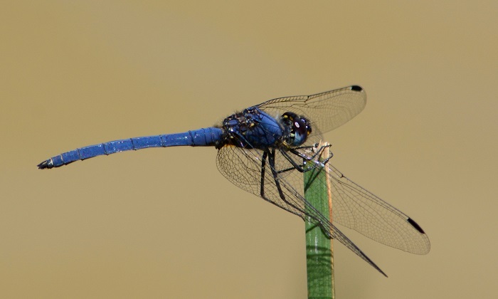
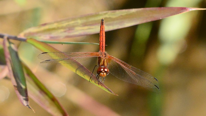
Amakhosi Game Reserve, KwaZulu-Natal
Photo by Ryan Tippett
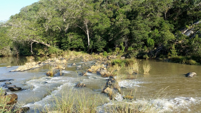
Habitat
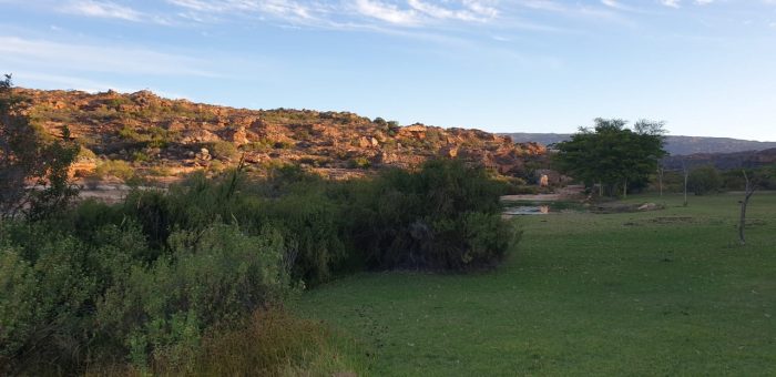
The Highland Spreadwing inhabits the edges of still water habitats such as ponds, pools, dams, and slow-moving sections of rivers and streams. It favours sites with emergent and fringing grass, sedges, or reeds.
The Highland Spreadwing occurs near the coast in some places but is mostly found from 700 to 1400m above sea level.
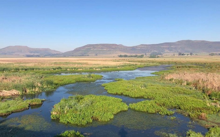
Photo by Rowan Poortier
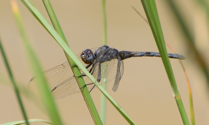
Behaviour
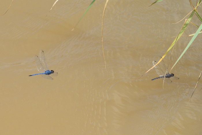
The Highland Spreadwing flits between emergent grass and sedge stems. It perches on plant stems with its wings outstretched, usually with the abdomen pointed downwards. Both sexes are found in the same vicinity.
The Highland Spreadwing is most Active from October to May (See Phenology below).

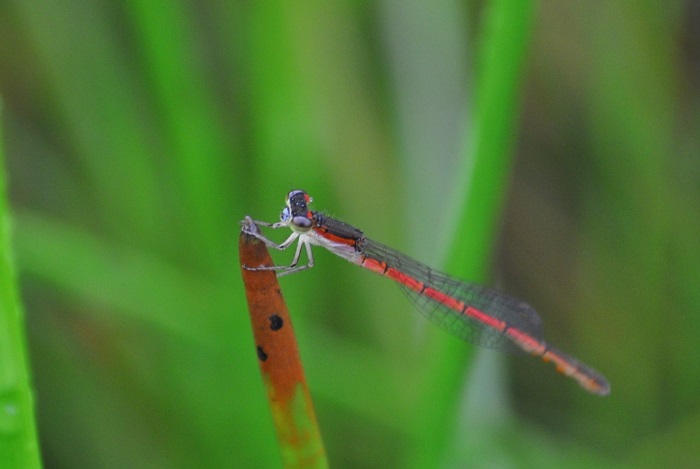
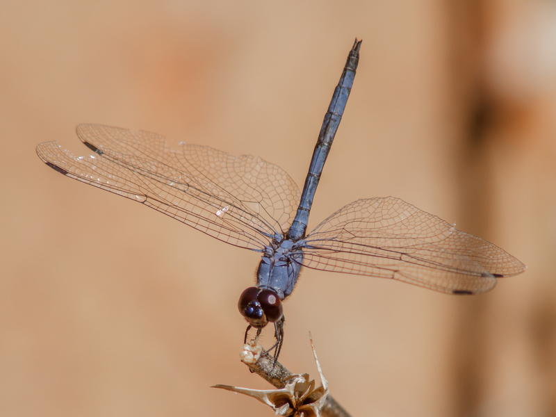
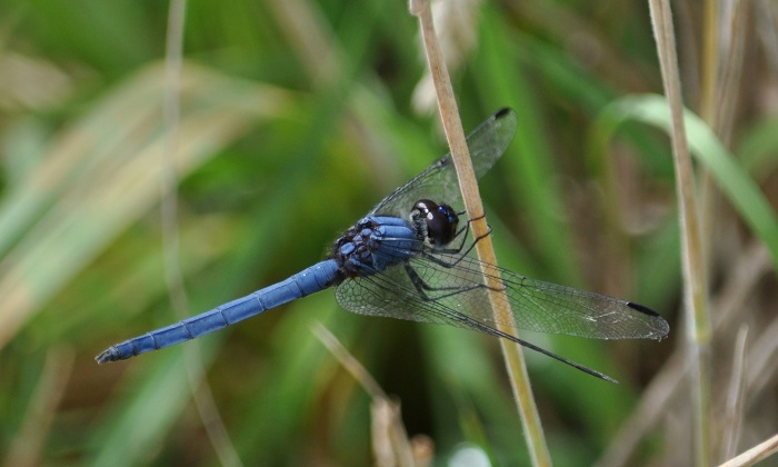
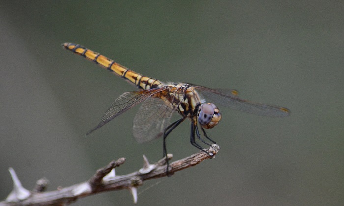
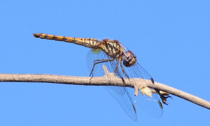
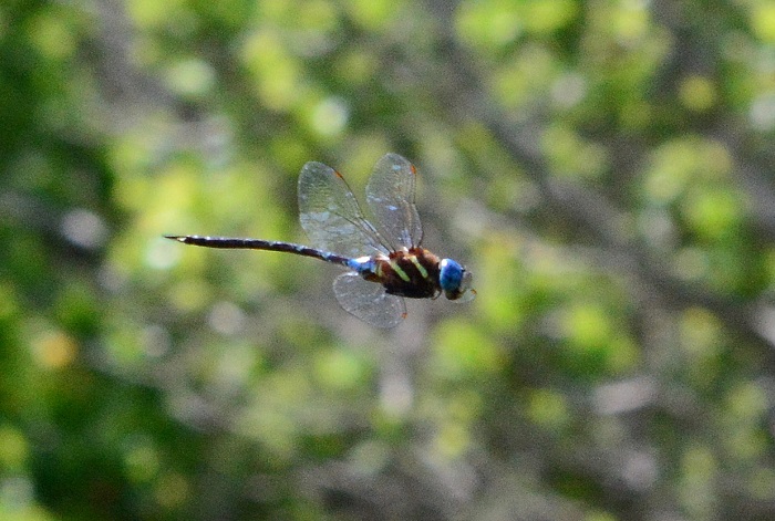
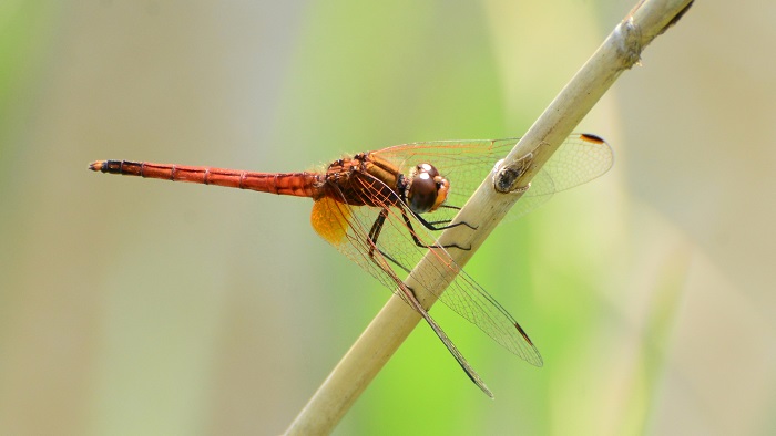
Elands River, Boston, KwaZulu-Natal
Photo by Ryan Tippett
Status and Conservation
The Highland Spreadwing is common and widespread in South Africa. It is listed as of Least Concern in the IUCN Red List of Threatened Species. The Highland Spreadwing is an adaptable species that has widely benefited from suitable man-made habitats like dams and ponds.

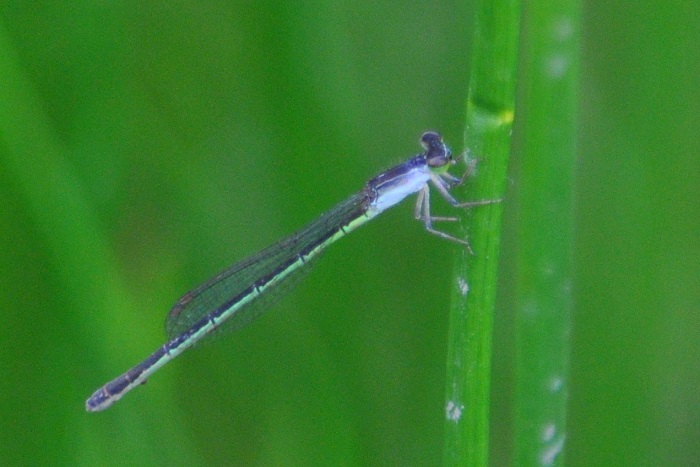
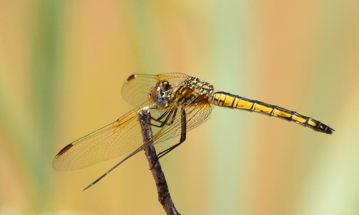
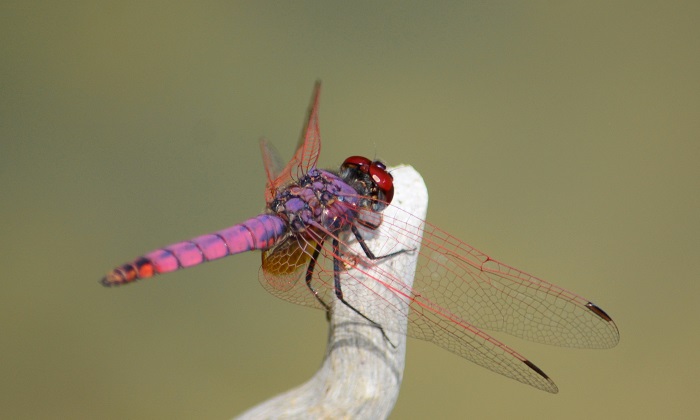
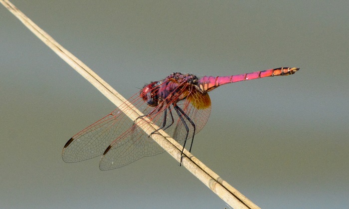
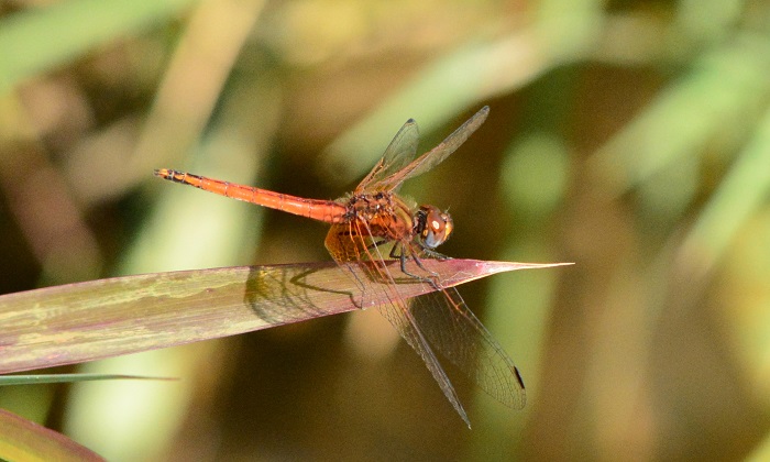
iXopo district, KwaZulu-Natal
Photo by Ryan Tippett
Distribution
Lestes plagiatus is widespread in eastern and southern Africa. In south Africa it is found primarily in the east where it is common. Marginal in the Northern and Western Cape.

Amakhosi Game Reserve, KwaZulu-Natal
Photo by Ryan Tippett
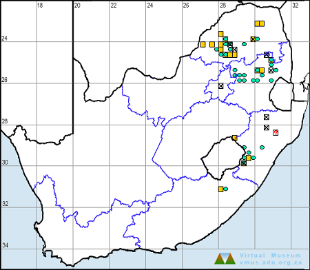
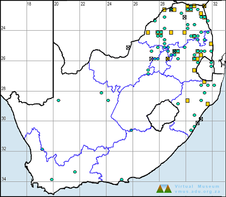
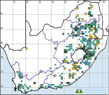
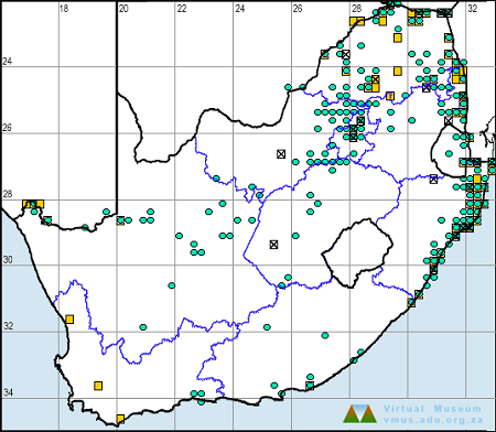
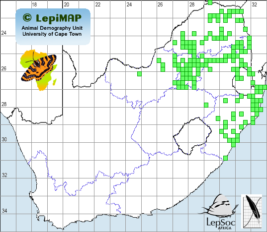
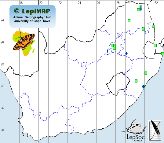
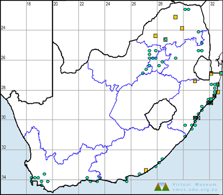
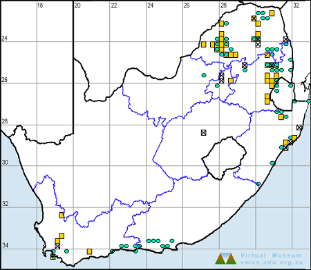
Below is a map showing the distribution of records for Highland Spreadwing in the OdonataMAP database as at February 2020.
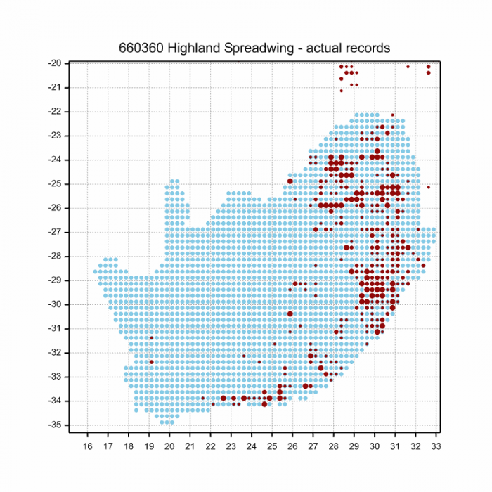
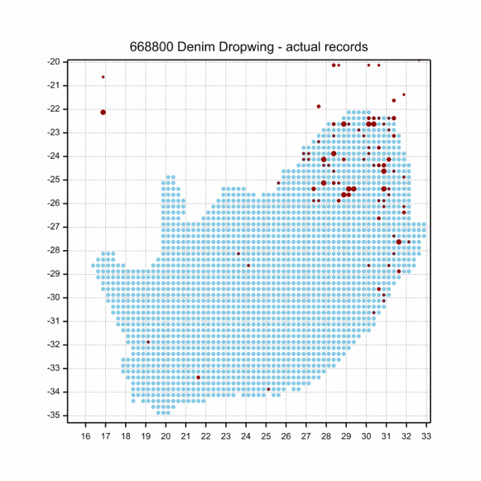
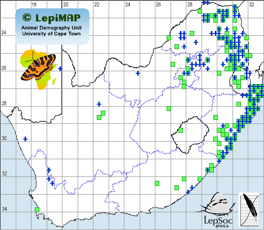
Below is a map showing the distribution of records for Highland Spreadwing in the OdonataMAP database as of December 2024.

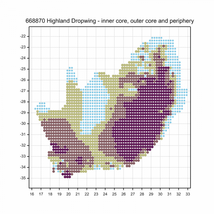
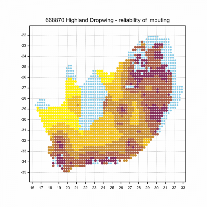
The next map below is an imputed map, produced by an interpolation algorithm, which attempts to generate a full distribution map from the partial information in the map above. This map will be improved by the submission of records to the OdonataMAP section of the Virtual Museum.
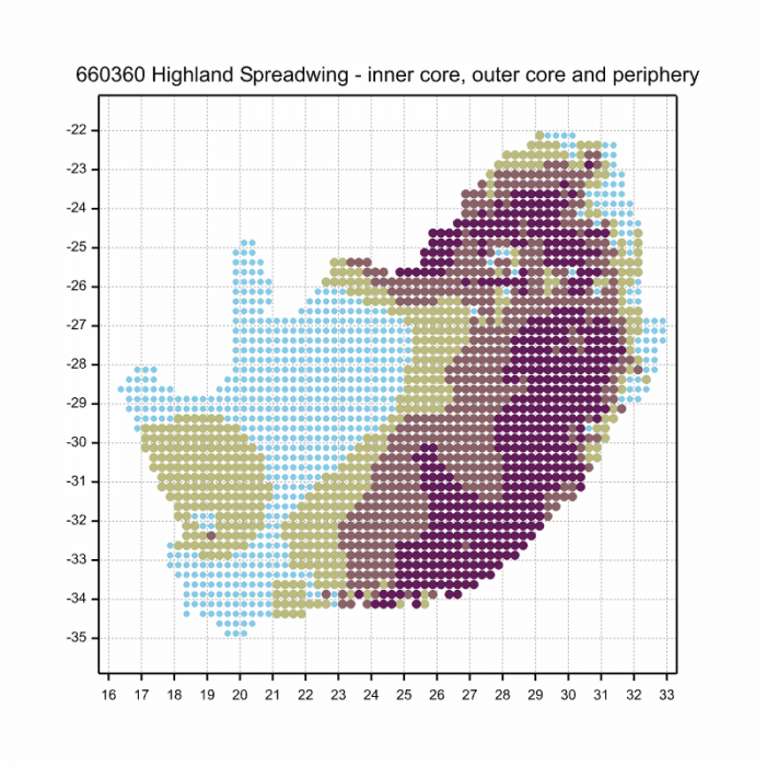

Ultimately, we will produce a series of maps for all the odonata species in the region. The current algorithm is a new algorithm. The objective is mainly to produce “smoothed” maps that could go into a field guide for odonata. This basic version of the algorithm (as mapped above) does not make use of “explanatory variables” (e.g. altitude, terrain roughness, presence of freshwater — we will be producing maps that take these variables into account soon). Currently, it only makes use of the OdonataMAP records for the species being mapped, as well as all the other records of all other species. The basic maps are “optimistic” and will generally show ranges to be larger than what they probably are.
These maps use the data in the OdonataMAP section of the Virtual Museum, and also the database assembled by the previous JRS funded project, which was led by Professor Michael Samways and Dr KD Dijkstra.

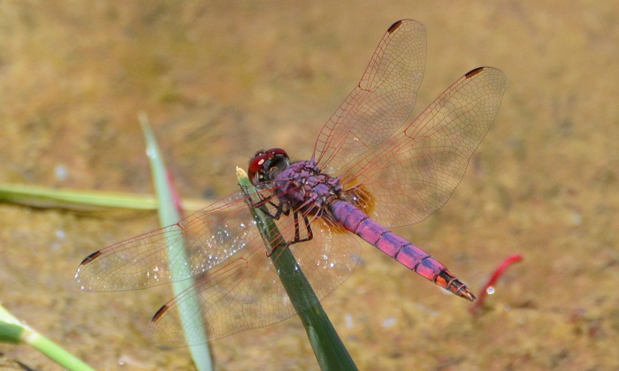
Lake Naverone, KwaZulu-Natal
Photo by Ryan Tippett
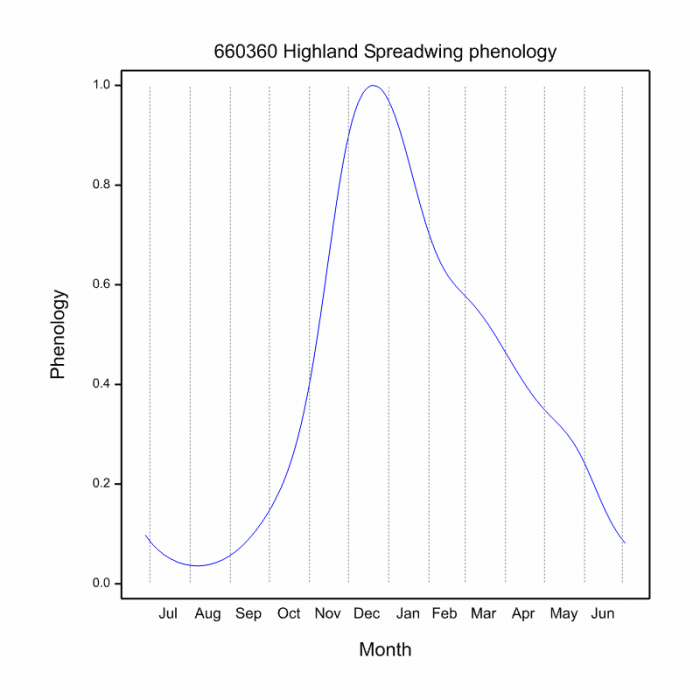
Phenology
The next two graphs shows how the occurrence of the Highland Spreadwing varies within the year, i.e. the phenology. There are 873 records in the database for this species, so these results are likely to be reliable. They show the overall phenology within the range. The first plot shows the number of records in each pentade, five-day periods, which start on 1 July and end on 30 June the following year. The blue line is generated by a smoother, an algorithm which aims to separate the “signal” from the “noise”, and shows the pattern of seasonality for this species. The second plot shows only the blue line, and it is scaled to lie between zero and one, for easy comparison between species.
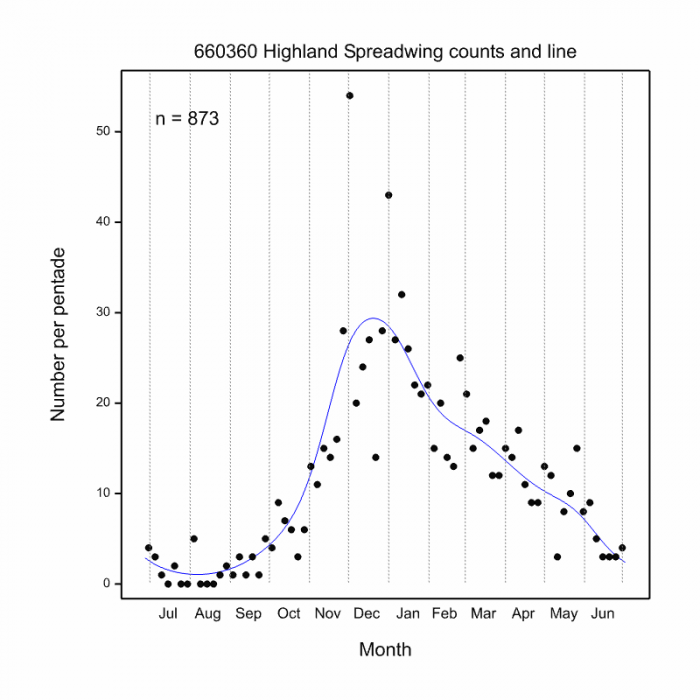
This phenology plot shows, reliably because of the large sample size, that Highland Spreadwings are mainly in flight from October to May. This is well-known; what is new is the shortness of the period of peak abundance, in December. The plot suggests a rapidly and accelerating build up of numbers, starting slowly in September. After the December peak, the decrease through late-summer, autumn and early winter is slower than the increase in spring. The numbers of Highland Spreadwings per pentade in the late-winter months are tiny.
With its large range, this species is a candidate for regional phenology plots. The more data available, the larger the number of regions, especially altitudinal bands, that can be reliably compared. Please keep submitting Highland Spreadwings to the OdonataMAP database.

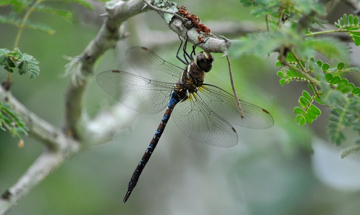
Amakhosi Game Reserve, KwaZulu-Natal
Photo by Ryan Tippett
Further Resources
The use of photographs by Peter Webb and Rowan Poortier is acknowledged. All other photographs by Ryan Tippett.
Highland Spreadwing Lestes plagiatus (Burmeister, 1839)
Other common names: Gewone Spanvlerkie (Afrikaans)
Recommended citation format: Loftie-Eaton M; Navarro R; Tippett RM; Underhill L. 2025. Highland Spreadwing Lestes plagiatus. Biodiversity and Development Institute. Available online at https://thebdi.org/2020/05/08/highland-spreadwing-lestes-plagiatus/
References: Tarboton, M; Tarboton, W. (2019). A Guide to the Dragonflies & Damselflies of South Africa. Struik Nature.
Samways, MJ. (2008). Dragonflies and Damselflies of South Africa. Pensoft
Samways, MJ. (2016). Manual of Freshwater Assessment for South Africa: Dragonfly Biotic Index. Suricata 2. South African National Biodiversity Institute, Pretoria
Martens, A; Suhling, F. (2007). Dragonflies and Damselflies of Namibia. Gamsberg Macmillan.

Wakkerstroom, Mpumalanga
Photo by Ryan Tippett


