
The Hantam is the general area north of Calvinia in the Northern Cape province of South Africa. It’s an arid area, and poorly covered in biodiversity surveys. Citizen scientist Salome Willemse arranged a BioBash for the area, the “Calvinia BioBash”, and found accommodation in a farm house called “’n Handvol Gruis”. The expression, “’n handvol gruis”, literally, “a handful of grit”, comes from a poem by C Louis Leipoldt:

For this poet, C. Louis Leipoldt, this area, the Hantam-wyk, was one of the most beautiful places he had experienced. I searched for an English version of this poem which captures the rich mood, but Wikipedia says that Leipoldt’s poetry doesn’t translate easily. In the last line, “arm” means “poor”, “eergister” is “the day before yesterday”, “en” is “and”, “nou” is “now”, and “skatryk” is “treasure rich”. Literally: “Poor the day before yesterday, and now treasure rich.”

The last line of the poem is about an emotional transformation from poverty to riches. The Calvinia BioBash aimed to make the same transformation, but in a somewhat more practical way. We aimed to transform the biodiversity database of the Hantam from poverty to riches. We certainly didn’t make it “skatryk”, but we enhanced the quality of the data dramatically.

The main focus of the Calvinia BioBash team was the bird atlas. The map below shows the coverage “before” and “after” the BioBash. Do a bit of visual exercise to see the difference between the two maps. You discover that a lot of pentads were atlased for the first time. Changes in colour between the two coverage maps show pentads which received additional checklists.

We also worked on enriching the Virtual Museum database (http://vmus.adu.org.za). Between us, with Zenobia van Dyk and myself being chief contributors, we added about 500 records to the various sections of the Virtual Museum. We highlight a few of the records.
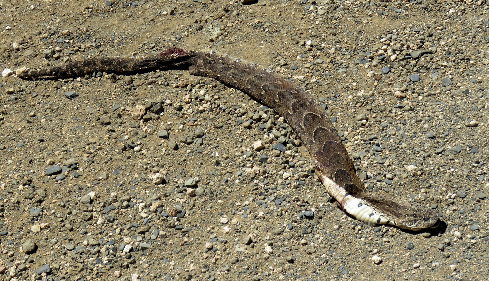
Roads are essential for the collection of biodiversity data. They made doing the Calvinia BioBash feasible! However, their direct impact on biodiversity is generally negative. Especially snakes and mammals become road casualties. Taking a photo and uploading it to the Virtual Museum means that the wasted animal is not a total dead loss, unless of course it is the last representative of the species in the district. The largely dried out Puff Adder above became a valuable point in the distribution map for this species. Believe it or not, this is the first ever formal record of Puff Adder in the quarter degree grid cell 3119BC, which lies immediately west of Calvinia, and with good roads. So even the published reptile atlas does not have Puff Adder for this grid cell. In fact, this grid cell has only had five records of reptiles, representing four species since 1980. The Puff Adder is the fourth! To see the map of this grid cell, and a list of the four species, go to http://vmus.adu.org.za/vm_locus_map.php?vm=ReptileMAP&locus=3119BC! This illustrates how much fieldwork still needs to be done!

Overall, fences are not a positive for biodiversity. But they are a big plus for BirdPixers. We are not bothered by the aesthetics of an ugly barbed wire fence. All we need are images in which the bird is easily identified. Fences provide great perches where we can take photos of a whole bird rather than a partly obscured bird.

Across much of the arid Karoo, trees are rare. Poles, and the wires between them, provide elevated perches for many bird predators, creating hunting opportunities that never existed before. Predators have an unobstructed view of the ground below, a luxury unavailable in pristine conditions, when the best hunting perch might be a shrub. It is likely that a more serious problem with poles is that they provide substitute trees for the nests of crows. Poles have enabled crows to spread into arid areas of South Africa. Controlling crows is not going to make any long-term difference, because there are plenty of spare crows to take the places of any that are culled. Removing poles might have a long-term impact.

Dragonflies are mostly associated with water. But the Hantam area is arid. So one would expect dragonflies to be as rare as rocking horse droppings. But there are isolated patches of water. There is a wonderful “watersplash” where the Hantam River crosses the gravel road in a remarkable gorge a few kilometres north of the farm Kaalplek. This was probably the best spot in quarter degree grid cell 3119BB for dragonflies. To see the map of this grid cell, and a list of the six species of dragonflies and damselflies recorded here, go to http://vmus.adu.org.za/vm_locus_map.php?vm=OdonataMAP&locus=3119BB!
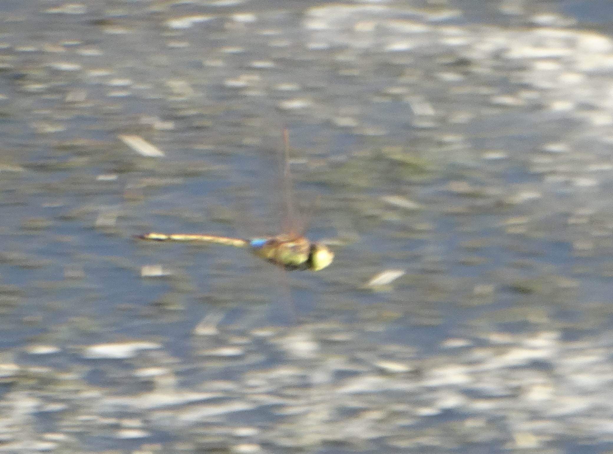
Perhaps the prize record of the Calvinia BioBash for OdonataMAP was this Vagrant Emperor, photographed by Zenobia van Dyk. In the entire Northern Cape, this was the fifth quarter degree grid cell in which the species has been recorded.
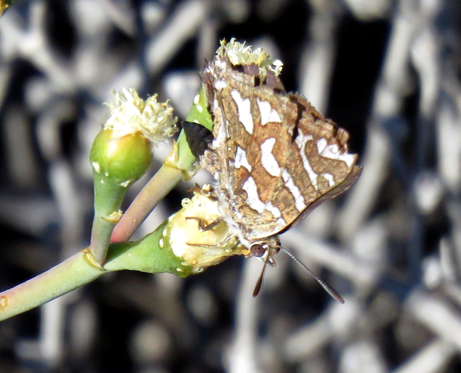
At the start of the expedition, the number of butterfly species recorded in quarter degree grid cell 3919BB was seven. Four species were photographed and uploaded. Three were the extremely common and almost ubiquitous African Monarch, Painted Lady and Common Meadow White. The fourth, Namaqua Bar (in the photo above) was identified by Fanie Rautenbach, LepiMAP expert panel. Astonishingly, all four species were new to the grid cell! See the list below! You get the up-to-date list by clicking on http://vmus.adu.org.za/vm_locus_map.php?vm=LepiMAP&locus=3119BB, and you can see if any additional records have been added.

All the columns are easy, but the last two need some explanation. The column headed “Last recorded” provides the most recent date on which a species was recorded in the Virtual Museum. This provides you with an insight into how urgently each species needs to be “refreshed”. Ideally, you should download this list before you go into the field, and choose a set of priority species for “refreshment”. A species which was last recorded 10 years or longer ago is definitely needing a new record to confirm that it is still present in the grid cell. Even a three-year old record needs refreshing. If you have a series of photos for a grid cell, upload them all. Don’t worry if some the “Last recorded” dates are recent. Any species which are not already on the list are especially valuable and important!
Every entry in the final column reads “Records”, in blue. Click on this and you will discover it is a link to all the records of the species in the grid cell (including any from before 1980!). But it won’t work here, because this is a photograph of the table! It is fascinating to be empowered to see when the records were made, and who the observer was.

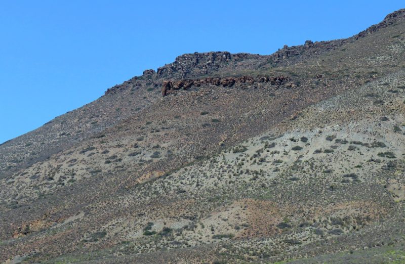
Kaalplek has been mentioned a couple of times above. To an English-speaking South African, with a modest grip on Afrikaans, this translates into “the place where you walk around naked”. This very literal translation does not capture the intended meaning: “the place which is barren and treeless.” The Hantam is a tough area to be a farmer, and the droughts of the past few years have resulted in many of the farms being totally abandoned.
Salome Willemse and Zenobia van Dyk did a reconnaissance trip to find the accommodation and test the roads for quality, and were part of the expedition, from 8 to 12 November 2018. Alan Collett and Tino Herselman traveled west from the Karoo to participate. Eric Hermann traveled north from Hopefield, and I came from Cape Town. We are all grateful to Salome for her coordination and leadership of the expedition. The Calvinia BioBash was citizen science at its best.
Is there a PDF copy available.
Wonderful report! That is such a spectacular area of South Africa! Well done on enriching the bio’data for the Hantam.
Glad you researched this region. I grew up here and it is part of my memorie!