

Cover photo by Gregg Darling.
Find the Yellow Presba in the FBIS database (Freshwater Biodiversity Information System) here.
Family Synthemistidae
Identification

Kogelberg Nature Reserve, Western Cape
Photo by Niall Perrins
Medium-large size
Length up to 48mm; Wingspan attains 70mm.
The Yellow Presba is easily differentiated from other presba species by the two diagonal yellow stripes on the sides of the thorax. The sexes are similar, but females have broader abdomens and a more pronounced amber wash in the wings.
Yellow Presbas most resemble the Rustic Presba (Syncordulia Serendipator) and Gilded Presba (Syncordulia legator), however, neither of these species show well defined yellow stripes on the sides of the thorax. They also have differently patterned abdomens.
Click here for more details on identification of the Yellow Presba.
Habitat
The Yellow Presba frequents rivers and streams, in mountainous fynbos and grassland habitats. It requires clear, flowing water with rocks and bushy streamside vegetation. The Yellow Presba spends much of its time away from water, foraging over the surrounding fynbos or grasslands.
Photo by Corné Rautenbach
Behaviour
The Yellow Presba is infrequently found at water and is most often encountered away from water, hunting over low bushy vegetation. It rests up in dense bushes where it is well camouflaged. Like other presbas, the Yellow Presba hangs from a branch when perched.
On the wing from mid October to late January. See Phenology below.
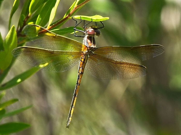
Photo by John Wilkinson
Status and Conservation
The Yellow Presba is uncommon, but still the most regularly encountered Syncordulia species. Listed as Vulnerable in the IUCN Red List of Threatened Species. Yellow Presbas are only found in undisturbed environments and are not tolerant of habitat degradation.
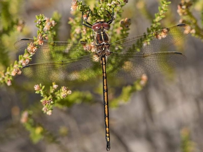
Photo by Desire Darling
Distribution
The Yellow Presba is endemic to South Africa. It is most regular in the Western Cape. Additionally, there are records of this species from the Drakensberg regions of the Eastern Cape and KwaZulu-Natal, where it is rare but likely to have been overlooked and under-recorded.
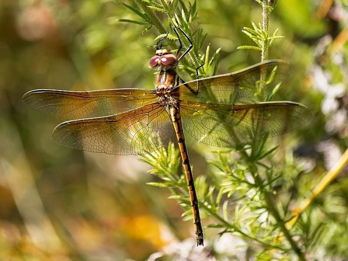
Photo by Hesmarie Els
Below is a map showing the distribution of records for Yellow Presba in the OdonataMAP database as at February 2020.

Below is a map showing the distribution of records for Yellow Presba in the OdonataMAP database as of December 2024.
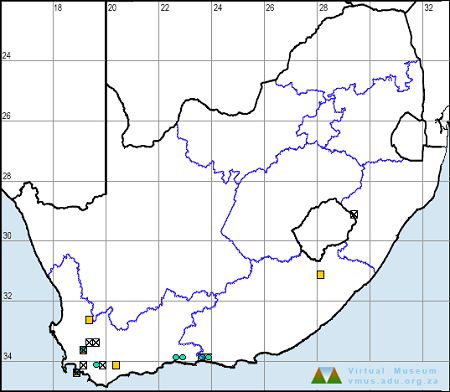
The next map below is an imputed map, produced by an interpolation algorithm, which attempts to generate a full distribution map from the partial information in the map above. This map will be improved by the submission of records to the OdonataMAP section of the Virtual Museum.


Ultimately, we will produce a series of maps for all the odonata species in the region. The current algorithm is a new algorithm. The objective is mainly to produce “smoothed” maps that could go into a field guide for odonata. This basic version of the algorithm (as mapped above) does not make use of “explanatory variables” (e.g. altitude, terrain roughness, presence of freshwater — we will be producing maps that take these variables into account soon). Currently, it only makes use of the OdonataMAP records for the species being mapped, as well as all the other records of all other species. The basic maps are “optimistic” and will generally show ranges to be larger than what they probably are.
These maps use the data in the OdonataMAP section of the Virtual Museum, and also the database assembled by the previous JRS funded project, which was led by Professor Michael Samways and Dr KD Dijkstra.
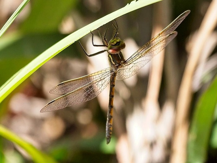
Photo by John Wilkinson
Phenology


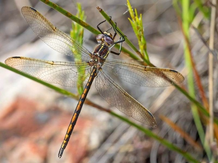
Photo by Desire Darling
Further Resources
The use of photographs by Basil Boer, Corné Rautenbach, Desire Darling, Hesmarie Els, and John Wilkinson is acknowledged.
Yellow Presba Syncordulia gracilis Burmeister, 1839
Other Common names: Geelswalker (Afrikaans)
Recommended citation format: Loftie-Eaton M; Navarro R; Tippett RM; Underhill L. 2025. Yellow Presba Syncordulia gracilis. Biodiversity and Development Institute. Available online at https://thebdi.org/2020/05/25/yellow-presba-syncordulia-gracilis/
References: Tarboton, M; Tarboton, W. (2019). A Guide to the Dragonflies & Damselflies of South Africa. Struik Nature.
Samways, MJ. (2008). Dragonflies and Damselflies of South Africa. Pensoft
Samways, MJ. (2016). Manual of Freshwater Assessment for South Africa: Dragonfly Biotic Index.Suricata 2. South African National Biodiversity Institute, Pretoria