
Cover photo by Wil Leurs.
Find the Sapphire Bluet in the FBIS database (Freshwater Biodiversity Information System) here.
Family Coenagrionidae
Identification

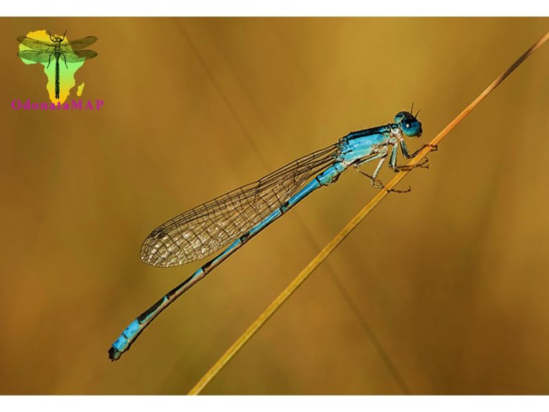
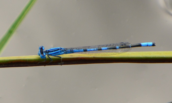
Near Kokstad, KwaZulu-Natal
Photo by Alan Manson
Very small
Length up to 28mm; Wingspan reaches 40mm.
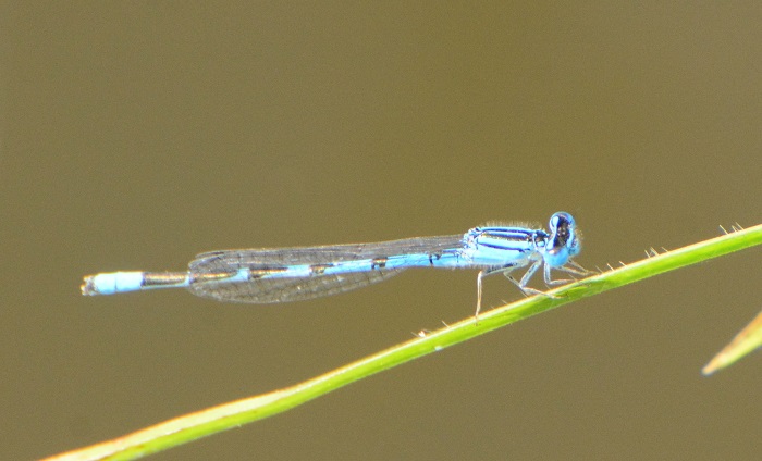
The male Sapphire Bluet carries bright blue and black colouration and is therefore similar to other Bluet species. However, it is easily recognised by its more vivid blue colouration, and by the diagnostic, broad black bands on the abdomen.
Females are distinctive and share the same markings as the males, but are far duller in appearance.
Click here for more details on identification.
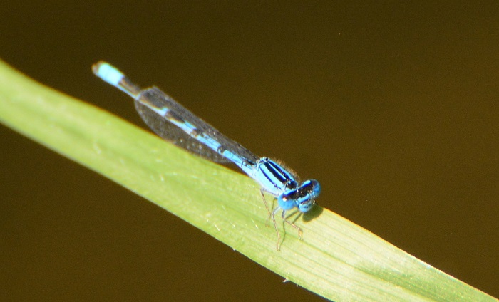
Near Colesburg, Northern Cape
Photo by Ryan Tippett
Habitat
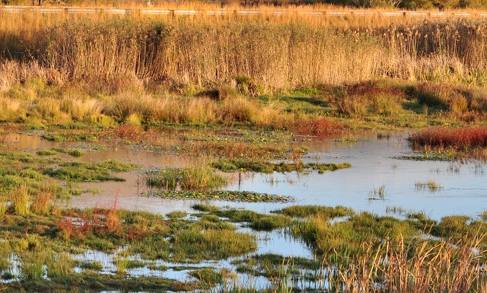
Photo by Ryan Tippett
The Sapphire Bluet is found in highveld grassland, where it prefers well-vegetated, still-water habitats. It favours water bodies with floating and half-submerged aquatic plants such as natural ponds, and the sheltered margins of lakes and dams. The Sapphire Bluet is sometimes also found along streams with thick, grassy banks and quiet pools. It mostly occurs at altitudes between 1000 and 1800m above sea level.
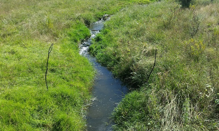
Near Colesberg, Northern Cape
Photo by Ryan Tippett
Behaviour
The Sapphire Bluet sits close to the water on overhanging grass or on floating vegetation. It is an alert and weary species that flies low across the water when disturbed. It hunts from a perch and feeds on small flying insects.
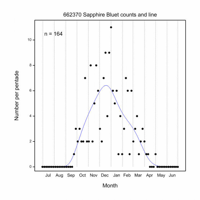
The Sapphire Bluet is on the wing from September to April (see Phenology below).
Near Colesburg, Northern Cape
Photo by Ryan Tippett
Status and Conservation
Africallagma sapphirinum is a common but localised species. It is listed as of Least concern on the IUCN Red List of Threatened Species. The Sapphire Bluet is moderately sensitive to habitat disturbance. It commonly occurs at suitable man-made dams and ponds, including those with some alien plant growth. Within its habitat range, this species has no doubt benefited from its use of artificial impoundments.
Near Colesburg, Northern Cape
Photo by Ryan Tippett
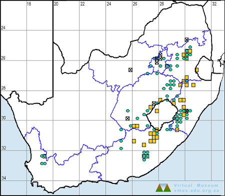
Distribution
The Sapphire Bluet is endemic to the highveld grasslands of South Africa. There is also an isolated population in the Cedarberg, Western Cape.
Below is a map showing the distribution of records for Sapphire Bluet in the OdonataMAP database as at February 2020.

Below is a map showing the distribution of records for Sapphire Bluet in the OdonataMAP database as at December 2024.
The next map below is an imputed map, produced by an interpolation algorithm, which attempts to generate a full distribution map from the partial information in the map above. This map will be improved by the submission of records to the OdonataMAP section of the Virtual Museum.

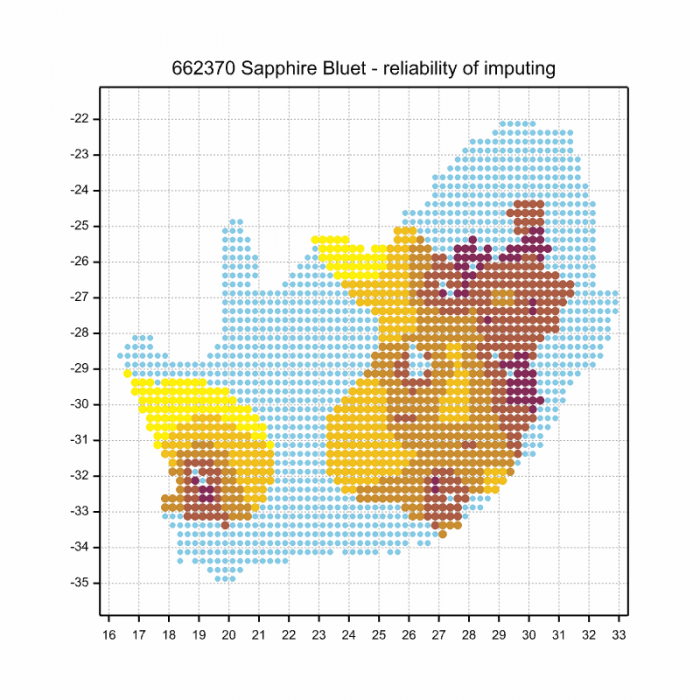
Ultimately, we will produce a series of maps for all the odonata species in the region. The current algorithm is a new algorithm. The objective is mainly to produce “smoothed” maps that could go into a field guide for odonata. This basic version of the algorithm (as mapped above) does not make use of “explanatory variables” (e.g. altitude, terrain roughness, presence of freshwater — we will be producing maps that take these variables into account soon). Currently, it only makes use of the OdonataMAP records for the species being mapped, as well as all the other records of all other species. The basic maps are “optimistic” and will generally show ranges to be larger than what they probably are.
These maps use the data in the OdonataMAP section of the Virtual Museum, and also the database assembled by the previous JRS funded project, which was led by Professor Michael Samways and Dr KD Dijkstra.
Phenology

Further Resources
The use of photographs by Alan Manson and Wil Leurs is acknowledged.
Sapphire Bluet Africallagma sapphirinum (Pinhey, 1950)
Other Common names: Saffierbloutjie (Afrikaans).
Recommended citation format: Loftie-Eaton M; Navarro R; Tippett RM; Underhill L. 2025. Sapphire Bluet Africallagma sapphirinum. Biodiversity and Development Institute. Available online at https://thebdi.org/2020/03/09/sapphire-bluet-africallagma-sapphirinum/
References: Tarboton, M; Tarboton, W. (2019). A Guide to the Dragonflies & Damselflies of South Africa. Struik Nature.
Samways, MJ. (2008). Dragonflies and Damselflies of South Africa. Pensoft
Samways, MJ. (2016). Manual of Freshwater Assessment for South Africa: Dragonfly Biotic Index.Suricata 2. South African National Biodiversity Institute, Pretoria