
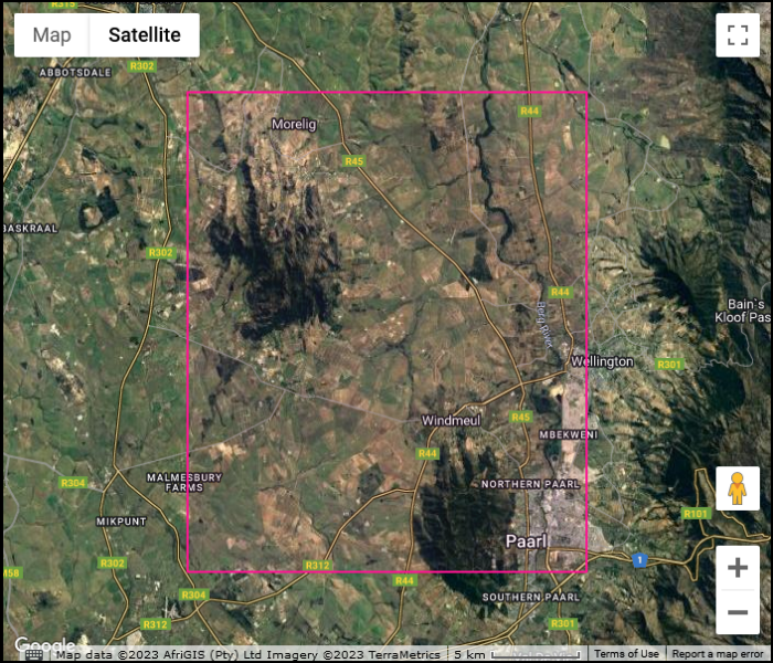
The Paardeberg is located in the northwestern corner of the quarter degree grid cell for Paarl, code name 3318DB. It is block of mountains about 5 to 6 km long both north-south and east-west. The highest point has an altitude of 758 m above sea level, which is 70% of the highest point on Table Mountain. Most of the area above the 200 m contour is natural vegetation; this is shown as dark green on the map below. The total area of natural vegetation is about 25 km2. Biologically it is quite poorly known.
To a geologist, the Paardeberg is a series of granite hills – they are dome-shaped hills technically called plutons. It was called the Paardeberg because, when it was discovered, it was inhabited by quaggas, which to the early settlers were horselike. There are dozens of mountains called Paardeberg across South Africa; the most famous (and the one you find first on Google) is near Kimberley in the Northern Cape, where the Battle of Paardeberg took place. Our Paardeberg is about 50 km northeast of Cape Town between the towns of Paarl and Malmesbury in the Swartland.

This granite dome (pluton) is along the northern edge of the Paardeberg.

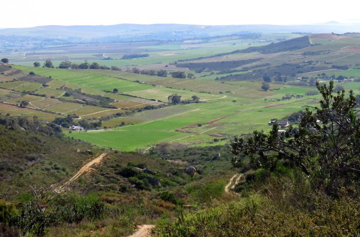
The Paardeberg lies in the Swartland, the mostly flat area north of Cape Town. Just over 97% of the natural vegetation has been lost, mostly replaced by agriculture. The remaining 2.5% consists of unploughed land, mostly hilltops where it is too difficult to plough. Effectively, there is a scattering of “islands” of natural vegetation in a sea that consists mostly of wheat and canola and some grapes. The Perdeberg is one of the largest of these islands. Almost the entire perimeter of the Paardeberg consists of vineyards. Just above these agricultural areas, especially on the western edge, is a band of renosterveld. Go a little higher, and the proportion of plants which are proteas, ericas and restios increases, and the renosterveld gives way to fynbos.
There are several tracks up the Paardeberg. This one starts on Fynbos Estate and is the service road to a cell phone base station on Dragons Ridge. It is not a public road. It passes through the Simson-Simons Nature Reserve.
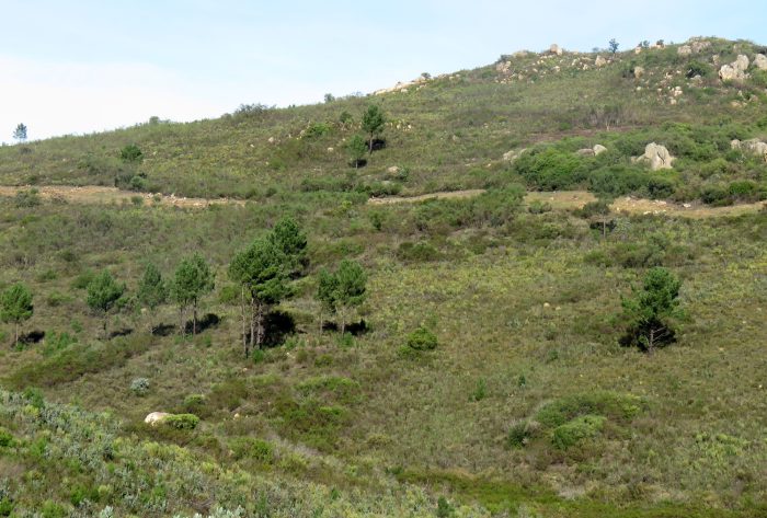
There are small infestations of alien plants in many areas of the Paardeberg. Here is a scattering of cluster pines.
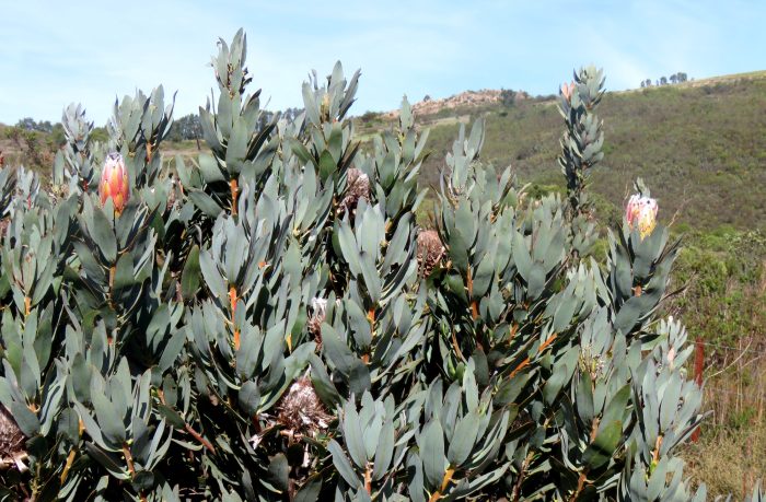
,,, but overall, the Paardeberg contains an amazing array of Fynbos biodiversity …
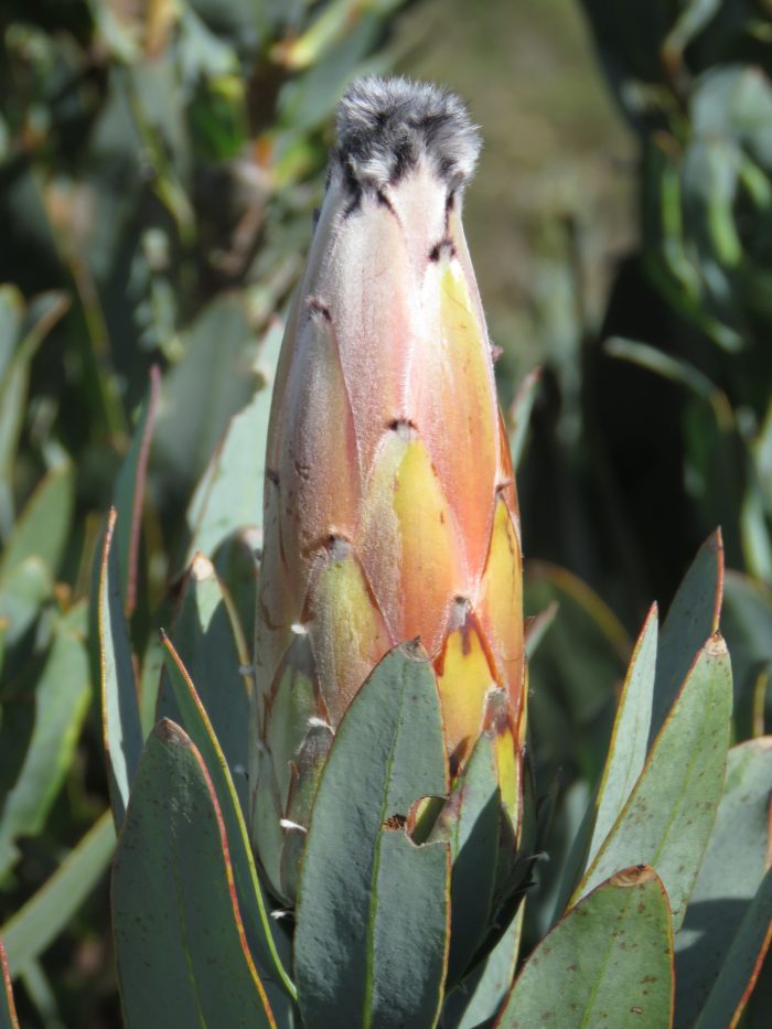
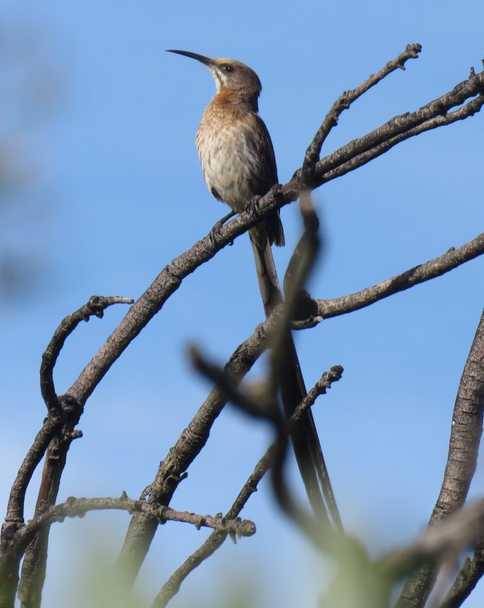
… including iconic species, endemic to the Fynbos Biome, such as protea and Cape Sugarbird!