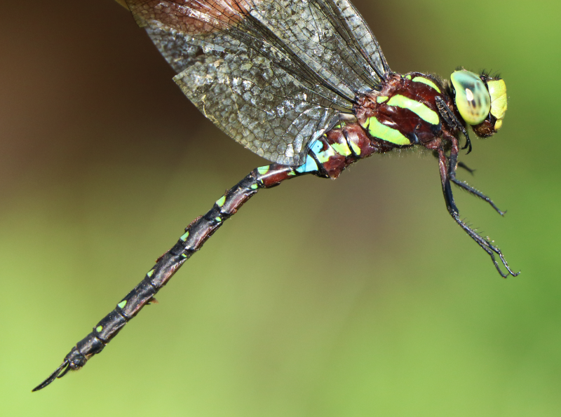
Cover photo by Gerhard Diedericks.
Find the Forest Hawker in the FBIS database (Freshwater Biodiversity Information System) here.
Family Aeshnidae
Identification

Near Sabi, Mpumalanga
Photographs by Gerhard Diedericks
Medium – large size
Length up to 45mm; Wingspan reaches 83mm.
The Forest Hawker is closely similar to the Friendly Hawker (Zosteraeschna minuscula), but differs in having a pentagon shaped marking on the forehead and triangle shaped green markings on the shoulders. The diagonal stripes on the sides of the thorax are also a brighter shade of green in the Forest Hawker.
The sexes are similar but females either lack the blue saddle or it is very reduced. Females also have amber outer wings.
Click here for more details on identification of the Forest Hawker.
Habitat
The Forest Hawker is associated with subtropical or tropical moist montane forests and forest-edge environments. It inhabits rivers, streams, ponds, marshes, and dams, both inside and outside the forest. It will also hunt over grasslands and high-altitude shrubland near forests. The Forest Hawker prefers indigenous forests but also makes use of exotic plantations.
Behaviour
The Forest Hawker is highly aerial, spending most of its time in flight. It patrols, to and fro along a chosen route over the wetland. The flight is fast and direct. The Forest Hawker hangs vertically from a perch while at rest.
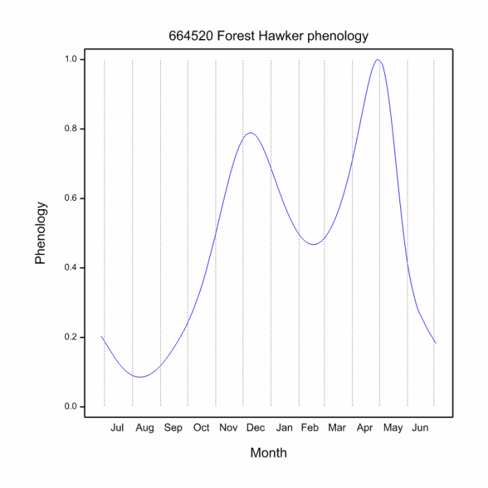
The Forest Hawker is mainly on the wing from October to May (see Phenology below).
Status and Conservation
The Forest Hawker is rare and localised in South Africa. It is listed for South Africa as being Vulnerable in the IUCN Red List of Threatened Species. It is threatened by the loss of wetland habitats due to the spread of commercial forestry and agriculture. The Forest Hawker does occupy exotic plantations, provided associated wetlands remain intact.
Distribution
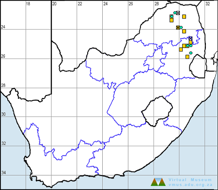
Zosteraeschna usambarica has a highly fragmented distribution that ranges from South Africa to Zimbabwe, Mozambique, Malawi, Tanzania and Kenya. In South Africa, it is restricted to isolated escarpment forests in Mpumalanga and Limpopo.
Below is a map showing the distribution of records for Forest Hawker in the OdonataMAP database as at February 2020.

Below is a map showing the distribution of records for Forest Hawker in the OdonataMAP database as of December 2024.

The next map below is an imputed map, produced by an interpolation algorithm, which attempts to generate a full distribution map from the partial information in the map above. This map will be improved by the submission of records to the OdonataMAP section of the Virtual Museum.


Ultimately, we will produce a series of maps for all the odonata species in the region. The current algorithm is a new algorithm. The objective is mainly to produce “smoothed” maps that could go into a field guide for odonata. This basic version of the algorithm (as mapped above) does not make use of “explanatory variables” (e.g. altitude, terrain roughness, presence of freshwater — we will be producing maps that take these variables into account soon). Currently, it only makes use of the OdonataMAP records for the species being mapped, as well as all the other records of all other species. The basic maps are “optimistic” and will generally show ranges to be larger than what they probably are.
These maps use the data in the OdonataMAP section of the Virtual Museum, and also the database assembled by the previous JRS funded project, which was led by Professor Michael Samways and Dr KD Dijkstra.


Further Resources
The use of photographs by Gerhard Diedericks is acknowledged.
Forest Hawker Zosteraeschna usambarica Kirby, 1896
Other names: Zosteraeschna ellioti (Alt. Scientific Name); Elliot’s Hawker (Alt. English); Vrolike Venter (Afrikaans)
Recommended citation format: Loftie-Eaton M; Navarro R; Tippett RM; Underhill L. 2025. Forest Hawker Zosteraeschna usambarica. Biodiversity and Development Institute. Available online at https://thebdi.org/2020/05/26/forest-hawker-zosteraeschna-usambarica/
References: Tarboton, M; Tarboton, W. (2019). A Guide to the Dragonflies & Damselflies of South Africa. Struik Nature.
Samways, MJ. (2008). Dragonflies and Damselflies of South Africa. Pensoft
Samways, MJ. (2016). Manual of Freshwater Assessment for South Africa: Dragonfly Biotic Index. Suricata 2. South African National Biodiversity Institute, Pretoria

