

Cover photo by Eugene Troskie.
Find the Elegant Dropwing in the FBIS database (Freshwater Biodiversity Information System) here.
Family Libellulidae
Identification

Ndumo Game Reserve, KwaZulu-Natal
Photo by Ryan Tippett
Small size
Length up to 40mm; Wingspan attains 66mm.
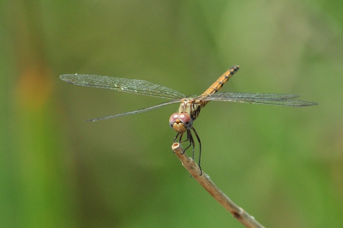
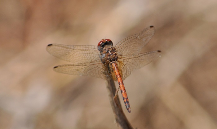
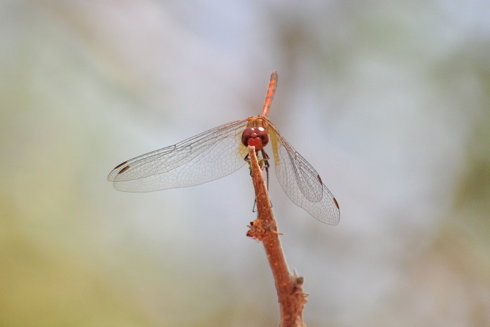
Male Elegant Dropwings are readily identified. The orange to mustard-yellow colouration with black markings and large amber hindwing patches are diagnostic.
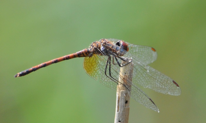
Females are less distinctive and are most similar to Trithemis annulata (Violet Dropwing) and Trithemis pluvialis (Russet Dropwing). They can be identified based on abdomen and thorax patterns, and the amber patches at the base of the hind wings. Some females also have small amber patches in the outer wings.
Click here for more details on identification.
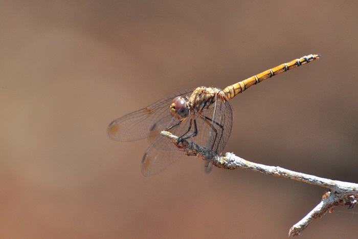
Ndumo Game Reserve, KwaZulu-Natal
Photo by Ryan Tippett
Habitat
Large tropical and subtropical rivers in hot savanna regions are the natural habitat of the Elegant Dropwing. It inhabits well-wooded areas with large trees along the upper banks. The Elegant Dropwing is frequently found along river sections with steep banks.
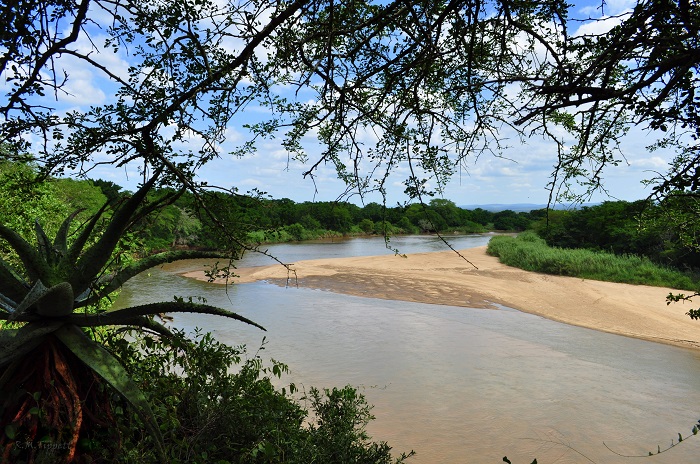
Photo by Ryan Tippett
Behaviour
The Elegant Dropwing is most often found perched on trees and large bushes away from water, frequently above the riverbanks. Individuals may be found more than 100m from the river. Both sexes occur in the same vicinity. The Elegant Dropwing typically perches high up in the outer canopy of riverine trees where it is inconspicuous. It is known to ‘skypoint’ from the tips of branches during the heat of the day. The Elegant Dropwing is seldom encountered at the water’s edge.
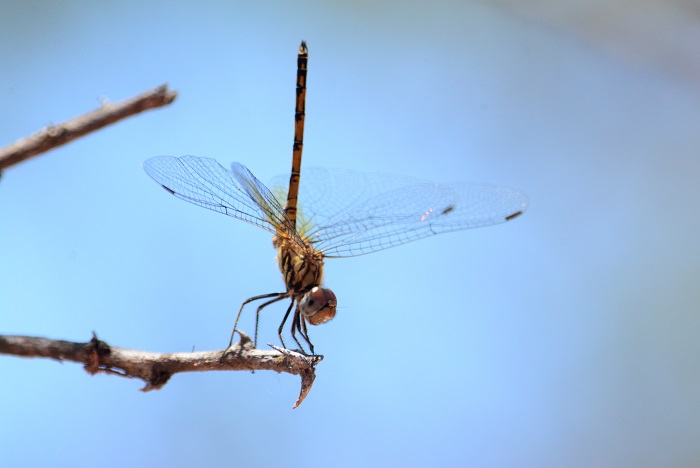
Ndumo Game Reserve, KwaZulu-Natal
Photo by Ryan Tippett
Status and Conservation
Trithemis werneri is uncommon and very localised in South Africa. This species is only known from undisturbed habitats and is not tolerant of habitat degradation. It is listed as of Least Concern in the IUCN Red List of Threatened Species. The South African population, however, is considered Near Threatened due to its marginal occurrence and dependence on pristine habitats.
Ndumo Game Reserve, KwaZulu-Natal
Photo by Ryan Tippett
Distribution
The Elegant Dropwing is sparsely distributed and is found mostly in eastern and southern Africa. It occurs from southern Sudan down to extreme northern KwaZulu-Natal in South Africa. There are also outlying populations in Angola and north-western Namibia.
Ndumo Game Reserve, KwaZulu-Natal
Photo by Ryan Tippett
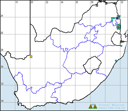
Below is a map showing the distribution of records in South Africa for Trithemis werneri. Taken from the OdonataMAP database as at February 2020.
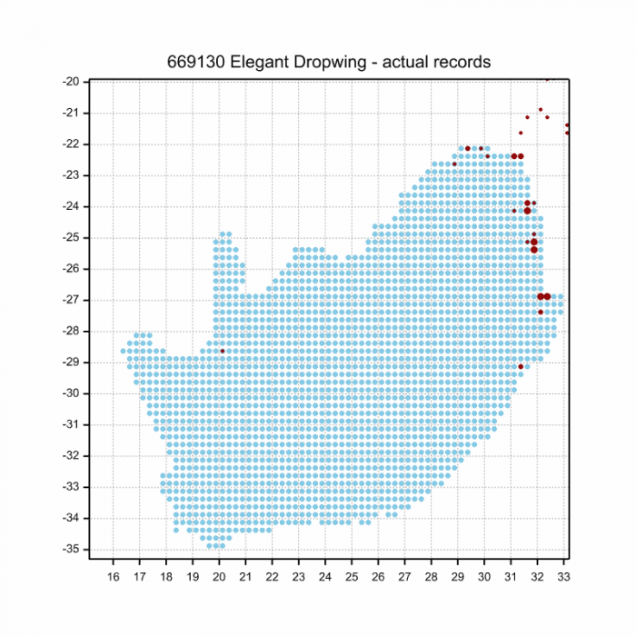
Below is a map showing the distribution of records in South Africa for Trithemis werneri. Taken from the OdonataMAP database as of December 2024.
The next map below is an imputed map, produced by an interpolation algorithm, which attempts to generate a full distribution map from the partial information in the map above. This map will be improved by the submission of records to the OdonataMAP section of the Virtual Museum.
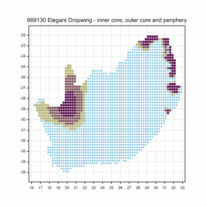
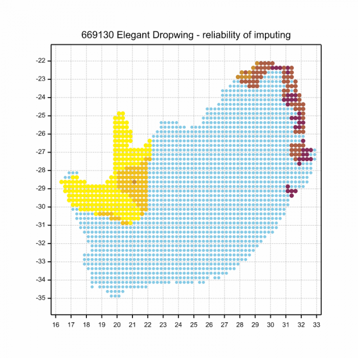
Ultimately, we will produce a series of maps for all the odonata species in the region. The current algorithm is a new algorithm. The objective is mainly to produce “smoothed” maps that could go into a field guide for odonata. This basic version of the algorithm (as mapped above) does not make use of “explanatory variables” (e.g. altitude, terrain roughness, presence of freshwater — we will be producing maps that take these variables into account soon). Currently, it only makes use of the OdonataMAP records for the species being mapped, as well as all the other records of all other species. The basic maps are “optimistic” and will generally show ranges to be larger than what they probably are.
These maps use the data in the OdonataMAP section of the Virtual Museum, and also the database assembled by the previous JRS funded project, which was led by Professor Michael Samways and Dr KD Dijkstra.
Ndumo Game Reserve, KwaZulu-Natal
Photo by Ryan Tippett
Further Resources
The use of photographs by Eugene Troskie is acknowledged.
Elegant Dropwing Trithemis werneri Ris, 1912
Other common names: Werner’s Dropwing (Alt. English); Siervalvlerkie (Afrikaans).
Recommended citation format: Loftie-Eaton M; Navarro R; Tippett RM; Underhill L. 2025. Elegant Dropwing Trithemis werneri. Biodiversity and Development Institute. Available online at https://thebdi.org/2020/04/24/elegant-dropwing-trithemis-werneri/
References: Tarboton, M; Tarboton, W. (2019). A Guide to the Dragonflies & Damselflies of South Africa. Struik Nature.
Samways, MJ. (2008). Dragonflies and Damselflies of South Africa. Pensoft
Samways, MJ. (2016). Manual of Freshwater Assessment for South Africa: Dragonfly Biotic Index.Suricata 2. South African National Biodiversity Institute, Pretoria
Martens, A; Suhling, F. (2007). Dragonflies and Damselflies of Namibia. Gamsberg Macmillan.
Ndumo Game Reserve, KwaZulu-Natal
Photo by Ryan Tippett