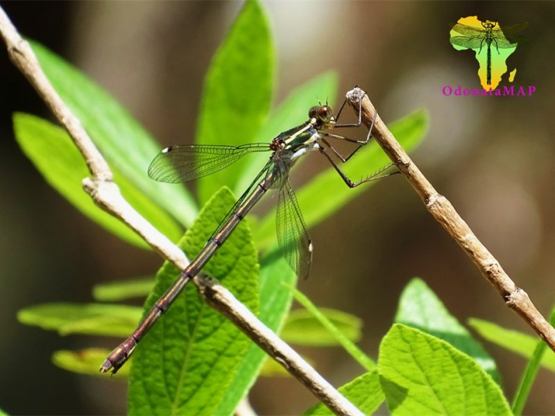
Cover photo by Riëtte Griesel.
Find the Drakensberg Malachite in the FBIS database (Freshwater Biodiversity Information System) here.
Family Synlestidae
Identification
Royal Natal National Park, KwaZulu-Natal
Photo by Riëtte Griesel
Large size
Length up to 59mm; Wingspan attains 76mm.
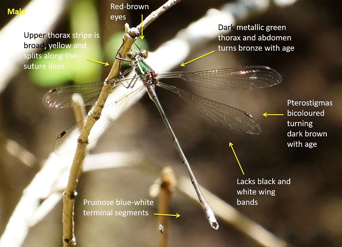
Within its restricted range Chlorolestes draconicus can only be mistaken for Chlorolestes fasciatus (Mountain Malachite). However, the Drakensberg Malachite is larger and there is virtually no size overlap between the two species. The two can be further differentiated by the yellow stripes on the upper thorax. This stripe is narrow in the Mountain Malachite and does not reach the wing bases. The stripes are broad and extend to the wing bases in the Drakensberg Malachite. In addition the Drakensberg Malachite does not have a form with black and white banded wings.
Click here for more details on identification.
Habitat
The Drakensberg Malachite frequents rocky streams with pools in high mountainous areas. The streams they inhabit are fringed by boulders, sedges, tall grass, and bushes. The Drakensberg Malachite also occurs along forested streams in protected ravines. The Drakensberg Malachite is only found above 1700m above sea level and is likely to occur to over 3000m.
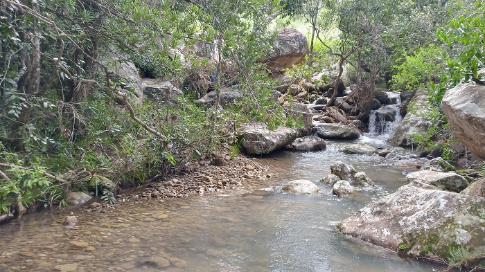
Photo by Ryan Tippett
Behaviour
The Drakensberg Malachite is most often seen sitting on vegetation over the water, typically with wings outstretched. Also regularly perches on rocks in the stream. The Drakensberg Malachite spends much of its time perched but occasionally takes flight to capture prey or to find another perch. The Drakensberg Malachite feeds on small flying insects.
The Drakensberg Malachite is on the wing from December to March (See Phenology below).
Status and Conservation
The Drakensberg Malachite is uncommon and localised. Much of its range is protected within the uKhahlamba / Drakensberg Park. As a result the Drakensberg Malachite’s conservation status has been assessed as Least Concern in the IUCN Red List of Threatened Species.
Distribution
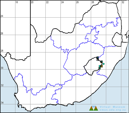
The Drakensberg Malachite is endemic to South Africa and Lesotho. This species has a restricted range in the Drakensberg Mountains.
Below is a map showing the distribution of records for Drakensberg Malachite in the OdonataMAP database as at February 2020.
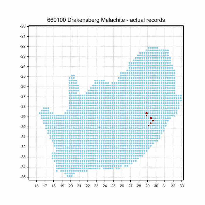
Below is a map showing the distribution of records for Drakensberg Malachite in the OdonataMAP database as of December 2024.
The next map below is an imputed map, produced by an interpolation algorithm, which attempts to generate a full distribution map from the partial information in the map above. This map will be improved by the submission of records to the OdonataMAP section of the Virtual Museum.
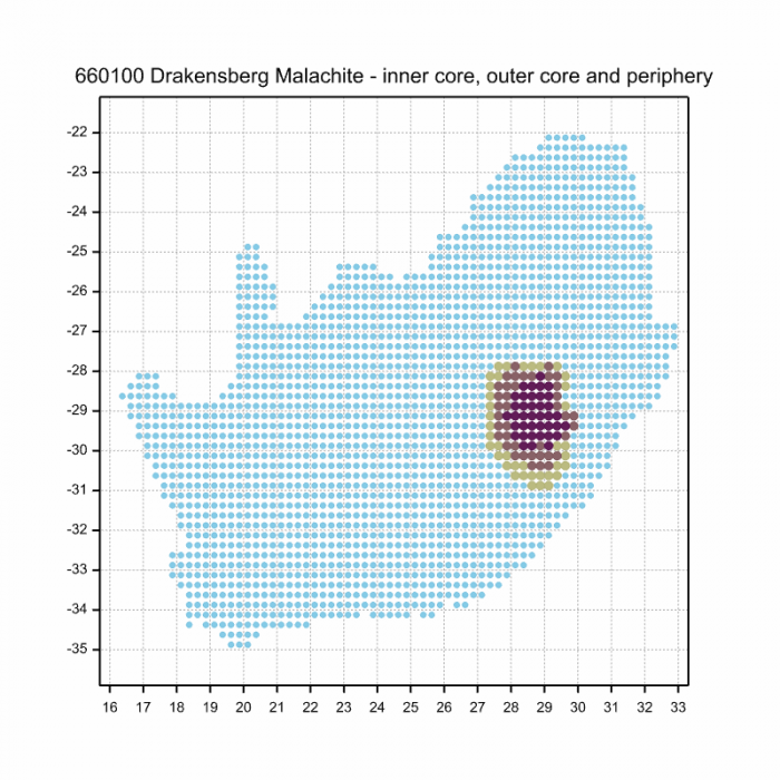
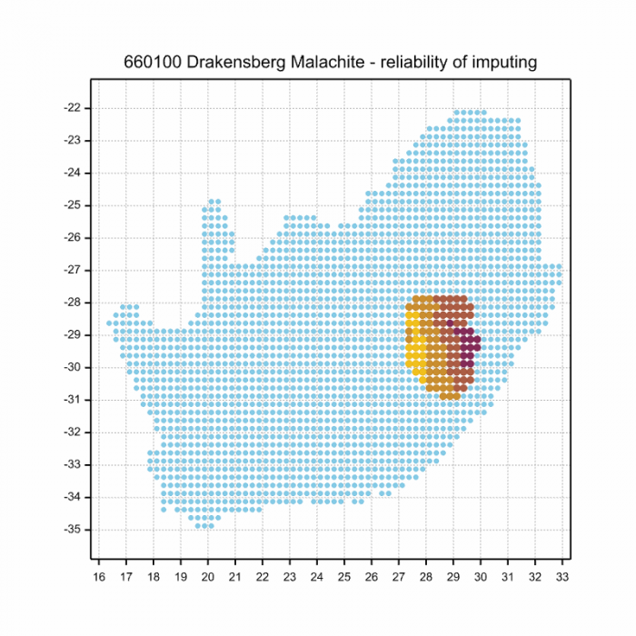
Ultimately we will produce a series of maps for all the odonata species in the region. The current algorithm is a new algorithm. The objective is mainly to produce “smoothed” maps that could go into a field guide for odonata. This basic version of the algorithm (as mapped above) does not make use of “explanatory variables” (e.g. altitude, terrain roughness, presence of freshwater — we will be producing maps that take these variables into account soon). Currently, it only makes use of the OdonataMAP records for the species being mapped, as well as all the other records of all other species. The basic maps are “optimistic” and will generally show ranges to be larger than what they probably are.
These maps use the data in the OdonataMAP section of the Virtual Museum, and also the database assembled by the previous JRS funded project, which was led by Professor Michael Samways and Dr KD Dijkstra.
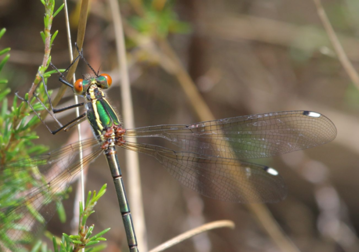
Photo by Alan Manson
The next two graphs shows how the occurrence of Drakensberg Malachites varies within the year, i.e. the phenology. There are only 11 records in the database for this species, so these results need to be treated cautiosly. The first plot shows the number of records in each pentade, five-day periods, which start on 1 July and end on 30 June the following year. There are two pentades with two records, in December-Janaury. The blue line is generated by a smoother, an algorithm which aims to separate the “signal” from the “noise”, and shows the pattern of seasonality for this species. The second plot shows only the blue line, and it is scaled to lie between zero and one, for easy comparison between species.
Phenology
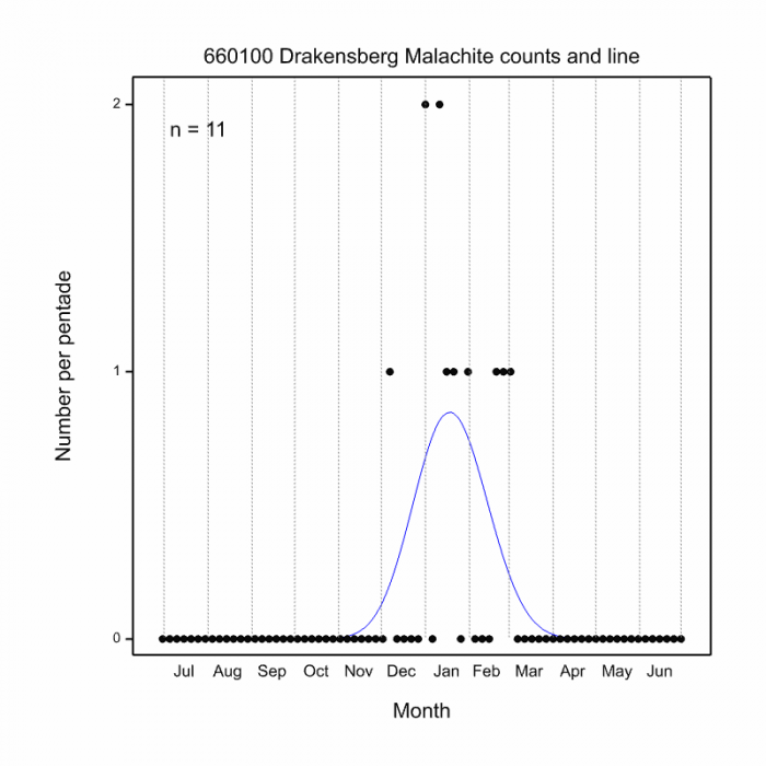
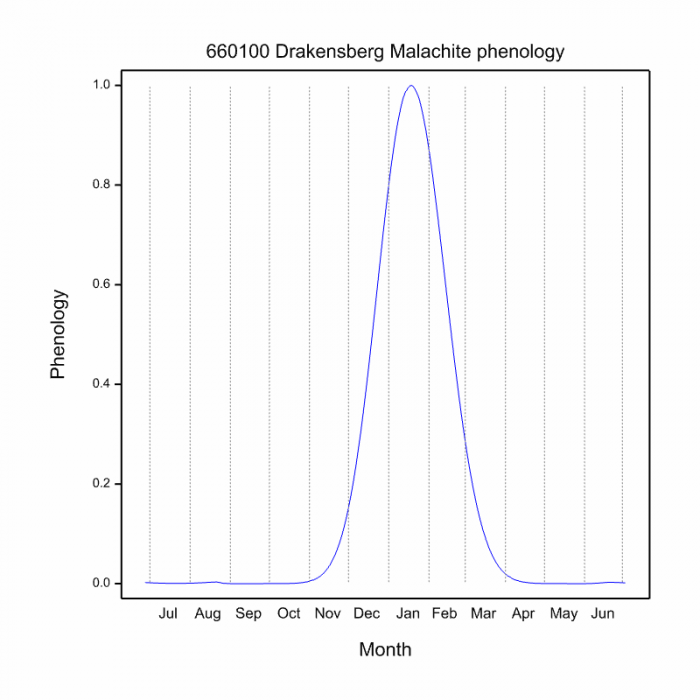
This phenology plot for the Drakensberg Malachite is tentative (because the sample size is extremely small, only 11 records. It suggests a flight period from December to March. This is a species for which the quality of the phenology plot would be greatly improved by obtaining more OdonataMAP records.
Further Resources
The use of photographs by Alan Manson and Riëtte Griesel is acknowledged.
Drakensberg Malachite Chlorolestes draconicus Balinsky, 1956
Other common names: Drakensbergmalagiet (Afrikaans).
Recommended citation format: Loftie-Eaton M; Navarro R; Tippett RM; Underhill L. 2025. Drakensberg Malachite Chlorolestes draconicus. Biodiversity and Development Institute. Available online at https://thebdi.org/2020/02/12/drakensberg-malachite-chlorolestes-draconicus/
References: Tarboton, M; Tarboton, W. (2019). A Guide to the Dragonflies & Damselflies of South Africa. Struik Nature.
Samways, MJ. (2008). Dragonflies and Damselflies of South Africa. Pensoft
Samways, MJ. (2016). Manual of Freshwater Assessment for South Africa: Dragonfly Biotic Index.Suricata 2. South African National Biodiversity Institute, Pretoria

