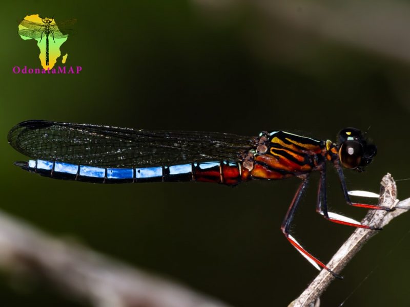
View the above photo record (by Gert Bensch) in OdonataMAP here.
Find the Dancing Jewel in the FBIS database (Freshwater Biodiversity Information System) here.
Family Chlorocyphidae
Platycypha caligata – DANCING JEWEL
Identification
Small size
Length attains 34mm; Wingspan reaches 52mm.
Adult Males are brightly coloured and easily recognised. Females and immature males are very difficult to separate from Platycypha fitzsimonsi females.
Females are best identified when seen alongside adult males.
Click here for more details on identification.

©Ryan Tippett 2020
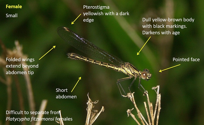
Photo by Christopher Willis
Habitat
A species of perennial streams and rivers. They prefer shallow, flowing and rocky stretches that are flanked by overhanging trees, bushes, and less often reeds. Often found in shade under overhanging vegetation during the heat of the day.

©Ryan Tippett 2020
Behaviour
Territorial males are normally found low down, on a rock or twig close to the waters edge. The females are usually found alongside the males. They frequently sit in the sun but retreat into the shade when it gets too hot. Dancing Jewels are perch hunters, taking short, low flights across the water. Immature males often sit higher up, away from the territorial males. Platycypha caligata males are well noted for having an eye-catching courtship display. The male hovers in front of a perched female. His legs hang down vertically as he twists or waves them, alternately flashing red and white.
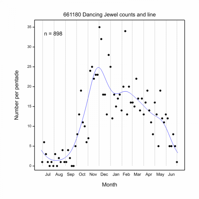
Recorded all year round in places, but most active from October to May (See Phenology below).
Status and Conservation
Platycypha caligata is a common and widespread species of the eastern parts of South Africa. It is listed as of Least Concern in the IUCN Red List of Threatened Species. It is reasonably resistant to habitat degradation and is not confined to pristine habitats.
Distribution
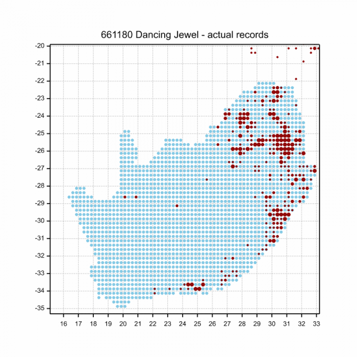
The Dancing Jewel is found in eastern, central and southern Africa from Ethiopia to Angola and South Africa where it is widespread in the eastern regions.
Below is a map showing the distribution of records for Dancing Jewel in the OdonataMAP database as at February 2020.
The next map below is an imputed map, produced by an interpolation algorithm, which attempts to generate a full distribution map from the partial information in the map above. This map will be improved by the submission of records to the OdonataMAP section of the Virtual Museum.

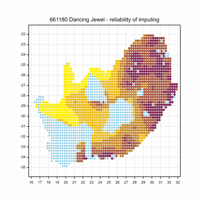
Ultimately, we will produce a series of maps for all the odonata species in the region. The current algorithm is a new algorithm. The objective is mainly to produce “smoothed” maps that could go into a field guide for odonata. This basic version of the algorithm (as mapped above) does not make use of “explanatory variables” (e.g. altitude, terrain roughness, presence of freshwater — we will be producing maps that take these variables into account soon). Currently, it only makes use of the OdonataMAP records for the species being mapped, as well as all the other records of all other species. The basic maps are “optimistic” and will generally show ranges to be larger than what they probably are.
These maps use the data in the OdonataMAP section of the Virtual Museum, and also the database assembled by the previous JRS funded project, which was led by Professor Michael Samways and Dr KD Dijkstra.
Phenology
