Cover photo by Felicity Grundlingh.
Find the Spotted Spreadwing in the FBIS database (Freshwater Biodiversity Information System) here.
Family Lestidae
Identification
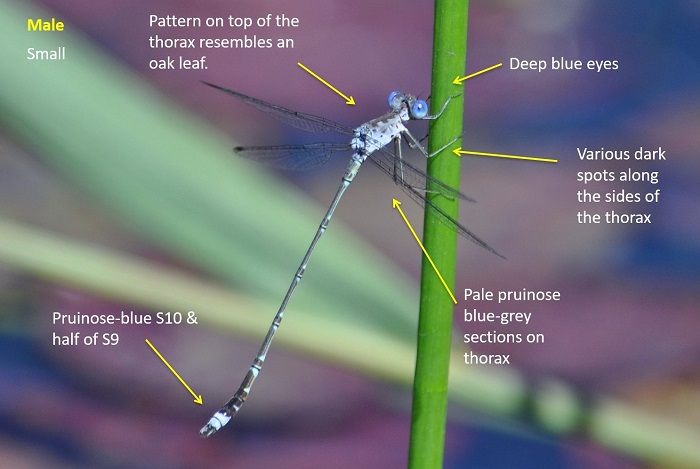
Near Hluhluwe, KwaZulu-Natal
Photo by Ryan Tippett
Small and slender
Length up to 42mm; Wingspan up to 46mm
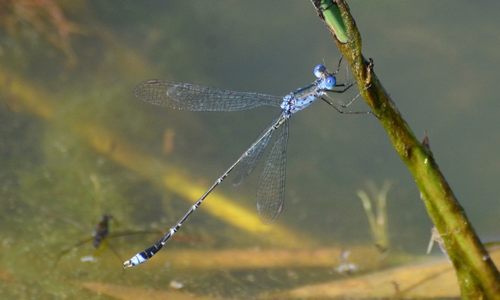
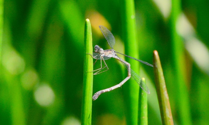
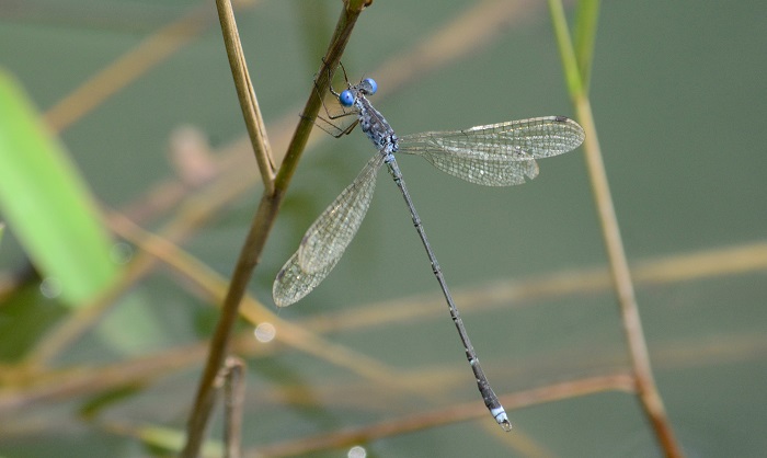
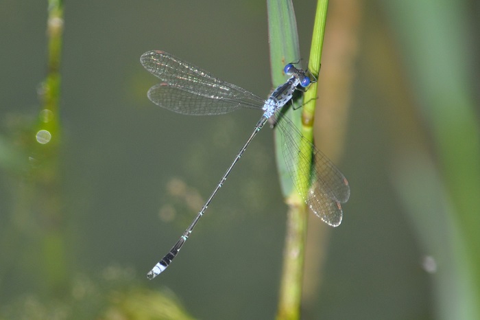
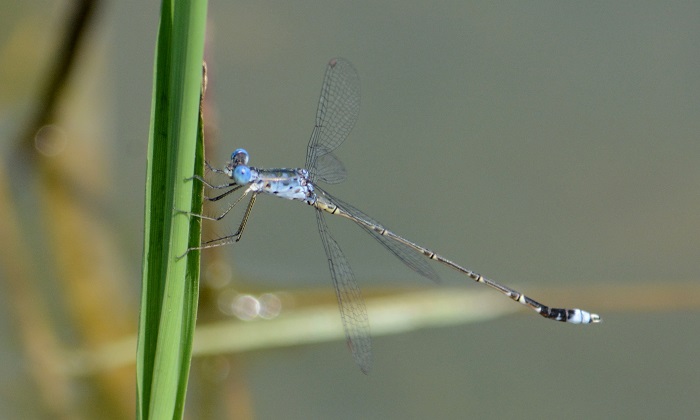
The Spotted Spreadwing is very similar to Lestes dissimulans (Cryptic Spreadwing). Males of the two are best seperated by the shape of the claspers. The pale pruinose blue terminal segments of Lestes tridens only extend half way up segment 9, whereas it extents to the top of segment 9 in Lestes dissimulans. The Spotted Spreadwing also shows a more distinctive pattern on the upper thorax.
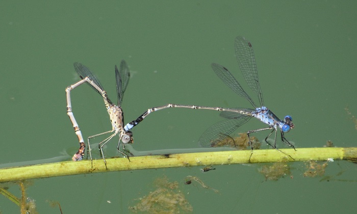
Females of the two are closely similar and best recognised by their association with the males.
Click here for more details on identification.
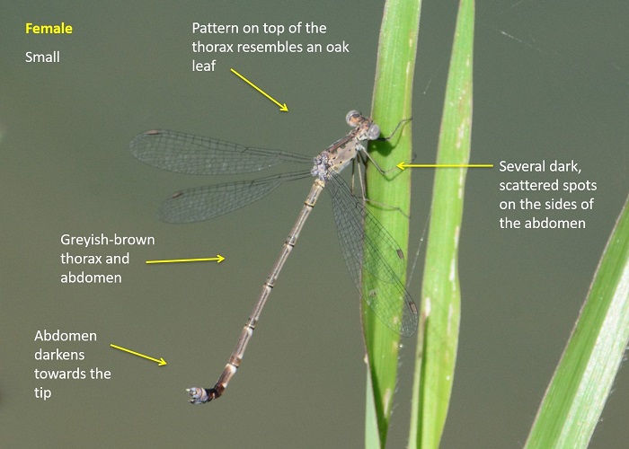
Near Hluhluwe, KwaZulu-Natal
Photo by Ryan Tippett
Habitat
The Spotted Spreadwing frequents both perennial and ephemeral, still-water habitats. They prefer shallow areas of pans, dams and ponds. The Spotted Spreadwing favours tall emergent or flooded grass but also inhabits areas with sedges and reeds. They can often be seen perched on waterlily flowers when they grow close to or among the flooded grass.

Photo by Ryan Tippett
Behaviour
During the hottest and coolest times of the day, Spotted Spreadwings are mostly inactive and spend long periods hanging vertically from emergent grass stems. At mid-morning, the males are often very active as they chase each other from stem to stem. The females are frequently seen with the males. Spotted Spreadwings are easily overlooked. Their blue-grey colouration and slender bodies blend perfectly with the grass and glare from the water.
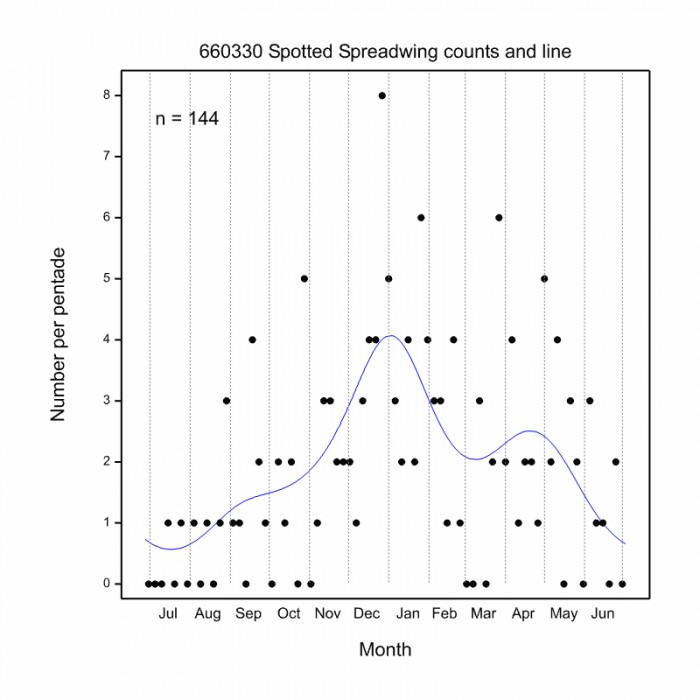
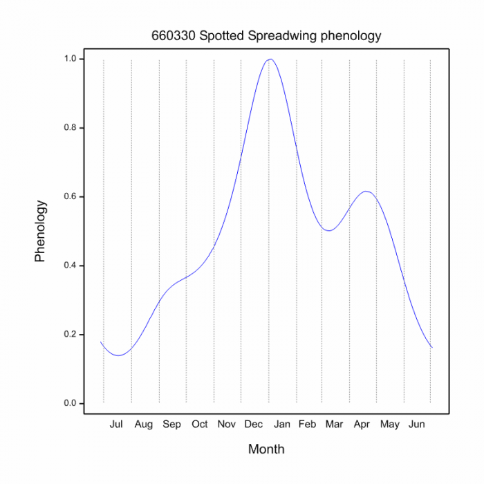
The Spotted Spreadwing is most active from September to May, but flies all year at some sites (See Phenology below).
Near Hluhluwe, KwaZulu-Natal
Photo by Ryan Tippett
Status and Conservation
Lestes tridens is a rather localised species, but it is often fairly common where it occurs. It is listed as of Least Concern in the IUCN Red List of Threatened Species. The Spotted Spreadwing has adapted to utilise suitable man-made dams and waterholes and is fairly resistant to habitat degradation.
Near Hluhluwe, KwaZulu-Natal
Photo by Ryan Tippett
Distribution
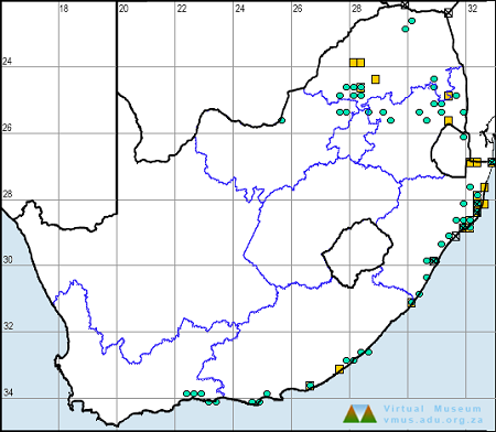
The Spotted Spreadwing is native to much of the southern half of Africa, where it is widespread, but localised. Its range also extends to East and Central Africa, and parts of West Africa. In South Africa, the Spotted Spreadwing is found in the warmer northern and eastern areas, extending down the east coast to near Mossel Bay.
Near Hluhluwe, KwaZulu-Natal
Photo by Ryan Tippett
Below is a map showing the distribution of records for Spotted Spreadwing in the OdonataMAP database as at February 2020.
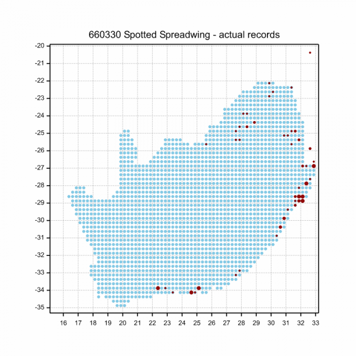
Below is a map showing the distribution of records for Spotted Spreadwing in the OdonataMAP database as of December 2024.
The next map below is an imputed map, produced by an interpolation algorithm, which attempts to generate a full distribution map from the partial information in the map above. This map will be improved by the submission of records to the OdonataMAP section of the Virtual Museum.
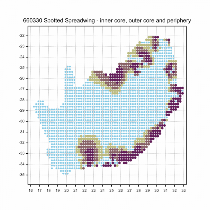
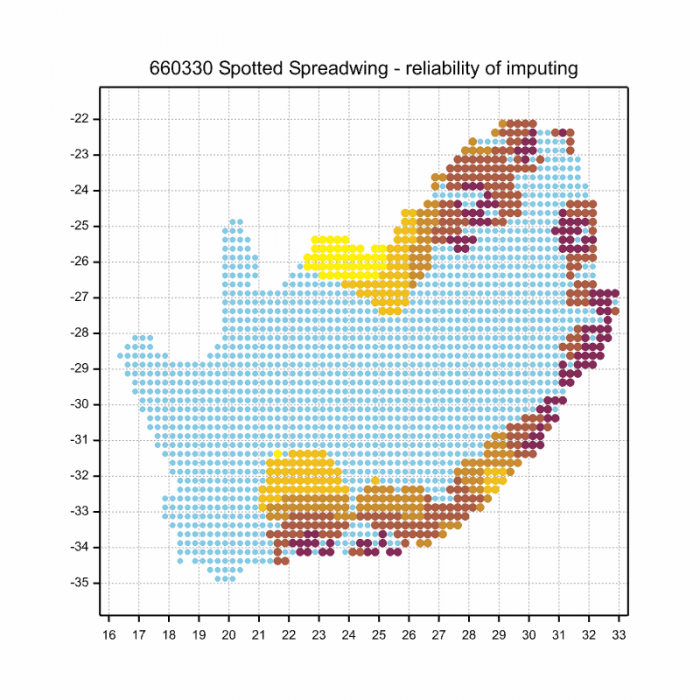
Ultimately, we will produce a series of maps for all the odonata species in the region. The current algorithm is a new algorithm. The objective is mainly to produce “smoothed” maps that could go into a field guide for odonata. This basic version of the algorithm (as mapped above) does not make use of “explanatory variables” (e.g. altitude, terrain roughness, presence of freshwater — we will be producing maps that take these variables into account soon). Currently, it only makes use of the OdonataMAP records for the species being mapped, as well as all the other records of all other species. The basic maps are “optimistic” and will generally show ranges to be larger than what they probably are.
These maps use the data in the OdonataMAP section of the Virtual Museum, and also the database assembled by the previous JRS funded project, which was led by Professor Michael Samways and Dr KD Dijkstra.
Near Hluhluwe, KwaZulu-Natal
Photo by Ryan Tippett
Phenology
Near Hluhluwe, KwaZulu-Natal
Photo by Ryan Tippett
Further Resources
The use of photographs by Felicity Grundlingh is acknowledged. All other photographs by Ryan Tippett.
Spotted Spreadwing Lestes tridens MacLachlan, 1895
Other common names: Gevlekte Spanvlerkie (Afrikaans)
Recommended citation format: Loftie-Eaton M; Navarro R; Tippett RM; Underhill L. 2025. Spotted Spreadwing Lestes tridens. Biodiversity and Development Institute. Available online at https://thebdi.org/2020/02/28/spotted-spreadwing-lestes-tridens/
References: Tarboton, M; Tarboton, W. (2019). A Guide to the Dragonflies & Damselflies of South Africa. Struik Nature.
Samways, MJ. (2008). Dragonflies and Damselflies of South Africa. Pensoft
Samways, MJ. (2016). Manual of Freshwater Assessment for South Africa: Dragonfly Biotic Index. Suricata 2. South African National Biodiversity Institute, Pretoria
Martens, A; Suhling, F. (2007). Dragonflies and Damselflies of Namibia. Gamsberg Macmillan.
Near Hluhluwe, KwaZulu-Natal
Photo by Ryan Tippett

