
Cover photo by Desire Darling.
Find the White Malachite in the FBIS database (Freshwater Biodiversity Information System) here.
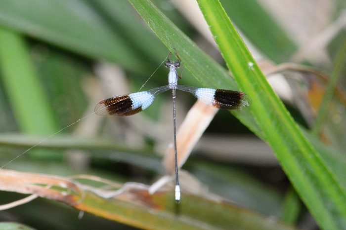
Family Synlestidae
Identification
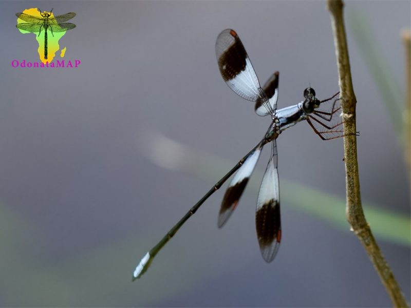
Nature’s Valley, Western Cape
Photo by Andre Marais
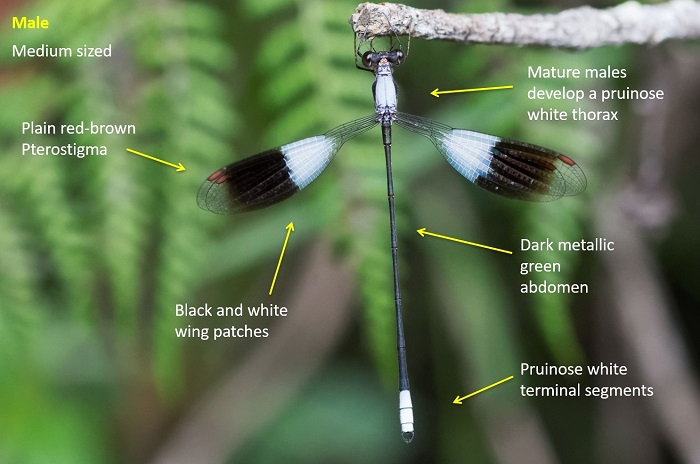
Medium Sized
Length reaches 47 mm; Wingspan can attain 52 mm
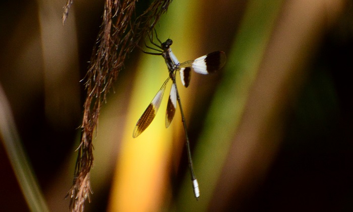
The mature male White Malachite develops a whitish pruinose bloom on the upper thorax. They also possess smoky-black and white wing bands. Non-pruinose males and females have a metallic-green or brown thorax and abdomen. The thorax sides have yellow antehumeral stripes. These individuals are perhaps most similar to Chlorolestes conspicuus, but that species is much larger, and there is no overlap in size.
Both sexes are distinguished from other Chlorolestes by their small size, uniformly coloured pterostigmas and wing venation.
Click here for more details on identification.
Habitat
The White Malachite is common along forested streams and rivers. It favours areas of shade and dappled light. It also occurs at well-vegetated streams in fynbos environments. The White Malachite is usually seen perched over pools and calm sections of water.
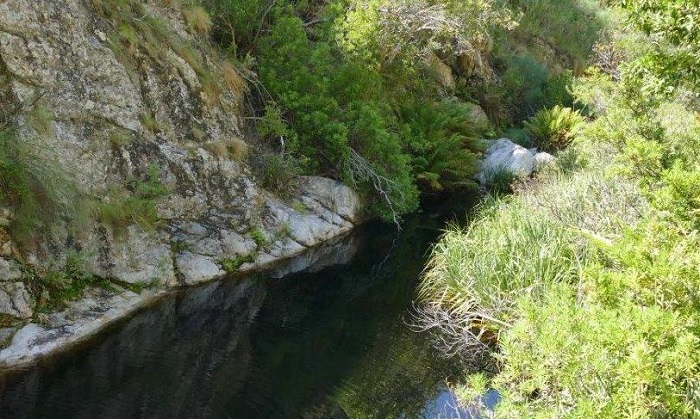
Photo by Sharon Stanton
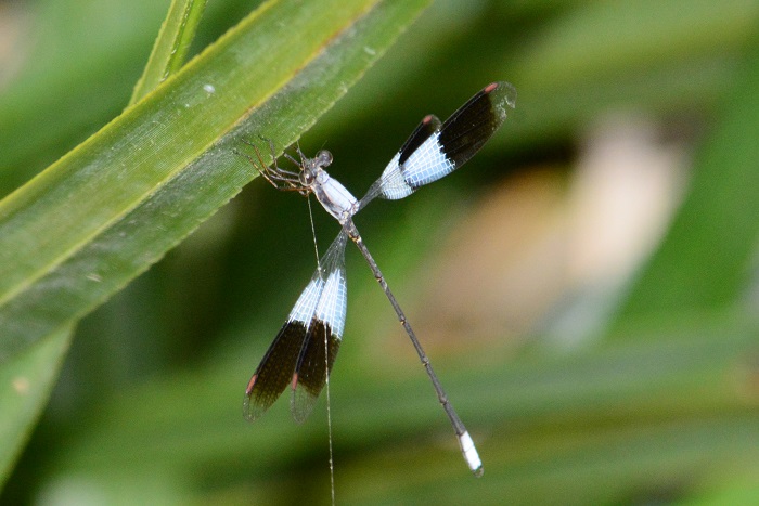
Behaviour
The White Malachite is an attractive species, mostly seen hanging from plants over the water. Mature males are conspicuous in the dappled forest light. The White Malachite is seldom seen away from water. Females are found in the same vicinity as the males, but are less conspicuous.
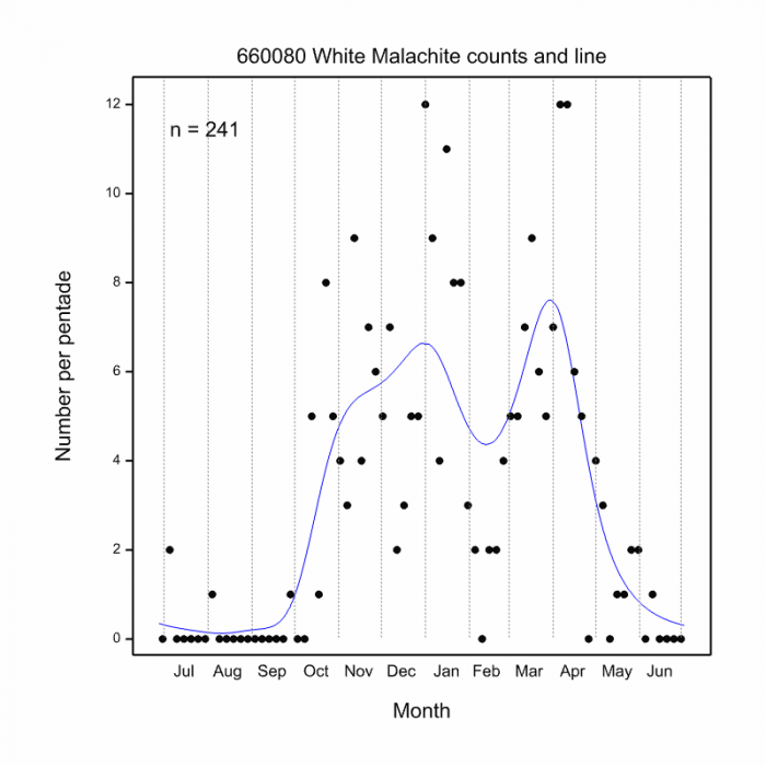
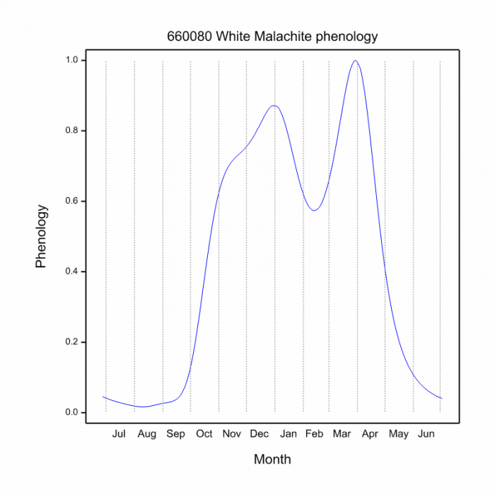
The White Malachite is active from September to May (see Phenology below).
Grootrivier, Western Cape
Photo by Ryan Tippett
Status and Conservation
Chlorolestes umbratus is a fairly common but localised species. Listed as of Least Concern in the IUCN Red List of Threatened Species. It is moderately sensitive to habitat damage.
Distribution
The White Malachite is endemic to the Western and Eastern Cape provinces in South Africa.
Marloth Nature Reserve, Western Cape
Photo by Ryan Tippett
The map below shows the distribution of records for Chlorolestes umbratus in the OdonataMAP database, as at January 2020.

The map below shows the distribution of records for Chlorolestes umbratus in the OdonataMAP database, as of December 2024.
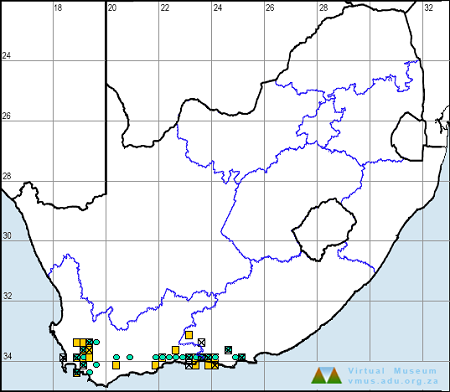
The following map below is an imputed map, produced by an interpolation algorithm, which attempts to generate a full distribution map from the partial information in the map above. This map will be improved by the submission of records to the OdonataMAP section of the Virtual Museum


Ultimately, we will produce a series of maps for all the odonata species in the region. The current algorithm is a new algorithm. The objective is mainly to produce “smoothed” maps that could go into a field guide for odonata. This basic version of the algorithm (as mapped above) does not make use of “explanatory variables” (e.g. altitude, terrain roughness, presence of freshwater — we will be producing maps that take these variables into account soon). Currently, it only makes use of the OdonataMAP records for the species being mapped, as well as all the other records of all other species. The basic maps are “optimistic” and will generally show ranges to be larger than what they probably are.
These maps use the data in the OdonataMAP section of the Virtual Museum, and also the database assembled by the previous JRS funded project, which was led by Professor Michael Samways and Dr KD Dijkstra.
Phenology
Grootrivier, Western Cape
Photo by Ryan Tippett
Further Resources
The use of photographs by Alan Manson and Jean Hirons is acknowledged. Other Photographs by Ryan Tippett.
White Malachite Chlorolestes umbratus Hagen in Selys, 1862
Other common names: Bleekmalagiet (Afrikaans).
Recommended citation format: Loftie-Eaton M; Navarro R; Tippett RM; Underhill L. 2025. White Malachite Chlorolestes umbratus. Biodiversity and Development Institute. Available online at https://thebdi.org/2020/02/11/white-malachite-chlorolestes-umbratus/
References: Tarboton, M; Tarboton, W. (2019). A Guide to the Dragonflies & Damselflies of South Africa. Struik Nature.
Samways, MJ. (2008). Dragonflies and Damselflies of South Africa. Pensoft
Samways, MJ. (2016). Manual of Freshwater Assessment for South Africa: Dragonfly Biotic Index.Suricata 2. South African National Biodiversity Institute, Pretoria