

The photo above (by John Wilkinson) can be viewed in OdonataMAP here.
Find this species in the FBIS database (Freshwater Biodiversity Information System) here.
Family Libellulidae
Diplacodes luminans – BARBET PERCHER
Identification
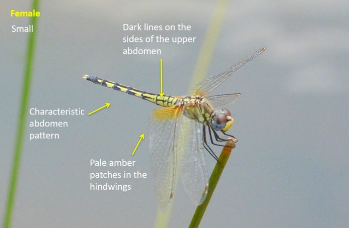
Small size
Length up to 40mm; Wingspan reaches 66mm.
The males are unmistakable with their distinctive bright red, yellow and black colouration.
Females are very similar to Diplacodes lefebvrii females, but can be distinguished by having horizontal stripes along the sides at the base of the abdomen.
Click here for more details on identification.

Near Hluhluwe, KwaZulu-Natal
Photo by Ryan Tippett
Mkuze River, KwaZulu-Natal
Photo by Ryan Tippett
Habitat
Inhabits a variety of still water environments. These include floodplains and marshes with well vegetated pools. Also occurs at grass and sedge lined pans, lakes and dams. They can on occasion be found at the marshy fringes of rivers.
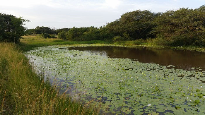
Photo by Ryan Tippett
Behaviour
Males sit conspicuously at the tips of reeds and sedges over the water. The flight is fast and darting and they quickly return to a perch. Females can be found in the same areas as the males but they are more common further from the water among trees and bushes.
Status and Conservation
A common, but localised species. It is listed as of Least Concern in the IUCN Red List of Threatened Species. Adaptable and fairly resistant to habitat degradation. It occurs commonly at well vegetated man-made habitats.
Distribution
Widely distributed in sub-Saharan Africa.
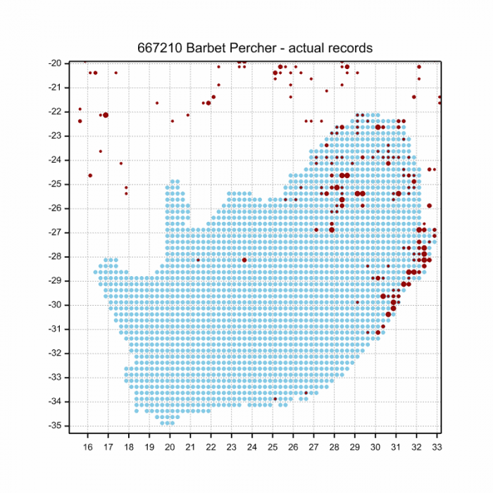
Below is a map showing the distribution of records for Barbet Percher in the OdonataMAP database as at February 2020.
The next map below is an imputed map, produced by an interpolation algorithm, which attempts to generate a full distribution map from the partial information in the map above. This map will be improved by the submission of records to the OdonataMAP section of the Virtual Museum.
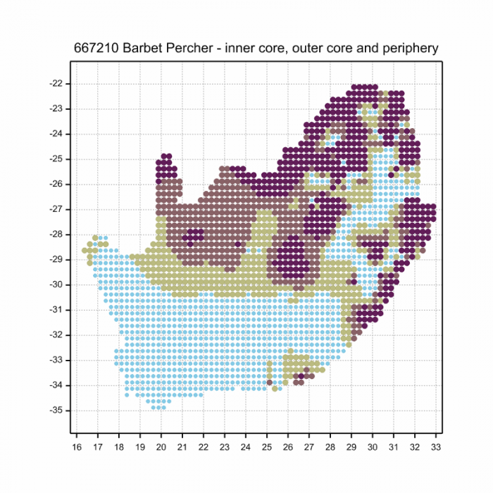

Ultimately, we will produce a series of maps for all the odonata species in the region. The current algorithm is a new algorithm. The objective is mainly to produce “smoothed” maps that could go into a field guide for odonata. This basic version of the algorithm (as mapped above) does not make use of “explanatory variables” (e.g. altitude, terrain roughness, presence of freshwater — we will be producing maps that take these variables into account soon). Currently, it only makes use of the OdonataMAP records for the species being mapped, as well as all the other records of all other species. The basic maps are “optimistic” and will generally show ranges to be larger than what they probably are.
These maps use the data in the OdonataMAP section of the Virtual Museum, and also the database assembled by the previous JRS funded project, which was led by Professor Michael Samways and Dr KD Dijkstra.