The photo above (by Ronelle White) can be viewed in OdonataMAP here.
Find this species in the FBIS database (Freshwater Biodiversity Information System) here.
Family Libellulidae
Bradinopyga cornuta – HORNED ROCKDWELLER
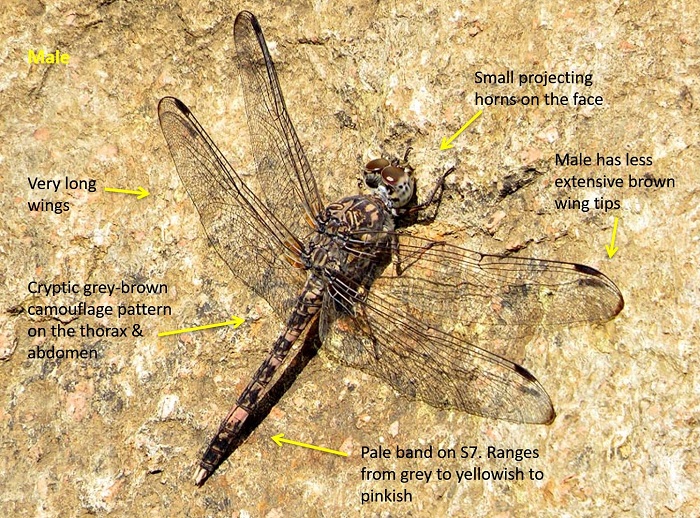
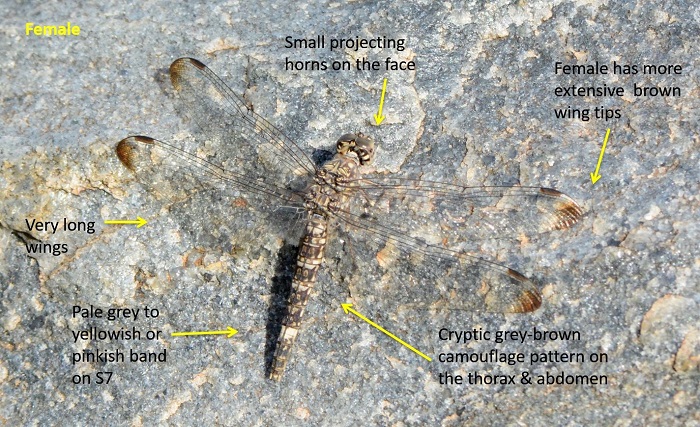
Identification
Medium sized
Length up to 45mm; Wingspan attains 79mm.
A unique and distinctive species. Unlikely to be confused with any other dragonfly in the sub-region. The habitat and behaviour alone is often enough to identify it.
The sexes are similar but females have more extensive brown wing tips and broader abdomens than males. Both sexes bear small ‘horns’ on the face and head, although these are better developed and more noticeable in the males.
Click here for more details on identification.
Mlawula Nature Reserve, Eswatini
Photo by Kate Braun
Mkuze River, KwaZulu-Natal
Photo by Ryan Tippett
Habitat
Bradinopyga cornuta has very specific habitat requirements. Inhabits savanna rivers and streams where there are large, exposed rock formations along the riverbanks. Breeds in rain or flood water-filled potholes that are left behind after the waters recede. Favours granite over other rock types.

Behaviour
The behaviour of this species is distinctive. Sits on exposed rock faces where it is very well camouflaged. Often clings to vertical rock faces and moves to shaded sections when it gets too hot.
A very alert species. Flushes at the slightest disturbance, but mostly returns to the same spot. The flight is fast and powerful. Often gregarious in good habitat.
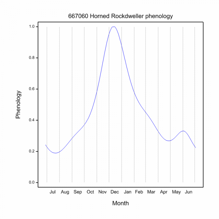
On the wing throughout the year, but more numerous during the warmer months.
Status and Conservation
Locally common but highly localised. Listed as of least Concern in the IUCN Red List of Threatened Species.
Distribution
Widely distributed in East and Southern Africa. Ranges from Kenya and Uganda in the north down to NE South Africa. Also ranges across to Zambia, Southern DRC and on to parts of Namibia.
In South Africa it is found in the North and East. Most widespread in Limpopo and Mpumalanga, but likely to be more widely distributed in KwaZulu-Natal than current records show. Occurs marginally in North-West, Gauteng and the Eastern Cape.
Below is a map showing the distribution of records for Horned Rockdweller in the OdonataMAP database as at February 2020.

The next map below is an imputed map, produced by an interpolation algorithm, which attempts to generate a full distribution map from the partial information in the map above. This map will be improved by the submission of records to the OdonataMAP section of the Virtual Museum.
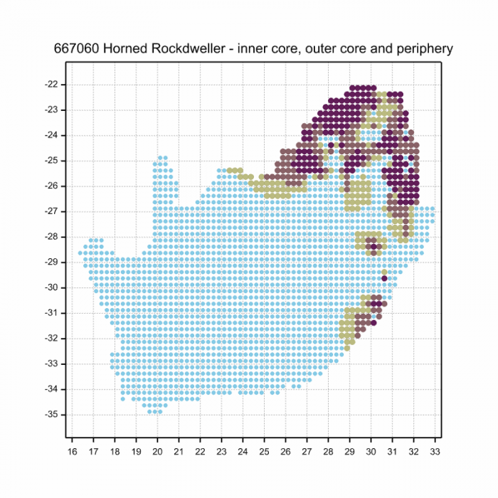
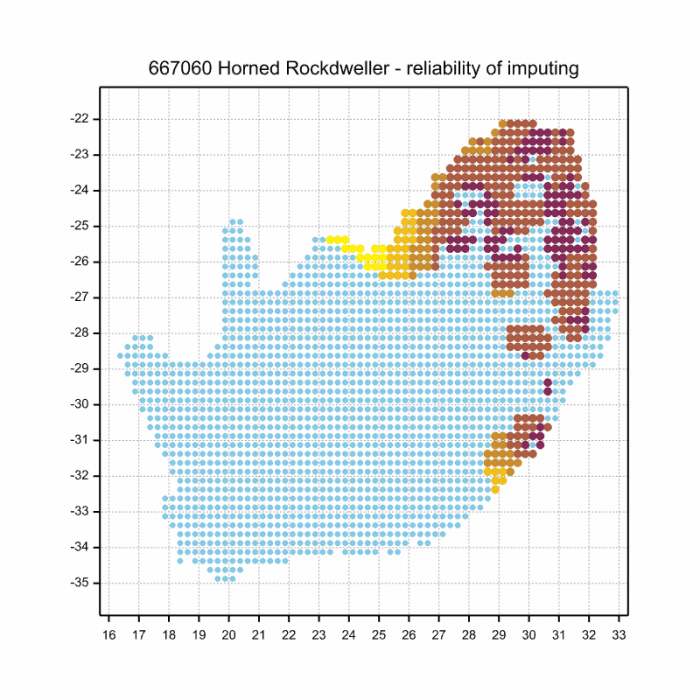
Ultimately, we will produce a series of maps for all the odonata species in the region. The current algorithm is a new algorithm. The objective is mainly to produce “smoothed” maps that could go into a field guide for odonata. This basic version of the algorithm (as mapped above) does not make use of “explanatory variables” (e.g. altitude, terrain roughness, presence of freshwater — we will be producing maps that take these variables into account soon). Currently, it only makes use of the OdonataMAP records for the species being mapped, as well as all the other records of all other species. The basic maps are “optimistic” and will generally show ranges to be larger than what they probably are.
These maps use the data in the OdonataMAP section of the Virtual Museum, and also the database assembled by the previous JRS funded project, which was led by Professor Michael Samways and Dr KD Dijkstra.