
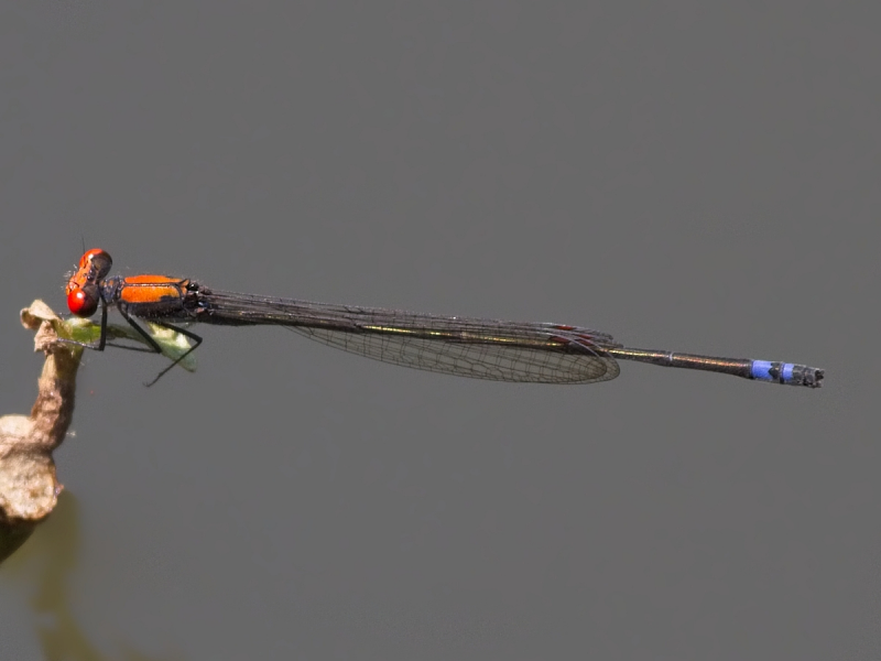
View the above photo record (by John Wilkinson) in OdonataMAP here.
Find the Variable Sprite in the FBIS database (Freshwater Biodiversity Information System) here.
Family Coenagrionidae
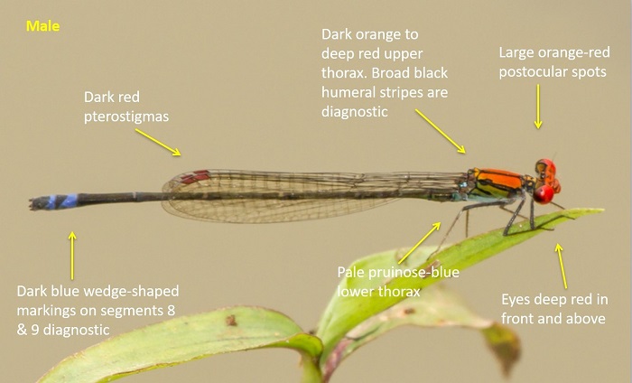
Pseudagrion sjoestedti – VARIABLE SPRITE
Identification
Small size
Length up to 36mm; Wingspan attains 48mm.
One of four predominantly ‘red’ sprite species in the region. The others being Pseudagrion massaicum (Masai Sprite), Pseudagrion acaciae (Acacia Sprite) and Pseudagrion vaalense (Vaal Sprite).
Pseudagrion sjoestedti is best told apart from the others by the morphology of the male claspers. However, the distinctive wedge-shaped blue markings on the terminal segments and the broad humeral stripe are also diagnostic.
Females are similar to those of other sprite species and are best identified by their association with the males.
Click here for more details on identification.
Near Tzaneen, Limpopo
Photo by John Wilkinson
Habitat
A riverine species, favouring sheltered sites with large overhanging trees, along flowing savanna rivers. Often found in shaded spots with dappled light.
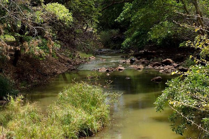
Photo by John Wilkinson
Behaviour
Perches on emergent and overhanging reeds near the water. Often found in dappled light.
On the wing from September to May (see Phenology below).
Status and Conservation
Uncommon and localised in South Africa. Listed as of Least Concern in the IUCN Red List of Threatened Species.
Distribution
Sparsely distributed throughout much of tropical Africa.
Found only in the Northern parts of South Africa, in the Limpopo and Mpumalanga provinces.
Below is a map showing the distribution of records for Variable Sprite in the OdonataMAP database as at February 2020.
The next map below is an imputed map, produced by an interpolation algorithm, which attempts to generate a full distribution map from the partial information in the map above. This map will be improved by the submission of records to the OdonataMAP section of the Virtual Museum.
Ultimately, we will produce a series of maps for all the odonata species in the region. The current algorithm is a new algorithm. The objective is mainly to produce “smoothed” maps that could go into a field guide for odonata. This basic version of the algorithm (as mapped above) does not make use of “explanatory variables” (e.g. altitude, terrain roughness, presence of freshwater — we will be producing maps that take these variables into account soon). Currently, it only makes use of the OdonataMAP records for the species being mapped, as well as all the other records of all other species. The basic maps are “optimistic” and will generally show ranges to be larger than what they probably are.
These maps use the data in the OdonataMAP section of the Virtual Museum, and also the database assembled by the previous JRS funded project, which was led by Professor Michael Samways and Dr KD Dijkstra.