
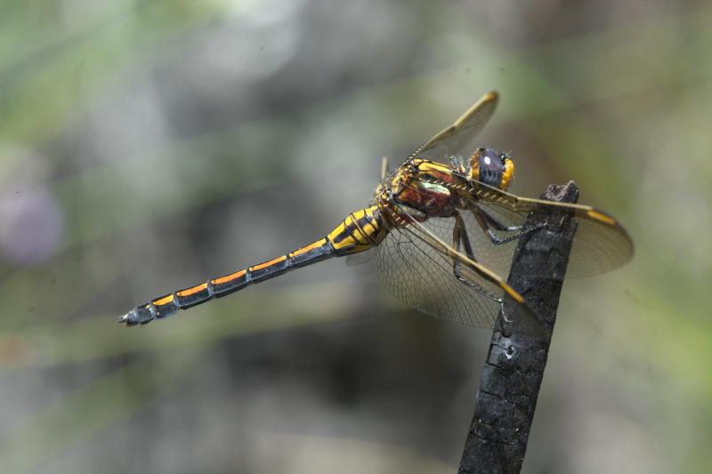
The photo above (by Andrew & Heather Hodgson) can be viewed in OdonataMAP here.
Find this species in the FBIS database (Freshwater Biodiversity Information System) here.
Family Libellulidae
Orthetrum rubens – ELUSIVE SKIMMER
Identification
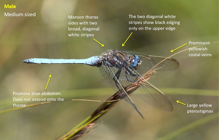
Medium sized
Length up to 43mm; Wingspan reaches 66mm.
Both sexes are highly distinctive and easily recognised. The bright maroon colour on the thorax is diagnostic and unique.
Males are most similar to Orthetrum caffrum (Two-striped Skimmer). Both species show a pair of diagonal white stripes on the thorax sides. In Orthetrum rubens the stripes are broad and of uneven width with a black border only along the upper edge. Orthetrum caffrum has narrower stripes that are even in width and with thin black edging along the upper and lower edges. Orthetrum caffrum may also have reddish-brown surfaces on the thorax but this tends to be dull and more brown than red.
Females are even more distinctive than the males and are unlikely to be mistaken for another species.
Click here for more details on identification.
Stettynsberg, Western Cape
Photo by Andrew and Heather Hodgson

Stettynsberg, Western Cape
Photo by Andrew and Heather Hodgson
Habitat
Inhabits open, high altitude seeps, bogs and marshes. Occurs up to 1300m above sea level.
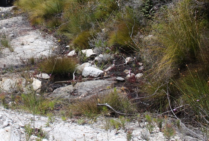
Hawequas Mountains, Western Cape
Photo by Corne Rautenbach
Behaviour
Not much is known about the behaviour of this species. Perches on vegetation above boggy ground and seeps.
On the wing from October to February.
Status and Conservation
Seemingly rare and highly localised. Listed as Endangered in the IUCN Red List of Threatened Species.
Distribution
Orthetrum rubens is endemic to South Africa where it is restricted to high mountainous terrain in the Cape fold mountains of the Western Cape.
Below is a map showing the distribution of records for Elusive Skimmer in the OdonataMAP database as at February 2020.

The next map below is an imputed map, produced by an interpolation algorithm, which attempts to generate a full distribution map from the partial information in the map above. This map will be improved by the submission of records to the OdonataMAP section of the Virtual Museum.


Ultimately, we will produce a series of maps for all the odonata species in the region. The current algorithm is a new algorithm. The objective is mainly to produce “smoothed” maps that could go into a field guide for odonata. This basic version of the algorithm (as mapped above) does not make use of “explanatory variables” (e.g. altitude, terrain roughness, presence of freshwater — we will be producing maps that take these variables into account soon). Currently, it only makes use of the OdonataMAP records for the species being mapped, as well as all the other records of all other species. The basic maps are “optimistic” and will generally show ranges to be larger than what they probably are.
These maps use the data in the OdonataMAP section of the Virtual Museum, and also the database assembled by the previous JRS funded project, which was led by Professor Michael Samways and Dr KD Dijkstra.