View the above photo record (by Desire Darling) in OdonataMAP here.
Find the Spined Fairytail in the FBIS database (Freshwater Biodiversity Information System) here.
Family Gomphidae
Lestinogomphus angustus – SPINED FAIRYTAIL
Identification
Medium sized, but one of the smallest members of its family.
Length up to 47mm; Wingspan attains 57mm.
The Eastern Scissortail has the typical colouration of many gomphid species. It is best recognised by its small size, and very distinctive downward pointing abdomen tip.
Similar in size and colouration to Microgomphus nyassicus (Eastern Scissortail), but Lestinogomphus angustus has a far more slender build and the two have very different clasper structures.
Click here for more details on identification of the Spined Fairytail.

Nwanedi Nature Reserve, Limpopo
Photo by Desire Darling
Habitat
Lestinogomphus angustus inhabits the well wooded banks of perennial streams and rivers in both savanna and forested regions.

Photo by Ryan Tippett
Behaviour
Unobtrusive, spends much time sitting on a shady perch over the water. Usually found under trees and bushes that overhang the stream or river. Typically perches horizontally with the last segment of the abdomen pointing downwards.
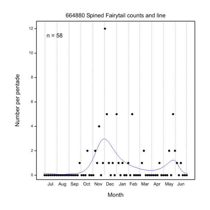
On the wing from October to May.
Status and Conservation
Uncommon in South Africa. Listed as of Least Concern in the IUCN Red List of Threatened Species.
Distribution
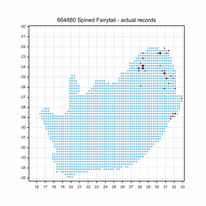
Lestinogomphus angustus is found mainly in Southern and East Africa. Occurs as far north as Kenya and all the way down to NE South Africa.
Below is a map showing the distribution of records for Spined Fairytail in the OdonataMAP database as at February 2020.
The next map below is an imputed map, produced by an interpolation algorithm, which attempts to generate a full distribution map from the partial information in the map above. This map will be improved by the submission of records to the OdonataMAP section of the Virtual Museum.
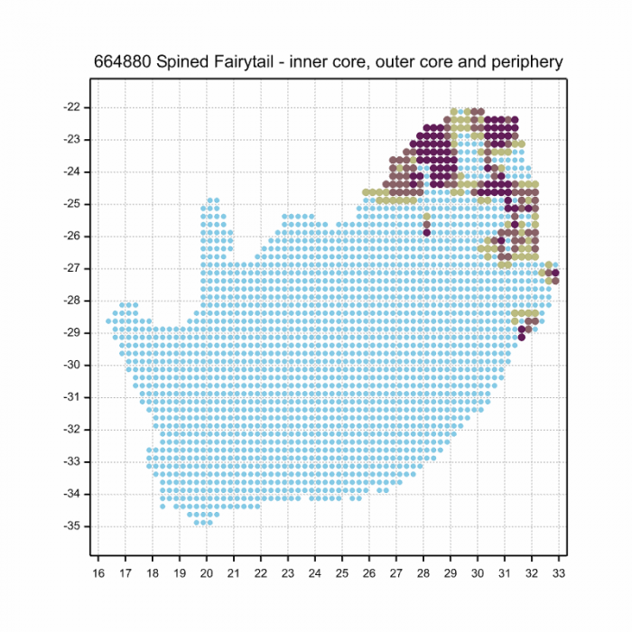

Ultimately, we will produce a series of maps for all the odonata species in the region. The current algorithm is a new algorithm. The objective is mainly to produce “smoothed” maps that could go into a field guide for odonata. This basic version of the algorithm (as mapped above) does not make use of “explanatory variables” (e.g. altitude, terrain roughness, presence of freshwater — we will be producing maps that take these variables into account soon). Currently, it only makes use of the OdonataMAP records for the species being mapped, as well as all the other records of all other species. The basic maps are “optimistic” and will generally show ranges to be larger than what they probably are.
These maps use the data in the OdonataMAP section of the Virtual Museum, and also the database assembled by the previous JRS funded project, which was led by Professor Michael Samways and Dr KD Dijkstra.