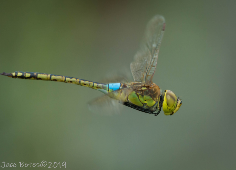
View the above photo record (by Jaco Botes) in OdonataMAP here.
Find the Vagrant Emperor in the FBIS database (Freshwater Biodiversity Information System) here.
Family Aeshnidae
Anax ephippiger – VAGRANT EMPEROR
Identification
Large size
Length up to 67mm; Wingspan attains 110mm.
Unlike any other species in Southern Africa. The yellow brown colouration and bright blue saddle of the males render them unmistakable.
Females in flight may be mistaken for Pantala flavescens (Wandering Glider), the two species often occur side by side. The wandering glider is smaller, often orange to red in colour and has a distinctive, tapered body shape.
Click here for more details on identification.

Near Hluhluwe, KwaZulu-Natal
Photo by Ryan Tippett
Habitat
The favoured breeding habitat is seasonal pools, pans and dams which it rapidly colonises after rain. Liable to turn up almost anywhere after rain.

Photo by Ryan Tippett
Behaviour
A highly nomadic and opportunistic species. Typically appears in an area shortly before or after rain, where it may breed if conditions are favourable, before moving on.
The Vagrant Emperor is a highly aerial species that spends long periods on the wing. Often forms or joins mixed species hunting swarms at dusk. Often seen singly but is frequently gregarious.
Rests by hanging vertically from a perch.
Most active from September to May (see Phenology below).
Status and Conservation
Common to abundant when present. Listed as of Least Concern in the IUCN Red List of Threatened Species.
Distribution
Distributed widely across Africa, Europe and central and southern Asia. Also occurs on many of the Indian Ocean islands.
The South African distribution is centered around the wetter northern and eastern regions, although vagrants could turn up almost anywhere.
Below is a map showing the distribution of records for Vagrant Emperor in the OdonataMAP database as at February 2020.

The next map below is an imputed map, produced by an interpolation algorithm, which attempts to generate a full distribution map from the partial information in the map above. This map will be improved by the submission of records to the OdonataMAP section of the Virtual Museum.


Ultimately, we will produce a series of maps for all the odonata species in the region. The current algorithm is a new algorithm. The objective is mainly to produce “smoothed” maps that could go into a field guide for odonata. This basic version of the algorithm (as mapped above) does not make use of “explanatory variables” (e.g. altitude, terrain roughness, presence of freshwater — we will be producing maps that take these variables into account soon). Currently, it only makes use of the OdonataMAP records for the species being mapped, as well as all the other records of all other species. The basic maps are “optimistic” and will generally show ranges to be larger than what they probably are.
These maps use the data in the OdonataMAP section of the Virtual Museum, and also the database assembled by the previous JRS funded project, which was led by Professor Michael Samways and Dr KD Dijkstra.
Phenology


