
Cover photo by Corrie du Toit.
Find the Goldtail in the FBIS database (Freshwater Biodiversity Information System) here.
Family Platycnemidide
Identification
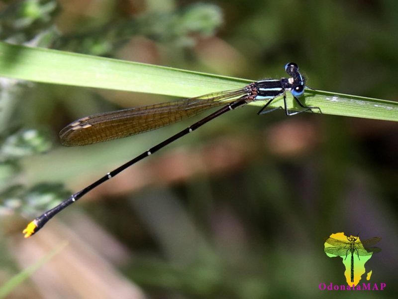
Moordkuil River, Western Cape
Photo by Ryan Tippett
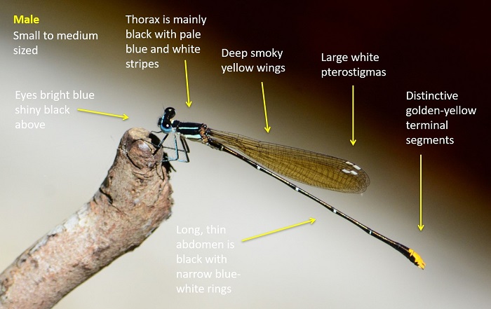
Small to medium sized
Length up to 46mm; Wingspan reaches 57mm.
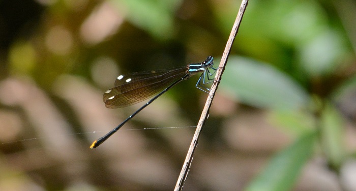
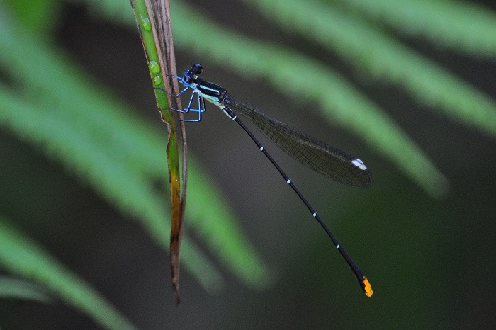
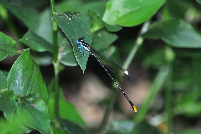
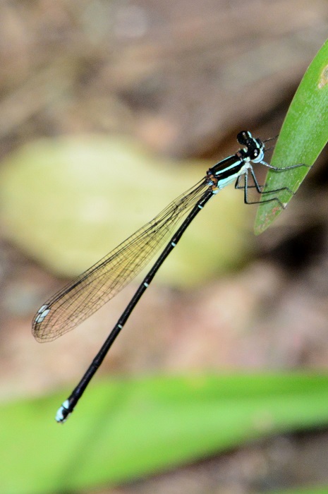
The Goldtail is a distinctive and easily recognised damselfly. It is unlike any other species in the region.
Largely black above and pale below with light blue-green stripes on the thorax. The diagnostic features include amber-washed wings with large white pterostigmas, and the males have golden-yellow terminal segments on the abdomen.
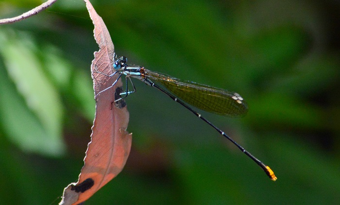
Females are similar but lack the golden yellow abdomen tips.
Click here for more details on identification.

Everton, KwaZulu-Natal
Photo by Rob Dickinson
Habitat
The Goldtail is a shade-loving species of forested or well-wooded streams and rivers. It prefers streams that have clear, shallow water. The Goldtail mostly inhabits mid to high altitude areas, but occurs at sea level in some places in KwaZulu-Natal and the Southern Cape. Allocnemis leucosticta is occasionally found at more open streams surrounded by grass and bushes, particularly in fynbos and montane grassland habitats.

Photo by Ryan Tippett
Behaviour
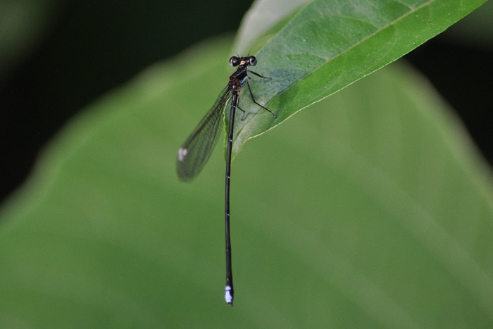
The males are rather noticeable as they sit in exposed positions over the stream in dappled sunlight. The Goldtail’s white pterostigmas and yellowish wings are conspicuous in flight, even in poor light conditions. The females are often found near the males, but are less numerous and not as conspicuous. Allocnemis leucosticta almost always perches on twigs, stems, or vegetation over or close to the water.
The Goldtail is most active from October to April (See Phenology below).
Seweweekspoort, Western Cape
Photo by Ryan Tippett
Status and Conservation
The Goldtail is common but localised due to its habitat requirements. It is listed as Least Concern in the IUCN Red List of Threatened Species. Goldtails are fairly sensitive to habitat degradation. They are intolerant of dirty water, but can be found on streams with some alien vegetation.
Ferncliffe Forest, KwaZulu-Natal
Photo by Ryan Tippett
Distribution
The Goldtail is endemic to South Africa and eSwatini (Swaziland). It is found in mid to high altitude escarpment areas, ranging from Table Mountain in the Western Cape to the Soutpansberg in Limpopo.
Mtunzini, KwaZulu-Natal
Photo by Ryan Tippett
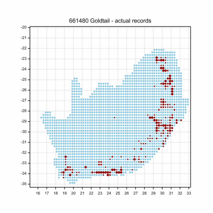
Below is a map showing the distribution of records for Goldtail in the OdonataMAP database as at February 2020.
Below is a map showing the distribution of records for Goldtail in the OdonataMAP database as of December 2024.
The next map below is an imputed map, produced by an interpolation algorithm, which attempts to generate a full distribution map from the partial information in the map above. This map will be improved by the submission of records to the OdonataMAP section of the Virtual Museum.
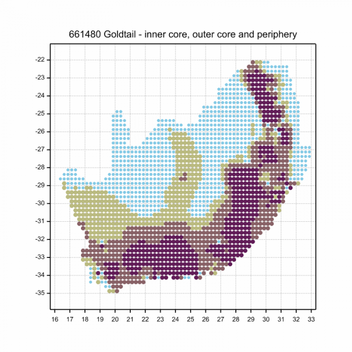
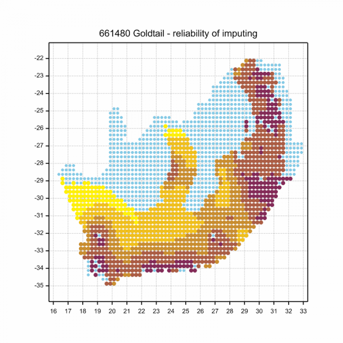
Ultimately, we will produce a series of maps for all the odonata species in the region. The current algorithm is a new algorithm. The objective is mainly to produce “smoothed” maps that could go into a field guide for odonata. This basic version of the algorithm (as mapped above) does not make use of “explanatory variables” (e.g. altitude, terrain roughness, presence of freshwater — we will be producing maps that take these variables into account soon). Currently, it only makes use of the OdonataMAP records for the species being mapped, as well as all the other records of all other species.
The basic maps are “optimistic” and will generally show ranges to be larger than what they probably are. These maps use the data in the OdonataMAP section of the Virtual Museum, and also the database assembled by the previous JRS funded project, which was led by Professor Michael Samways and Dr KD Dijkstra
Ferncliffe Forest, KwaZulu-Natal
Photo by Ryan Tippett
Phenology


National Botanical Gardens, Pietermaritzburg, KwaZulu-Natal
Photo by Ryan Tippett
Further Resources
The use of photographs by Corrie du Toit and Rob Dickinson is acknowledged. All other photographs by Ryan Tippett.
Goldtail Allocnemis leucosticta Selys, 1863
Other common names: Goudstertjie (Afrikaans)
Recommended citation format: Loftie-Eaton M; Navarro R; Tippett RM; Underhill L. 2025. Goldtail Allocnemis leucosticta. Biodiversity and Development Institute. Available online at https://thebdi.org/2020/03/02/goldtail-allocnemis-leucosticta/
References: Tarboton, M; Tarboton, W. (2019). A Guide to the Dragonflies & Damselflies of South Africa. Struik Nature.
Samways, MJ. (2008). Dragonflies and Damselflies of South Africa. Pensoft
Samways, MJ. (2016). Manual of Freshwater Assessment for South Africa: Dragonfly Biotic Index. Suricata 2. South African National Biodiversity Institute, Pretoria
Martens, A; Suhling, F. (2007). Dragonflies and Damselflies of Namibia. Gamsberg Macmillan.
iXopo district, KwaZulu-Natal
Photo by Ryan Tippett