

The photo above (by Gerhard Diedericks) can be viewed in OdonataMAP here.
Find this species in the FBIS database (Freshwater Biodiversity Information System) here.
Family Libellulidae
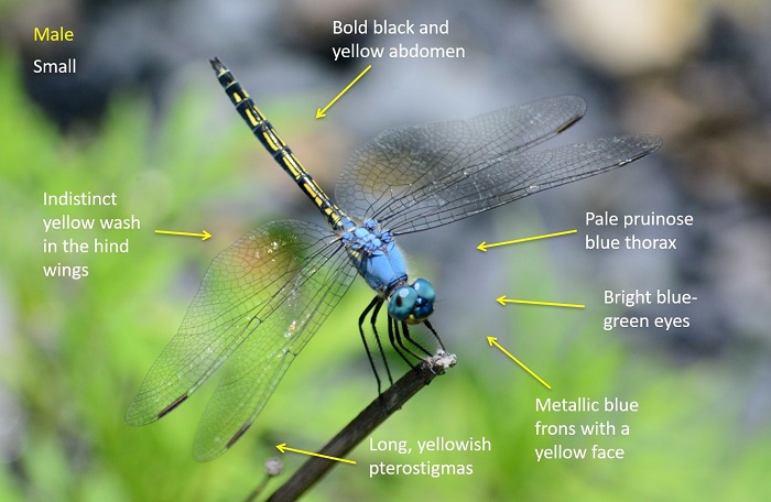
Trithemis stictica – JAUNTY DROPWING
Identification
Small size
Length up to 38mm; Wingspan reaches 66mm.
Males are distinctive and unmistakable within South Africa. There are other very similar species further north in Africa, notably Trithemis palustris (Marsh Dropwing).
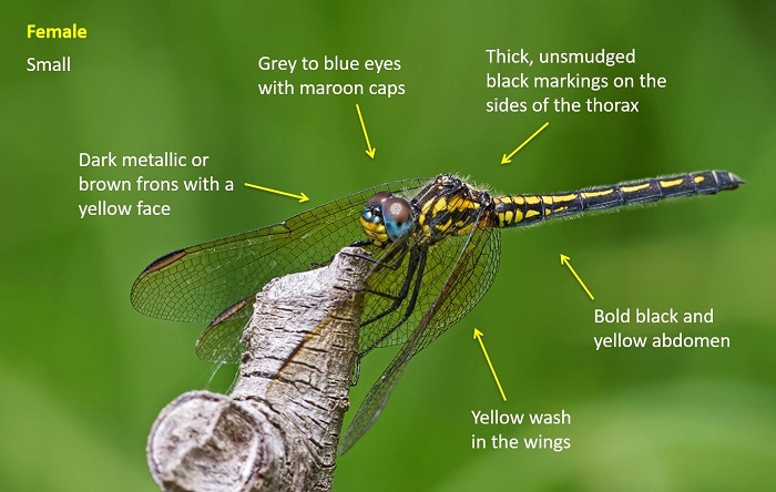
Females can be easily confused with other dropwing species. Trithemis stictica females can be told by the thick, unsmudged black markings on the sides of the thorax and the bold black and yellow abdomen pattern.
Click here for more details on identification.
Wilge River, Free State
Photo by Ryan Tippett
Near Oyster Bay, Eastern Cape
Photo by Desire Darling
Habitat
Inhabits the vegetated margins of still water environments, such as marshes, pans, dams and quiet backwaters of rivers and streams. Seldom found at running water. Jaunty Dropwings prefer areas rich in vegetation, like sedges, reeds and emergent grass.
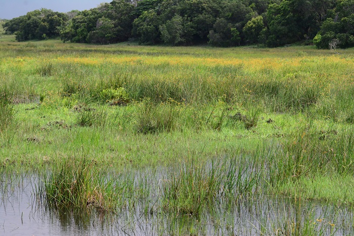
Photo by Ryan Tippett
Behaviour
Jaunty Dropwings are perch hunters and spend as much time perched as they do darting off to intercept prey, or to chase off a rival. They like to sit in open, sunny positions. During the heat of the day they can often be seen in the obelisk position, pointing the abdomens at the sun to reduce the amount of direct sunlight on their bodies.
Status and Conservation
Trithemis stictica is a common and widespread species. It is listed as of Least Concern in the IUCN Red List of Threatened Species. It is reasonably tolerant of habitat degradation and is commonly found at suitable man-made water bodies.
Distribution
This species has a wide distribution throughout most of sub-Saharan Africa and is also found on Madagascar.
Below is a map showing the distribution of records for Jaunty Dropwing in the OdonataMAP database as at February 2020.

The next map below is an imputed map, produced by an interpolation algorithm, which attempts to generate a full distribution map from the partial information in the map above. This map will be improved by the submission of records to the OdonataMAP section of the Virtual Museum.
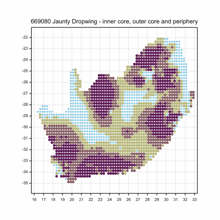
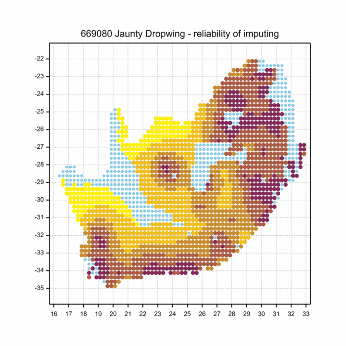
Ultimately, we will produce a series of maps for all the odonata species in the region. The current algorithm is a new algorithm. The objective is mainly to produce “smoothed” maps that could go into a field guide for odonata. This basic version of the algorithm (as mapped above) does not make use of “explanatory variables” (e.g. altitude, terrain roughness, presence of freshwater — we will be producing maps that take these variables into account soon). Currently, it only makes use of the OdonataMAP records for the species being mapped, as well as all the other records of all other species. The basic maps are “optimistic” and will generally show ranges to be larger than what they probably are.
These maps use the data in the OdonataMAP section of the Virtual Museum, and also the database assembled by the previous JRS funded project, which was led by Professor Michael Samways and Dr KD Dijkstra.